At 736 PM CDT, a confirmed #tornado was located 10 miles northeast
of Marshfield, or 25 miles southwest of Wausau, moving east at 20
mph.#wiwx
TAKE COVER NOW!
SOURCE...Law enforcement confirmed tornado.
At 433 PM CDT, a confirmed #tornado was located over Webster City,
moving southeast at 30 mph.
SOURCE...Law enforcement receiving multiple reports of a tornado
on the ground near Webster City.#iawx
TAKE COVER NOW!
At 533 PM EDT/433 PM CDT/, a severe thunderstorm capable of
producing a #tornado was located near Channing, or 17 miles east of
Crystal Falls, moving east at 35 mph.#miwx
SOURCE...Radar indicated rotation.
At 429 PM CDT, a severe thunderstorm capable of producing a #tornado
was located near Crystal Falls, moving east at 40 mph.#miwx
SOURCE...Radar indicated rotation.
At 357 PM CDT, a severe thunderstorm capable of producing a #tornado
was located over Aplington, or 14 miles northwest of Grundy Center,
moving southeast at 50 mph.#iawx
SOURCE...Radar indicated rotation.
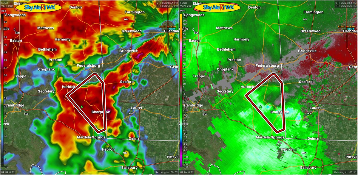
At 627 PM EDT, a severe thunderstorm capable of producing a #tornado
was located near Seaford, or 10 miles east of Hurlock, moving
northeast at 45 mph.#mdwx#dewx
SOURCE...Radar indicated rotation.
At 624 PM EDT, a severe thunderstorm capable of producing a #tornado
was located over Sharptown, or 7 miles southeast of Hurlock, moving
northeast at 50 mph.#mdwx
SOURCE...Radar indicated rotation.
At 617 PM EDT, a severe thunderstorm capable of producing a #tornado
was located over Deposit, moving southeast at 50 mph.#nywx
SOURCE...Radar indicated rotation.
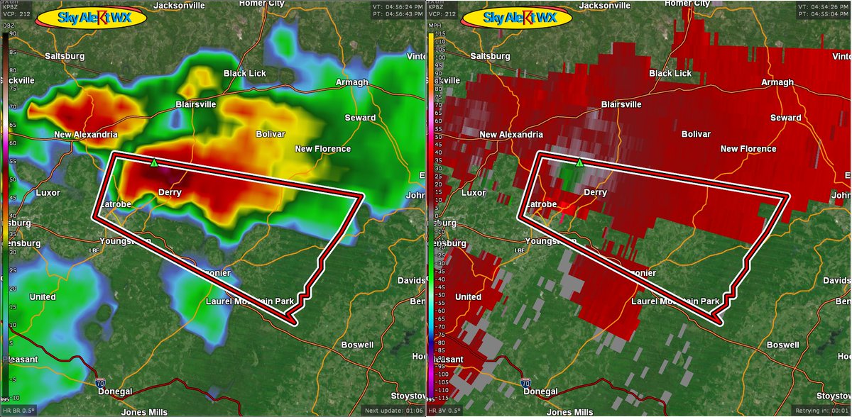
At 455 PM EDT, a severe thunderstorm capable of producing a #tornado
was located over McChesneytown-Loyalhanna, or over Latrobe, moving
east at 25 mph.#pawx
SOURCE...Radar indicated rotation.
At 1238 PM EDT, a severe thunderstorm capable of producing a
#tornado was located over Central City, moving east southeast at 40 mph.#pawx
SOURCE...Radar indicated rotation.
a confirmed #tornado was located near Maddock, or 19
miles northeast of Harvey, moving southeast at 20 mph.#ndwx
SOURCE...Law enforcement confirmed tornado.
At 802 PM EDT, a severe thunderstorm capable of producing a #tornado
was located over Bass River State Forest, or 18 miles north of
Atlantic City, moving southeast at 25 mph.#njwx
SOURCE...Radar indicated rotation.
At 1230 AM CDT, a severe thunderstorm capable of producing a
#tornado was located over Washer, or 7 miles north of La Pryor, moving north at 15 mph.#txwx
SOURCE...Radar indicated rotation.
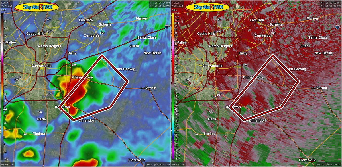
At 1004 PM CDT, a severe thunderstorm capable of producing a
#tornado was located over Government Canyon State Natural Area, or
14 miles west of San Antonio, moving north at 20 mph.#txwx
SOURCE...Radar indicated rotation.
At 404 PM CDT, a severe thunderstorm capable of producing a #tornado
was located near Calaveras Lake, or near Stinson Municipal Airport,
moving northeast at 15 mph.#txwx
SOURCE...Radar indicated rotation.
At 740 PM EDT, a severe thunderstorm capable of producing a #tornado
was located over Allenhurst, moving east at 10 mph.#gawx
SOURCE...Radar indicated rotation.
At 613 PM EDT, a confirmed #waterspout was located just offshore
near Wicomico River, moving east at 30 mph.#mdwx#torando
SOURCE...Weather spotters confirmed waterspout moving onshore.
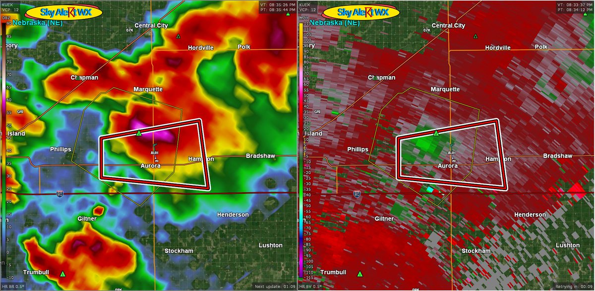
At 734 PM CDT, a severe thunderstorm capable of producing a #tornado
was located over Aurora, or 16 miles east of Grand Island, moving
east at 20 mph.#newx
SOURCE...Weather spotters reported funnel cloud.
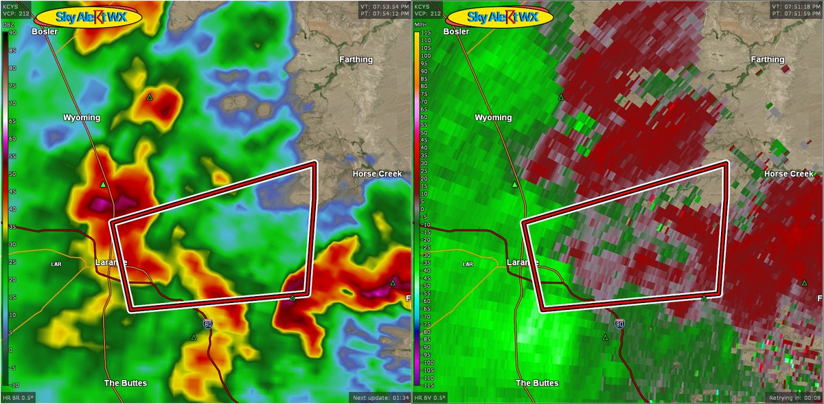
t 554 PM MDT, a severe thunderstorm capable of producing a #tornado
was located over University Of Wyoming War Memorial Stadium, or
near Laramie, moving east at 20 mph.#wywx
SOURCE...Radar indicated rotation.