The ST. Mary Parish OHSEP created this to provide ACCURATE, TIMELY information. The goal of this page is to share important information with our public.
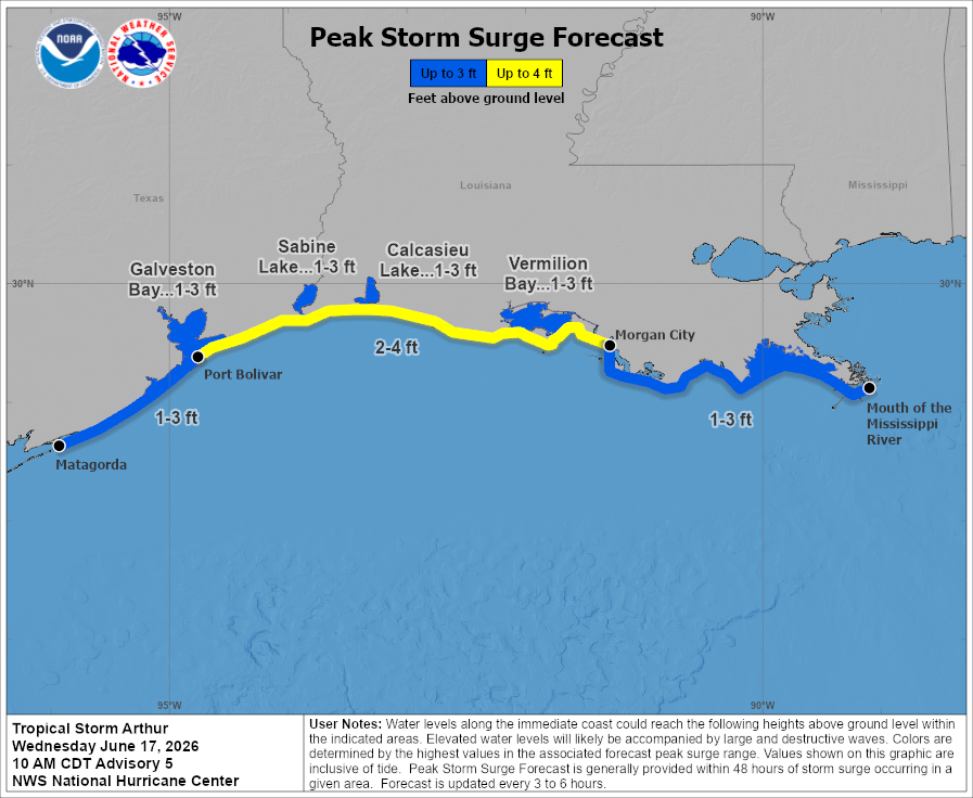
PTC1 has been upgraded to Tropical Storm Arthur this morning with maximum sustained winds near 40 MPH. We will host a live social media briefing at 11:30 this morning to discuss the latest on Arthur and its expected impacts across the region.
6/17 10am CDT: Minor to moderate coastal flooding from Tropical Storm #Arthur is expected along portions of the Upper Texas and Louisiana coastlines today.
For more information, please visit https://t.co/0BMJEzOlHs.
NHC has initiated advisories on Potential Tropical Cyclone One, currently located over southern Texas. A Tropical Storm Watch has been issued for all coastal areas of southeast Texas and southwest Louisiana from Morgan City westward.
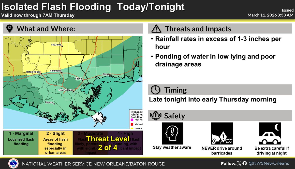
This is a stay weather aware week. Biggest threat is heavy rainfall leading to flash flooding, but we will also have some issues with coastal flooding, hazardous marine conditions and isolated severe weather. Keep an eye on the latest forecasts. #LAwx#MSwx
Jun 16 8am EDT: Key Messages for the Disturbance Over the Northwestern Gulf of America. Stay up to date with the latest at https://t.co/tW4KeGdBFb and https://t.co/SiZo8ozBbn
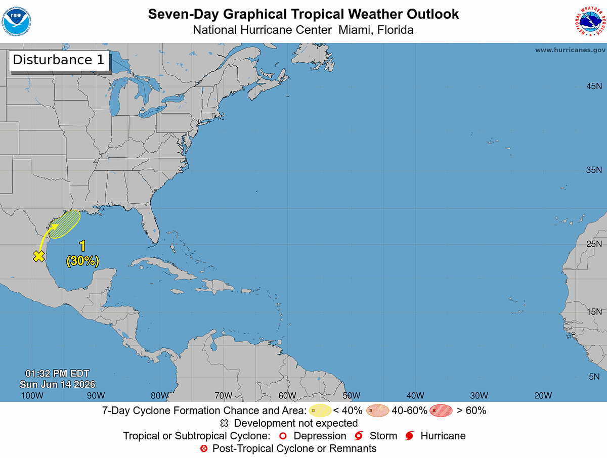
Sun 6/14 2 PM EDT: A trough is producing showers and storms over northeastern Mexico, and no development is expected in the next 24-48 h. However, the system could move into the northwestern Gulf by midweek where conditions may become more favorable for development. Heavy rain and flash flooding are possible across parts of Texas and Louisiana this week. Check out https://t.co/Wq6ZtKfHp9 and https://t.co/zJDnFUKPfU for the latest information.
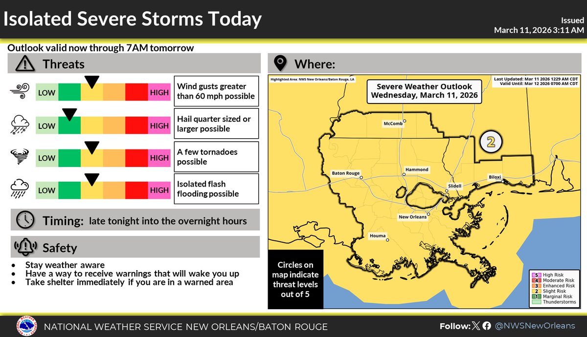
Slight risk of severe weather tonight/early tomorrow has expanded to all of SE LA/S MS. Storms will start entering the area late this afternoon into the evening. Damaging winds will be the main threat. Make sure to have warnings that can wake you up overnight tonight! #LAwx#MSwx
Severe weather remains a concern this today with a Slight Risk (level 2 of 5) for severe weather . Storms are expected to form this afternoon with the main line of thunderstorms leaving the region after midnight. Make sure to stay weather aware today!
NWS - Lake Charles - Nicholas Slaughter [4:53 AM]
Key Messages:
Tornado risk has increased
Slight Risk for severe weather across most of the region
Timing will be Wednesday afternoon and overnight (4 PM to 11PM)
2026 ST MARY PARISH HAZARD MITIGATION PLAN UPDATE KICKOFF MEETING TUESDAY, MARCH 10TH 10 AM COURTHOUSE COUNCIL MEETING ROOM 5TH FLOOR.
VIRTUAL LINK: https://t.co/ViIYk6c7IM...