Happily married, father of 2. Member of the Citizen's Weather Observer Program (CWOP EW9077). Weather is fascinating and enjoy useful wx info. Tweets are my own
Here is map of the rain from the remnants of Isaias, from Saturday morning through this morning. The highest amount was 9.08 inches near Seven Devils, in Watauga County, NC!
Additionally, we have found 5 tornadoes in our forecast area - 4 in SC and 1 in GA. Four of these have been rated EF1, with the final tornado (Newberry/Fairfield County line) confirmed but pending a final rating. We'll have the info on that last tornado later this afternoon!
We have confirmed the details of two tornadoes that occurred in the area on Saturday afternoon, both in Barnwell County. We are sending an additional survey team out and expect to release additional information later today on the tornadoes that occurred this weekend.
Hurricane #Simon Advisory 18 (3 PM CST, Sun Oct 11): Core of Hurricane Simon Continues to Skirt the Coast of West-Central Mexico with Hurricane Conditions Likely Occuring. New Hurricane Watches Issued Farther Up the Mexican Coast. https://t.co/NyUGSIFCuo
HUGE SCIENCE MISSION WIN with Dominator weather balloon sampling the eye and sting jet of Hurricane Isaias as it interacted with an upper low to the west. This is a trajectory with wind and thermodynamics attached. Extreme engineer @WillClay25 overnight science mission
Destructive waves from Tropical Storm #Rachel smashing into already damaged homes as this relentless super El Niño continues to hammer the California coastline and continues to claim more homes and piers #CAwx@JordanHallWX
🚨 0745 Sunday update: we are still seeing impacts from the remnants of Isaias across WNC. Going into today, we need to remain weather aware. Flood sirens are activated in the Chimney Rock area, many areas have seen flash flooding and rainfall ponding, and there have been some landslides overnight. Do not drive through flood waters.
Here is a view of the current flash flooding outside of Chimney Rock in Rutherford County.
#ReadyNC #IsaiasNC
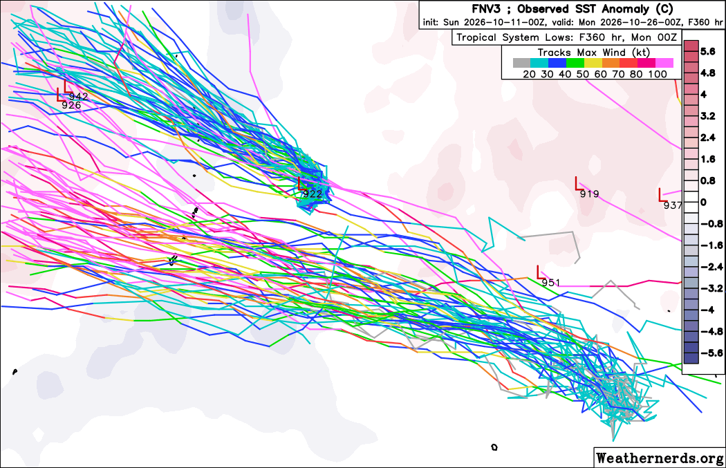
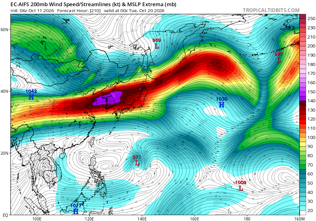
We've had several impactful TCs across the Western Hemisphere recently (Polo, Nolo, Rachel, Simon, Isaias). Looks like the West Pacific might be loading up for one now. Invest 96W is coming together around 160E, and models suggest it could become a very powerful typhoon in time. The downstream environment looks very favorable, with a large anticyclone overhead.
The Mariana Islands, including Guam and Saipan, should keep a close eye on this one. Models indicate it could be starting its rapid intensification near the islands. The timing on this intensification will probably determine how severe the impacts are.
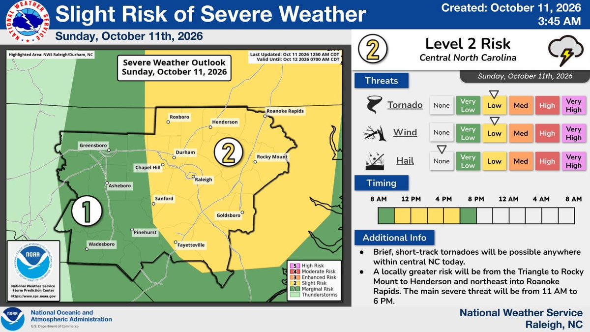
⚠️ Severe Weather Update ⚠️
There is a Level 2 (Slight) Risk for severe thunderstorms across central NC today, October 11th. Brief short-track tornadoes will be possible, especially along and east of the Triangle. #NCwx
Post-Tropical Cyclone #Rachel Advisory 57 (2 AM PDT, Sun Oct 11): Rachel Continues to Bring Heavy Rains and Gusty Winds to Portions of Baja California and the Southwestern United States. https://t.co/NyUGSIFCuo
Hurricane #Simon Advisory 16 (3 AM CST, Sun Oct 11): Eyewall of Extremely Dangerous Hurricane Simon Very Near the Coast of West-Central Mexico. https://t.co/NyUGSIFCuo
❗️Saturday at 10:20pm: Attention Rutherford County Residents and Visitors- Please see the message below from Rutherford County Emergency Management:
🚨FLASH FLOOD WARNING SIRENS ACTIVATED IN CHIMNEY ROCK 🚨
Rutherford County Emergency Management has activated flash flood warning sirens for the Fall Creek area just north of Chimney Rock, NC.
Residents and visitors in the affected area are strongly encouraged to move away from the river and seek higher ground immediately.
If you are near the Rocky Broad River in the Chimney Rock/ Lake Lure area, please maintain situational awareness and closely monitor weather conditions and water levels. Conditions can change rapidly and water levels may rise with little warning.
Please continue to monitor trusted weather sources, local emergency notifications, and official Rutherford County Emergency Management updates for additional information.
Your safety is our top priority. Stay alert. Stay informed. Stay safe