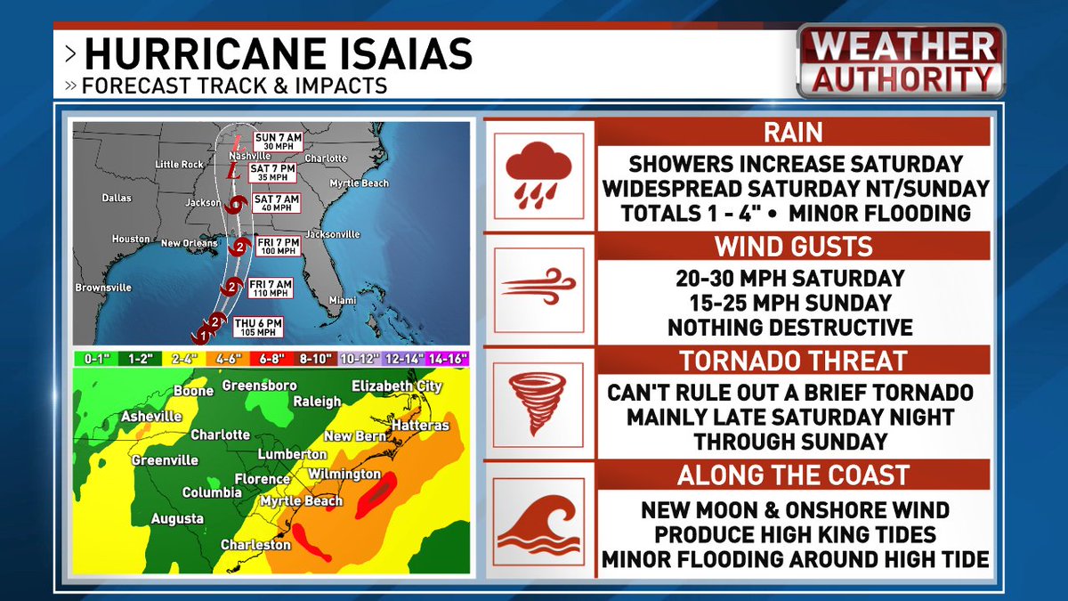
Here's an overview of what to expect this weekend. Rain totals could approach 5-6" in a few spots near the coast. We'll keep you posted on the low tornado threat as well.
TROPICAL UPDATE
1 PM MONDAY 10/5/2026
BOTTOM LINE - We could eventually get rain from this system over the weekend.
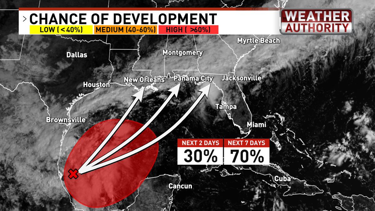
Odds are high that a tropical depression or storm will form in the southern Gulf by the end of the week, but how strong it becomes remains an open question.
If it spends enough time over warm water, avoids persistent wind shear, and gets support from upper-level divergence (air spreading outward aloft, allowing air below to rise), it could strengthen. A hurricane isn’t completely off the table. On the other hand, if it's pounded by relentless wind shear and lacks upper-level support, it would remain weak and disorganized. Until a well-defined system develops, it’s too early to say which outcome is more likely. I’ll be watching closely.
Regardless of its strength, the system will most likely be pulled north or northeast, coming ashore somewhere between Louisiana and the Florida Panhandle. How quickly that happens will determine our rain chances this weekend.
Based on current models, rain chances look low Saturday but increase significantly Sunday. Remember, the system hasn’t even developed yet, so confidence in the rain forecast remains low.
Today’s Smoke Alarm Blitz totals, all across Horry County, courtesy of Horry County Fire Rescue’s career and volunteer staff teams:
570 doors knocked on
337 FREE smoke alarms installed
1,914 FREE smoke alarms installed by HCFR so far this year
#HCFR#TeamHorry