11:19 PM Radar Update: Storms in Northern LA will move toward Central MS overnight, bringing the return of rain to the Metro before sunrise on Wednesday. Scattered storms will stick around throughout the day, and become more isolated by the afternoon.
The Pearl River is expected to reach its highest level(crest) later today before slowly receding over the next few days. In Jackson, the river is forecast to fall below minor flood stage by late Wednesday. https://t.co/NipV4Zv9kD @WJTV@StormTeam12#RiverFlooding#mswx
11:24 PM Radar Update: Some loud thunderstorms are making their way through portions of Central Mississippi. These storms will continue to move southeast, bringing more rain to the city of Jackson as we go into Tuesday morning. https://t.co/NH5dTq1uq4 #mswx
A new Severe Thunderstorm Watch has been issued for portions of Central Mississippi. Get the latest severe weather forecast: https://t.co/NH5dTq1uq4 #mswx
Father's Day is tomorrow, so hopefully you already purchased a gift! If you have plans outside, then be cautious as more scattered showers and storms are expected in the afternoon. #mswx
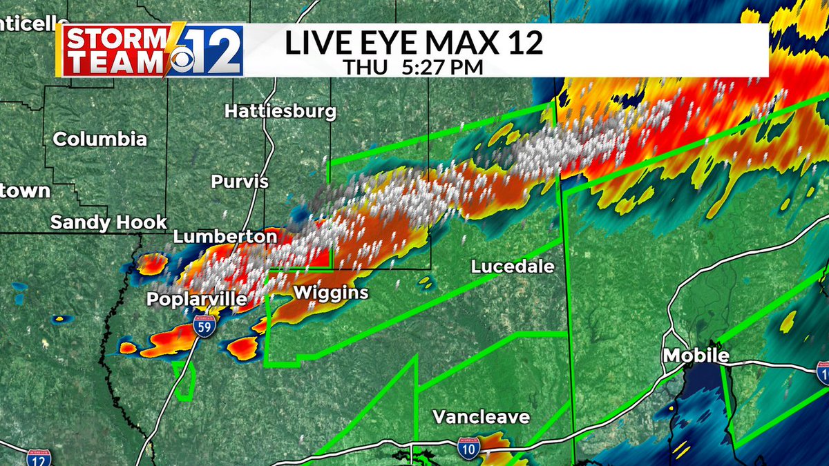
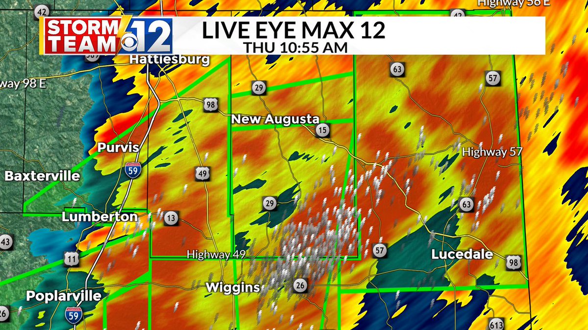
A Flood Watch will remain in effect for Central Mississippi and the Pine Belt through 7 PM Friday. While storms will be more scattered on Friday, flash flooding could still be an issue. Additional rainfall amounts between 1 and 3 inches will be possible in some areas. #mswx