The Storm Prediction Center has issued an ENHANCED RISK for the entire state of Wisconsin for this late afternoon and evening!
This is day 3 of the ring of fire pattern - we expect supercells to erupt off the Lake Superior lake breeze south of Duluth and move southeast through nearly the entire state of Wisconsin. These supercells will likely congeal into a destructive wind bag by evening.
Gorilla hail and isolated tornadoes possible with the initial supercellular mode
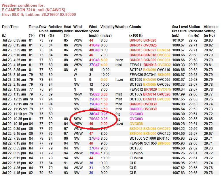
TROPICAL UPDATE: A new center tried to form last night with #Bertha, but couldn't do it. The original center, right now along the Louisiana coast, remains. Most storms are still closer to the mid-level circulation (yellow)...which last night for a few minutes produced hurricane-force wind at around 100 feet up on an offshore platform (60 - 65 mph if at the surface). Most wind has been lower overall by comparison. Strongest part of the storm will likely head towards the Texas coastline between Corpus Christi and Sargent later today with heavy rain and gusty wind.
7/22 11am HST: Hurricane #Fausto is expected to continue moving in a direction between west and west-northwest for the next several days.
See the latest update at https://t.co/Oy8uoeRKme
Very nice rain totals the past seven days, especially where it is needed the most, right along our west coast. As Bertha continues to move away, our rain chances will drop. Less rain = more heat!! #Florida#Skytower
Definitely squally here in St. Petersburg, FL. Its kind of exciting, you know these squalls are just fun, they are not strong enough to ruin your life.
30 sec video clip from the Circle K last night in Cadott, Wisconsin. Took on 5 minutes of sustained 45+mph winds, the rain bands were nuts. Purely outflow, but it sure felt like being in the backside of a few rain wrapped tornadoes in the past 😅 storm was unreal, pics later
We now have an invest area (#91L) in the Gulf. Some satellite observations so far today:
1. There is a bit of a double-barrelled look as two mid-level vorticity maxima appear (circled). This is the beginning of the expected "stretching out" process (see yesterday's post).
2. Surface rotation is more apparent today and confirmed by surface observations (circled), albeit still very weak relative to the mid-levels.
3. Convective (thunderstorm) coverage is muted so far, likely due to some dry air punching into the north side via #Georgia and northern #Florida. The preexisting environment was never impressively moist either.
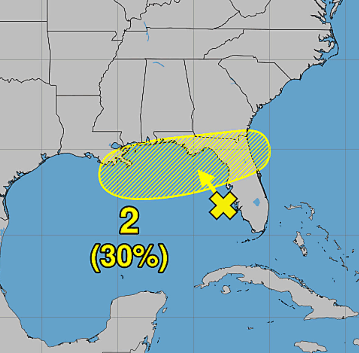
These signs don't point toward rapid development short-term, but the system nevertheless has a chance to become a tropical depression or storm over the next couple of days. The National Hurricane Center has bumped those odds to 40% today.
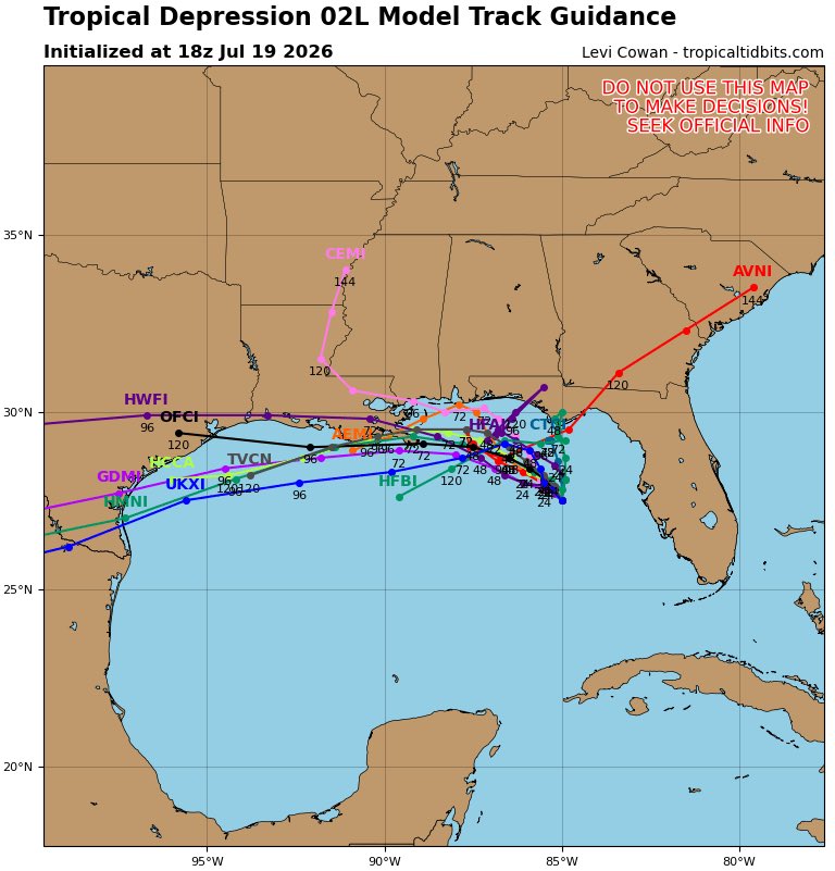
The AI ensembles have perked up today on developing this disturbance. This is mostly mid-level activity, however it is clearly a robust circulation so if it can stay over water it may have enough time to work its way down to the surface and spin up a TC along the NE Gulf Coast. We are preparing to fly a LLI as early as Sunday.
Small circulation passed over @FlyTPA ✈️ around 2 PM before moving to the southeast and weakening. These mini circulations can lead to short-lived tornadoes/waterspouts and produce damage as atmospheric boundaries interact and converge in this dynamic airmass with low pressure off the Tampa Bay coastline. #FLwx
Wicked MCV spinning in the eastern Gulf this afternoon! The satellite presentation shows a well defined mesoscale vortex driving explosive thunderstorm development offshore. 🌀 #FLwx