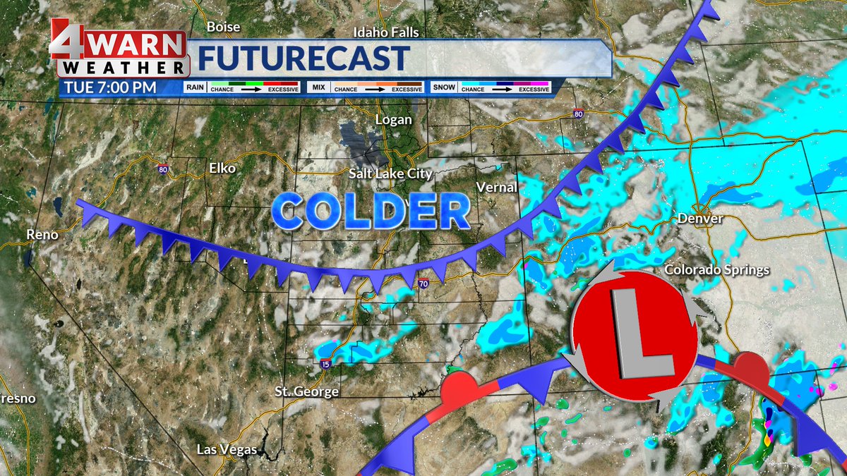
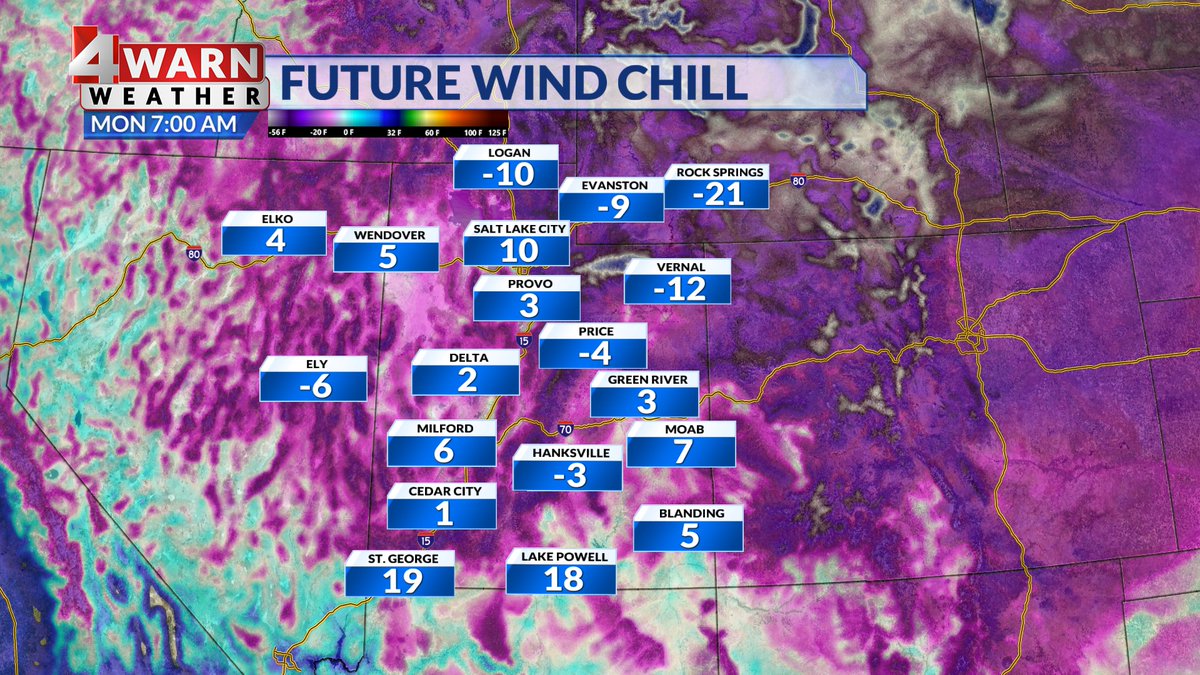
TUESDAY COLD FRONT: Another surge of cold air will move into the Beehive state on Tuesday. A weak front will arrive across the north Tuesday morning, then drop south through the day. Lows by Wednesday AM will be in the 0's & low 10's with colder wind chills likely.
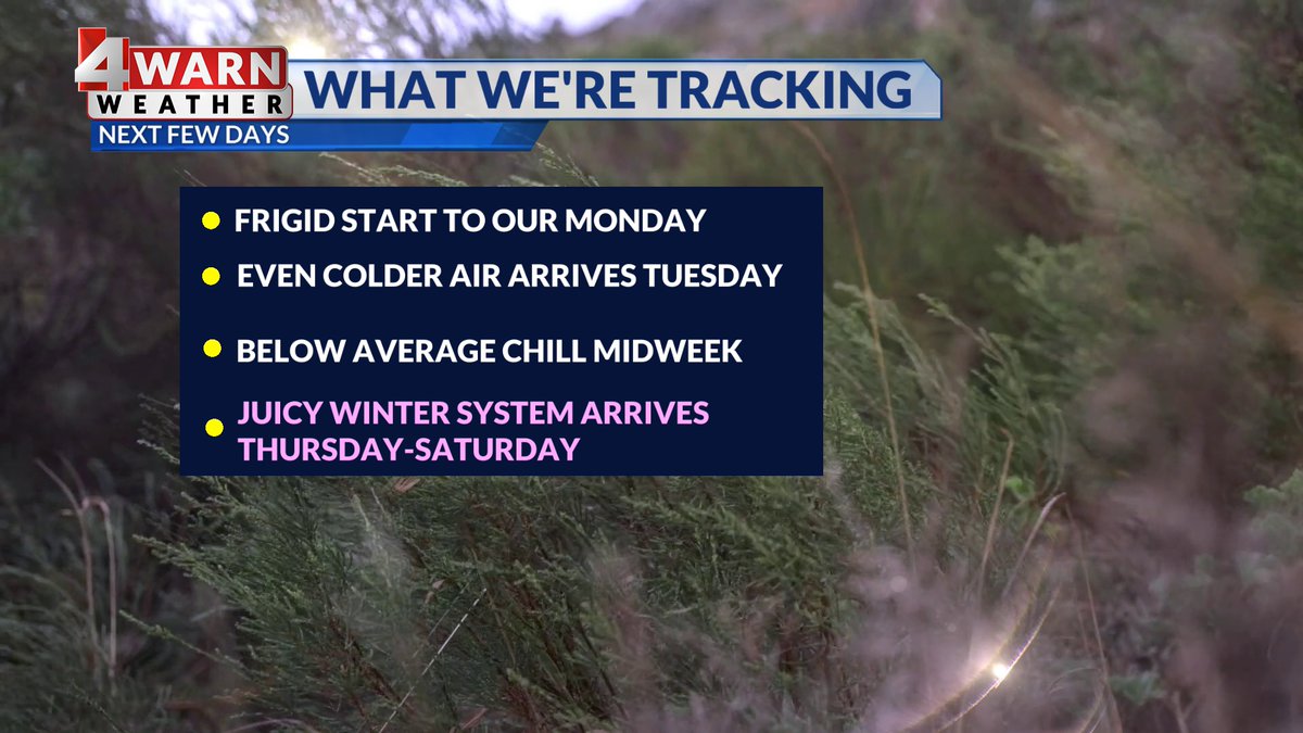
The work week starts cold & dry around Utah! A cold front arrives Tuesday, bringing a surge of colder air and really low wind chills.
Few flurries & Mtn. snow showers will also be possible Tuesday.
A "stronger" system arrives late-week bringing state-wide moisture!
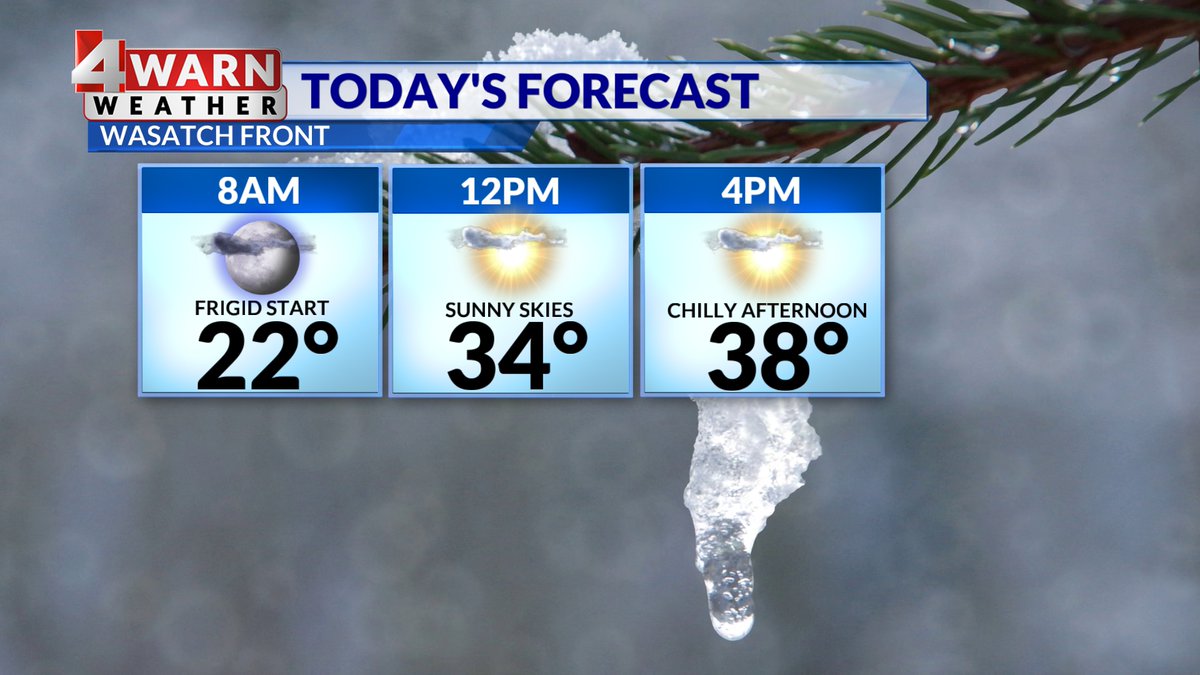
Good Monday morning, Utah! It's a frigid one this morning with temperatures down into the 10s & lower 20s.
A few clouds across southern Utah is helping hold temps up a bit for now.
Look for clearing skies today across the south, with sunny skies to the north!
#utwx
A few areas across northern Utah could hear & see a few rumbles of thunder or flashes of lightning, along with snow this afternoon as a potent front with plenty of dynamics roll through the region today!
#utwx
FRIDAY WINTRY MIX: We're starting to see precipitation fill in across NW Utah this morning.
We're expecting a band of moderate rain to some valley snow, to develop late-morning, then slowly drift south through the afternoon & evening hours.
#utwx
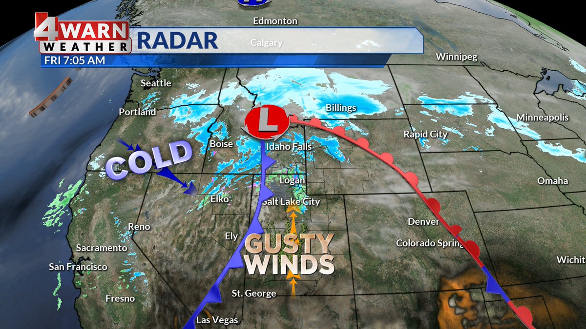
FRIDAY MORNING: It's a windy & warm start to the day around Beehive state. Winds are averaging between 15-30 mph, with gusts between 40-50 mph. A Wind Advisory is in effect for the western half of the state.
50s now, but afternoon temps drop with a rain/snow mix!
Happy Friday, Utah! It's been a roller-coaster ride of temperatures the past several mornings.
A potent cold front is approaching the area & ahead of it, strong winds have pushed temps 10°-30° above Thursday morning temps.
Later today, temps drop behind the front!
Sunday clears out the wet weather in northern Utah, but now it's southern Utah's turn! Rain and snow showers will impact the southwest portion of the state for the next couple days, but they'll be just skimming the tip of the storm, so precip will be fairly light #utwx@abc4utah
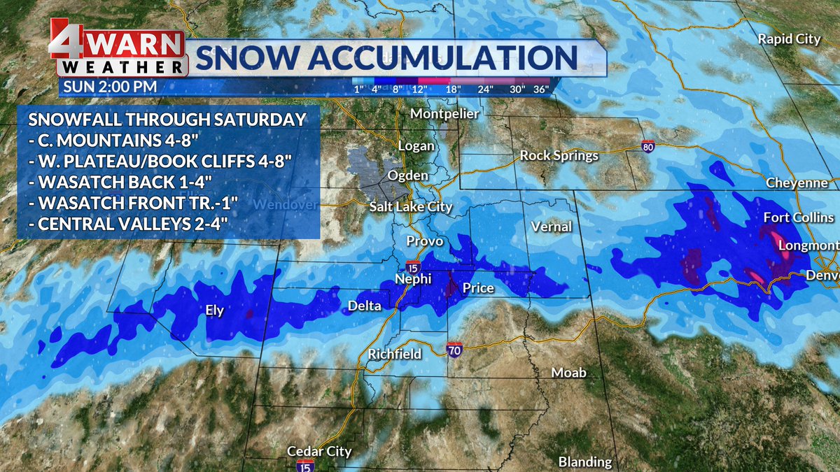
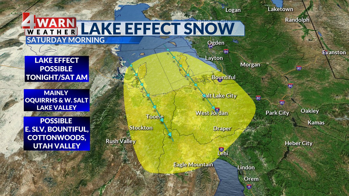
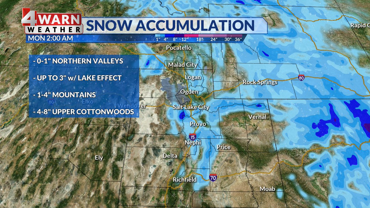
A band of snow will set up tonight into Saturday for portions of N. and C. Utah. Snowfall amounts for the Wasatch Plateau, Book Cliffs, and C. Mtns is 4-8" while most valleys from SLC south to Fillmore is 1-4". Wasatch Front will see a trace-1". Snow in S. Utah late Sun-Tue.
Extreme Cold Warning issued for areas near Zion & Lake Powell. Warning in effect until 10AM Tuesday for bitterly, unusually cold wind chills in parts of Southern Utah including Springdale, Big Water and Bullfrog.
Stay warm!
@abc4utah
Gear up with all your winter clothes because it's going to be a frigid MLK Day! High temps in the 10s and 20s for most with even colder wind chill. On the bright side, sunshine will help keep us feeling somewhat warm. We hop on a warming trend by tomorrow! #utwx@abc4utah
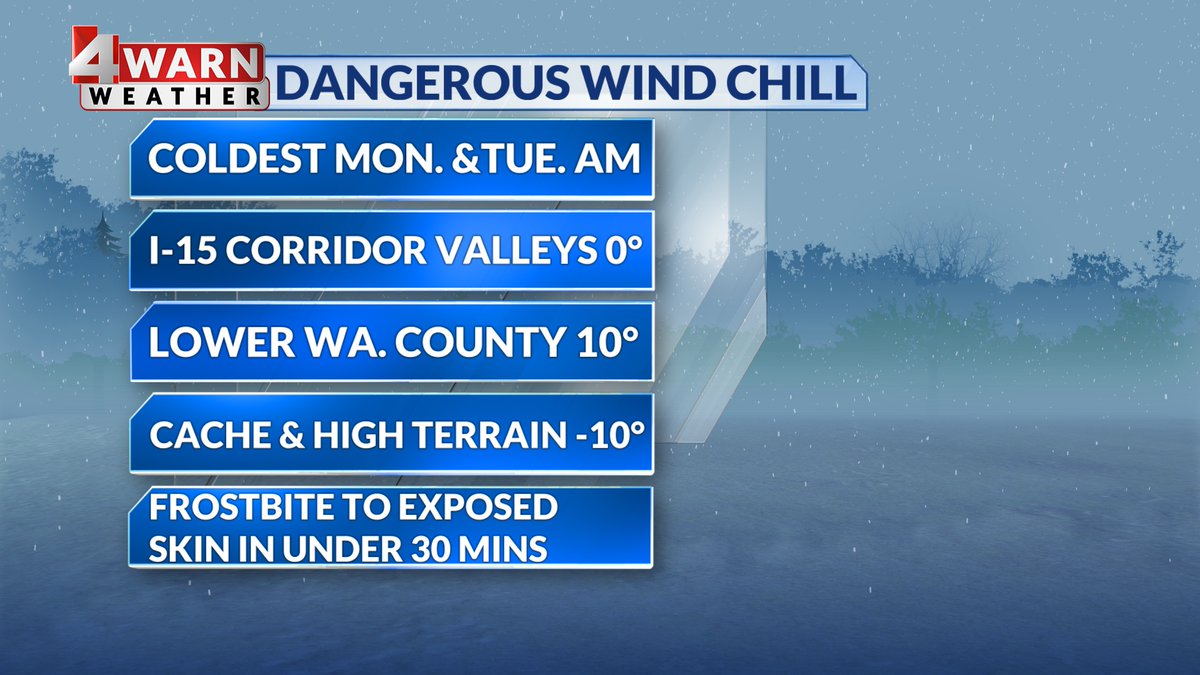
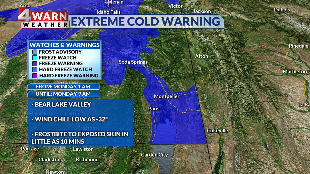
Brace for bitter wind chill values tonight! Frostbite to exposed skin could occur in under 30 mins, make sure to prepare with gloves, a hat, and a good jacket. Extreme Cold Warning is in effect for the Bear River Valley where frostbite in only 10 mins is possible #utwx@abc4utah
If you're joining @abc4utah in the Salt Lake MLK March tomorrow afternoon you'll want to bundle up! Temps will be in the 20s, but the wind chill could make it feel even colder #utwx
SATURDAY: Light now showers will push through parts of northern Utah Saturday morning, but they should clear out before noon. Temps drop significantly tomorrow behind this incoming cold front, and with a breeze the wind chill will be brutal - bundle up! #utwx@abc4utah
FRIDAY: Poor air quality grips northern valleys, but a system grazing the northeast will help clear it out & bring a few light snow showers. Snow will first be seen Fri. evening in higher terrain, then valleys late Fri. PM - Sat. AM, but accumulation will be light #utwx@abc4utah
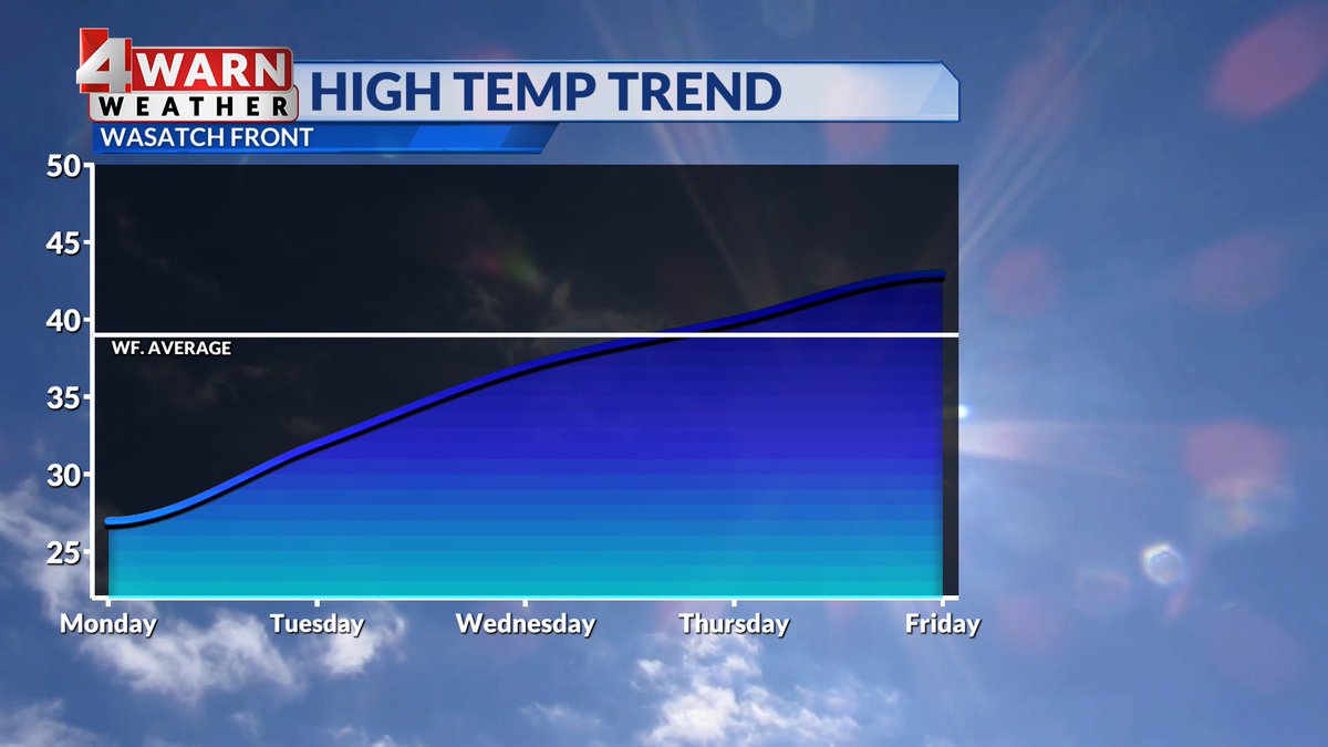
MONDAY: Another chilly day is on deck with many valleys struggling to reach above freezing. There's a chance of a brief PM snow shower for NE. mountains, but apart from that it's a mix of sun & clouds. We gradually warm through the week before a major cooldown #utwx@abc4utah
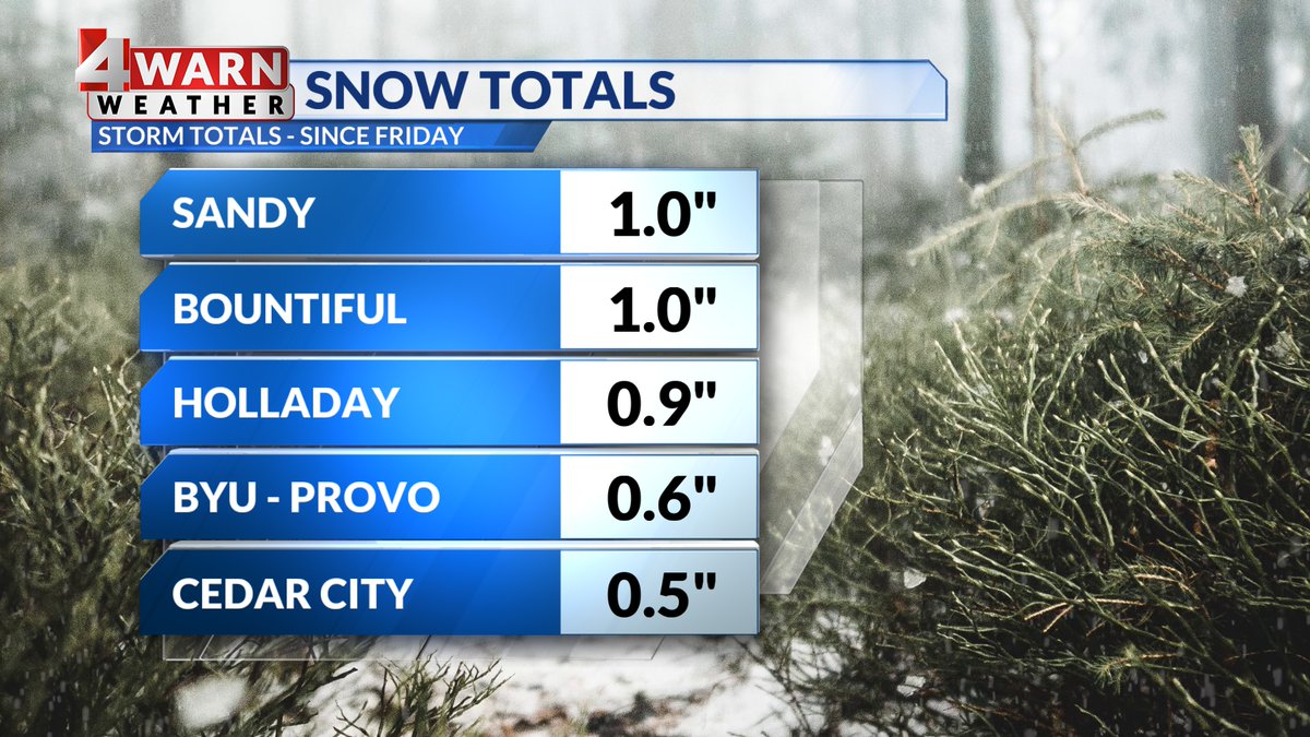
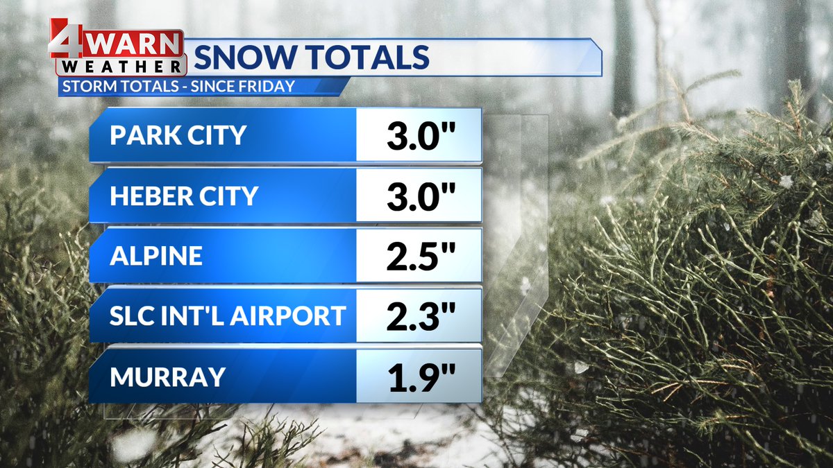
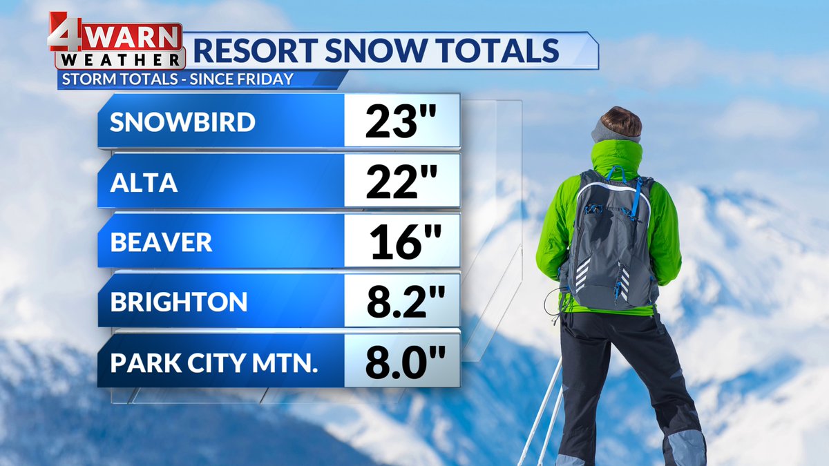
Now that the bulk of the snow is behind us, we can take a look at our snow totals the past few days have brought us. We had healthy mountain snow, especially in the Upper Cottonwoods. Valleys were modest, but we'll take whatever we can get! #utwx@abc4utah