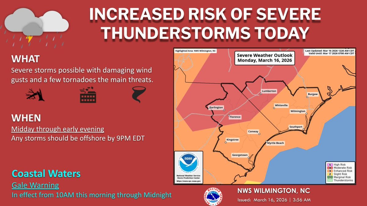
Severe thunderstorms will be possible today into tonight ahead of a very strong cold front. Wind gusts of 40-50 mph will even be possible outside of any storms today.
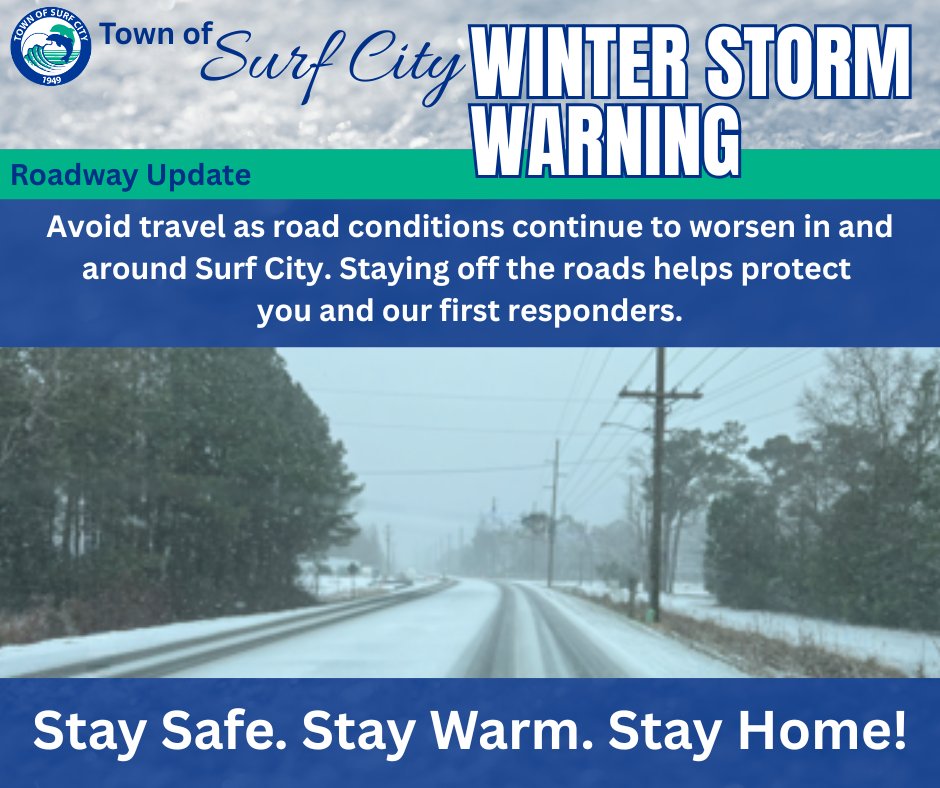
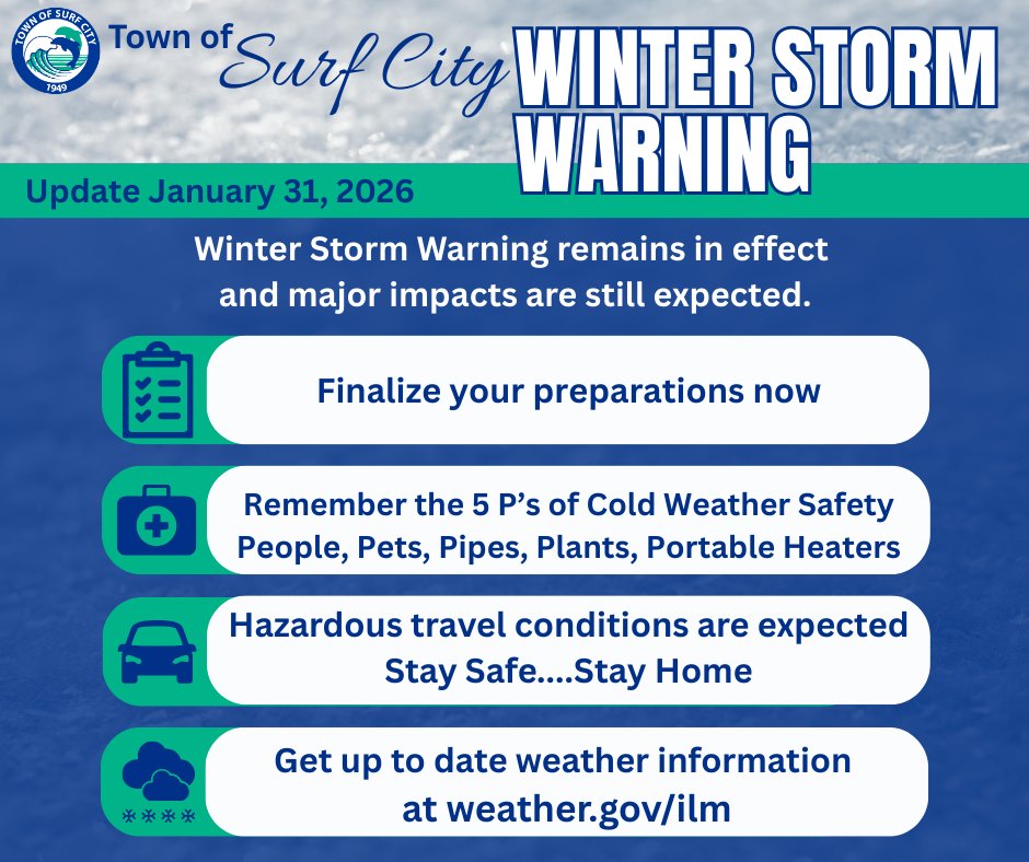
We remain under a Winter Storm Warning with major impacts expected. All preparations should now be completed. Hazardous winter conditions include snow, dangerously cold temps, strong winds. Stay safe, warm, and informed, and stay off the roads if possible. @NWSWilmingtonNC
A Winter Storm Watch is in effect for the Surf City area this weekend. Residents are encouraged to begin preparing now to keep themselves, their loved ones, and their homes safe before, during, and after the storm. Follow @NWSWilmingtonNC
More info: https://t.co/CVncNJljnt
Of course, I didn't realize that our latest graphic didn't update accordingly from one computer to another. Ouch.
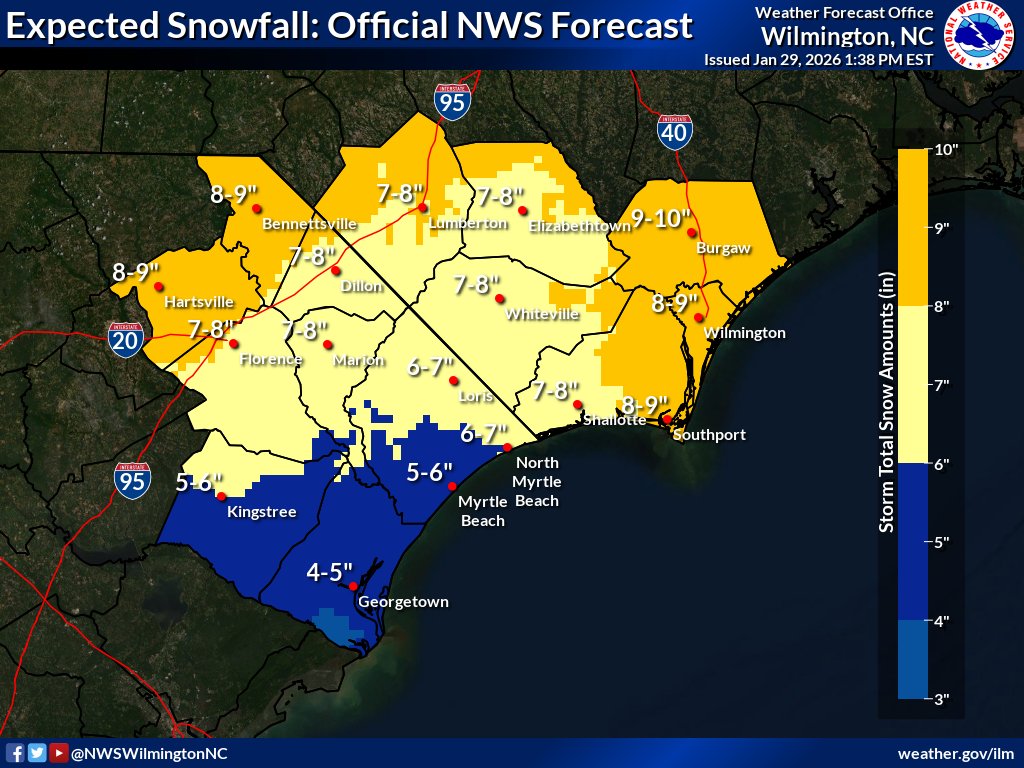
THIS is our latest official snow forecast. 7-10 inches over much of our area, with 4-6 inches in parts of the Grand Strand. Apologies for this error. #ncwx#scwx
Heads up everyone! There is another possibility of wintery weather this weekend. We will be following the progression closely and will provide updates as needed.
⚠️ We are monitoring the potential for a significant winter weather event this coming weekend. There is a wide range of potential scenarios. Monitor the forecast over the coming days using trusted sources. #ncwx#scwx https://t.co/D4DrUp4LQH
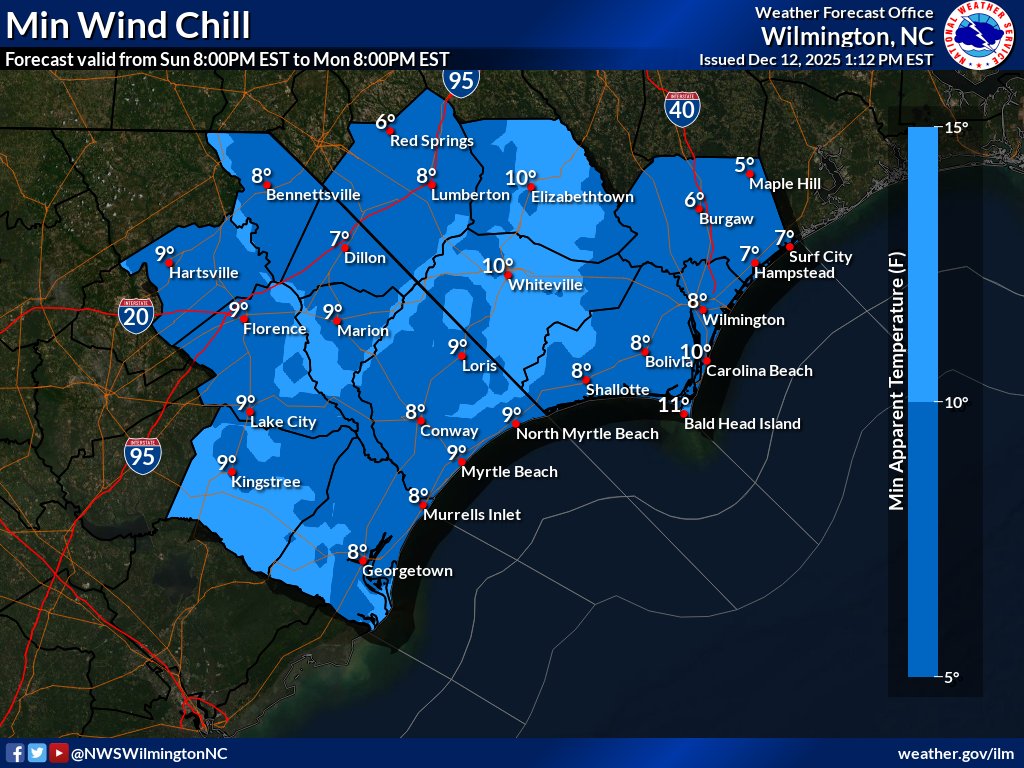
🧊ALERT: Extreme Cold Watch issued for Sun night for all of SE NC & NE SC for wind chill temps in the single digits! Take advantage of the milder conditions thru Sat to prepare as wind chills will fall quickly Sun.
💻Latest at: https://t.co/D4DrUp4LQH
#ncwx#scwx#ilmwx#myrwx
🧊ALERT: Extreme Cold Watch issued for Sun night for all of SE NC & NE SC for wind chill temps in the single digits! Take advantage of the milder conditions thru Sat to prepare as wind chills will fall quickly Sun.
💻Latest at: https://t.co/D4DrUp4LQH
#ncwx#scwx#ilmwx#myrwx
Town of Surf City continues to monitor Tropical Depression 9 and encourages residents to stay informed as conditions develop. Follow official updates from the NWS Wilmington: https://t.co/Wdf2diBAH6
CodeRED alerts: https://t.co/8w1xwmzOoh
SurfCityNC app: https://t.co/uXdxn3QlBK
Town of Surf City continues to monitor Tropical Depression 9 and encourages residents to stay informed as conditions develop.
Follow official updates from the NWS Wilmington: https://t.co/nZmJXISid0
CodeRED alerts: https://t.co/8w1xwmzOoh
SurfCityNC app: https://t.co/uXdxn3QlBK
Town of Surf City is monitoring PTC9 and encourages residents to stay informed as conditions develop.
Official updates from the National Weather Service : https://t.co/nZmJXISid0
Sign up for CodeRED: https://t.co/8w1xwmzOoh
Download the SurfCityNC app: https://t.co/e6dy9Rqw41
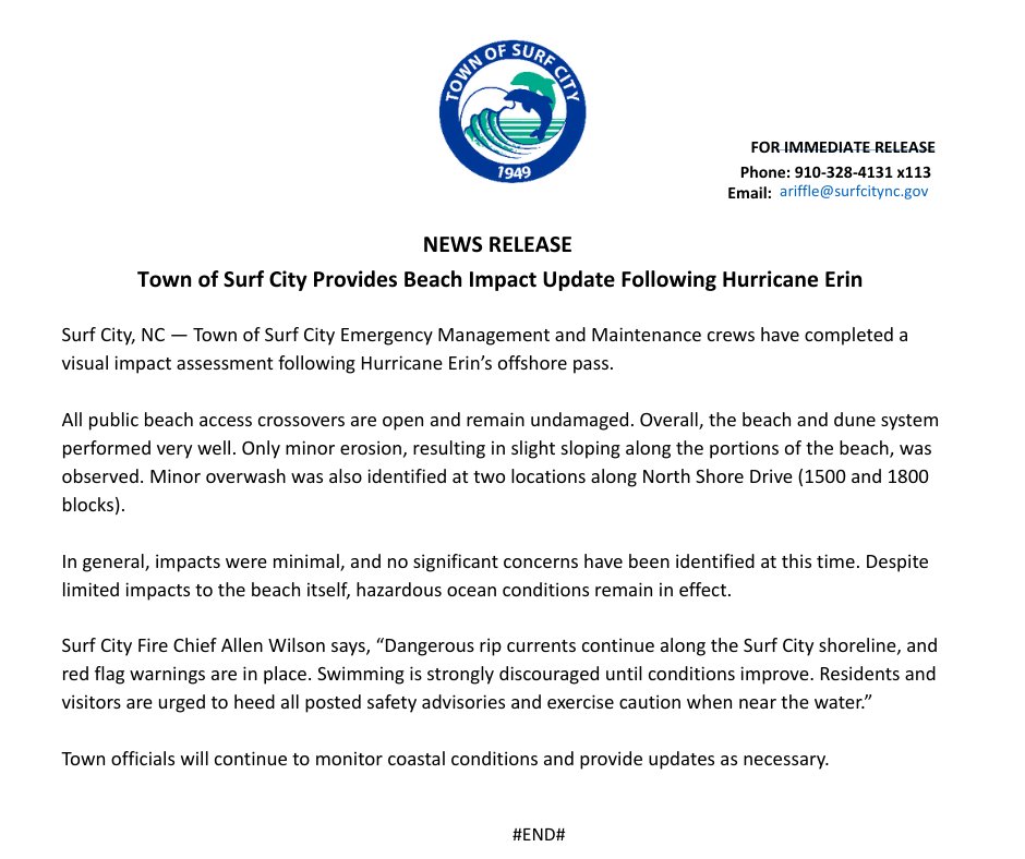
When a hurricane stays out at sea, it can still bring dangerous rip currents, high surf, coastal flooding, and beach erosion to the coast. Rip currents are powerful, unpredictable, and can sweep even the strongest swimmers out to sea in seconds. Stay safe, stay ashore.
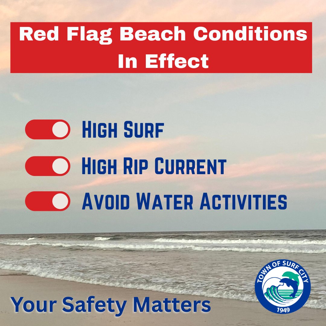
Surf City beaches are currently under red flag warning.
We strongly encourage everyone to avoid entering the water during these conditions. Please stay safe and enjoy the beach from the shore when red flags are up. Your caution could save a life. #RedFlagWarning#BeachSafety
🌧️ Water accounts for ~90% of deaths from Atlantic tropical cyclones. Inland flooding is the most deadly and serious threat that hurricanes bring to the inland Carolinas. The amount of rain a tropical storm produces is NOT related to its category. Turn around, don't drown!
Do you know what to do when a storm threatens? Prepare for hurricane season by taking the time now to understand the actions needed when time is of the essence. #ncwx#scwx#ILMwx#HurricanePrep#HurricaneStrong https://t.co/rDRQzeDlKd
🌪️ Any tropical system is capable of producing tornadoes! Tropical tornadoes are often short lived, but they can produce enhanced areas of damage. Sometimes, these tornadoes can occur in the outer rain bands well ahead of the center of the storm. #ncwx#scwx#ILMwx#HurricanePrep
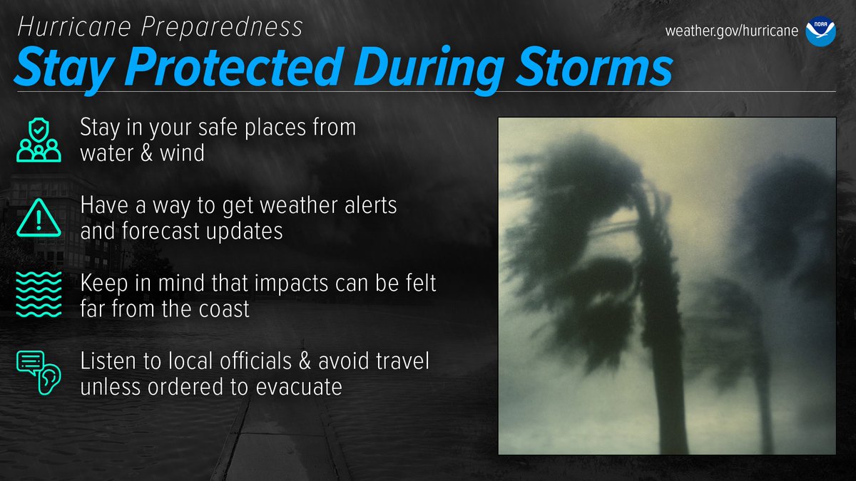
Be prepared for hurricane season by knowing what to do during a storm. Whether you’ve evacuated or are sheltering in place, know what to expect from the hazards you may face. #ncwx#scwx#ILMwx#HurricanePrep#HurricaneStrong https://t.co/iTeIDNZZaP
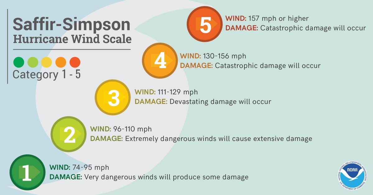
🌬️ Tropical-storm-force winds, 39-73 mph, are strong enough to be dangerous to those outside. For this reason, evacuations are planned before the onset of tropical-storm-force winds. Hurricane-force winds, 74 mph or more, can destroy buildings and mobile homes. #ncwx#scwx#ILMwx
Prepare for hurricane season by knowing how to understand forecasts. They can tell you a lot about what is expected, including the storm's path, rainfall amounts, wind speeds, and more. #ncwx#scwx#ILMwx#HurricanePrep#HurricaneStrong https://t.co/IIWCca0XO6