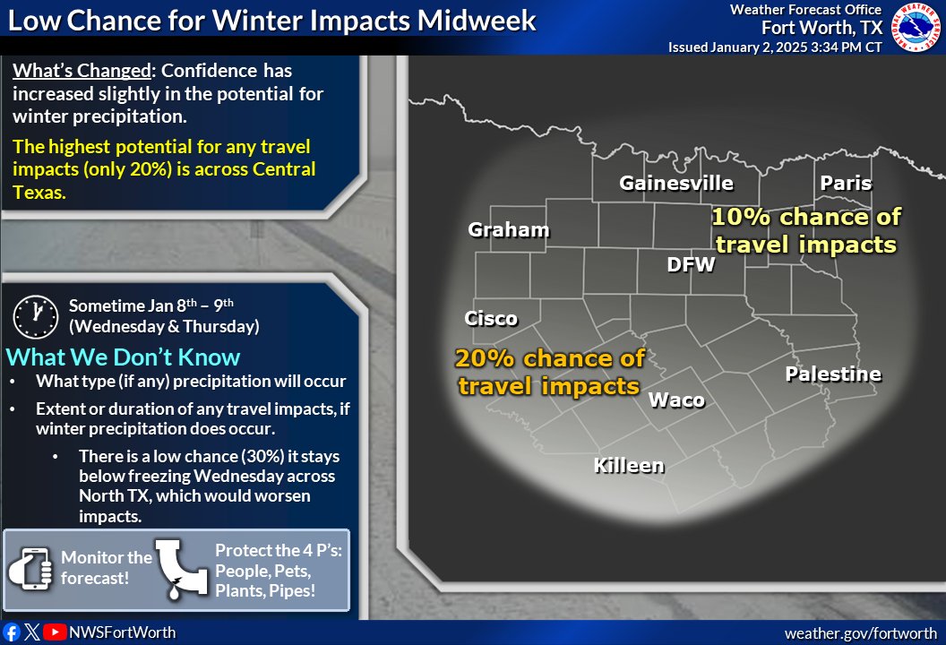
Next Week: Confidence has increased slightly in the potential for winter precip in the Wed - Thurs timeframe next week. The highest potential for any travel impacts (only 20%) is across Central TX. Still a lot that can and will change, so monitor the forecast. #dfwwx#ctxwx#txwx
Wednesday is the last day of the winter where the normal high is 56. This means we are leaving the statistical coldest time of the year. Thursday it's up to 57, and it'll keep rising until it reaches 97 in late July.
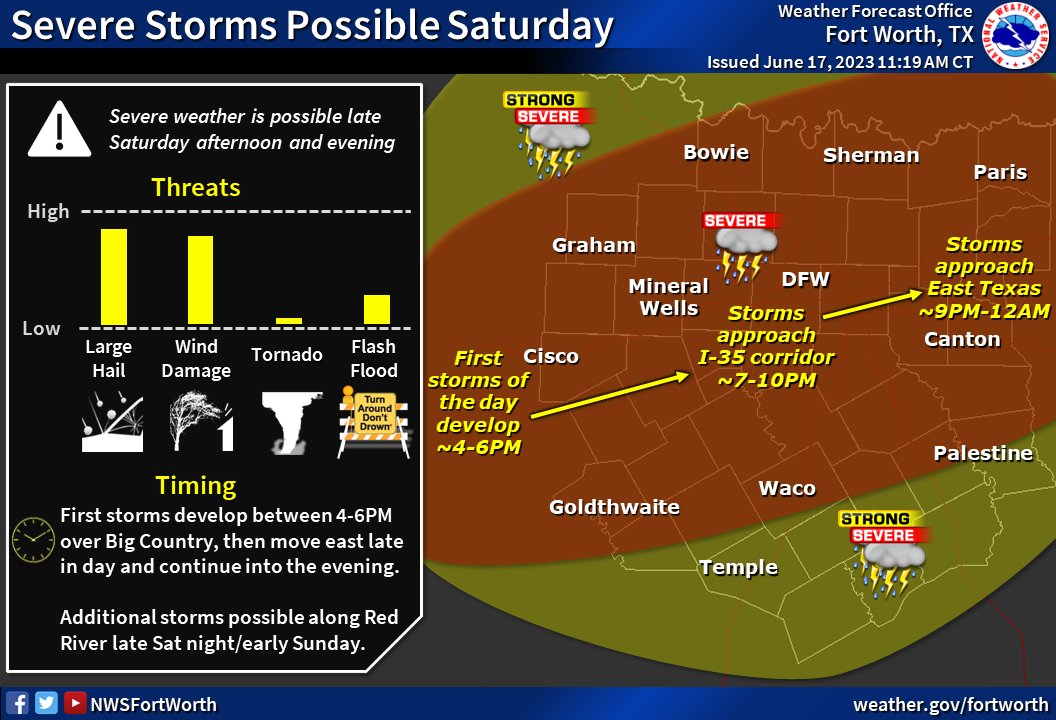
Our current thinking for today's (6/17) severe threat. Still expecting storms to fire up along the dryline and move east late this afternoon, with additional storms along the Red River late tonight. Large hail and damaging winds remain the greatest threat. #dfwwx#ctxwx#txwx