Starting as early as March 9, traffic on the Mt Lehman structure across #BCHwy1 in #Abbotsford will go from 3 to 2 lanes for construction of an improved 5 lane structure. Work planned until the end of 2026.
Learn more: https://t.co/O7b5RqTVui
EmergencyInfoBC is also on Facebook: https://t.co/F0koj9jilI
We share verified updates, instructions & links to official sources during emergencies in #BC, including floods, wildfires, earthquakes & tsunamis.
Follow our Facebook page for trusted emergency information, alongside our posts here on X. #BCFlood #BCWildfire #BCEarthquake
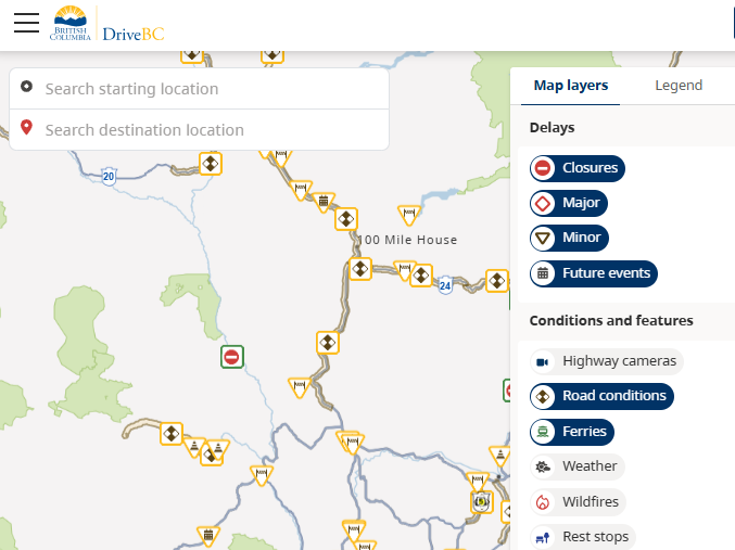
Help shape the future of DriveBC!
Participate in user research to provide feedback on the website.
Those selected and who participate will receive a gift card in appreciation of their time. #BCTrucking#BCTrks#BCHwys @DricveBC
Sign up: https://t.co/F7XRdOP5bE
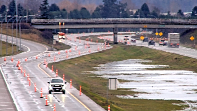
The Keating Cross Rd southbound onramp to #BCHwy17 (Pat Bay Hwy) is scheduled to open Saturday morning (Jan 24) following improvement work.
The area remains an active work zone, follow signage and use caution.
Check @DriveBC for updates. #Saanich
https://t.co/8RcRk0pO4C
🚧⛔#BCHwy3 - Paving operations officially underway westbound between Exit 177 and Exit 171 until 4:30 PM this afternoon. Westbound travelers MUST use Exit 173: Old Hope Princeton Way in #HopeBC to access #BCHwy1.
ℹ️For more info: https://t.co/FTolLRaJVT
Overnight lane closures planned for George Massey Tunnel starting Sun, Jan 11 #RichmondBC#YVR#BCHwy99
Overnight single-lane closures to continue through March, prep for construction of the new tunnel.
More details: https://t.co/KOdfrZPeH1
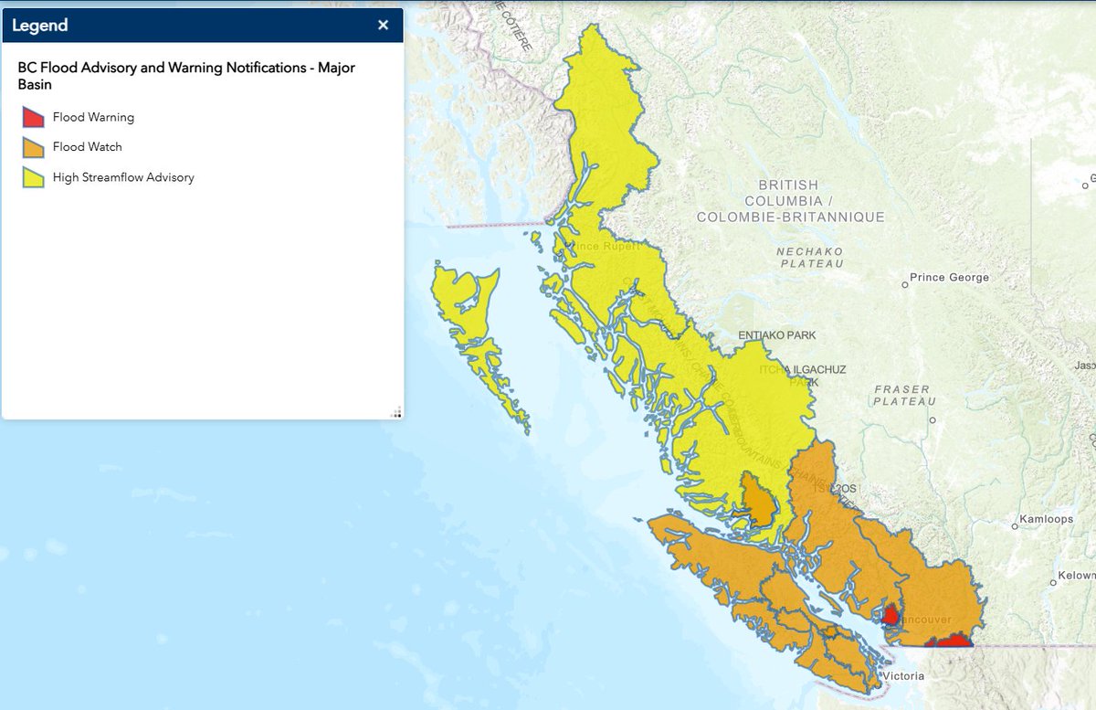
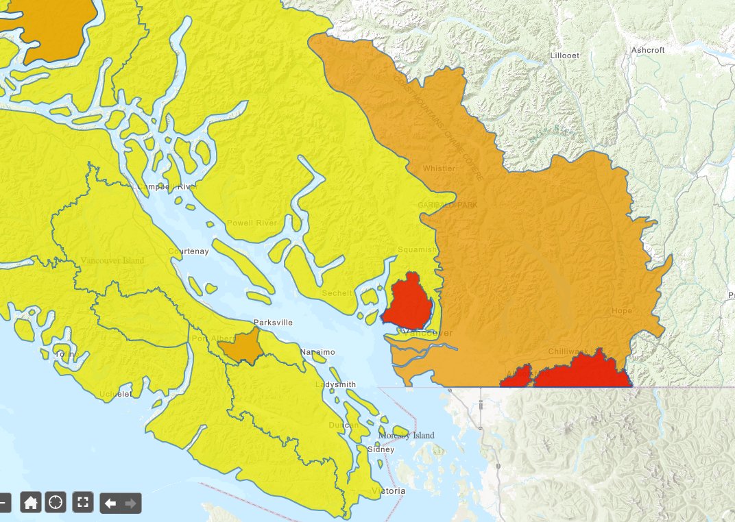
The #BC River Forecast Centre has UPGRADED the High Streamflow Advisory to a Flood Watch for #VancouverIsland including Englishman River & the South Coast including Sunshine Coast, Howe Sound & #SeatoSky. Avoid fast-flowing rivers & potentially unstable riverbanks. Info: https://t.co/W87tVOtmvR #BCFlood
The #BC River Forecast Centre has UPGRADED the Flood Watch to a Flood Warning for the #NorthShoreMountains. Stay clear of fast-flowing rivers & potentially unstable riverbanks. More info: https://t.co/VoNY4i9htI #BCFlood#YVR
⛔#BCHwy99 Closure starting at 8pm tonight until Mon Dec 15 9km north of #Pemberton to #Lillooet due to risk of rockfall, debris flows and washouts with heavy rainfall forecast. ℹ️https://t.co/Ian2AZZrue #SeaToSky
⛔#BCHwy1 Closure starting at 10pm tonight until Mon Dec 15 between #HopeBC & #Lytton due to risk of rockfall, debris flows and washouts with heavy rainfall forecast. ℹ️https://t.co/L1atFNcwTx #FraserCanyon
⚠️ UPDATE #BCHwy1 - The eastbound left lane has been reopened between #BCHwy9 and #HopeBC. The right lane remains closed.
Additionally, the westbound left lane will be closed while crews continue cleanup.
A 50km/hr speed limit is in effect for both directions. Watch for crews and expect delays.
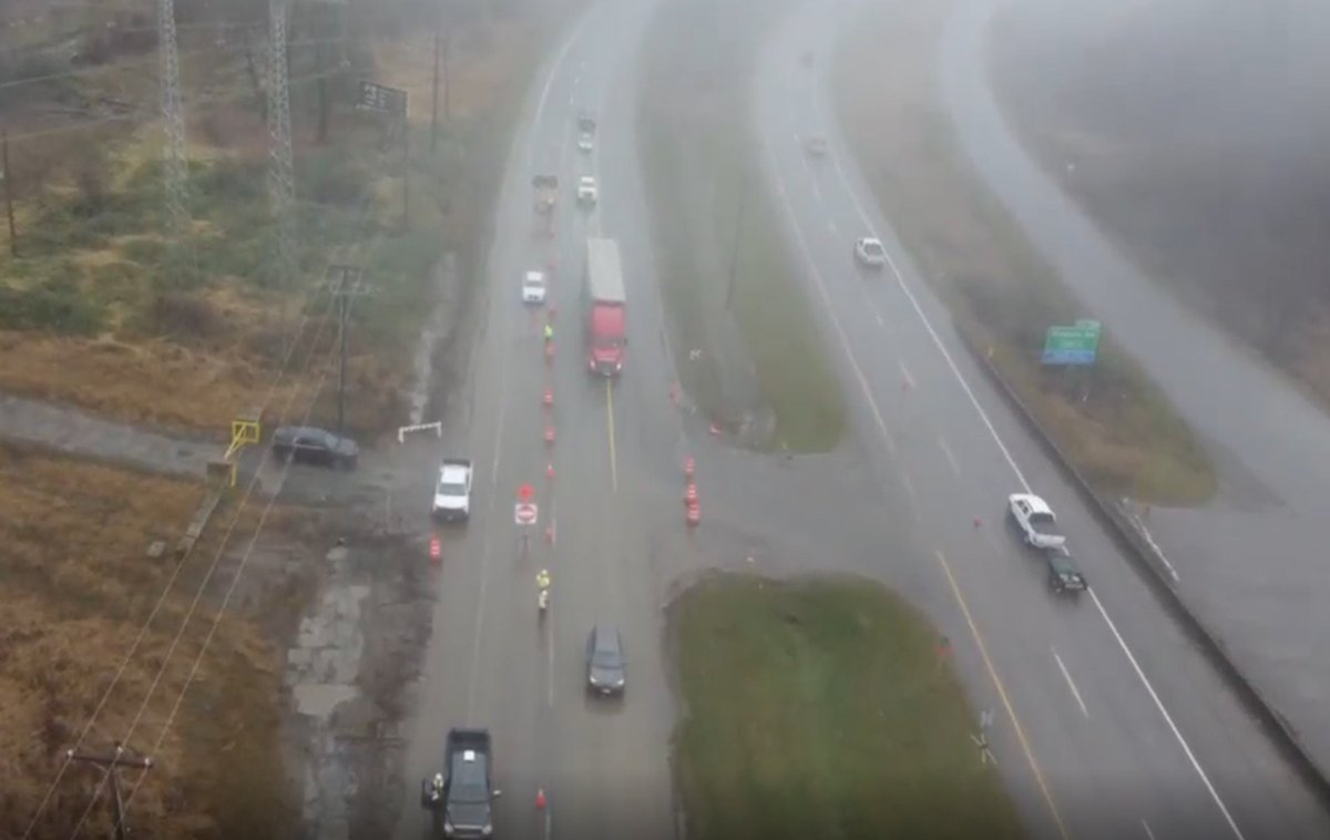
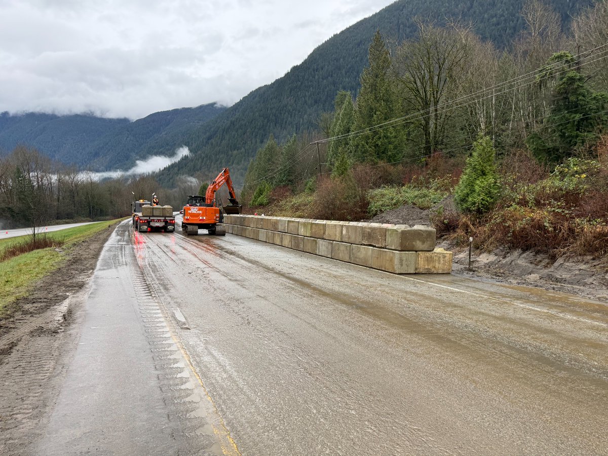
⚠️👷🏽♀️Work continues #BCHwy1 eastbound at #HerrlingIsland. One lane is currently open with a crossover in place. We’re working to protect the EB lanes and reinstate effective water flow to the culverts. Further work and assessments ongoing today. Check https://t.co/yVVq38WOJL for updates. https://t.co/DxouTT0VGK #HopeBC #FraserValley #Chilliwack #Agassiz
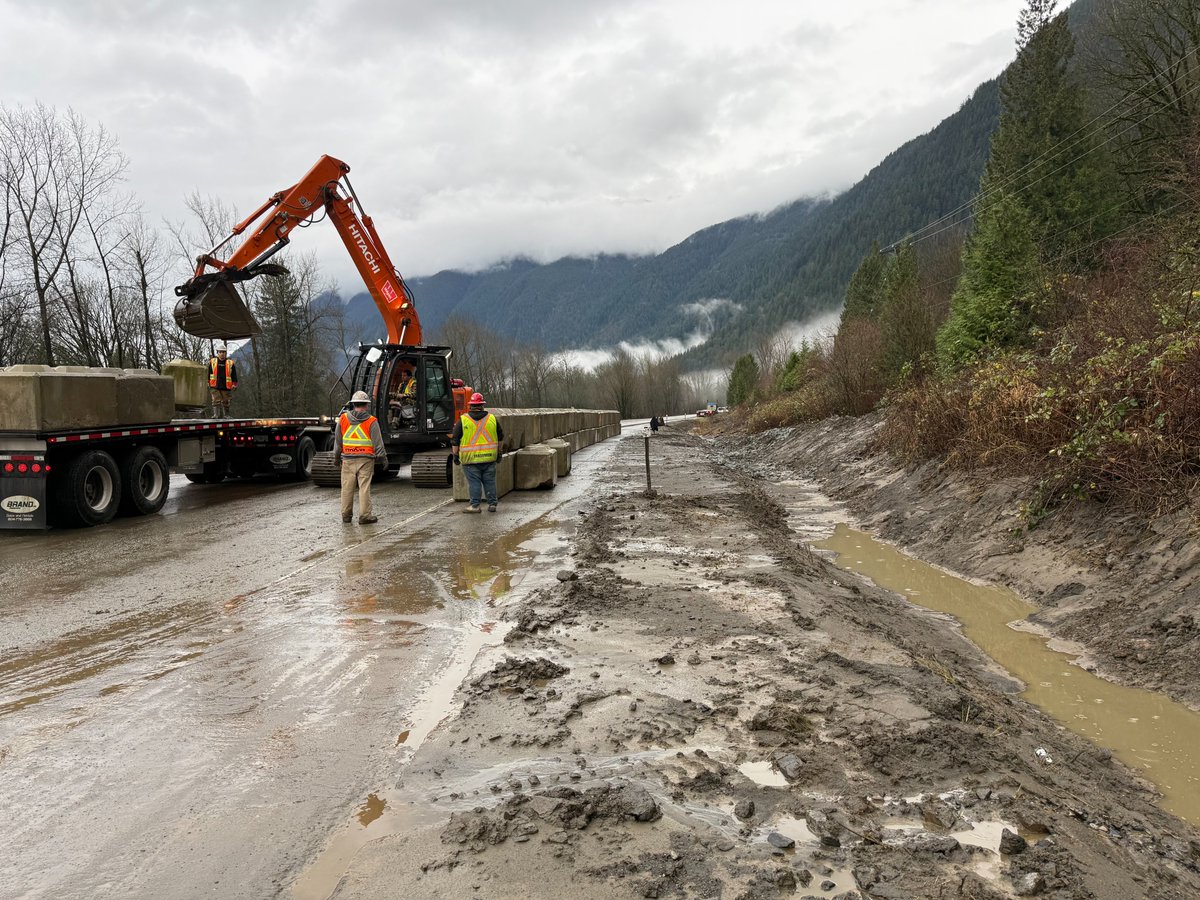
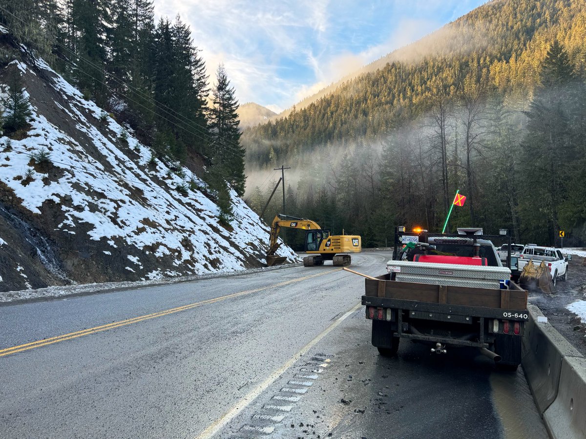
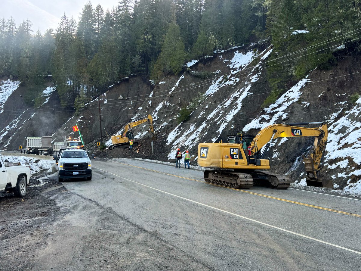
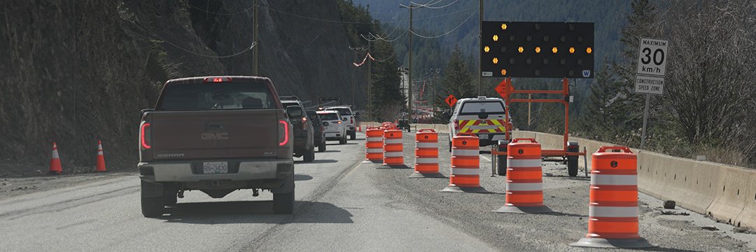
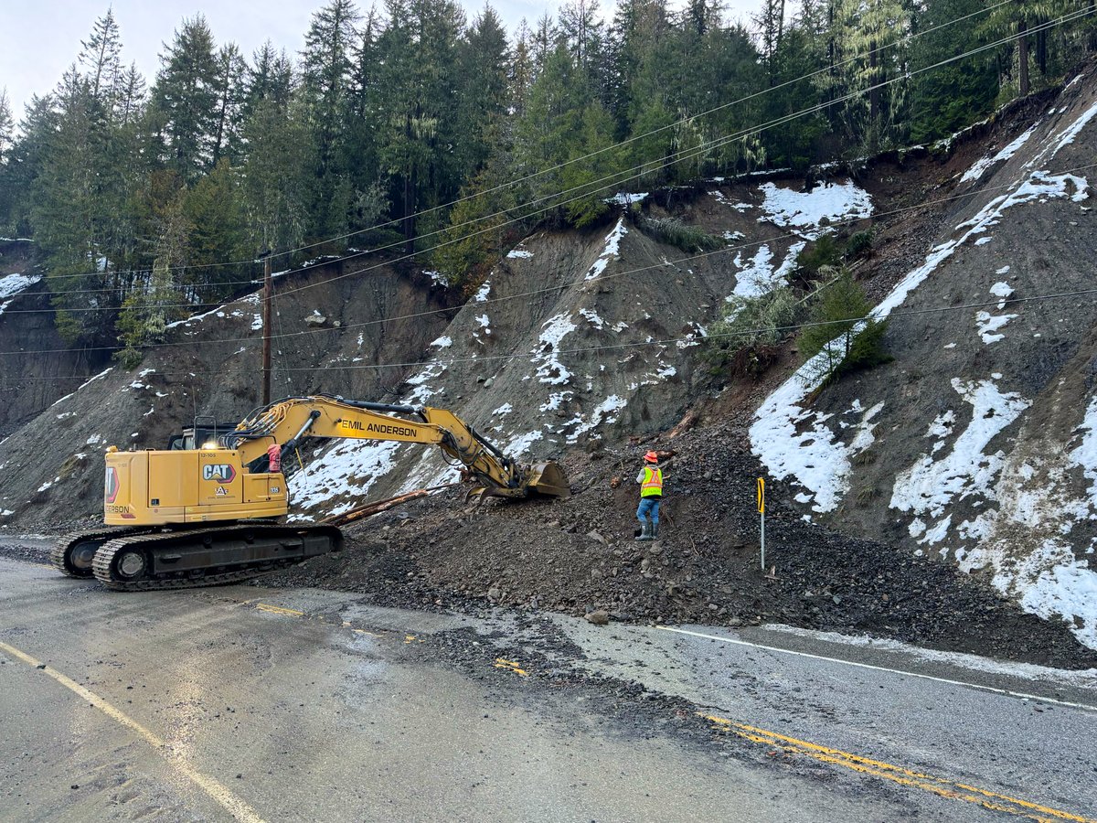
🚧 #BCHwy3 Update:
Crews hard at work doing slope & culvert repairs, debris cleanup & shoulder restoration.
This 📸 shows 1 of 23 active sites in the corridor.
✅ Repair work ongoing.
⏳ No estimated reopening yet, but response work is well underway.
https://t.co/GoFD503Hai