Dry conditions are holding on for now, and most models are trending a little lower with rain coverage this afternoon. We could still see a few pop-up showers and storms, but they look to be more isolated overall.
2:58 PM - Severe Thunderstorm Warning for eastern George County until 3:45 PM. This storm is moving southwest at 10 MPH and is capable of 60 MPH winds.
We will see our NEXT WEATHERMAKER arrive early next week as increased moisture and instability move into the area. Heavy rain is possible and potenially even localized flooding. Stay with NBC15 as we narrow down the details in the days to come!
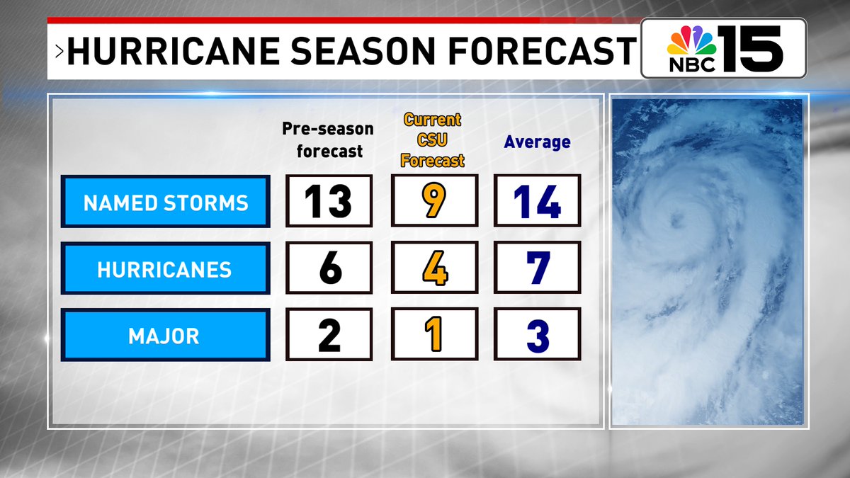
CSU lowers their Atlantic hurricane season forecast. Now predicting only 9 named storms, and 4 hurricanes, with 1 of those becoming a major hurricane. Scientists at CSU cite an intensifying El Niño as the main factor in the decision to lower their initial forecast.
Good morning and happy Fourth of July weekend!🎆🌭⛱️ Aside from the muggy heat, it's going to be a beautiful day with highs in the mid 90s and minimal rain chances.