Get your local forecasts, weather articles, and video forecasts from the Texas Storm Chasers, along with interactive weather radar in TSC's Mobile App.
From Apr. 24–May 1, parts of North, Central & Northeast Texas endured a difficult stretch of severe weather. Damage was significant. People were hurt. Lives were lost.
It was an honor for Texas Storm Chasers to provide useful real-time information.
We never take that trust lightly.
The severe storm threat for most of the area is decreasing. However, a few strong to severe wind gusts are still possible across the southeast. Flash flooding may occur across Gray and Wheeler counties. If you encounter flooded roadways, do not attempt to drive through them!
6/25 813PM: Line of storms with damaging winds and heavy rain near Wildorado moving east down I-40 toward Amarillo, Canyon, Washburn. It’s ’bout to get wild!
June 25, 2026 @ 7:45 PM: Severe potential will continue through the evening, with large hail and damaging wind gusts being the main concern. There are outflow boundaries colliding across the central TX Panhandle, which could provide forcing to initiate more thunderstorms.
#phwx
Severe Thunderstorm Warning continues for Wheeler TX, Mobeetie TX and Benonine TX until 8:45 PM CDT. This storm will contain wind gusts to 70 MPH and two inch sized hail!
6/25 736PM: Severe storm northeast of Ropesville, southeast of Smyer, moving northeast at 25 MPH toward Reese Center, west sides of Lubbock with large hail and damaging winds. -David
A plume of Saharan dust is expected to push into Southeast Texas late Sunday and persist through late Tuesday. This dust may result in reduced air quality (especially for sensitive groups), hazy skies, and vibrant sunrises/sunsets early next week.
6/25 310PM: A tornado watch has been issued for the far northeastern Texas Panhandle through 10 PM. A severe thunderstorm watch will be issued soon for the remainder of the Texas Panhandle and West Texas for damaging wind and large hail potential. Due to prior obligations, Baldy-in-Chief David will *NOT* be available for any live coverage until after 7 PM today, so please ensure you have alternative ways to receive weather information (National Weather Service, local broadcast media, our free mobile app, etc).
Thunderstorms will develop near the TXNM border later this afternoon and expand in coverage this evening as they overspread the Caprock and Rolling Plains. Severe winds up to 80 mph, hail to 1 inch, and heavy rain are all possible before storms taper around midnight #lubwx#txwx
1052pm - Severe storms capable of 60 mph wind gusts and 1” diameter hail are approaching Hereford and Abernathy in West Texas. Heavy rain and lots of lightning.
9:50 PM CDT 06/24/2026 Radar Update - We're seeing some boundaries collide over northwestern portions of the #KLBK forecast area this evening. This is resulting in rapid development of new showers and storms! These storms could turn severe, and are worth monitoring over the next 1-2 hours! Stay #WeatherAware! #TXwx #NMwx #SPwx #Lubbock #SevereWeather
We are watching a few thunderstorms make their way out of NM and into the TX Panhandle. Some of these storms could be severe as they move in. Large hail and damaging winds are our main concern tonight. Storms should cross the state line within the next hour. #phwx#txwx
Statewide reservoir storage has increased this past month, specifically around ~2ft for Choke Canyon in Corpus Christi. Though in the summer months of Texas reservoir levels drop due to evaporation, in some lakes it's up to half. #TX#Lake#reservoir#storage
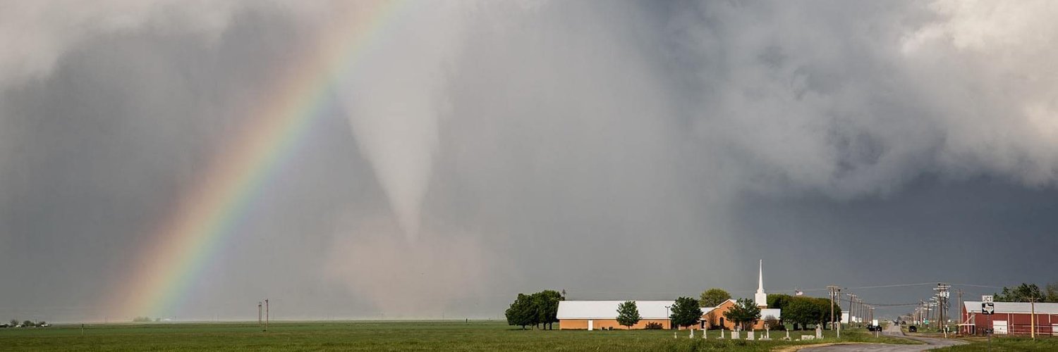
Bishop, TX F3 #Tornado – June 24, 1970!
The day’s only confirmed tornado traveled 1.5 miles but devastated the Golden Acres Trailer Park. The F3 destroyed all but nine of an estimated 20 mobile homes and injured 15 people.
The infant son of Mr. and Mrs. J. E. Allred, less than one month old, was killed. More than 150 sailors assisted in the search for him.
https://t.co/aegZ3MSlcr
#txwx #OTD #tornadohistory
903PM: A severe storm north of Brownfield is moving south toward town with tennis-ball-sized hail and damaging winds. Heads up, it'll be in town by 9:20PM. Other storms in West Texas have been weakening. ~David