Official page of the Upper Gwynedd Township Emergency Management Agency & Fire Marshal's Office. For an emergency, dial 911! This account is not monitored 24/7.
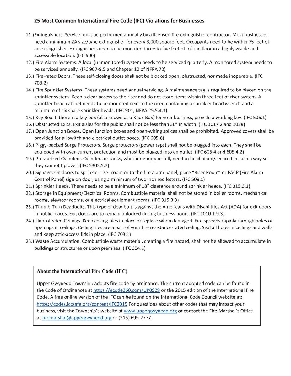
Below are 25 common deficiencies noted when conducting Fire Safety Inspections. In the near future, the FMO will be reaching out to businesses to schedule a facility inspection. Add'l information will be forthcoming through newsletters and website updates.
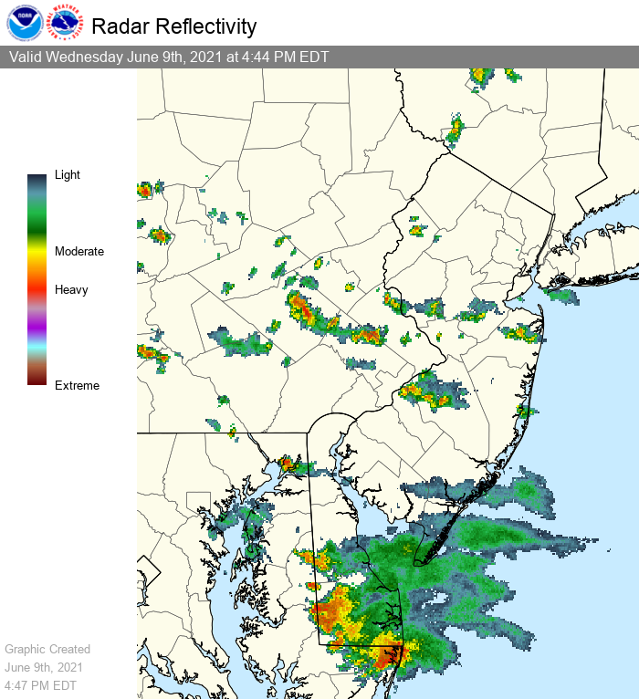
A look at current radar; scattered storms are present across the area. Most are sub-severe, but we have had two incidents today of individuals struck by lightning. This underscores the importance of seeking shelter *any* time a storm threatens your area. #NJwx#PAwx#DEwx#MDwx
We've issued a Flash Flood Watch for part of the area due to the potential for heavy rain with showers and storms late this afternoon and evening. Soils are saturated from recent rain and high rainfall rates are possible, which may lead to flash flooding. #NJwx#PAwx#DEwx#MDwx
We have been notified by AT&T that their wireless customers may experience difficulty calling 9-1-1 from a cell phone. If you are calling from Montgomery County and are unable to reach a 9-1-1 operator, please call 610-635-4300.
For those longing for the heat of summer, you're in luck! It'll be very warm today across the region, the warmest day of the season so far for most. Expect partly cloudy skies as well with a southwesterly breeze. 😎🌡️ #PAwx#NJwx#DEwx#MDwx
Here comes round 2. Showers and thunderstorms are approaching the region from the west. Damaging wind gusts are possible with this line, especially in the southern half of the area. Secure loose outdoor objects and be prepared for possible power outages! #NJwx#PAwx#DEwx#MDwx
We're Hiring!! 📢 Upper Gwynedd Township is hiring for the position of Deputy Fire Marshal/Emergency Management Coordinator. Click here for more information: https://t.co/sAZgx87nvF
Let the SPRING begin (well at least the spring weather.) The Playground at Parkside Place has been re-opened. Please note it is very muddy and there is still snow in the rear, so please be careful! HAVE FUN and enjoy this weather!!
Northwest winds will increase today, bringing in colder and very dry air. Wind chills tonight will be quite low, from 0 to -10 in the Poconos to the single digits and teens elsewhere. Bundle up! #pawx#njwx#dewx#mdwx
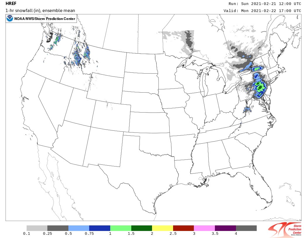
The Advisory has been expanded to include Sussex County, NJ and portions of Bucks and Montgomery Counties in PA. Snowfall rates may be quite heavy in the advisory area towards midday tomorrow. The model below is indicating rates of 1 to 2 inches per hour around noon! #NJwx#PAwx
❄️🌨️❄️ Scattered snow showers will continue through early this evening, mainly over portions of eastern PA and northern and central NJ. A couple of locally heavier squalls are possible, which may briefly reduce visibility to one mile or less. #pawx#njwx
As one storm closes, another storm opens, is that how it goes? Here is the latest timeline on the the next storm that will effect the region Monday and Tuesday with impactful freezing rain.
#PAwx#NJwx#MDwx#DEwx
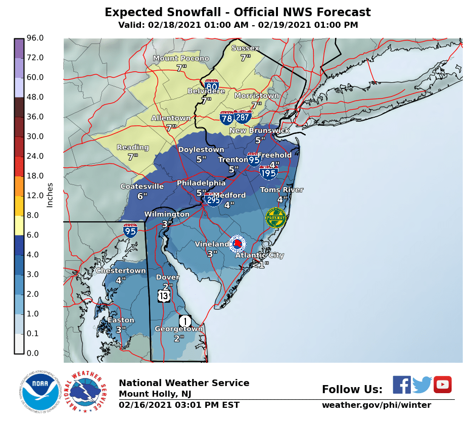
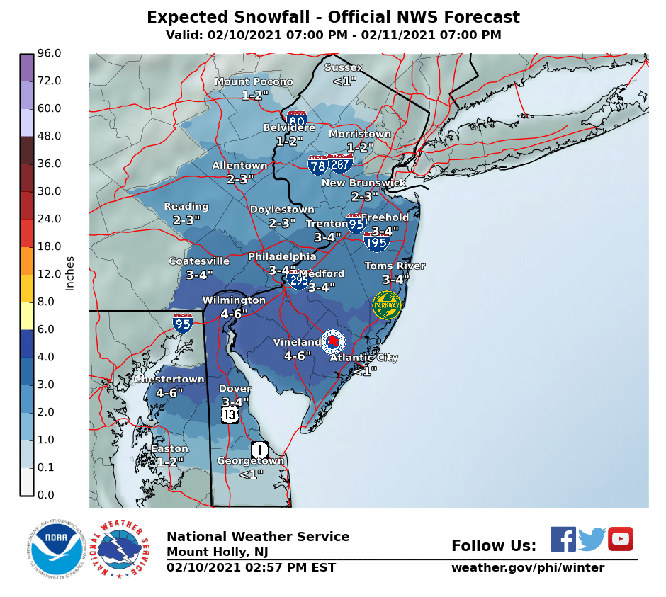
Another round of snow for the region tonight and Thursday morning. Some mixed precipitation though looks to occur across portions of Delmarva into far southeastern NJ, otherwise an all snow event is expected. The Thursday morning commute will be slippery. #pawx#njwx#dewx#mdwx