Outflow Boundary Drama Unfolds for the Twin Cities.
A relatively modest amount of instability is making the most of it. There's already a few persistent rotating updrafts that could support hail drifting ESE with the shortwave. Expect upscale growth. Hail and microbursts. #mnwx
A tornado is touching down SW of Clay Center, KS. This semi-discrete supercell is incredibly well organized and likely to continue to be tornadic for the next hour. A dangerous situation unfolding for the county seat. Take cover Morganville. #kswx
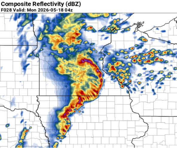
A powerful MCS is deepening near Elk Creek, NE with an absurdly strong mesocyclone that is beginning to accelerate ENE towards the Iowa border near Brownsville, NE. #newx#iawx
A blossoming cluster of storms east of the main MCS is beginning to become tornadic between Sherburn, MN and Northrop, MN . Flowing NNE towards Truman, MN. #MNwx
@CurryIsMyGOATT We are on the norther end of the QLCS and a few bookend vortices are still a major threat for tornadoes, especially for the SW and S metro. The warming was much more robust than expected due to afternoon clearing! Watch for the notches!
The 00z HRRR just printed a potent QLCS nailing the Twin Cities at around 11pm. The timing is still uncertain but the likelihood of widespread damaging winds (70+mph), large hail, and a few tornadoes, especially SW of the Metro. Likely will be upgraded to enhanced risk. #mnwx
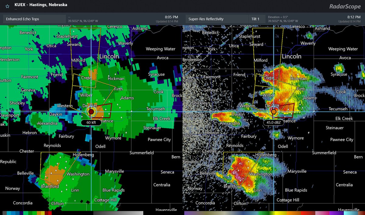
Monster Supercells absolutely flourishing in southern Nebraska and North Kansas. Echo Tops reaching 60k ft for the tornadic storm north of Beatrice, NE. #kswx#newx
Loving these little convective buds lighting up the night sky as they zoom east. Multiple rounds of top shelf b buds. Brief downpour, vibrant lightning that lingers, and soothing thunder. #mnwx
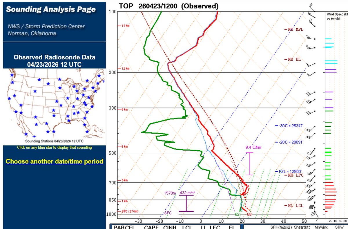
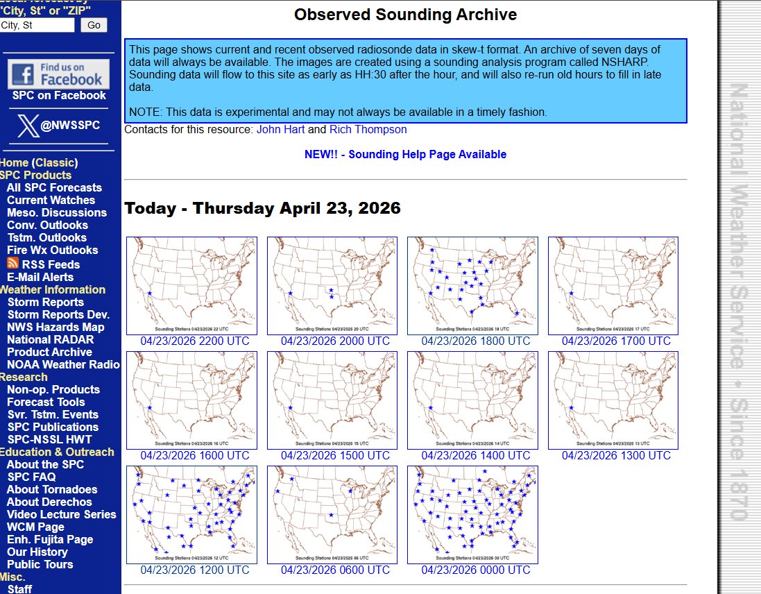
@paulhuttnerwx The lack of soundings is absolutely an issue but I think the post was made before all the stations had reported. This is what I am seeing on the SPC sounding page.