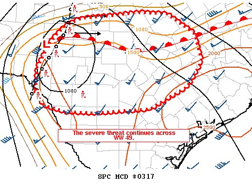
Chances for rain increase across most of Texas for tonight into Wednesday as an upper-level low approaches from Mexico. Periods of heavy rain (mainly over northern Texas) and isolated gusty winds will be possible... https://t.co/HuOADGbnot
7:34 AM Line of thunderstorms now moving towards Brackettville with a supercell in between Uvalde and Hondo. Main threat with the line is straight line winds and main threats with the supercell are hail, winds, and could be capable of a tornado.
As storms move out of West Texas to the east, a new Tornado Watch very well could be issued in the 8-9am hour. That watch may include parts of the Brazos Valley.
More from @NWSSPC: https://t.co/7gUHUAC2a1
Strong/severe storms will be possible today as a storm system pushes eastward across SE TX. Isolated tornadoes, damaging winds, large hail & frequent lightning will be possible. Heavy downpours could lead to localized flooding. Stay weather aware! #txwx#houwx#bcswx#glswx
New Severe Thunderstorm Watch expected to come out for parts of North & Central Texas this morning as storms continue to march across the state.
Could clip parts of the Northern Brazos Valley.
More: https://t.co/M0wPFD9XvA
A dangerous weather day is expected across Eastern Texas, Louisiana, and Mississippi as a strong trough pushes through the southern plains. Over the moderate risk area, strong winds and tornadoes will be possible... https://t.co/prJyai1r4E
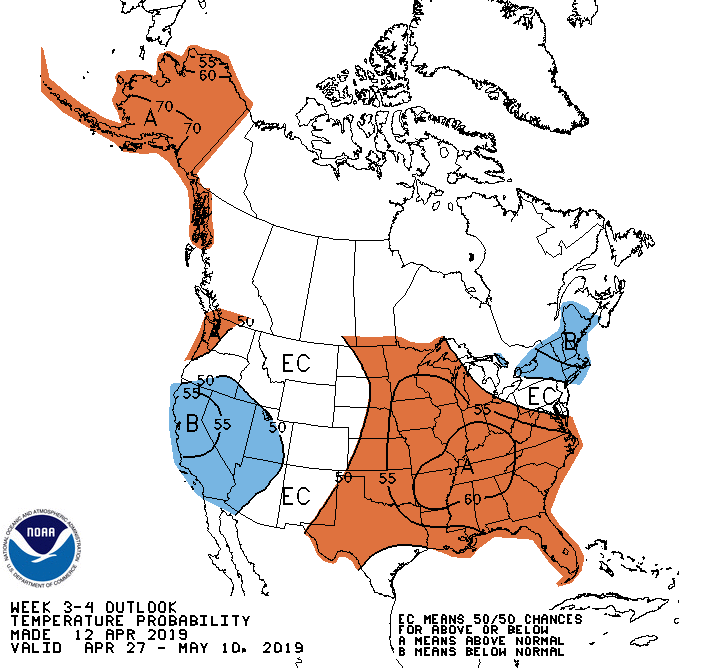
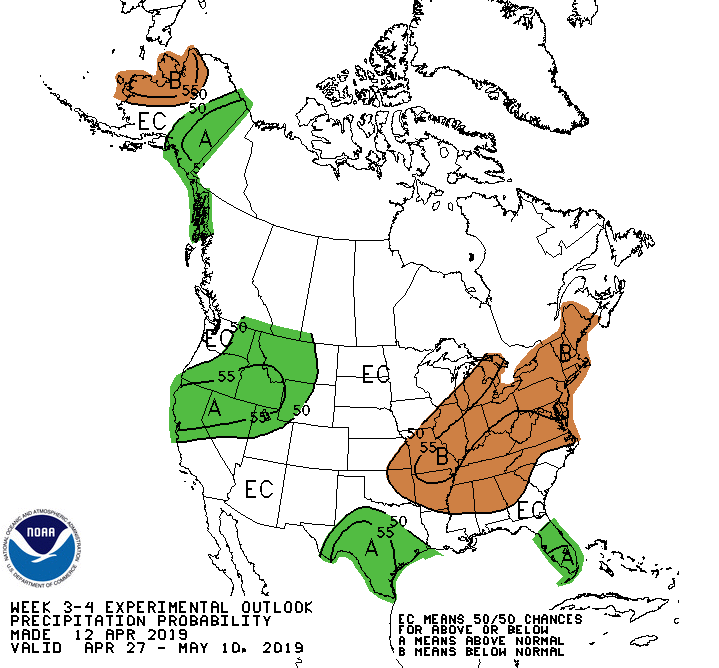
A pattern change appears likely in today's Weeks 3-4 outlook for 4/27-5/10, with increased chances for above-normal temperatures and below-normal precipitation across much of the eastern half of the lower-48 states. https://t.co/ZyQxYYjbSQ
Along with a few isolated severe thunderstorms SATURDAY -- few spots of EXCESSIVE RAIN not ruled out for the Brazos Valley.
Most rain rates will be manageable. Bigger flash flood concern is just northeast of our backyard. Still -- isolated concern will carry us to the weekend
Severe Thunderstorm Warning now in effect for Houston-Galveston areas. Be ready to move to a interior location.
BULLETIN - IMMEDIATE BROADCAST REQUESTED
Severe Thunderstorm Warning
National Weather Service... https://t.co/SY3jRxQx3D
Severe Thunderstorm Warning
TXC039-321-071700-
/O.NEW.KHGX.SV.W.0031.190407T1612Z-190407T1700Z/
BULLETIN - IMMEDIATE BROADCAST REQUESTED
Severe Thunderstorm Warning
National Weather Service Houston/Galveston TX... https://t.co/2DxYKMmnLU
Several tornado watches have been issued across Central and Northeast Texas today, and continue as we head into the evening and overnight hours. The threat for severe weather and heavy rain will shift south... https://t.co/Z05VeEKyQB
An enhanced risk for severe today has been posted by the SPC from Central Texas into Western Mississippi. Strong winds and hail are the main threat, but an isolated tornado cannot be ruled out.
The focus will... https://t.co/G28GL0C2o5
An update to the severe weather this weekend indicates multiple lines of thunderstorms will cross through the region Saturday and Sunday.
On Saturday afternoon, areas across Central and Northern SE Texas will... https://t.co/FPML7XoQXE
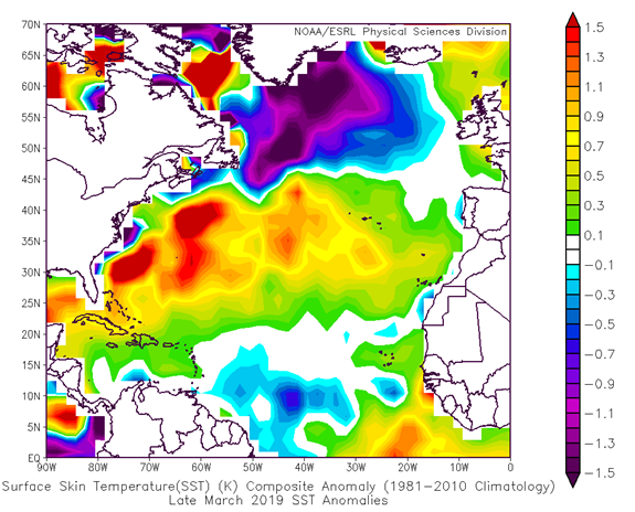
The first seasonal #hurricane forecast from @ColoradoStateU will be released this Thursday, April 4 from the @HurricaneCon at 11am EDT. The release can be viewed live at https://t.co/cHhcoMDPjZ