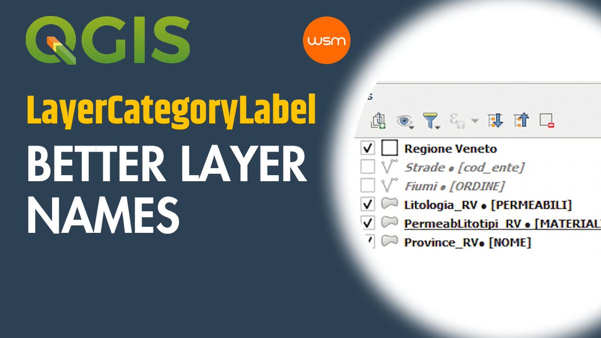
🚀 LayerCategoryLabel: my first QGIS plugin
Working with many categorized layers? This plugin automatically adds the categorization field name to the Layer Name, making layers easier to recognize in the QGIS Layers Panel.
https://t.co/7hihiCmQG9
#QGIS#GIS
#agenziadelleentrate#catasto#QGIS#GIS
𝗠𝗮𝗽𝗽𝗲 𝗰𝗮𝘁𝗮𝘀𝘁𝗮𝗹𝗶 𝗴𝗿𝗮𝘁𝘂𝗶𝘁𝗲!
Da nov 2025 fogli di mappa e originali di impianto sono online per tutti.
VIDEO: come importarli in QGIS (CXF e GeoJSON)👇
https://t.co/vEFoWSx16B
#catasto#visurecatastali#innovazione#agenziaentrate
🔥 𝐍𝐨𝐯𝐢𝐭𝐚̀ 𝟐𝟎𝟐𝟓!
Visure catastali ed estratti di mappa GRATIS per tutti gli immobili sul sito dell'Agenzia delle Entrate.
🚀 Scarica:
👉 Visure dei tuoi beni o di terzi
👉 Estratti di mappa
https://t.co/3WpBNqkFuS
#MapDesign#Cartography#MapPoster#DesignTools
🌍��� Create your own City Map Poster with style!
Guide to 𝗦𝗻𝗮𝘇𝘇𝘆 𝗠𝗮𝗽𝘀 🎨 + 𝗖𝗮𝗻𝘃𝗮 🖌️: customize, import & design! 🎥
📽 Watch here: https://t.co/P2fBpxWZZ6
🗣 Italian 💬 English
#QGIS 𝐩𝐥𝐮𝐠𝐢𝐧 𝐠𝐨𝟐𝐬𝐭𝐫𝐞𝐞𝐭𝐯𝐢𝐞𝐰
🔥 La nuova versione dell'ottimo e utilissimo plugin è disponibile dopo aver installato almeno QGIS 3.36.3 e le librerie pyQtWebEngine nella versione 5.16.6 o superiore.
👇 Seguite queste istruzioni.
https://t.co/B07vKYzdh2
#QGIS ✔️✔️✔️La lista qgis-it-user sarà spostata su OSGeo Discourse i primi giorni di giugno.
Iscrivetevi per non perdervi nulla.
[1] https://t.co/MbAch1Y6uS
[2] iscrizione: https://t.co/1lj8yO4Wm2
#qgis#gis#geopackage
𝗢𝗡𝗟𝗜𝗡𝗘 la pubblicazione completa dei miei cinque video tutorial dedicati alla guida sull'utilizzo del 𝗚𝗘𝗢𝗣𝗔𝗖𝗞𝗔𝗚𝗘 in QGIS.
https://t.co/9UIC57BsnH
🗣 Italiano 💬 Inglese
#qgis#GIS
𝗤𝗚𝗜𝗦 - 𝗔𝗱𝗱 𝗟𝗮𝘆𝗲𝗿 𝗡𝗼𝘁𝗲𝘀
Layer Notes allow you to store important messages, to-do lists, instructions, within the current project.
https://t.co/2xGqPYn5qf
#QGIS#GIS
𝐐𝐆𝐈𝐒 - 𝐇𝐨𝐰 𝐭�� 𝐬𝐞𝐭 𝐭𝐫𝐚𝐧𝐬𝐩𝐚𝐫𝐞𝐧𝐜𝐲 𝐨𝐟 𝐥𝐚𝐲𝐞𝐫 𝐠𝐫𝐨𝐮𝐩
This is possible since QGIS 3.24, via "Render Layers as a Group" in the layer styling panel.
https://t.co/lfoiTeAA6h
𝐐𝐆𝐈𝐒 - 𝐔𝐬𝐢𝐧𝐠 𝐜𝐨𝐧𝐝𝐢𝐭𝐢𝐨𝐧𝐚𝐥 𝐟𝐨𝐫𝐦𝐚𝐭𝐭𝐢𝐧𝐠 𝐢𝐧 𝐩𝐫𝐢𝐧𝐭 𝐥𝐚𝐲𝐨𝐮𝐭
Print Layout. To use conditional formatting to set different colors, icons and font to each rows, depending on an expression, refering to an attribute.
https://t.co/Hq98Apkog3
𝐐𝐆𝐈𝐒 - 𝐇𝐨𝐰 𝐭𝐨 𝐚𝐠𝐠𝐫𝐞𝐠𝐚𝐭𝐞 𝐟𝐞𝐚𝐭𝐮𝐫𝐞𝐬 𝐛𝐚𝐬𝐞𝐝 𝐨𝐧 𝐚 𝐠𝐫𝐨𝐮𝐩 𝐛𝐲 𝐞𝐱𝐩𝐫𝐞𝐬𝐬𝐢𝐨𝐧
This algorithm take a vector or table layer and aggregate features based on a group by expression.
https://t.co/YyD56ryml3
Per un rapido e completo recupero di tutti i dati OSM riguardanti l'Italia possiamo utilizzare il servizio 𝐄𝐬𝐭𝐫𝐚𝐭𝐭𝐢 𝐎𝐩𝐞𝐧𝐒𝐭𝐫𝐞𝐞𝐭𝐌𝐚𝐩 𝐈𝐭𝐚𝐥𝐢𝐚.
Il sito, mi permette di scaricare i dati filtrandoli per regione, provincia o comune.
https://t.co/iBV26DXIbq
#mapping#webmap#world#shademap
Shade Map - Shadow webmap in the world [ITA AUDIO - SUB ENG]
Shade Map is an online tool that displays sunlight and shadow on a webmap.
https://t.co/FkiT8g72LE






![qgisitalia's tweet photo. #QGIS ✔️✔️✔️La lista qgis-it-user sarà spostata su OSGeo Discourse i primi giorni di giugno.
Iscrivetevi per non perdervi nulla.
[1] https://t.co/MbAch1Y6uS
[2] iscrizione: https://t.co/1lj8yO4Wm2 https://t.co/UgvR67ehaT](https://pbs.twimg.com/media/GO4-bVSWEAAL-fy.png)





