3 shot, 2 dead at the Forest Ridge Apts on Beasley Rd. JPD processing scene. One person taken in for questioning, but not detained. More details at 10pm on @WLBT
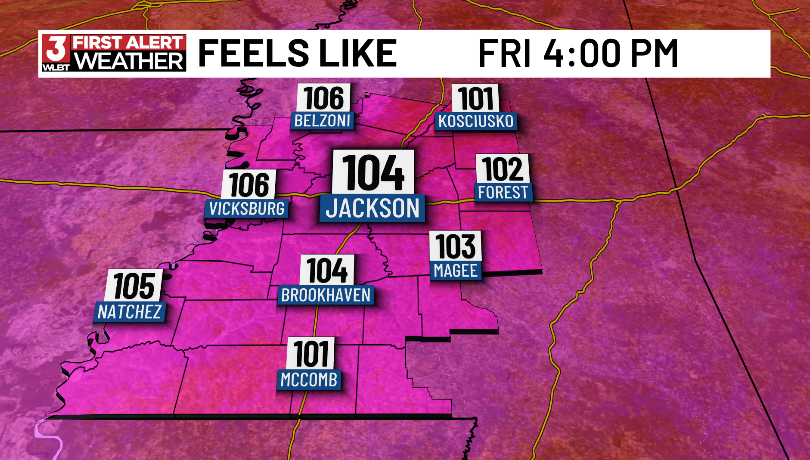
Heat index values could soar between 105° and 110° through Sunday, making it feel dangerously hot during the afternoon hours.
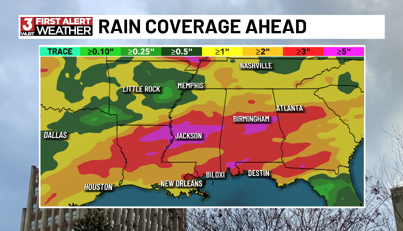
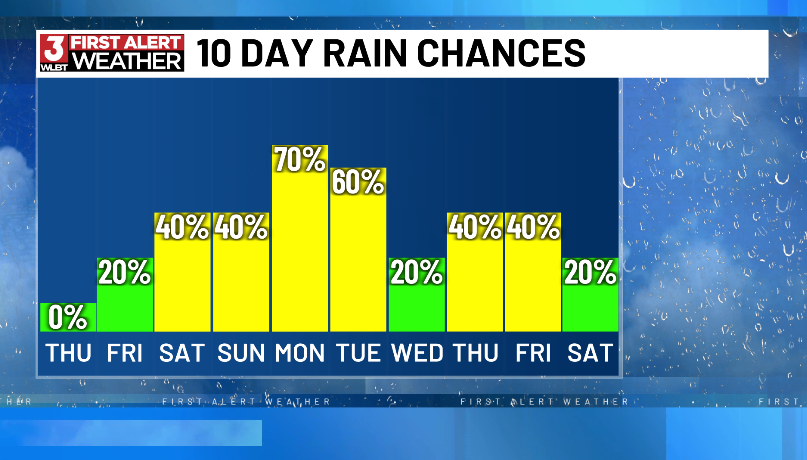
The bigger story is next week. Multiple rounds of showers and thunderstorms are expected Monday through Wednesday.
#mswx@WLBT
The eastbound lanes of Hwy 18 just west of Siwell Rd in Hinds County have buckled. 3 vehicles were damaged. MDOT on scene. Expect delays and please use caution in this area folks.
A Heat Advisory is in effect Friday and Saturday as heat index values approach 105°. Stay hydrated and limit outdoor activities during peak afternoon heat. ☀️🥵
⛈️ Rain chances increase Sunday, with widespread showers and storms expected Monday through Wednesday.
#mswx@WLBT
A 4.3-magnitude earthquake struck near Cuba just one day after a stronger 6.1-magnitude quake rattled the region. Officials have reported no tsunami threat. 🌎
#Mississippi#Earthquake#GulfCoast
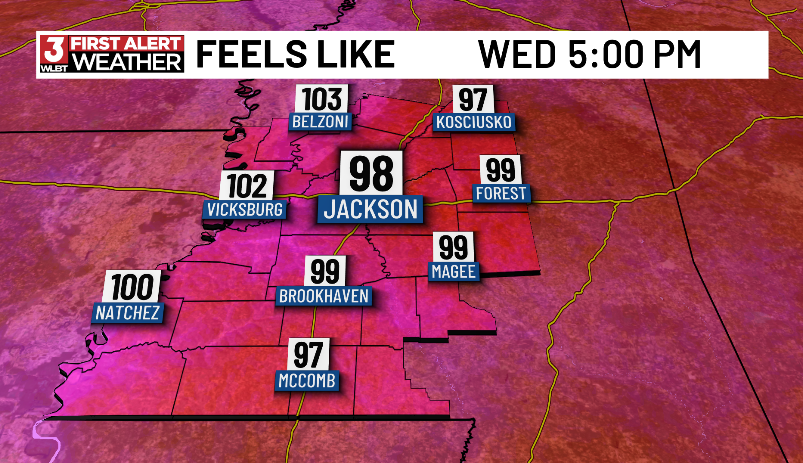
Expect highs in the mid-90s through the weekend, with heat index values climbing into the upper 90s and lower 100s during the afternoon.
💧 Stay hydrated
☀️ Limit time outdoors during peak afternoon heat
🐶 Never leave children or pets in vehicles
#mswx@WLBT
Heat and humidity are on the rise across Central Mississippi.
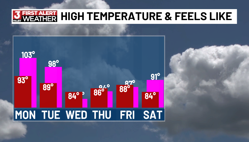
Highs will stay in the low to mid 90s through the week, with heat index values climbing into the triple digits. By the weekend, it could feel close to 105° at times.
#mswx@WLBT
The heat is cranking up across Central Mississippi this week!
Afternoon highs will reach the lower 90s, with heat index values climbing to 100° to 105° by late week. Rain chances stay low through Thursday before scattered storms return this weekend.
@WLBT#mswx
BREAKING NEWS🚨: A Capitol Police Car in Jackson, #Mississippi was involved in a car crash at the intersection of Pearl St. & Gallatin St. in front of the Iron Horse Steakhouse. One woman in the car it collided with was taken by AMR to the hospital. The road’s still blocked off.
It’s unfortunate that we’ve learned today from the @RankinCountySO, their K-9 Deputy Fox has died after he “suffered a medical emergency” during a search for an escaped juvenile prisoner back on May 21st. He died with his family Friday night. More to come on @WLBT tonight.
After a pleasant Friday, rain and storm chances will increase this weekend as Gulf moisture returns to the region.
⛈️ Storms possible both days
🌧️ Heavy rainfall possible at times
🌡️ Highs in the mid-80s
💧 Humidity on the rise
Stay weather-aware and have a safe weekend!
@WLBT
Enjoy the comfortable weather while it lasts!
Low humidity, sunshine, and highs in the 80s stick around through Friday. Showers and thunderstorms return this weekend, with daily storm chances expected next week. ⛈️
#mswx@WLBT
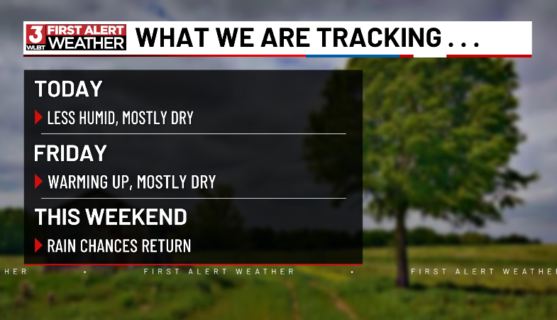
A refreshing stretch of weather is here through Friday, bringing lower humidity, mostly dry skies, and highs in the lower to middle 80s.
Perfect weather for outdoor plans, yard work, or simply spending some time outside.
#mswx@WLBT
A cold front moves through Mississippi today, bringing scattered showers and thunderstorms followed by cooler, less humid weather.
Enjoy highs in the low to mid-80s and mostly dry conditions through Friday. Rain chances return this weekend as humidity begins to build back in. ⛈️
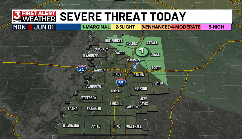
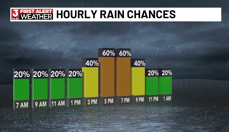
🌦️ We are starting the day with dry weather across central Mississippi, but showers and thunderstorms will develop this afternoon and become more numerous this evening.
A few storms could become strong with gusty winds and small hail being the primary concerns.
#mswx@WLBT
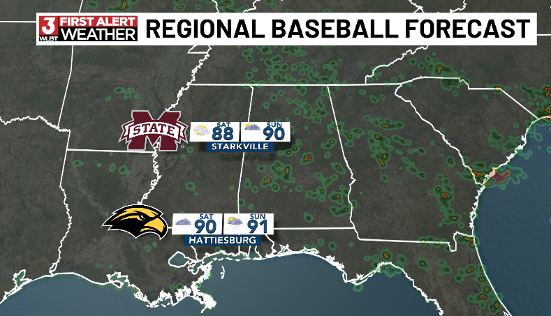
⚾️ Regional baseball weather update! ⚾️
If you’re heading to Starkville or Hattiesburg this weekend, expect hot and humid conditions with highs in the upper 80s and low 90s. Most of the weekend looks dry, but a few isolated afternoon storms could pop up and briefly delay play.
🌤️ While a few isolated showers and thunderstorms are possible each day, most of Central Mississippi will stay dry. Warm and humid conditions continue with highs in the mid-80s, but any storm that develops could bring brief heavy rain and lightning.
Central Mississippi stays locked in a wet and stormy pattern through the rest of the week with daily rounds of showers and thunderstorms expected. Heavy rain could lead to localized flash flooding. A few storms may also produce gusty winds and small hail.
#Mswx@WLBT