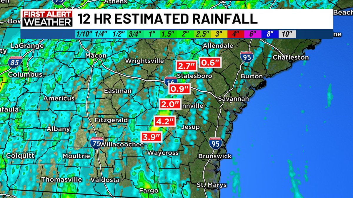
Flash Flood Warning for parts of Jeff Davis county until 9pm. Doppler radar estimates of 4+" have fallen with an additional 1+" possible. Never drive through roads that you do not know how deep it is. Turn around, don't drown!
Special Weather Statement for parts of Bacon, Appling and Jeff Davis county until 7:15pm. Strong thunderstorms are developing over the same areas from Denton to Jordan. Heavy rain may cause some flooding and winds may gust to 40mph.
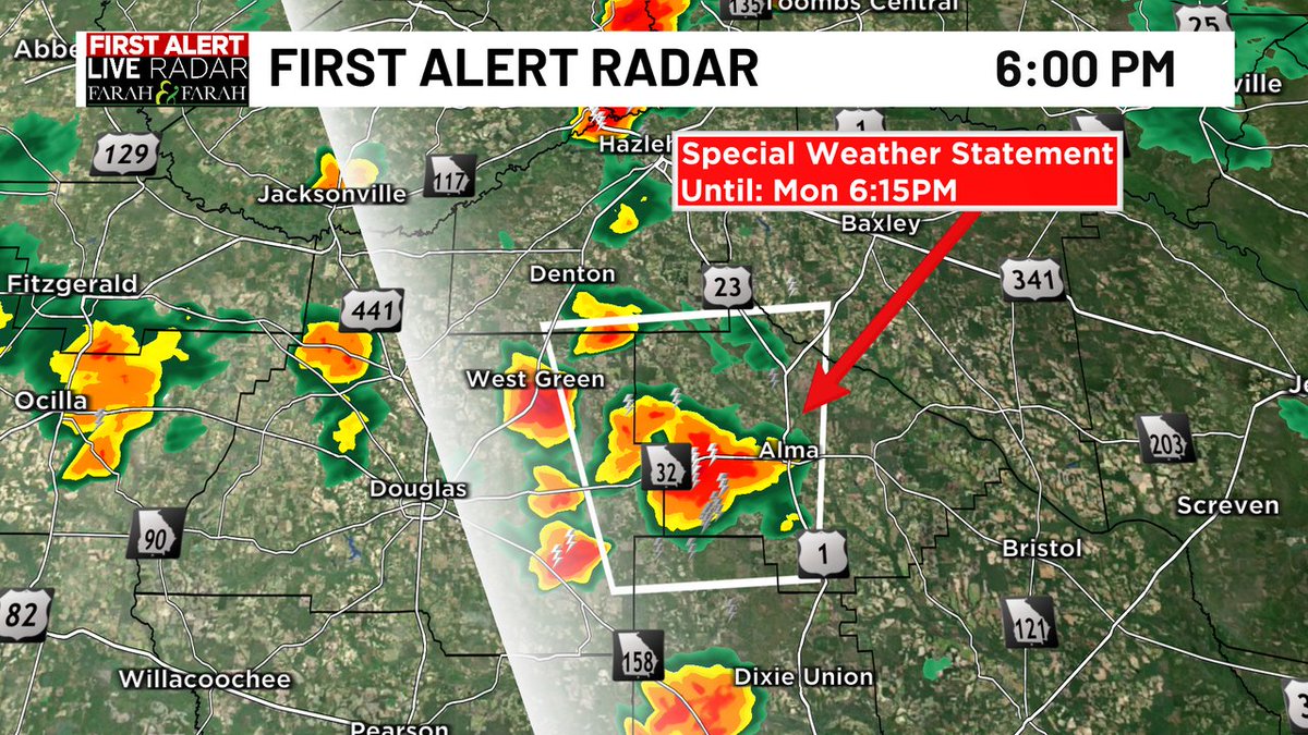
Severe Thunderstorm Warning for western Jeff Davis county until 6:45pm. Wind gusts to 60mph and penny size hail possible as storm moves north about 10mph.
Much needed rain chances return for our Memorial Day weekend. Most of it will be in the afternoon/evenings so at least the mornings should be dry. Check the live radar on THE WTOC First Alert WX App.
NOAA released their 2026 Hurricane Season Outlook. They are calling for a slightly below average season as El Nino is forecast to strengthen this Summer. Even though the forecast calls for below average activity, it only takes one storm to make an impact.
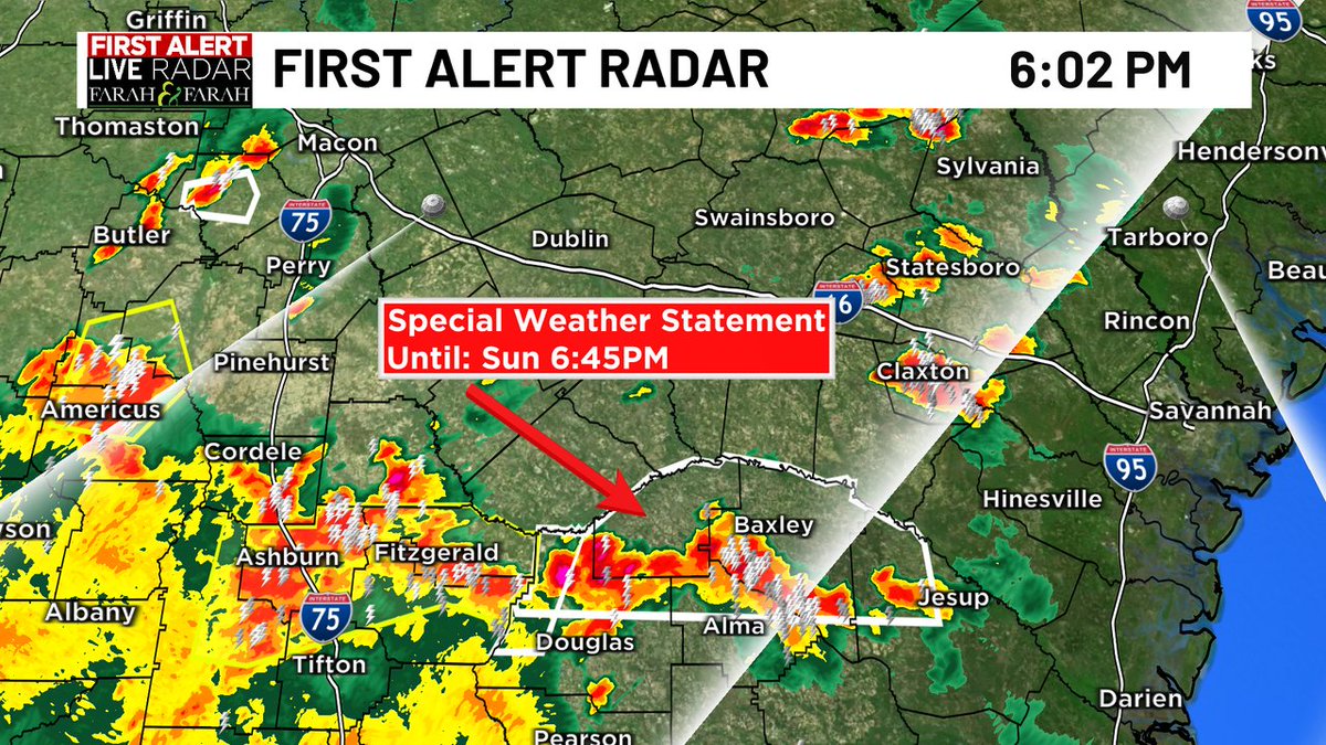
Severe Thunderstorm Warning for northern Montgomery county until 5:30pm. Then main threat is from wind gusts to 60mph and .25" hail. Storm is moving to the north about 10mph and should be out of our area shortly.