A High Risk for Excessive Rainfall has been issued for portions of the Central Gulf Coast today. High Risks are not issued lightly & indicate the potential for both widespread & life-threatening flash flooding.
🛑NEVER walk or drive into flood waters. Turn around, don't drown!
While the MDT area has been struggling, Tropical Storm Arthur formed this morning along the Gulf Coast and appears to have undergone a center relocation deeper into the Gulf. Max winds ~45-50mph.
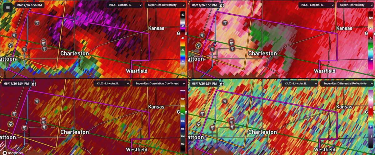
Been about 2 hours and... not a lot has changed. Still have meandering supercells but overall not a lot of tornado activity. Sounding from Lincoln IL did show stable air as expected; might have to wait until sunset for something to get going.
Currently have a couple of supercells in central Illinois that could produce intense tornadoes at any time, but are currently struggling with stable air judging by radar data. This could change.
Currently have a couple of supercells in central Illinois that could produce intense tornadoes at any time, but are currently struggling with stable air judging by radar data. This could change.
Tropical Storm #Arthur Advisory 5 (10 AM CDT, Wed Jun 17): Tropical Storm Arthur Develops Near the Middle Texas Coast. Life-Threatening Flooding Expected Across Portions of the Southeastern United States. https://t.co/tW4KeGdBFb
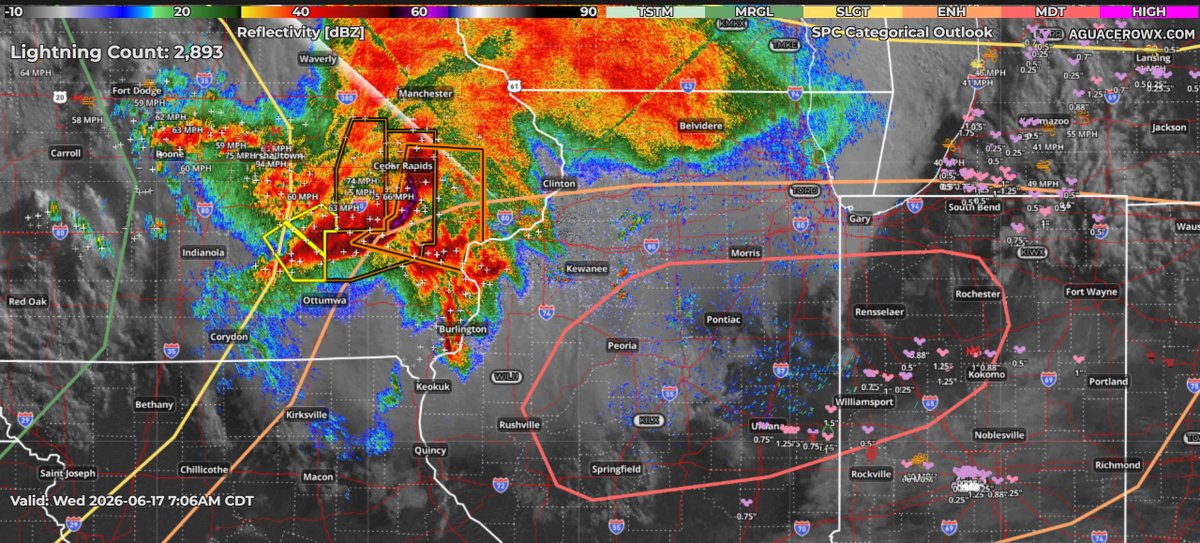
Things not trending the right way this morning for the risk areas (if you want something to happen).
Surface lows coming in a bit weaker than expected and most models have shoved risk southward, with less instability/potent shear overlap.
There is also a Moderate Risk (Level 4/5) of severe weather today in the Midwest, but things have become more complicated since yesterday. A morning round of storms has come in much more robust than expected; even so, a few strong/intense tornadoes may be possible later on.
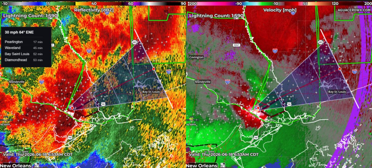
PTC One is currently located on the Gulf Coast and will be bringing a major flooding risk to the southeast U.S over the next few days. Close to a foot of rain could fall near Mobile, AL.