@ibamarief Sudah pernah nyoba nyuruh optimisasi cost buat https://t.co/FQzyUAuSJJ juga. ya walaupun turun beberapa dolar aja per bulan tetep lumayan wkwk
@rachmatwhd@wikimediaid Tim inuka sudah bubar per 2024-06-30 gmn nie nasib wikistories yg katanya "akan menarik minat pengguna baru untuk berkontribusi di Wikipedia." 😂🤣
@pengennyetir@ogiehart Lah serius, disini ada TK internasional, anak2nya dari ortu expatriat semua. Biar was wes wos bahasa inggris. Ortunya bela belain dari kotaku masukin anaknya di kota berbeda yg jaraknya pp aja udah 80 km.
@pengennyetir@ogiehart Belum tau aja, ipar saya dari SD-SMP-SMA sudah diplotkan mau jadi dokter harus ambil sekolah yang mana. Ipar yang lain mau karir luar negeri sudah harus plot dari dia TK
🚀GeoLibre just passed 1,000 stars on GitHub, in only three weeks!
I am blown away. GeoLibre went public on May 27, and the community has already pushed it past 1,000 stars and 140+ forks. Thank you to everyone who starred, forked, filed issues, opened pull requests, and shared the project.
For those just discovering it: GeoLibre is a free and open-source, lightweight, cloud-native GIS platform for visualizing, exploring, and analyzing geospatial data. It runs everywhere you do, in the web browser, on the desktop, on mobile, and inside Jupyter notebooks, all while keeping your data local and private.
A few things that have resonated with the community:
- Runs anywhere: the same app ships as a native desktop app, a browser web app, a native Android app, and a Jupyter widget.
- Local and private by default: load and analyze GeoJSON, GeoParquet, GeoPackage, Shapefile, COG, LiDAR, 3D Tiles, and more, right in the browser.
- Powered by open source: built on MapLibre GL JS, DuckDB-WASM Spatial, https://t.co/Iu3zs18eJk, Tauri, React, and TypeScript.
- Spatial SQL in the browser: query your data with DuckDB Spatial, PostGIS via PGlite, and Apache Sedona.
- Extensible: a growing plugin system for cloud data, federal web services, and custom tools.
Three weeks in, we have already shipped five releases, the latest being v1.5.0. There is a lot more on the roadmap, and the best way to shape it is to jump in.
Try it out
- Live demo: https://t.co/hOVekblXMc
- GitHub: https://t.co/VXq8c1o2Nd
- Documentation: https://t.co/7VA2AQoCUc
If GeoLibre is useful to you, a star on GitHub and a share here go a long way. Thank you for an incredible first three weeks.
#GIS #GeospatialData #OpenSource #RemoteSensing #DataVisualization #MapLibre #Python
@empty__core Wkwkwk, amplop di nikahan saya malah ada yang 2rb aja, tapi senang banget mereka sudah mau hadir jauh2 dari proyek. Ngerti karena mereka cuma kuli bangunan. Aku undang aja karena sama2 rekan kerja di proyek. Biar dapet makan gratis dan pulangnya dapat bungkusan.
#NewPublication
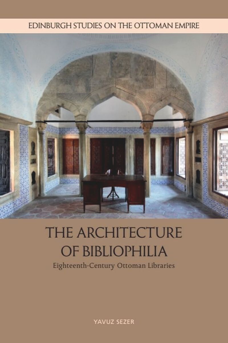
The Architecture of Bibliophilia
Eighteenth-Century Ottoman Libraries
Yavuz Sezer, Edinburgh University Press, 2026
https://t.co/ilYnKzns86
#OpenAccess The author's PhD Diss on which the book is based
https://t.co/2cDoBQSGJ8
PDF 🎯
https://t.co/ApuvGaDRaT
Pustaka Langka butuh dukunganmu!
Hi all, beberapa bulan terakhir, website Langka dikunjungi ratusan ribu hingga jutaan kali. Tentunya kami sangat senang, tetapi ini berarti biaya yang dikeluarkan juga lebih besar.
Bagi yang mau mendukung, bisa lewat https://t.co/bJOIc8UhMp ya!
Kami tidak menerima donasi dari organisasi atau yayasan agar tetap bisa menjalankan proyek-proyek Logos tanpa tekanan, tetapi hal ini juga membuat keuangan kami minus sejak didirikan pada tahun 2020.
Selama 6 tahun terakhir, kami membuat ribuan artikel gratis, 300+ kelas gratis, dan yang terbaru adalah digitalisasi 1000+ buku dan majalah langka.
Semuanya gratis untuk masyarakat, tetapi ada harga yang harus dibayar oleh tim Logos ID dari dompet kami sendiri.
Semoga dukungan teman-teman dapat mengurangi defisit kas Logos ID dan suatu saat kami bisa berkembang lebih jauh apabila ada uang lebih untuk membuat proyek pendidikan gratis lainnya.
Introducing: The Earth Simulator from @Mycosoft
https://t.co/g7P45BiTv2
Earth Simulator is Mycosoft’s living environmental intelligence map — a nature-first Common Relevant Environmental Picture for seeing Earth as one connected system.
I am very excited to release GeoLibre v1.0 🌍
GeoLibre is a free and open-source, lightweight, cloud-native GIS platform for visualizing, exploring, and analyzing geospatial data. One application that runs everywhere: in your web browser, as a native desktop app, on your phone, and inside a Jupyter notebook. No account, no server, no cost. Everything runs locally and your data stays private.
In this video, I walk through GeoLibre 1.0 step by step: how to install and run it, load vector and raster data, stream gigabyte-scale cloud-native datasets without downloading them, edit attributes and geometry, work with PMTiles, 3D tiles, LiDAR point clouds, and DuckDB, and share your projects as static links.
GeoLibre is built on MapLibre GL JS, React + TypeScript, Tauri (Rust), DuckDB, and https://t.co/Iu3zs18MyS.
Try it: https://t.co/7VA2AQpaJK
GitHub: https://t.co/VXq8c1oACL
Full video tutorial: https://t.co/nmlHL8I80Y
If you have feature requests or run into bugs, leave a comment or open an issue on GitHub. And if you find GeoLibre useful, please give it a star.
#GIS #OpenSource #Geospatial #MapLibre #Python #DataVisualization #GeoLibre
🚨Out today in @Nature our new paper uses deep learning to map four decades of global human migration.
By building the first comprehensive dataset of global annual flows (1990-2023), we reveal that migration has nearly tripled since 2000.
🔗https://t.co/DuPQKF1asT