Wind Advisory until 6 PM Thursday. Sustained winds of 15-25 mph with gusts as high as 40-50 mph will be possible. Gusty winds could blow around loose objects & blow down tree limbs. Drivers of high-profile vehicles should use extra caution, especially on east-west oriented roads.
It is an ALERT DAY!
-Watch out for slick roads during both commute times today.
-Some areas of western KY could see as much as 5 inches of snow.
https://t.co/P8yT7NtyLm
#AlertDay⛈️Showers and thunderstorms will move from west to east through the Tri-State this afternoon. Most of these will be run-of-the-mill thunderstorms, but an isolated severe storm capable of producing hail and damaging wind gusts is possible. #tristatewx#inwx#kywx#ilwx
We have some warmer weather in store this weekend, but our temperatures will decline through the first half of next week, and it looks like our weather may stay cooler than normal through the first few days of October. #tristatewx#inwx#kywx#ilwx#fall
Lots of sunshine today, but our skies still look a little hazy due to smoke from the wildfires out west that is being carried into our region by winds in the upper levels of the atmosphere. #tristatewx#inwx#kywx#ilwx
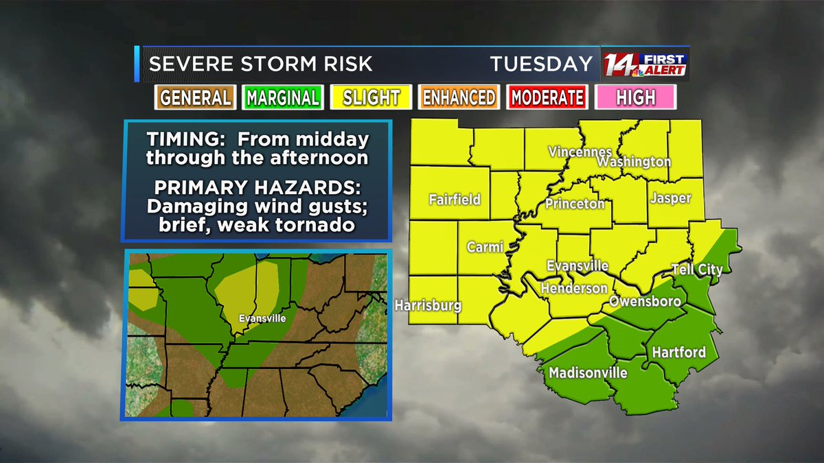
A large portion of the Tri-State upgraded to a Slight Risk for severe storms Tuesday as the remnants of Tropical Storm Cristobal move through our region. The main threat will be isolated damaging wind gusts, but tropical systems are also prone to weak, short-lived tornadoes.
#AlertDay Tuesday for the possibility of a few strong to severe storms during the afternoon and evening. The main threats will be damaging wind gusts and localized flash flooding. Some of this could change, so stay tuned to @14News for the latest information. #tristatewx
It looks like the chances for any significant snow accumulation Sunday and Monday will stay to our north and west. This system will be mainly rain for the Tri-State, and we may even see some heavy rain in Kentucky. #tristatewx#inwx#kywx#ilwx#snow#rain
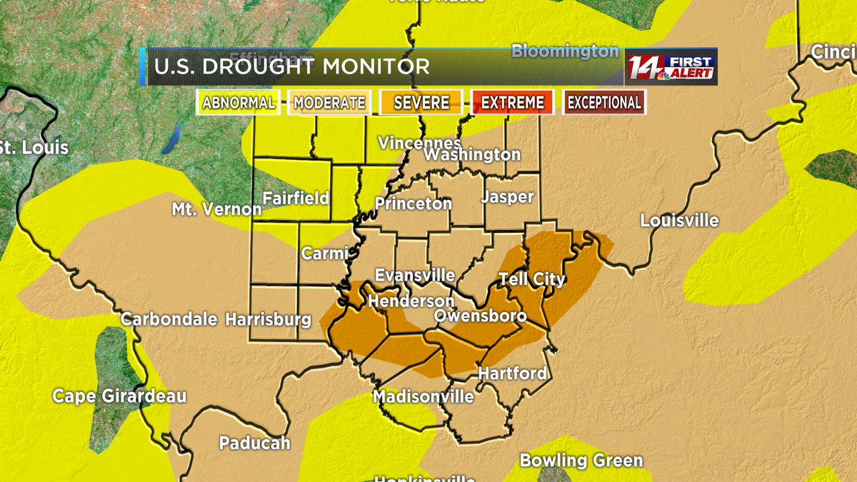
Still thirsty across the Tri-State. October is nearly an inch below normal on rainfall. Moderate-Severe drought conditions may be eased by rain on Tue-Wed. #tristatewx
While some burn bans have been lifted following Friday's rain, burn bans are still in effect for many counties in the Tri-State! In KY, even if your burn ban has been lifted, it is illegal statewide to burn within 150 ft of any woodland or brushland between 6AM & 6PM until Dec 15
This is something we haven't seen in a while! As the skies clear, the winds calm, and temperatures drop overnight, patchy frost may develop by Saturday morning! You may want to cover any sensitive plants. #tristatewx#inwx#kywx#ilwx#FrostAdvisory
Flash Flood Warning until 7:30 p.m. for portions of Ohio County, including Beaver Dam, McHenry and Rockport. Do not try to walk or drive through floodwaters! #turnarounddontdrown#tristatewx#kywx
Flash flooding has been reported by law enforcement in central Muhlenberg County, including Greenville and Central City. A Flash Flood Warning is in effect until 10:30 p.m. Do not try to walk or drive through floodwaters! #turnarounddontdrown#tristatewx#kywx
We finally have some significant rainfall in the forecast! Most of the Tri-State is expected to pick up 0.25-1" of rain from Sat night thru Mon morning. The heaviest rain is expected late Sun night into early Mon. The highest rainfall totals will likely be to the east-southeast.