ALERT | Severe T-Storm Watch now in effect for parts of our Arkansas, Oklahoma, and Missouri coverage areas through 1:00 AM tonight!
.
https://t.co/KQk8TkPnp1 #ARwx#MOwx#OKwx
Earlier this week I ran a story of damage from a tornado that hit parts of Benton County. I shared the story of Diane Puckett and her families experience during the tornado. They have a go-fund me for their storm recovery: https://t.co/3moetLmrE3 #ARwx#NWAwx
Future #HurricaneHelene is now expected to reach major hurricane status before landfall along parts of the FL coast by Thursday. Here’s our latest update: https://t.co/Sbce5h724x #FLwx#cwwx#wn225wx
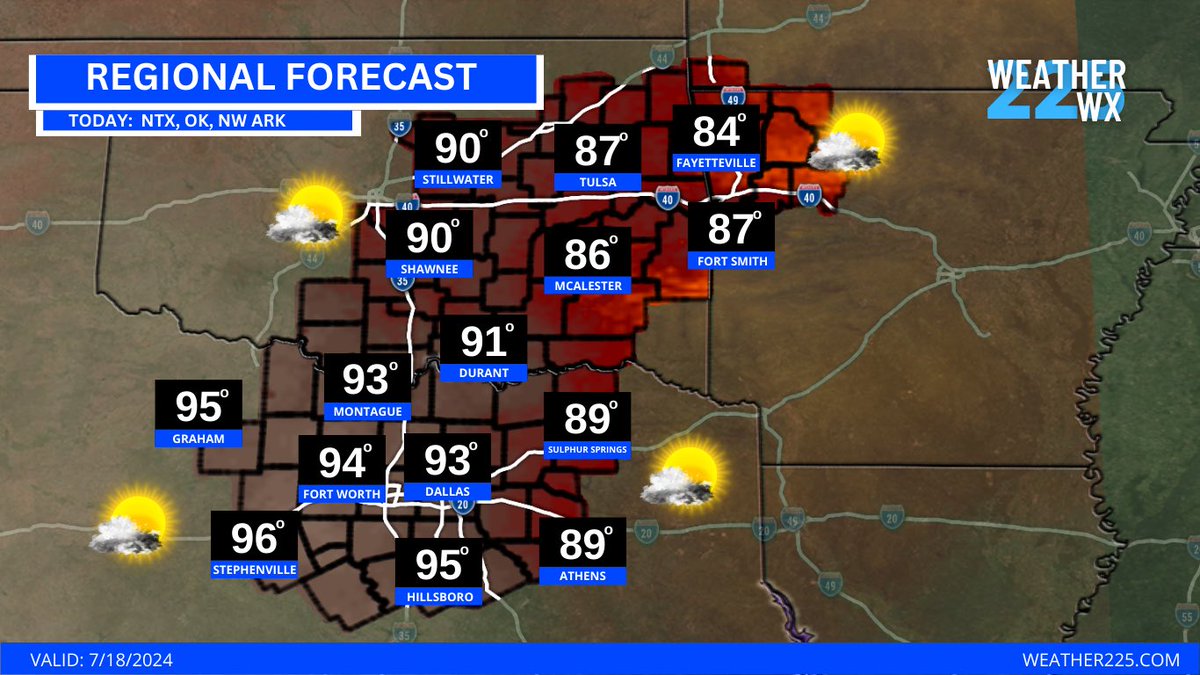
Good morning North Texas! Here's today's forecast: More Forecasts- https://t.co/PWhnvFoeKN
Sponsored by MyPro Construction https://t.co/yMfWN7EXd8 (Refer Weather225) #ntxwx#dfwwx#txwx#wn225wx
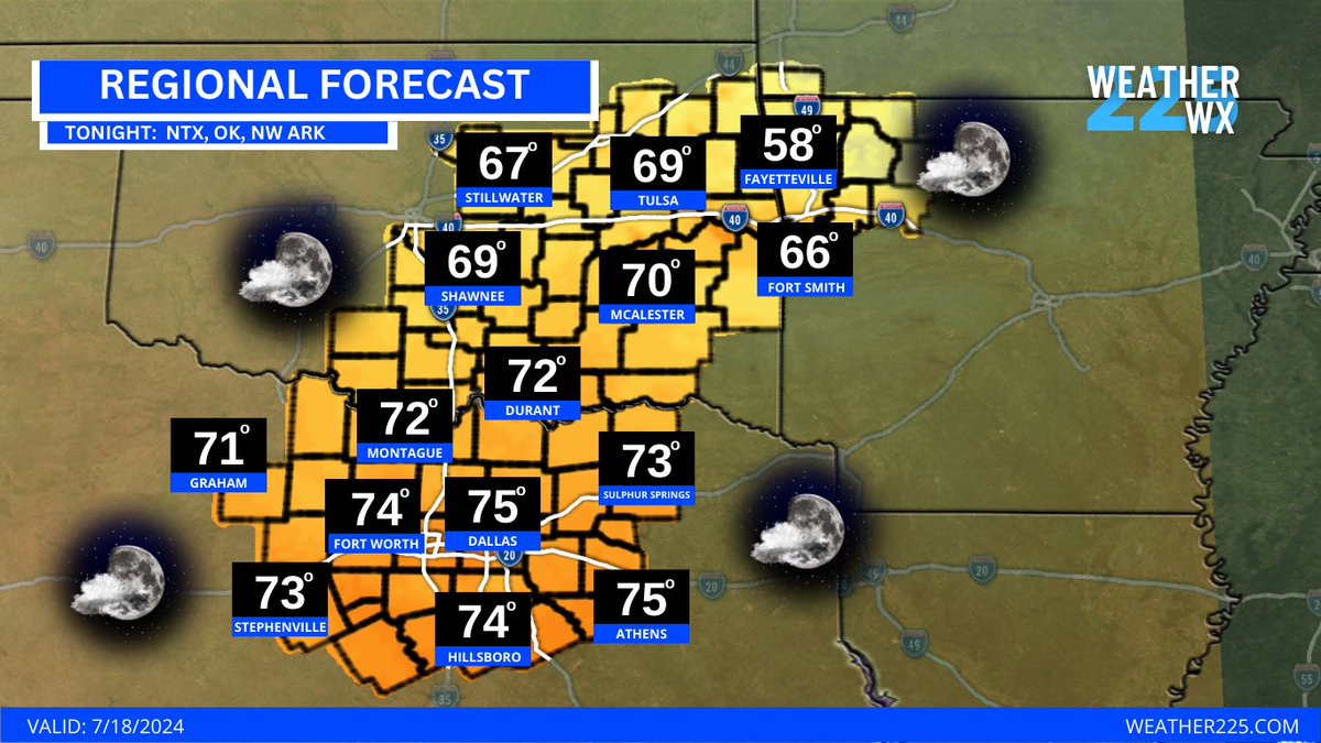
Good morning North Texas! Here's today's forecast: More Forecasts- https://t.co/SxtPQuQP9r
Sponsored by MyPro Construction https://t.co/XJbF5ALvl4 (Refer Weather225) #ntxwx#dfwwx#txwx#wn225wx
We’re trying out a new channel type for live 24/7 weather! Introducing the LIVE all coverage areas weather channel! This includes everyone of our coverage areas (DFW, Northwest Arkansas, New York, and Tropics!) Watch here: https://t.co/T1tcYAuq7p #NYwx#ARwx#TXwx#CWwx
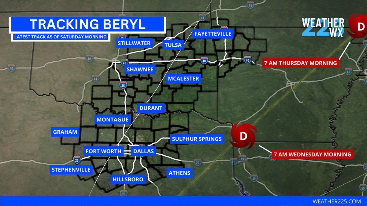
Latest track from #Beryl has it reaching our coverage areas Wednesday and Thursday as a tropical depression inland. Increasingly likely both NWA and NTX experience rain/t-storms as a result of Beryl moving through the region. #arwx#txwx
#UPDATE | #Berly is now forecasted to potentially make landfall near Port Isabel #Texas as a CAT 1 #Hurricane by early Monday morning. Heavy rainfall and hurricane conditions could be expected Monday for southern TX coast. Here’s the latest track. #cwwx#txwx
It’s hot outside today, but check this out some relief may be on the way! The latest 6-10 day temperature outlook shows about a 40-50% chance for below average temperatures across the southern U.S.! We’ll take it! https://t.co/KQk8TkPVez #txwx#arwx#ntxwx#nwawx
We have a 70% chance for tropical development in the Gulf of Mexico over the next 24-72 hours as an area of low pressure over the Bay of Campeche with winds of 35-40 mph occurring and gradually developing. Heavy rains to the TX coast likely. https://t.co/n9ZVTNSVDp #txwx#cwwx
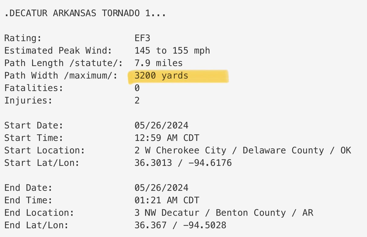
It’s hard to comprehend that the same supercell on Saturday produced 2 nearly 2 mile wide tornadoes within a few miles of one another. Previous record for max width tornado in Arkansas was 1.6 miles wide. This storm alone took #1 and #2 widest tornadoes in the state… #ARwx
Uploaded the full tornado coverage REPLAY from 5/25/2024 over North Texas. Watch the replay here: https://t.co/zB5tWIfuPH #txwx#dfwwx#ntxwx#texomawx#wn225wx