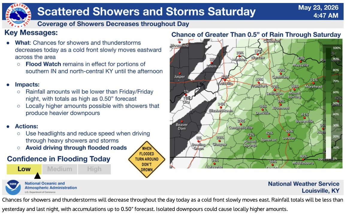
Sitting at 0.01" today, some storms still popping up around. But consider this wet pattern moving out after today. Already seeing plenty of sun today, though that moisture is humid. dew points near 69-70˚ across region. #KYWX
picked up another 1.83" with the heaviest last evening picking up over 9/10th of an inch in an hour. Today may be our last chance for any more could it be another half inch or greater day.... already 7 consecutive days, definitely a station record for me going back to July 2005. Month to date is 8.09" (+3.49") Year to Date is 18.85 (-1.83") for Georgetown, KY #KYWX
Today will be a quieter on the rain showers, 20% POPs around Scott County, still a chance for a shower somewhere, but then Tuesday will be bring back copious amounts of precipitation back into the state from South to North and may carry into Wednesday. Picked up 0.66" for 24-hr period ending at 7 AM this morning.
5-day rainfall totals from the Community Collaborative Rain, Hail and Snow network (https://t.co/MI7cEEqh1l) for Franklin, Scott, and Harrison Counties in Kentucky.
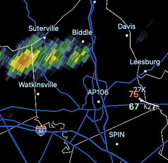
scatter rain increasing to thunderstorms later with approaching warm front. Severity unknown due to cloud cover. will continue to monitor. but Flooding issues not out of the question.
We will see a wetter pattern over the next week, this is much needed as we are 2" short so far this month, and 7 1/2 inches for year. Lets look at a snapshot before this period of forecasted rain for Georgetown, KY #KYWX