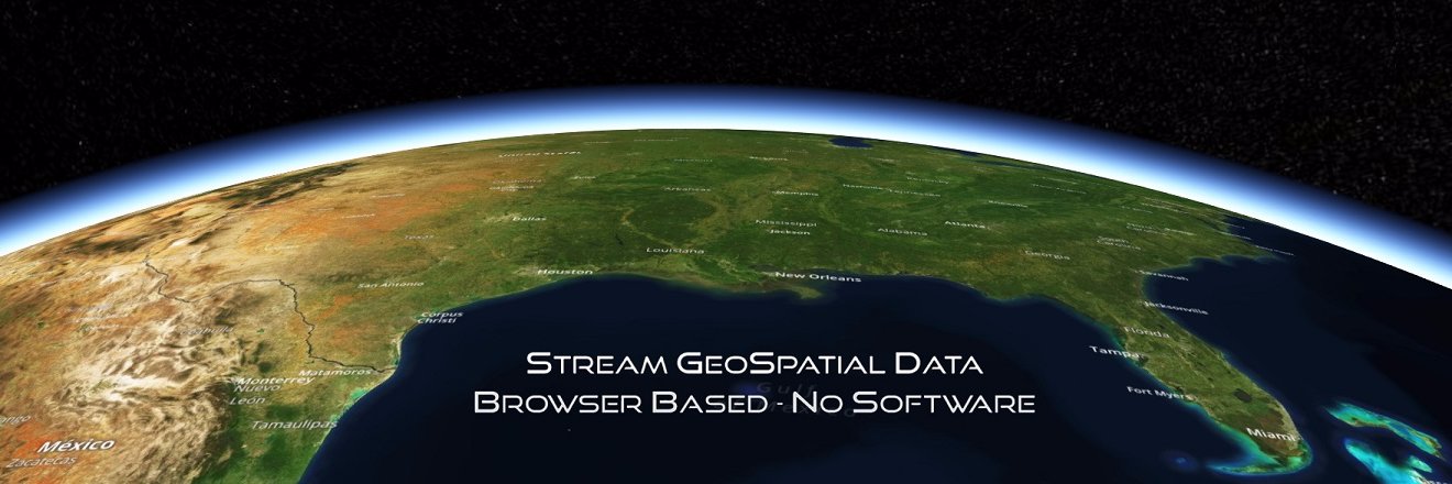
4DMapper is a cloud based, feature rich platform which accepts and streams multi format geospatial data and enables rapid access by multiple users. No software!
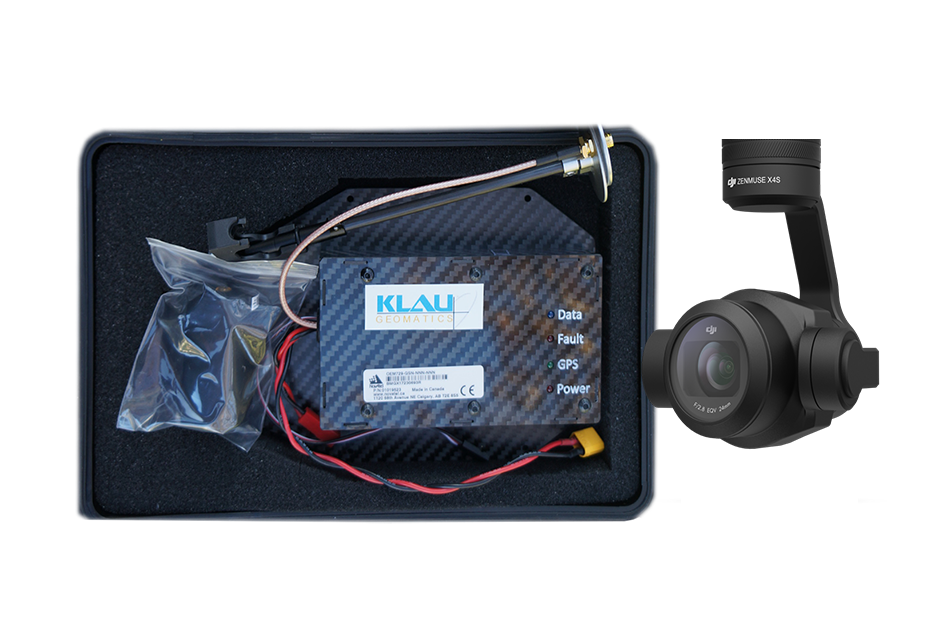
KlauPPK post-processing software for DJI P4RTK
KlauGeomatics released a dedicated PPK processing software for DJI Phantom4RTK drone bringing efficiency, reliability and accuracy to drone surveying: https://t.co/7tdJLQLOFW
'DJI Phantom4 Surveyor' powered by KlauPPK is now available for surveyors with optional end-to-end data management and inspection workflow.
Surveyors can now achieve better than 3cm XYZ geopositioning accuracy for 3D mapping and i…https://t.co/QpcdR1cF7D https://t.co/YwzbMU5jZD
Australia’s largest geospatial solutions retailer brings the high precision drone geo-referencing module to the construction, mining and mapping industry. https://t.co/qTrVTbNOeg https://t.co/abYzoGk15W
"You guys rock I am impressed. I was asked to build a system that will hit 0.10ft accuracy at 250ft for under $30k with no ground control. You guys appear to have delivered!". It was great to see this comment from one of the biggest survey and drone sol…https://t.co/esBJlqbvvL
PPK with No-Base Station – Accurate Georeferencing for UAV surveying
Another innovative solution from KlauGeomatics revolutionising the aerial mapping accuracy from UAVs :
https://t.co/EcfTLs9hr8 https://t.co/l354EAk2V7
4DMapper seamlessly turns the DJI PPK enabled drone data into accurate 3D models and maps without any local computer or desktop software licensing.
Our unique and innovative web-based platform enables rapid photogrammetry processi…https://t.co/PJaTYP3hdR https://t.co/tZkdjm3sHJ
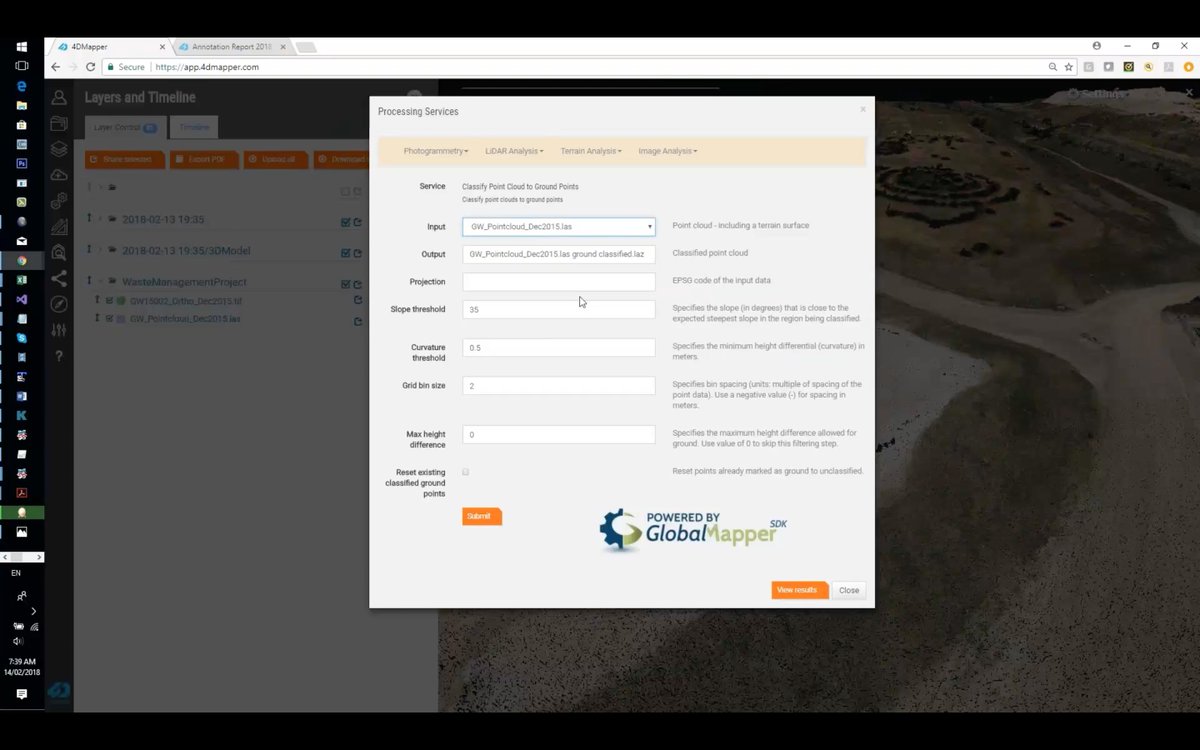
Watch this webinar to see how 4DMapper enables Blue Marble Geographics (Globalmapper) analytics in the cloud.
This webinar shows how 4DMapper enables advanced cloud based GIS data analytics without any high-end computer or local d…https://t.co/phQFJfWZwp https://t.co/hVGZip1lYa
Unprecedented Aerial Surveying Accuracy with DJI drones.
KlauPPK users keep reporting incredibly accurate and precise surveying results from their PPK enabled DJI drones (better than 3cm absolute geo-positioning accuracy). See https://t.co/1JjuZzlcM1 fo…https://t.co/tW2TUpPZ8S
@eagle_drones_us@BlueMarbleGeo Thanks @eagle_drones_us ! There is one more update on @4Dmapper , we enable accurate drone surveying without placing traditional ground targets across the entire site area. See https://t.co/zMOtwu2dKA