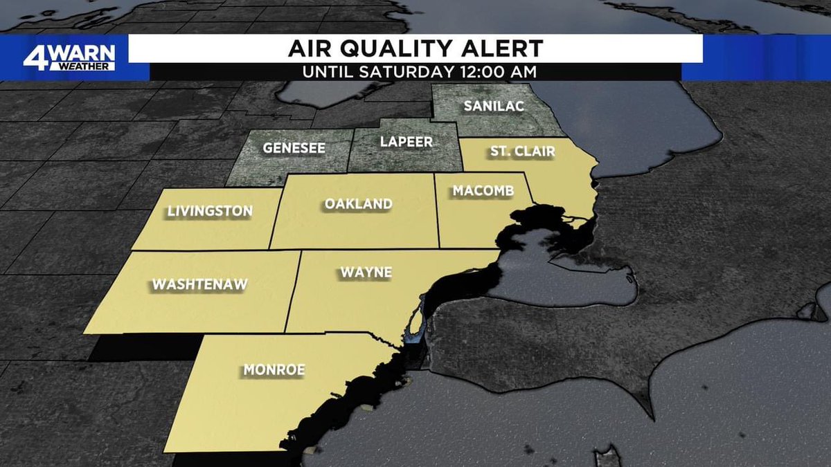
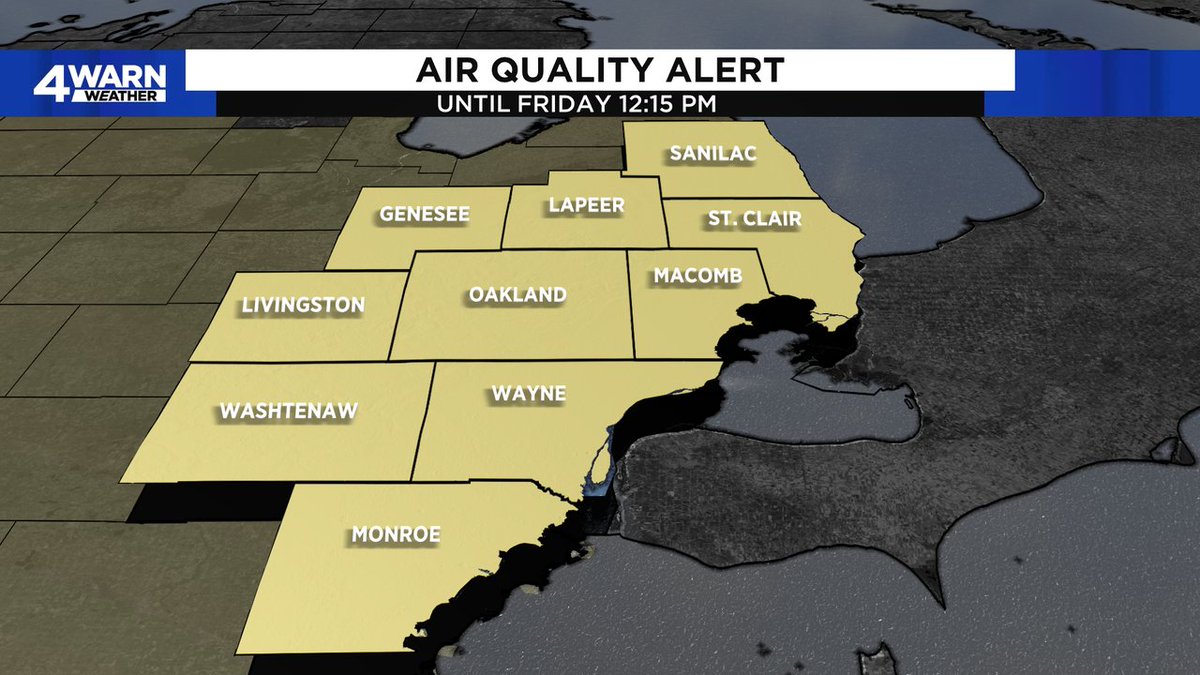
AIR QUALITY ALERT: St. Clair, Livingston, Oakland, Macomb, Washtenaw, Wayne, and Monroe counties for Friday, July 28th due to Elevated Ozone levels taking our Air Quality into the Unhealthy for Sensitive Groups (Orange) Range… #MIWX@Local4News
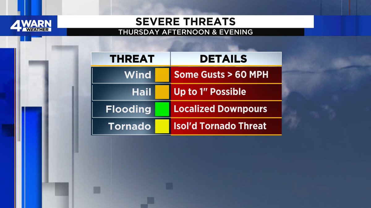
4WARN WEATHER ALERT DAY: Has been declared for this afternoon and evening with severe thunderstorms moving into the region with all modes of severe weather possible. Stay with @Local4News on all platforms for severe weather coverage today! #MIWX
4WARN WEATHER ALERT DAY: We're declaring a 4Warn Weather Alert Day for tomorrow (Wednesday) as we've been placed under an Enhanced Risk (3 out of 5) for severe weather along & South of M-59. All modes of severe weather possible in the late afternoon/evening.. #MIWX@Local4News
SEVERE THUNDERSTORM WARNING: Genesee County, MI until Jul 20, 2023 3:30PM EDT. Seek shelter indoors & stay away from windows. Tune into @Local4News for more information... #MIWX
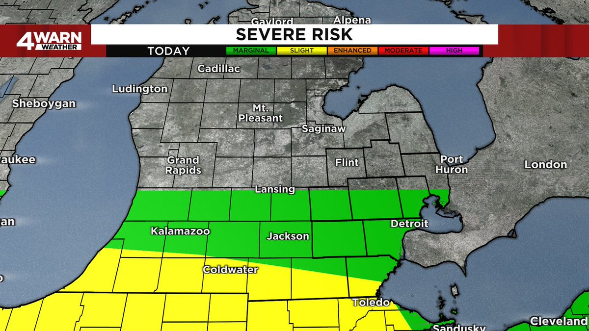
SEVERE RISK UPDATE: Lenawee & Monroe Counties are now up to a Slight Risk (2 out of 5) for severe weather, while areas along and South of M-59 remain at a Marginal Risk (1 out of 5) for severe weather. Winds, hail and heavy rain remain the threats.. #MIWX@Local4News
SEVERE THUNDERSTORM WARNING: Washtenaw, Livingston County, MI until Jun 25, 2023 6:30PM EDT. Seek shelter indoors & stay away from windows. Tune into @Local4News for more information... #MIWX
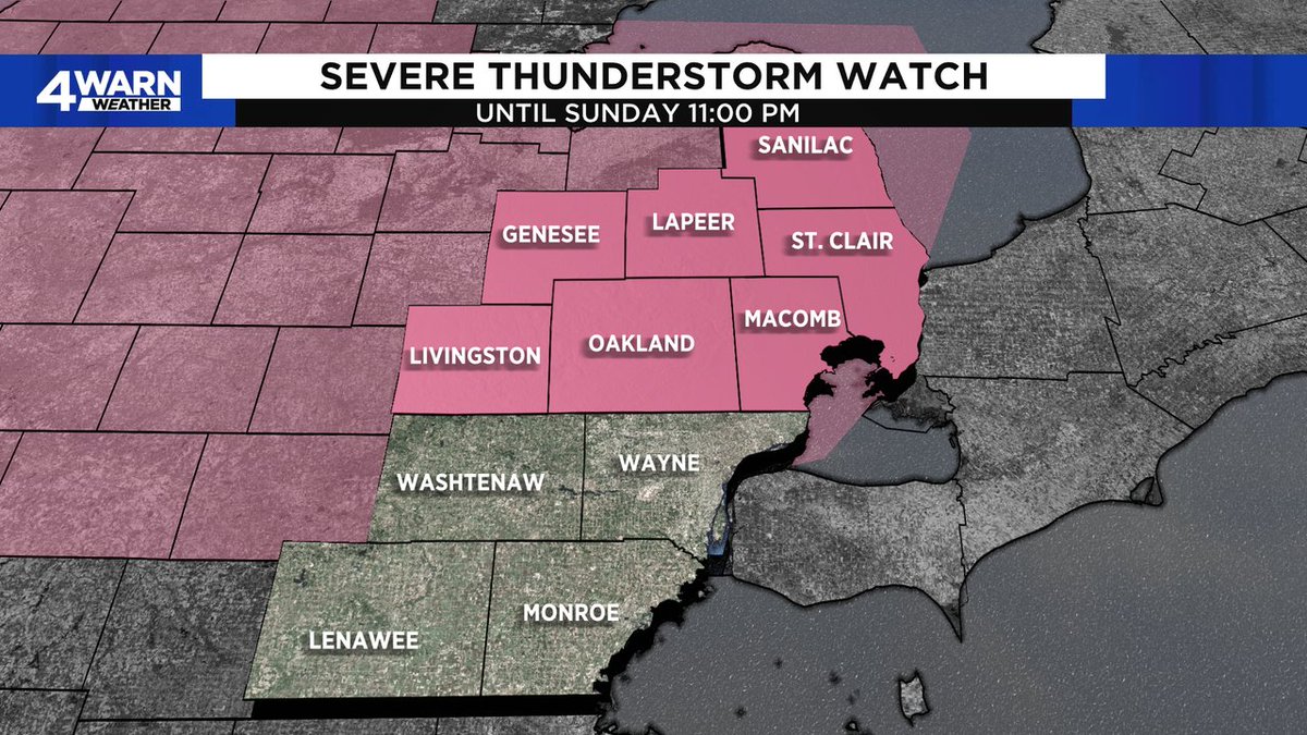
SEVERE THUNDERSTORM WATCH: A Severe Thunderstorm Watch has been issued for portions of Southeastern Michigan. Tune in WDIV Local 4 News & 4Warn Weather for the latest information. More Info: https://t.co/2ej3eimrwf #MIWX#DetroitWX@Local4News
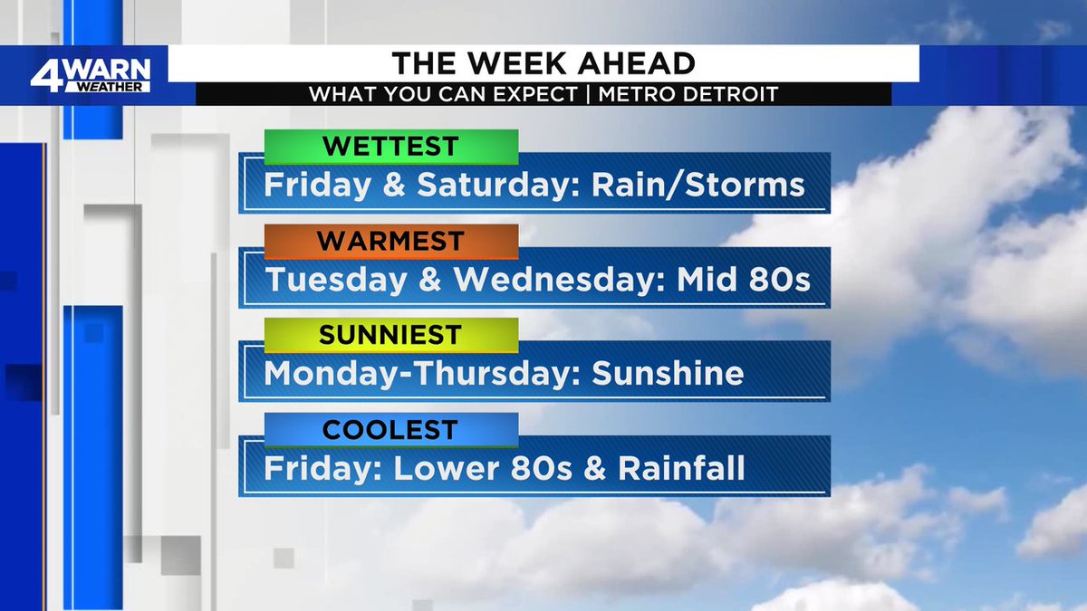
THE WEEK AHEAD: Not a bad week for us, plenty of sunshine for most of the week before the rain and storms move back into the region by the end of the week and into the upcoming weekend. So, enjoy the 80s and sunshine through Thursday! #MIWX@Local4News
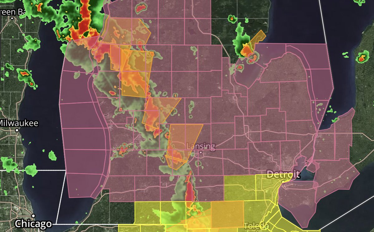
LIVINGSTON COUNTY: Tracking a severe thunderstorm just off to your west that has just been warned on for Ingham County for winds to 60 MPH and 1" hail possible as it moves East at 35 MPH... Be prepred for warnings to potentially be issued... #MIWX@Local4News
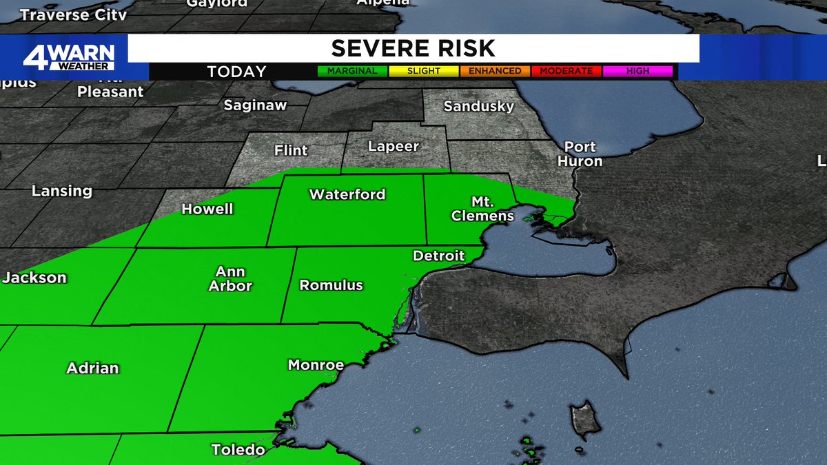
SEVERE STORMS POSSIBLE: This afternoon & evening as our front moves through.. Marginal Risk (1/5) for today. Winds to 60 MPH & hail are possible, but with a little "spin" , I am not ruling out an isolated tornado primarily along the shoreline... #MIWX@Local4News
AIR QUALITY ALERT has been extended through noon Friday, June 9th for all of Southeast Michigan due to the wildfire smoke from Canada. Limit outdoor activity. @Local4News
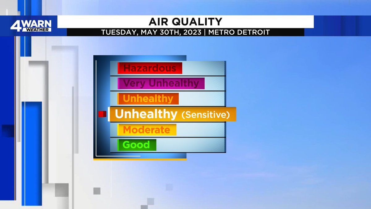
AIR QUALITY ALERT: Is in effect for most of the region today as the air quality will be in the Unhealthy for Sensitive Groups range today.Carpool or bike when possible, make sure to check on our senior friends & those with asthma/respiratory illnesses... #MIWX@Local4News
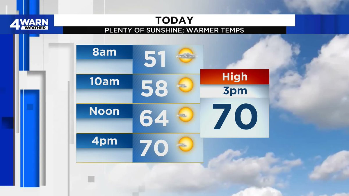
TUESDAY PLANNER: A few morning clouds give way to plenty of sunshine as we work throughout the day! We're in the 50s this morning, heading for right around the 70° mark by late this afternoon! Enjoy the sunshine! #MIWX@Local4News
Stream Local 4 news 24/7 on our free streaming platform Local 4+, available on your smart TV device, or right here on ClickOnDetroit https://t.co/7DWqpMfPfm