YES, the last time we saw an El Nino this strong, over 50 million people died.
YES, that occurred in 1877. While some weather extremes have already been and will continue to be felt, our world is obviously much more advanced and prepared to handle the heat next summer, and whatever this winter and next spring, bring. Relax people. Get off Tiktok. ❤️- George
@skynoer@KushiticGyal Even if you are correct with the facts, this account does not need to be acting like it’s the end of the world. If they simply stated the facts without the whole 13 post thread, I’d be fine.
@skynoer@KushiticGyal Yeah, I know what the El Niño Southern Oscillation is. What I don’t know, is why people like this poster acts like ENSO is a serial killer on the loose
killing hundreds of thousands of people. There’s no point. If you want to see the true effects of ENSO go to the NWS website.
proportions of what will actually happen this winter/spring. If any of you see these types of posts, block the creator, and ignore them. The only outcome they want out of posting it is for revenue. (2/2)
Over the last couple of days, I’ve seen TONS of fear-mongering posts about the upcoming “Super” El-Nino. Though the El Niño this year will possibly break records, that does not break the fact that people should be scaring the lives out of other people by breaking the (1/2)
the attention of more people. If either I gain more viewers or if y’all do not like this style of posting, I will return to normal. However, until things get really active (strong severe weather & snow storms), I will be using this new method of posting. Spread this around! (2/2)
Hello y’all! If anyone sees this, as I am getting very low views per post, I’m going to begin using AI for posting. What I do is type my original post into an AI chat in order for it to translate it into a social-media-fitting post. These posts will hopefully catch… (1/2)
Potentially 10+ day stretch of mostly dry weather ahead! ☀️
📅 THURSDAY currently has the best shot at rain — and even then, we’re only talking about around a 20% chance.
After that? A mix of clouds & sunshine could take over through much of next week. 👀
(2/2)
🌥️ CLOUDS ARE TAKING OVER… BUT A BIG PATTERN SHIFT MAY BE COMING! 👀
The next 2+ days look pretty gloomy, with clouds dominating and keeping highs stuck around 73°F. 🍂
🌧️ BUT HERE’S THE INTERESTING PART: Rain chances may basically disappear after Thursday, with a (1/2)
FALL LIKE TEMPS RETURN TO LOUISVILLE THIS WEEK
After the recent heat, temperatures will finally start feeling more like fall again.
Highs: Low–mid 70s
Lows: Mid 50s
Coolest highs: ~74°F Wednesday & Thursday
Clouds will be a major story this week, helping keep daytime (1/2)
There is a very slim chance for rain as we reach the evening, but nothing to be afraid of. Looking ahead for rain, we have a chance Monday night into Tuesday morning for some rain showers, with Tuesday mainly being a cloudy day with a ~25-30% chance of rain. (2/2)
Today’s LTL Forecast: Today will be another, but likely the last, hot day of the year with temps reaching 96F. Speaking of temps, there will be a ~20 temp difference between today and Tuesday’s high temp, with Tuesday’s high temp being ~77F. (1/2)
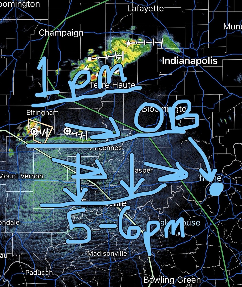
Update: The outflow boundary is continuing to track SE and it is also strengthening a bit. However, less showers and storms are popping off from it, leading me to believe clouds and gusty winds are the only things needed to be worried about. If anything changes ill have an update
to our west that would track east as seen in the pic below. Therefore, a more designated time zone I would focus for rain is 7-9pm. It is possible this outflow boundary (OB) loses steam however. More updates will come as the outflow boundary becomes closer to the area.
Update for LTL & UofL game: An outflow boundary (about a 100 miles NW from the area) is tracking south, allowing for the formation of new pop up rain showers and storms. At its current rate, the boundary will reach west of our area around 5-6pm, possibly forming showers (1/2)