...TECHNICAL ISSUES REGARDING OUR PHONE LINE...
We have identified an issue that may prevent incoming calls from notifying the office. Our text line is functional. While we investigate, use our text line if issues with the call line arise. Both use 361-280-4644.
REGARDING THE "Made With AI" TEXT:
ACSTS CCI *does* occasionally use AI to remove unnecessary text from images. For example, model guidance tracking contains unnecessary text in which AI is used to remove the text. WE NEVER USE COMPLETELY AI GENERATED IMAGERY.
(1/2) We are continuing to monitor what is now Tropical Storm Isaias. According to model guidance, rapid intensification to hurricane (and possibly major hurricane) status are expected over the next several days before it is likely to make landfall along the LA/FL border.
(2/2) Minimal impacts to our area are expected. However, our main concern is rip currents and potentially coastal flooding. We will be continuing to monitor for these potential hazards.
(1/2) We are continuing to monitor what is now Tropical Storm Isaias. According to model guidance, rapid intensification to hurricane (and possibly major hurricane) status are expected over the next several days before it is likely to make landfall along the LA/FL border.
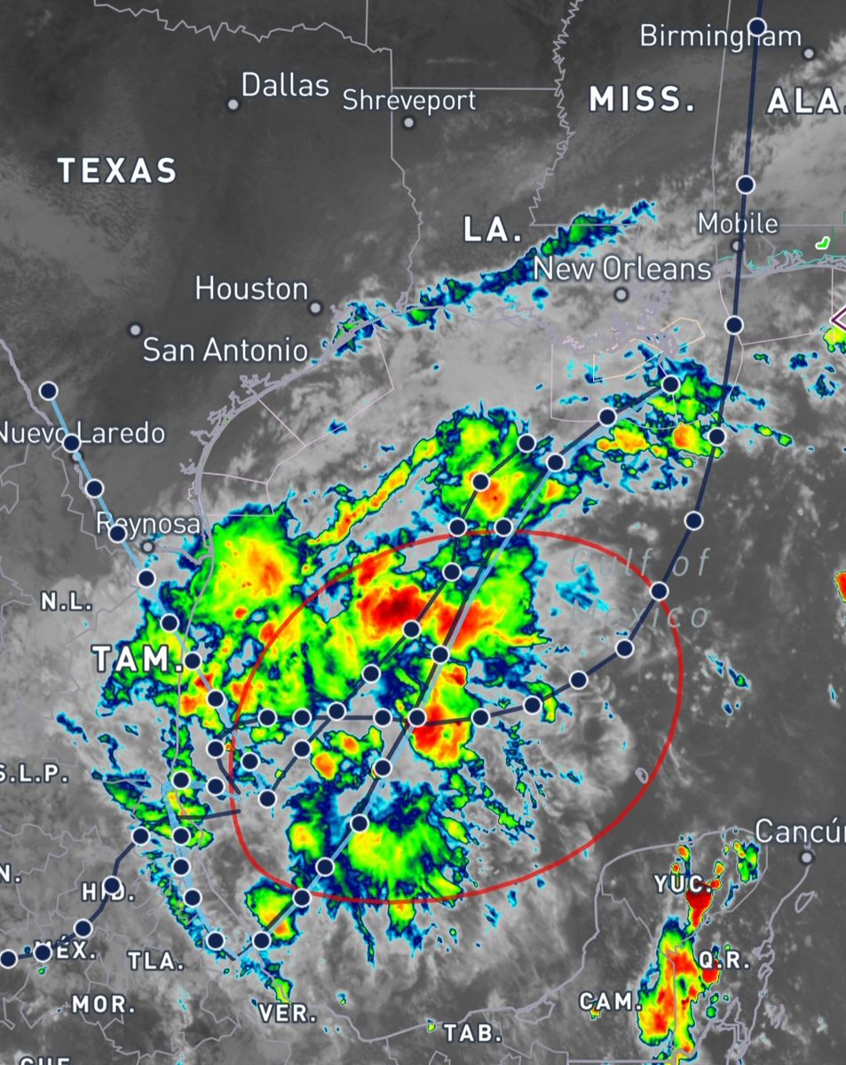
We are continuing to monitor a disturbance in the Gulf. Showers and thunderstorms are much better organized then yesterday, and a Tropical Depression is expected during the middle part of the week.
Formation chances:
48 hours: MEDIUM (60%)
7 days: HIGH (80%)
We are continuing to monitor a disturbance in the Gulf. Showers and thunderstorms are much better organized then yesterday, and a Tropical Depression is expected during the middle part of the week.
Formation chances:
48 hours: MEDIUM (60%)
7 days: HIGH (80%)
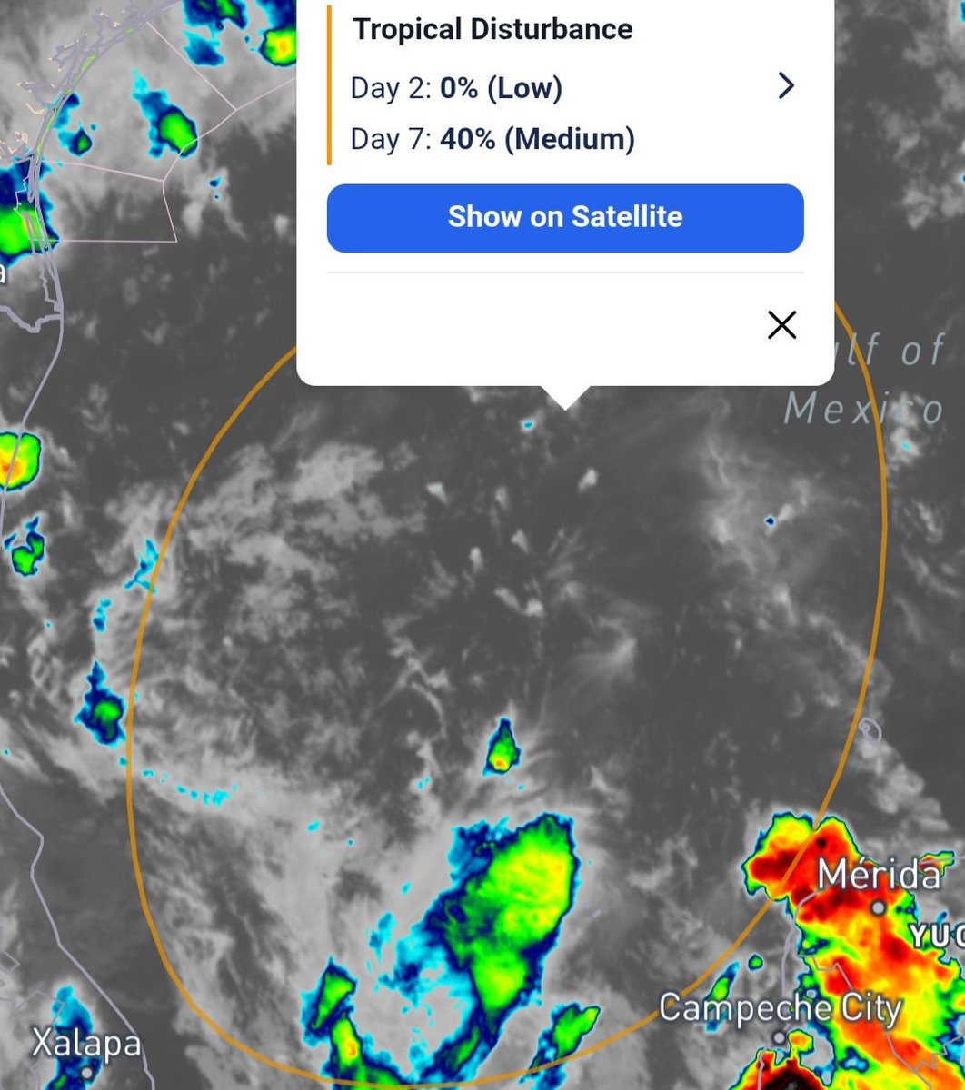
We are currently monitoring an area of interest just off the coast of Mexico. At this time, convection appears heavily disorganized and no immediate development is expected. However, development is possible later in the week.
Formation chances:
48 hours: 0%
7 days: 40%
@acstsbal We genuinely have no idea why it exists either. But given how corrupt the Mexican Government is, we aren't surprised they wanna call some of their cities shit.
(This is a joke. Please do not come after me, Mexican Cartel.)
We are currently monitoring an area of interest just off the coast of Mexico. At this time, convection appears heavily disorganized and no immediate development is expected. However, development is possible later in the week.
Formation chances:
48 hours: 0%
7 days: 40%
...THE FLASH FLOOD WARNING FOR
CENTRAL GOLIAD COUNTY WILL EXPIRE AT 1AM CDT...
The heavy rain has ended. Flooding is no longer expected to pose a
threat. Please continue to heed any remaining road closures.
CONSIDERABLE FLASH FLOOD WARNING FOR CENTRAL GOLIAD COUNTY UNTIL 1AM.
Between 4 and 7 inches of rain have fallen. The expected rainfall rate is 2-4 inches in one hour.
Locations impacted: Goliad
Move to higher ground now, act quickly to protect your life.
CONSIDERABLE FLASH FLOOD WARNING FOR CENTRAL GOLIAD COUNTY UNTIL 1AM.
Between 4 and 7 inches of rain have fallen. The expected rainfall rate is 2-4 inches in one hour.
Locations impacted: Goliad
Move to higher ground now, act quickly to protect your life.
Flood Advisory for SC Victoria CO until 715PM
At 519 PM CDT, Doppler radar indicated heavy rain due to thunderstorms. This will cause minor flooding. Poor drainage areas will result in minor flooding in the advisory area. Between 1.5 and 2 inches of rain have fallen over 30 min.
A STRONG THUNDERSTORM APPROACHING THE WATERS
The areas affected include...
Corpus Christi and Nueces Bays...
At 510 PM CDT, Doppler radar indicated a strong thunderstorm,
capable of producing winds to around 30 knots near Portland.
A Special Marine Warning maybe needed.
...THE FLASH FLOOD WARNING REMAINS IN EFFECT UNTIL 130AM CDT FOR
NW CALHOUN AND SE VICTORIA COUNTIES...
* At 12:19 AM CDT, Doppler radar indicated thunderstorms producing heavy rain across the warned area. Between 2 and 5.5 inches of rain have
fallen.
Turn around, don't drown.
FLASH FLOOD WARNING FOR NE CALHOUN AND SE VICTORIA CO UNTIL 1:30AM.
At 11:33 PM CDT, Doppler radar indicated thunderstorms producing
heavy rain across the warned area. Between 2 and 4 inches
of rain have fallen.
Turn around, don't drown. Be especially careful at night.
FLASH FLOOD WARNING FOR NE CALHOUN AND SE VICTORIA CO UNTIL 1:30AM.
At 11:33 PM CDT, Doppler radar indicated thunderstorms producing
heavy rain across the warned area. Between 2 and 4 inches
of rain have fallen.
Turn around, don't drown. Be especially careful at night.
...A SEVERE THUNDERSTORM WARNING CONTINUES UNTIL 815 PM CDT
FOR W SAN PAT...NW NUECES...BEE...
NE JIM WELLS AND SE LIVE OAK COUNTIES...
At 749 PM CDT, storms were along a line from 5 miles N of West Sinton to
Annaville, moving E at 30 mph.
Wind gusts to 60mph are possible.
SEVERE THUNDERSTORM WARNING FOR SW REFUGIO, W SAN PAT, SC BEE, NE JIM WELLS, AND SE LIVE OAK UNTIL 8:15PM CDT.
Wind gusts to 70MPH are possible.
For your protection move to an interior room on the lowest floor of a building.
SEVERE THUNDERSTORM WARNING FOR SW REFUGIO, W SAN PAT, SC BEE, NE JIM WELLS, AND SE LIVE OAK UNTIL 8:15PM CDT.
Wind gusts to 70MPH are possible.
For your protection move to an interior room on the lowest floor of a building.
A special weather statement has been issued for SC Live Oak, NE Duval, Jim Wells, SW San Patricio and Nueces counties.
Wind gusts up to 45 mph are the main hazards.
This storm may intensify.
CONSIDERABLE FLASH FLOOD WARNING FOR NORTHERN DUVAL COUNTY UNTIL 9:45PM.
At 652 PM CDT, Doppler radar indicated thunderstorms producing
heavy rain across the warned area. 3-6 inches of rain have fallen. The expected rainfall rate is 2-3 inches in one hour.