A&N Electric Cooperative is a member-owned electrical distribution cooperative serving over 35,000 members on Virginia's Eastern Shore and Smith Island, Md.
Due to hot weather and higher projected energy use in the region, A&N Electric Cooperative has issued a Beat the Peak Alert from 3-6 p.m. today (July 13).
https://t.co/gemTDz8roq
Due to hot weather and higher projected energy use in the region, A&N Electric Cooperative has issued a Beat the Peak Alert from 4-7 p.m. today (July 12).
https://t.co/8AIPLyUt6g
Due to hot weather and higher projected energy use in the region, A&N Electric Cooperative has issued a Beat the Peak Alert from 3-6 p.m. today (July 5).
https://t.co/gemTDz8roq
Tropical Storm Nicole update (as of 3PM 11/9/22): Nicole will turn NNE Thurs night-Fri and begin post-tropical transition as it interacts with a cold front. For our area, locally heavy rain, isolated tornadoes, and isolated strong winds will be possible Fri. #vawx#ncwx#mdwx
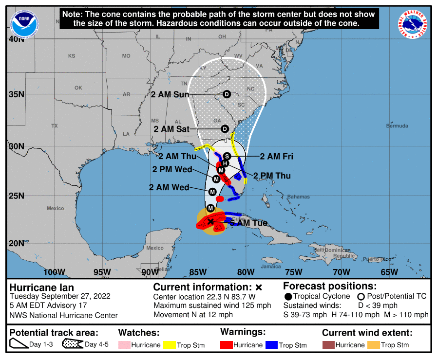
Good morning! Morning clouds should give way to mostly sunny skies by this afternoon. Cooler with highs in the 70s for most. Stay up to date with the latest information about Hurricane Ian by visiting https://t.co/CzzerFKMrT and https://t.co/YjPX0rmTBI
Enjoy mostly sunny and warm conditions across the region today. Highs will be in the lower to mid 80s. There is a slight chance for a shower or storm late this aftn into this evening over the extrm NW counties. Clear to partly cloudy tonight with lows ranging through the 60s.
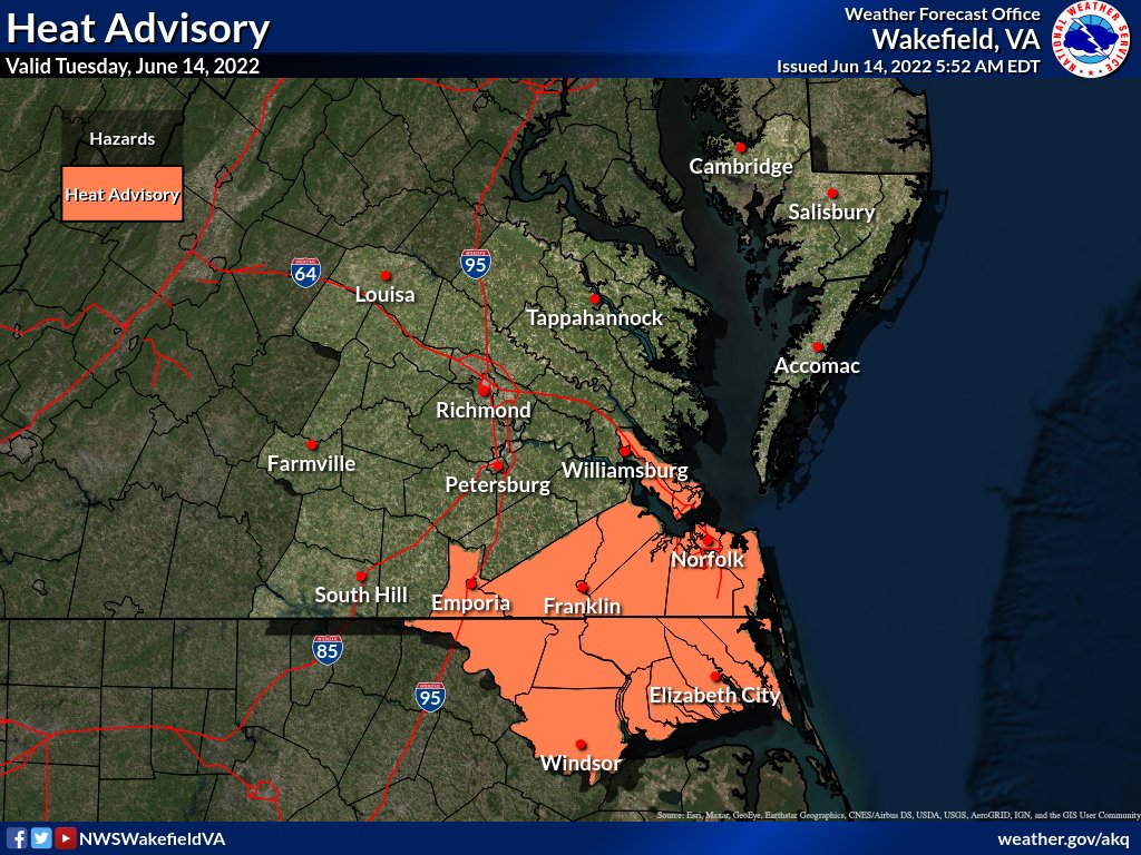
Heat Advisories are in effect for most of the area today, expect heat indices of 105 to near 110 degrees. A few storms will be possible later today. Continued hot and humid Friday, then cooler as storms become more widespread late. Not as hot for the weekend. Have a great day!
Quite warm to begin the day with temperatures in the mid 70s to near 80. Heat index values range from 100-105 W to 105-110F E this afternoon. There is a potential for a few severe thunderstorms later this afternoon and evening. Hot conditions continue through the weekend.
Watching some patchy fog to start the day, but fog any fog should burn off shortly after sunrise. Scattered showers and storms develop once again this afternoon. A few storms may be strong to severe with damaging wind gusts, heavy rain, and frequent lightning.
Due to hot weather and higher projected energy use in the region, A&N Electric Cooperative has issued a Beat the Peak Alert from 4-7 p.m. today (July 12).
https://t.co/ThCZ9rzNG9
Good morning! Mostly sunny, hot and humid conditions are expected across the region today. Highs will range from the upper 80s to mid 90s. There is a chance for scattered thunderstorms across the extreme northern counties very late this afternoon into early tonight.
Due to hot weather and higher projected energy use in the region, A&N Electric Cooperative has issued a Beat the Peak Alert from 3-6 p.m. today (July 1).
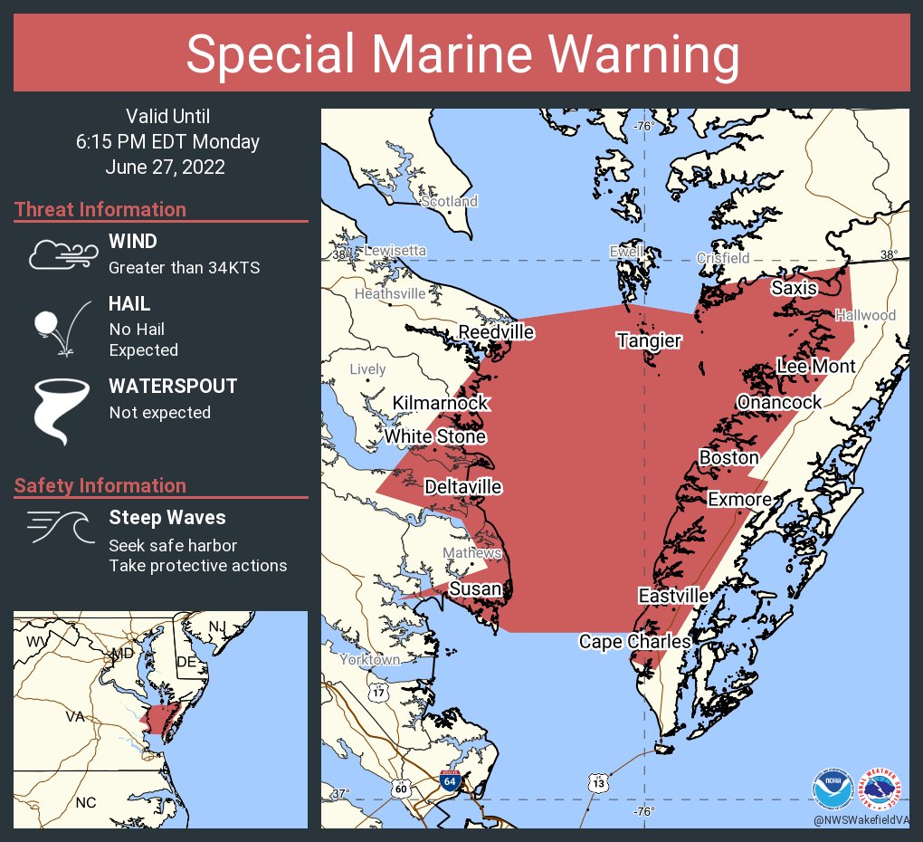
Special Marine Warning including the Chesapeake Bay from Smith Point to Windmill Point VA, Chesapeake Bay from Windmill Point to New Point Comfort VA and Rappahannock River from Urbanna to Windmill Point until 6:15 PM EDT
Special Marine Warning including the Chesapeake Bay from New Point Comfort to Little Creek VA and Chesapeake Bay from Little Creek VA to Cape Henry VA including the Chesapeake Bay Bridge Tunnel until 6:45 PM EDT
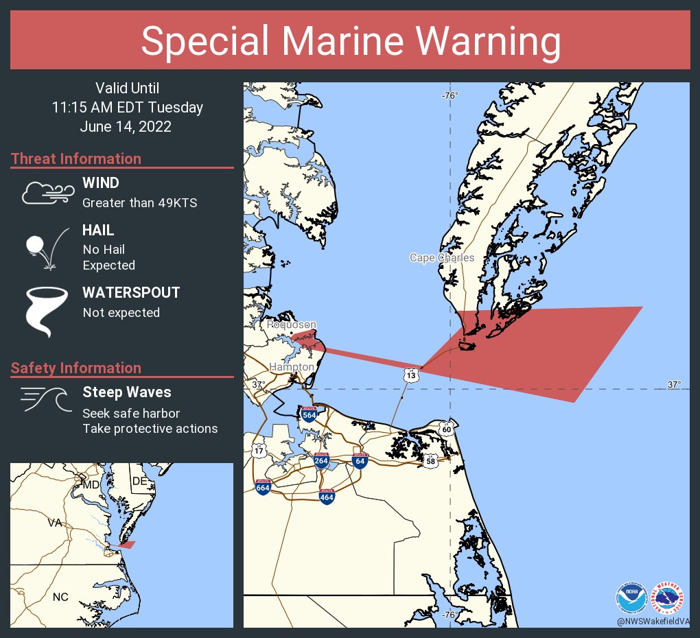
Special Marine Warning including the Coastal waters from Parramore Island to Cape Charles Light VA out 20 nm and Coastal Waters from Cape Charles Light to Virginia-North Carolina border out to 20 nm until 11:15 AM EDT
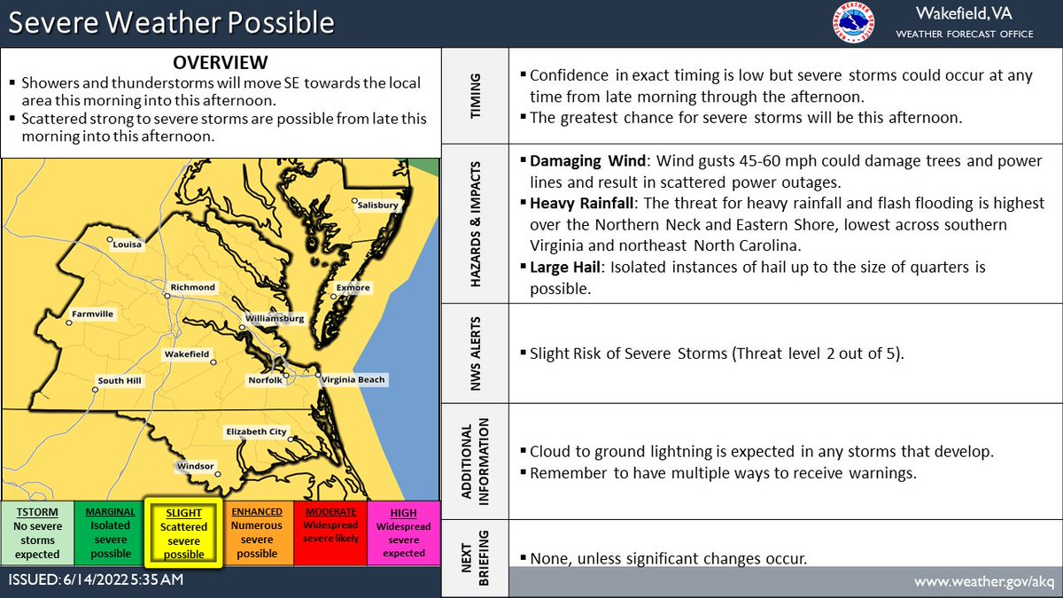
Complex weather day today with showers/storms moving into the area this morning through the afternoon. Some strong to severe storms are possible with damaging winds the main threat. A hot and humid day as well, especially in SE VA and NE NC where a Heat Advisory is in effect.