@F4FXL Try this: https://t.co/YJ98yxqHjP
Above example is for https://t.co/8YkYDyDmnp (maintained by me). If you do the same thing using one of the APRS-IS versions found on https://t.co/MmaTPrUXR0 it might be good to ask the maintainer for permission.
APRS Direct's own map is now closed, instead our new website is displayed where there are links to new fantastic APRS websites that uses the "APRS Track Direct" source code.
@F4FXL Lack of time is the main reason. I think the best thing for the community is that I release the source code and let others hams set up new APRS websites.
I have good news and bad news ...
The bad news is that https://t.co/MmaTPrUXR0 and https://t.co/8YkYDyDmnp will be shut down within about 1-2 months.
The good news is that I'll be releasing the source code on github.
@dg1sek Lack of time is the main reason. But I will very soon release source code including instructions on how to set everything up. If all goes well, we will soon have multiple APRS websites.
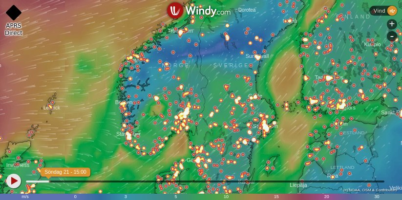
We now support the Windy Map API, a pretty cool weather forecast map. Click on the "layer" symbol in the toolbox to the left and select the Windy Map API.
We now support the Leaflet Map API, we need more options if the bill from Google becomes too high. We will use both Google Maps and Leaflet, if you want to change Map API, look in the menu. By default, the https://t.co/MmaTPrUXR0 desktop version will use Google Maps. #aprs
APRS Direct has got a new design and is now better than ever!
The raw feed is no longer displayed by default, but can be enabled using settings. https://t.co/LkI7InA34m #aprs
I have created a "sister" page for https://t.co/MmaTPrUXR0. If you are interested in gliders, check out https://t.co/gUTnBneT48! https://t.co/ahKKRx0tyI