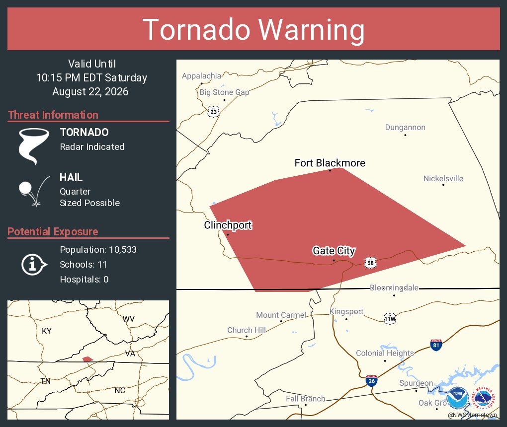
TORNADO WARNING for Scott County, VA! A severe thunderstorm capable of producing a tornado was located near Big Stone Gap, or 11 miles south of Norton, moving southeast at 20 mph.
TAKE COVER NOW!
Video: Bridge repair activities continue on James White Parkway in Knox County with tonight’s epoxy overlay. James White Parkway will remain closed to northbound traffic until 6am Monday. #myTDOT#WorkWithUs
Tornado Warning for Scott, VA until 10:15 PM 8/22/26. Tornado and quarter-size hail possible; radar indicated rotation. Gate City and Weber City are in the storm’s path. Take cover now in a basement or interior room.
A Tornado Possible Severe Thunderstorm Warning has been issued for Bledsoe County. This storm is showing signs of broad rotation south of Crossville and should be monitored closely as it moves toward the area.
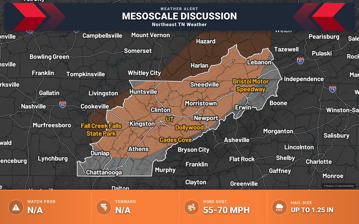
Mesoscale Discussion — Portions of eastern KY, far western VA, and eastern TN. Atmospheric setup may support locally damaging wind gusts and hail this evening east of Severe Thunderstorm Watch 616, though a downstream watch is not expected.
Isolated severe storms will continue to travel into our area ahead of an approaching cold front. However the threat will remain too isolated for a severe thunderstorm watch.
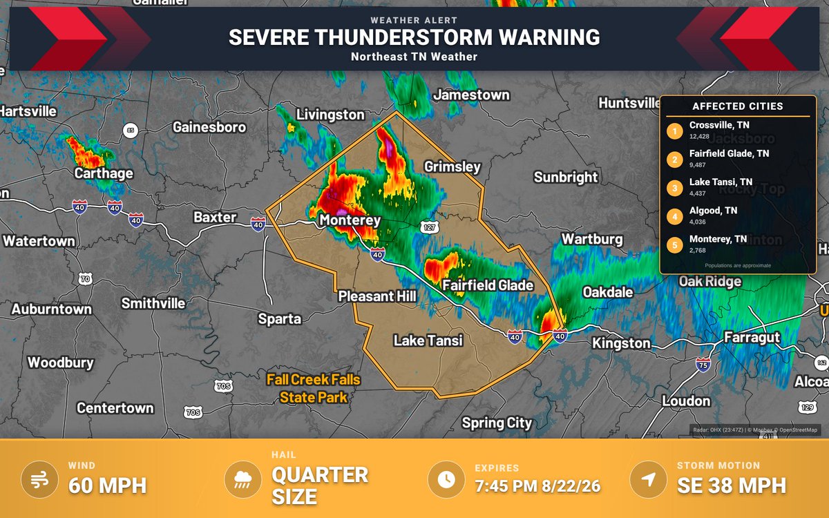
Severe Thunderstorm Warning for Cumberland, TN & Others until 7:45 PM CDT. 60 mph wind gusts and 1.0" hail. A storm was over Monterey moving SE at 40 mph. Move to an interior room on the lowest floor.
Severe Thunderstorm Warning for Wise, VA & Others until 9:00 PM EDT. 60 mph wind gusts and 0.75 in hail possible. Radar indicated a storm moving SE near Fishpond Lake. Move to an interior room on the lowest floor.
Severe Thunderstorm Warning for Cumberland, TN until 7:00 PM. 60 mph winds and 1.0 in hail are possible. A storm is moving SE near Fairfield Glade. Move to an interior room on the lowest floor.
Special Weather Statement for Russell and Washington Counties until 5:45 PM 8/22/26. Wind gusts 50-55 mph and penny-size hail possible. If outdoors, seek shelter inside a building.
Flood Advisory for Russell, VA until 8:30 PM 8/22/26. Flooding from excessive rainfall is expected. Minor flooding in low-lying/poor drainage areas; up to 1.5" rain. Turn around, don’t drown on flooded roads.