🌲🛰️ Congrats to GEOG Res Assoc Prof @AdPscual on receiving the 2026 @bsosumd Early Career Impact Award!
Read how his remote sensing & LiDAR research advances sustainable forest management + inspires the next generation of environmental scientists ⤵️
https://t.co/bRMRDikYx5
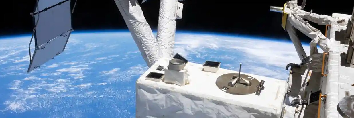
Cada etapa de Artemis II está guiada por decisiones clave.
En este video, Carlos García-Galán, recientemente nombrado ejecutivo del programa Base Lunar, explica la labor del equipo de gestión de la misión y el papel que desempeña en la trayectoria de @NASAArtemis II.
@GoogleDeepMind@googleearth any chance to inform on the weight each EO dataset has on a given band? I would love to isolate bands and remove the impact of bands heavily informed by optical data for burned area mapping and time-series consistency. Thank you!
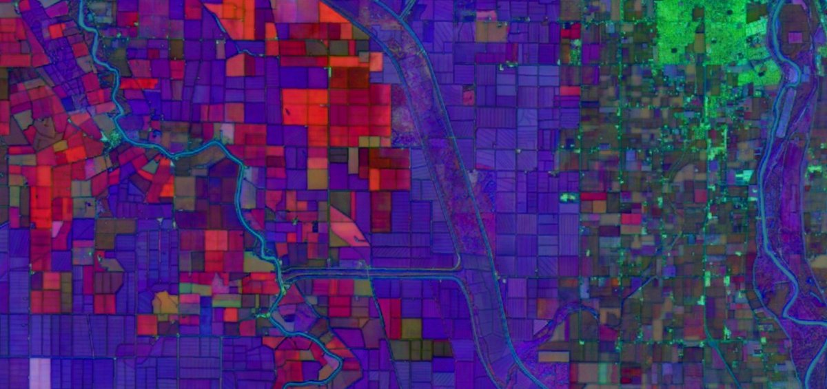
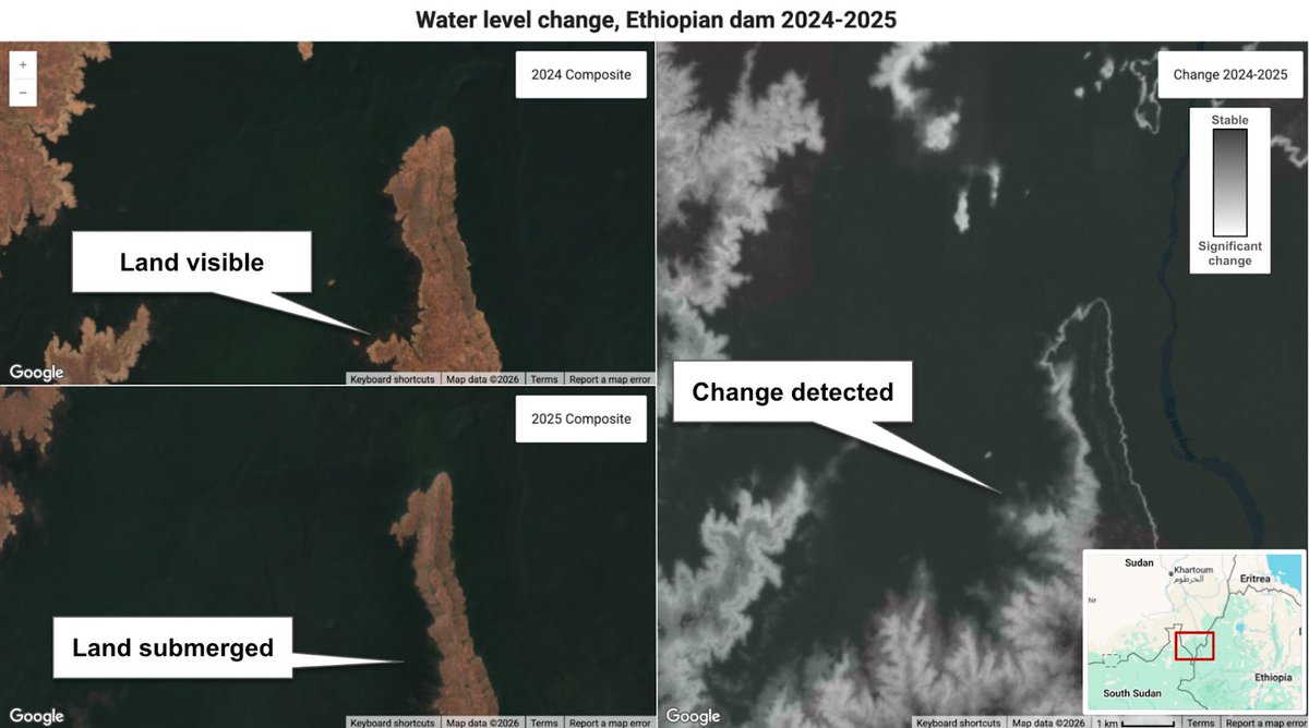
We are thrilled to announce that Google’s Satellite Embedding dataset, powered by @GoogleDeepMind's AlphaEarth Foundations model, has been updated for 2025. This additional year of coverage now unlocks the ability to look back, compare, and detect change across the planet with unprecedented clarity. Learn more here ➡️ https://t.co/yCHMhXCnq6
Part of Google's Earth AI, the new data represents the state of the planet throughout 2025, distilling petabytes of multi-sensor data into a 64-dimensional embedding for every 10 meter pixel.
What’s new in this update? 🧵👇
- 🌍 2025 Data: The state of the planet throughout 2025 is now available on the Earth Engine Data Catalog and Google Cloud Storage.
- 🔬 Unprecedented Change Detection: Because these embeddings capture subtle spectral, spatial and temporal signatures, they make it easy to spot significant year-over-year changes without the heavy lifting of raw image processing.
- 💚 Long-term Commitment: We are formalizing our commitment to the ongoing production of these annual layers to support your operational workflows.
Since we first launched the Satellite Embedding dataset, we’ve been inspired by how our community is putting this data to work. Applications are ranging from ecosystem mapping and agricultural crop-typing to carbon stock prediction. We can’t wait to see what you do next.
#EarthEngine #GeoAI #DeepMind
Stay tune for a follow-up paper on the latter. In any case, Alpha Earth is already a great product already despite its only a first version. It is flexible and enables mapping applications calibrated with GEDI metrics and reference data.
Quite satisfactory performance of Google DeepMind Alpha Earth to estimate and map forest biomass over ~ 100.000 ha of my home region in Spain. I trained using GEDI biomass estimates and inventory plots. https://t.co/2Nml5m4yYm
It would be terrific for the community if Google DeepMind let us know more details for each embedding - definition and what EO datasets have more weight on each band - so we can tune variable selections and address complexities such as mapping in the post-fire.
📢 TODAY! First session of the @NASAEarth#ARSET training on Spaceborne Lidar for Monitoring Vegetation Structure and Biomass using #GEDI
🛰️English session: 11am-1pm EDT
🛰️Spanish session: 2-4pm EDT
https://t.co/8aeFNRvqdA
Due to the increasing number of submissions and interest, we have extended our SpaceEcoLidar SI at Forest Ecology and Management. New deadline is 31 December 2025. https://t.co/V1A95yz3PP
Google AI model mines trillions of images to create maps of Earth ‘at any place and time’ https://t.co/iF4u7xqAJD
Not only optical, but with SAR and GEDI @GEDI_Knights