Bando di concorso per Dottorato di Ricerca in collaborazione con la Commissione Europea Global Human Settlement Layer: https://t.co/kERyveX7tA @EU_Commission
GHSL provides data covering functional urban areas across the entire world in the form of a 100 meter by 100 meter grid with population-density value https://t.co/KGfLI6yMDX
Our birthday is in 1⃣7⃣days! 🎂
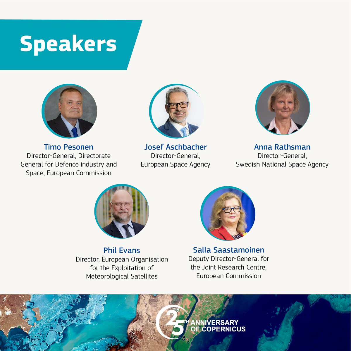
On 8 June, we'll be joined by
☑️@TimoPesonen1
☑️@AschbacherJosef
☑️Anna Rathsman
☑️Phil Evans, @eumetsat
☑️@SallaLoi
This panel will reflect on Copernicus' main achievements 🚀
Sign-up: https://t.co/5DeL2rpaLe
#Copernicus25
Inondations en Émilie-Romagne 🇮🇹 :
🛰️🇪🇺 les satellites européens @CopernicusEU mobilisés pour suivre l'évolution de la situation & soutenir les équipes de secours sur le terrain 👇
According to our #EDO’s Combined #Drought🚱 Indicator, in the third 10-day period of April 2023:
🟠2⃣1⃣.6⃣ % of the EU-27 territory was in Warning conditions (-1.4%)
🔴3⃣.2⃣% was in Alert conditions (+1%)
➡️The Iberian Peninsula continues to be the most affected area
We recently released a 🆕version of the Global Flood Monitoring #GFM tool output layer which estimates the population potentially impacted by #floods ❗️
It combines observed flooding with the latest #GHSL data depicting residential population density at 100 metres resolution💡
#DYK about the Global Human Settlement Layer❓
#GHSL provides highly accurate information on the presence of settlements & population based on:
➡️🛰️data
➡️Census data🧑🤝🧑
👇Example of our data showing 🧑🤝🧑 density in the #LaPalma, #Tenerife, and #GranCanaria islands, in #Spain🇪🇸
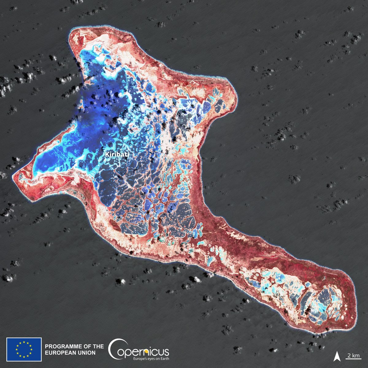
#Kiribati 🇰🇮 is an archipelago located in the Pacific Ocean
It could be the first country in danger of disappearing as a consequence of rising sea levels caused by #ClimateChange
⬇️#Copernicus#Sentinel2🇪🇺🛰️ image of the Kiritimati island (a.k.a. Christmas Island) from 23 March
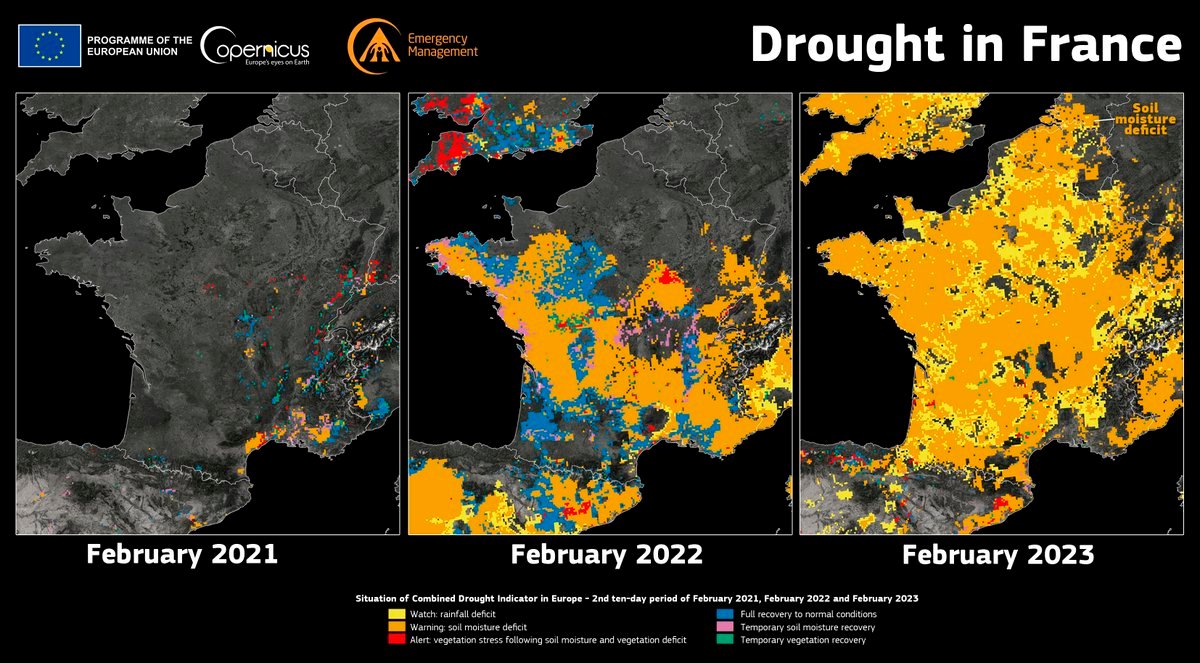
.@CopernicusEMS has recently realesed a 🆕Global Drought Observatory #GDO Analytical Report which analyses the current #drought 🚱status in #Europe
➡️#France 🇫🇷 is among the most affected countries
More at👇
https://t.co/i709ZC3MuT
#DYK?
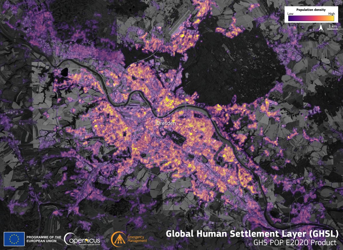
The @CopernicusEMS Global Human Settlement Layer is derived from #Sentinel1 🇪🇺🛰️ and #Sentinel2 🇪🇺🛰️data
It provides detailed information about human 🧍presence on #OurPlanet 🌍
More at 🔗https://t.co/F0UXNrU1DH
⬇️Dresden 🇩🇪
#EMSR654 Tropical #CycloneFreddy🌀 in #Mozambique🇲🇿
Our #RapidMappingTeam has delivered its updated Delineation Product for the #Mutarara AoI, detecting:
➡️+680 km² flooded (+120 km² in 24h)
➡️~54,000 people🧑🤝🧑 affected
All the maps are available at
🔗https://t.co/1WTivIo0Ox
#GISRUK2022 is around the corner and we have extended the 1500 word abstract submissions by a week to Jan 17! Please help spread the word! @geodatascience@livunigeog
https://t.co/Yv8Epdl8Hz
Happy to invite to our conference in @IUSSP together with @AleDemogr, about Internal migration impact on sex ratios: a case study using Colombian 2018 census data. On Migration Patterns Session. Wednesday Dec 8. Time: 8:00 - 9:30 GMT. @Fcorowe