Hello there! My name is Alex LaMotte, and I am a meteorologist and reporter with @nbc_montana!
Feel free to follow my other social media platforms for more weather content:
Instagram: @alexlamottewx
Facebook: Meteorologist Alex LaMotte
•
•
•
•
•
•
#weatherman#montana
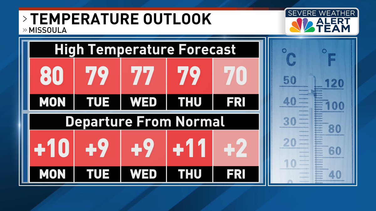
We can expect to see a string of warm and dry days as high pressure becomes the dominant feature over the region. Temperatures will be about 10 degrees above seasonal averages. Our next chance for moisture likely won't arrive until late week. ☀️
https://t.co/IcML3Zi2Mj
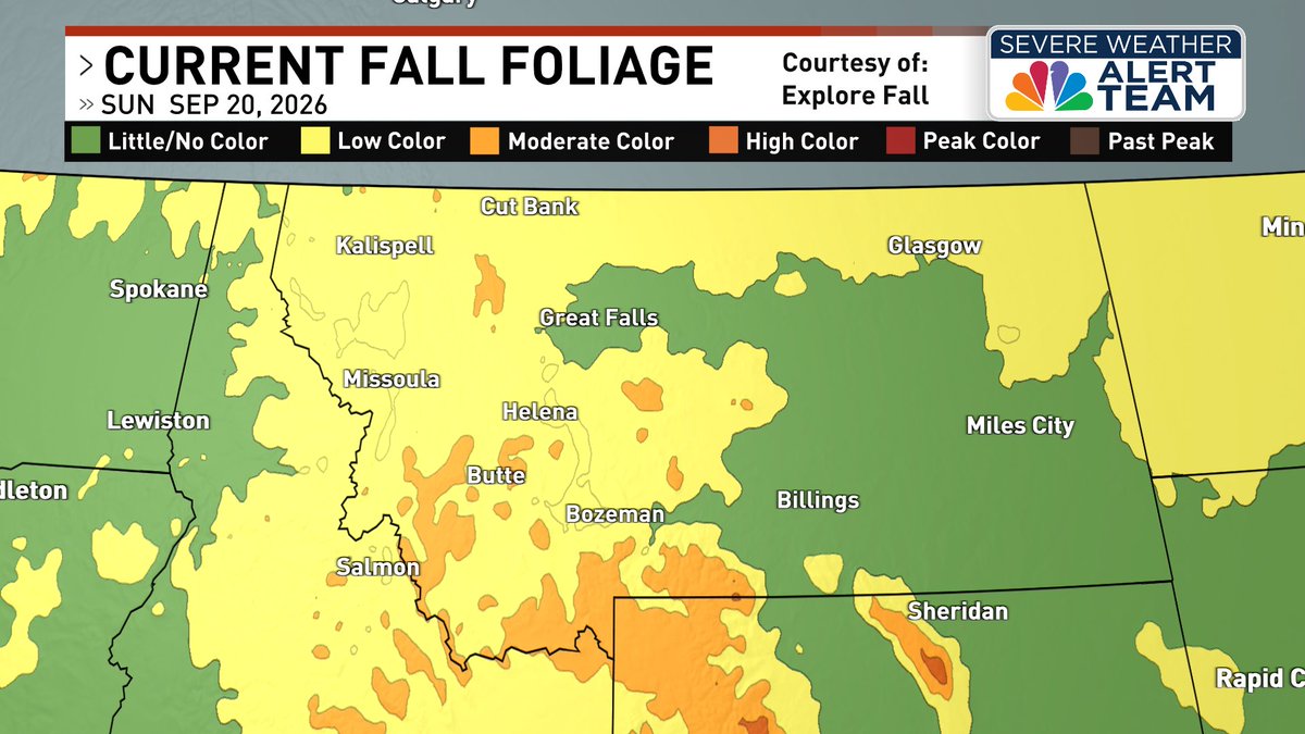
We're beginning to see moderate fall color across parts of southwest Montana, with most areas only starting to see color. More change is expected next week, where areas near Big Sky and the Absaroka Mountains may see their peak!
Submit your pictures here: www.nbcmontana/chimein
For those looking to attend the Missoula Renaissance Fair tomorrow, weather conditions should remain favorable! Daytime highs will be in the mid- to upper 70s with abundant sunshine. Just be sure to pack sunscreen! ☀️
https://t.co/gVKX9SeqvI
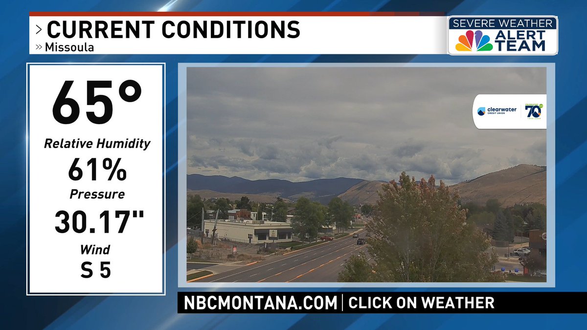
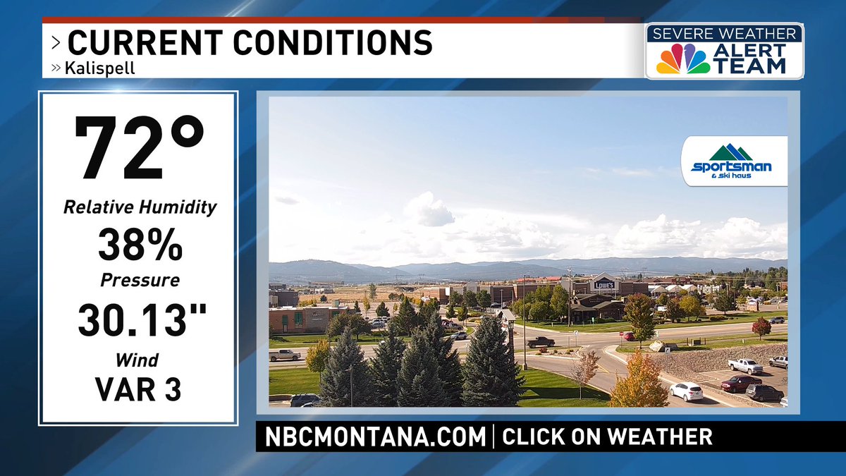
Conditions are a bit of a mixed bag this afternoon, with overcast skies and showers for southwest Montana and sunshine for northwest Montana. Precipitation will taper off this evening, with lows expected to fall into the 30s and 40s.
Current conditions: https://t.co/8WCZwXixDs
Overnight lows will drop into the 30s for many areas, with sub-freezing temperatures expected for higher valleys along the Divide and other cold-prone locations. Frost is anticipated, so protect sensitive vegetation. Tomorrow, conditions will moderate.
https://t.co/Ea5kdhrkIj
We can expect to see cloud cover throughout the evening, primarily for northwest and west-central Montana. More substantial clearing is expected for southwest Montana, where overnight lows will fall to the 20s and 30s. Frost is expected to develop.
https://t.co/Ea5kdhrkIj
Overcast skies are taking hold of the region this afternoon as low pressure moves its way east, with a few spotty showers moving through the Missoula area. Current temperatures are sitting in the 50s with breezy westerly winds at times.
https://t.co/Ea5kdhrkIj
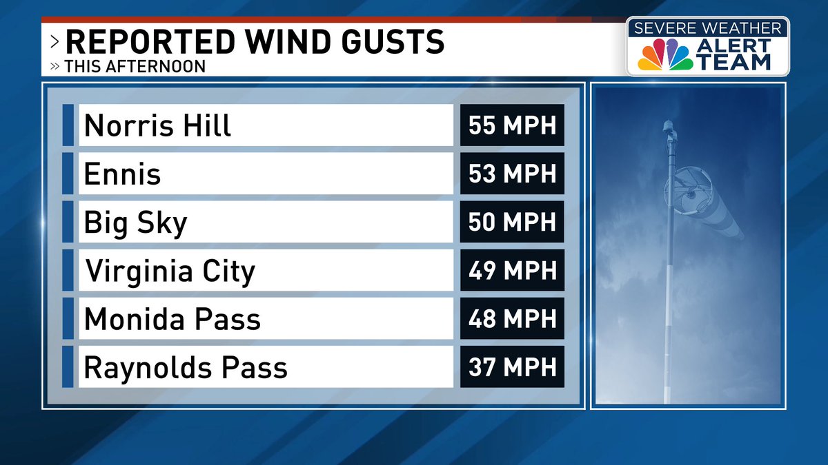
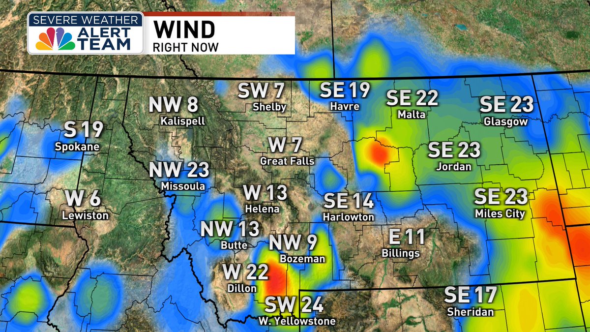
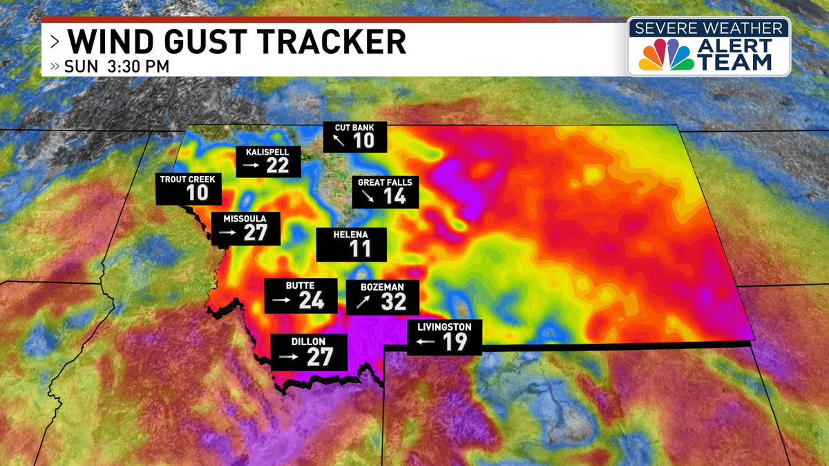
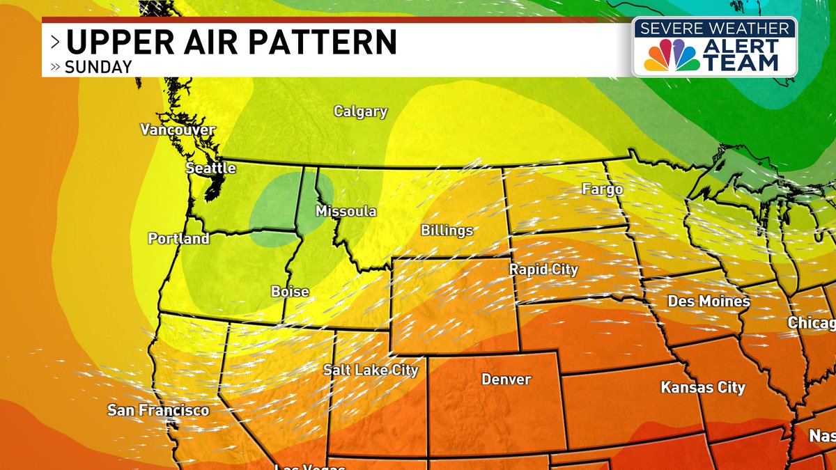
Portions of southwest Montana reported strong wind gusts throughout this afternoon and evening, with many areas seeing readings over 50 mph!
What did you record where you are? Let us know in the comments! 🍃
https://t.co/sa6uwor4s0
Strong winds are expected primarily for southwest Montana this evening, with a High Wind Warning in place for the Madison River Valley. 50-55 mph gusts have also been reported near Monida Pass. Those driving along I-15 should prepare for difficult travel.
https://t.co/sa6uwor4s0
A line of strong thunderstorms 13 miles north of Plains is moving northeast at 30 mph, producing 40 mph and pea size hail. If on or near Flathead Lake, get out of the water and move indoors or inside a vehicle. 🌧️
Current conditions: https://t.co/8WCZwXixDs
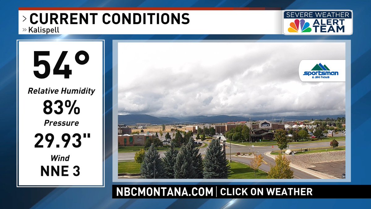
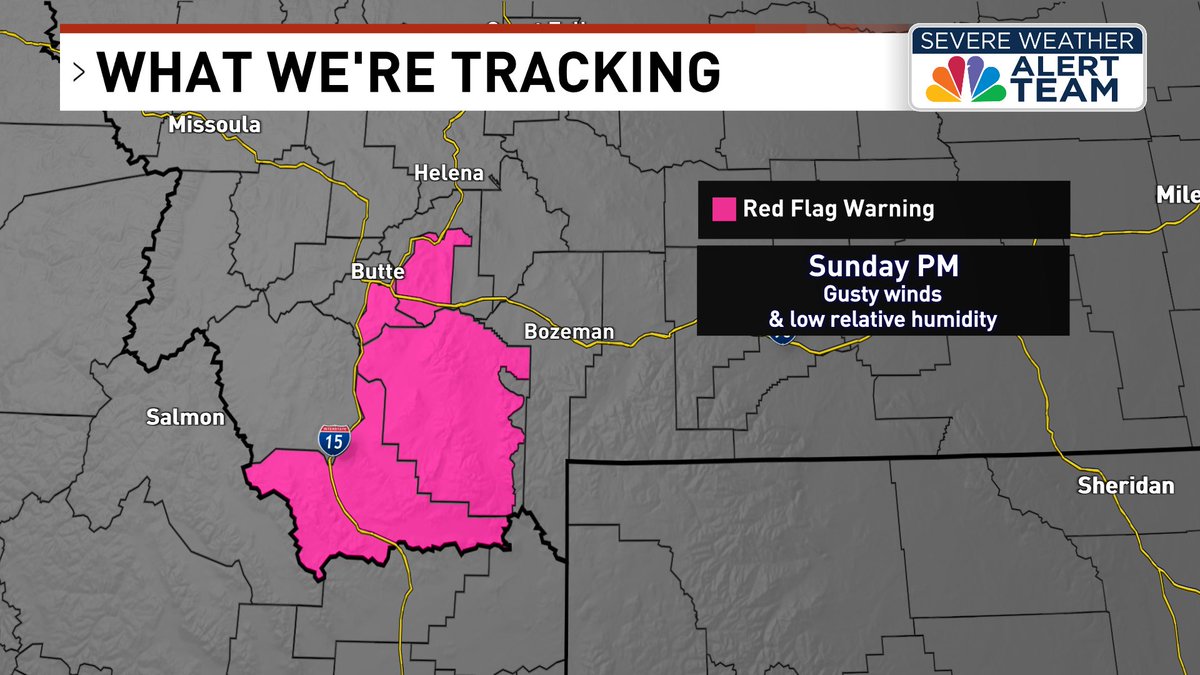
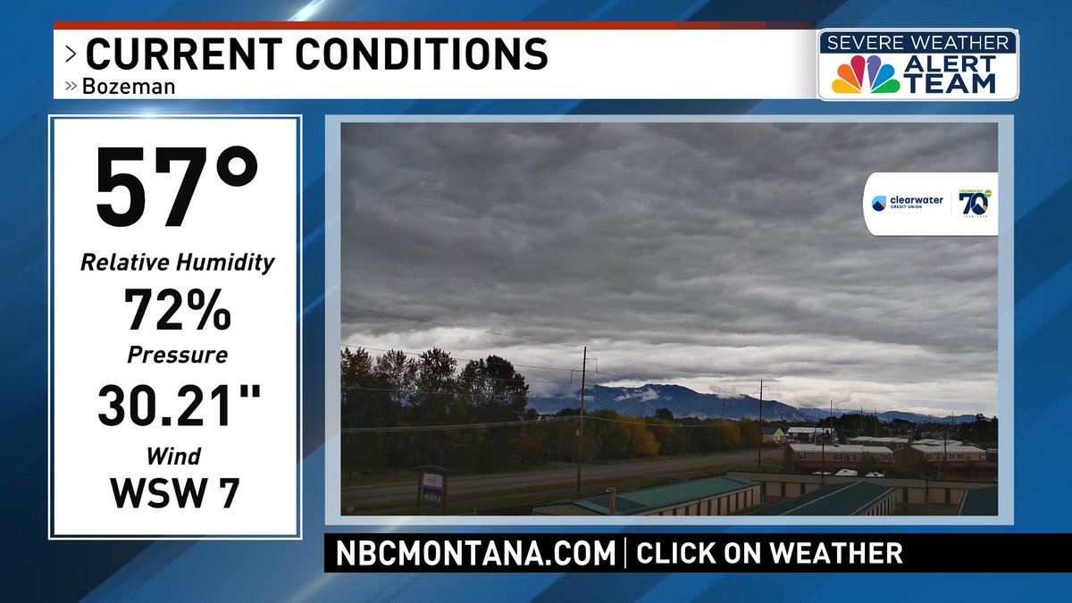
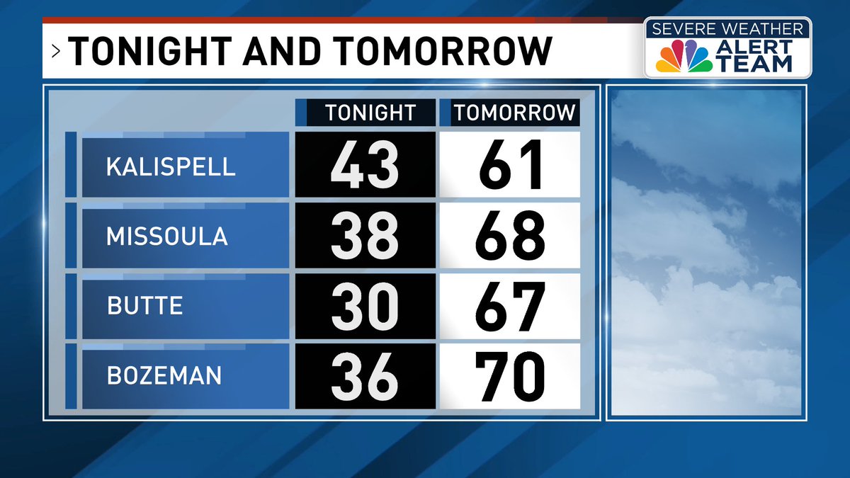
We're tracking a mix of conditions across the region this afternoon. Cooler and wetter weather will take hold of northwest Montana through tomorrow, while southwest Montana will see highs in the 70s with critical fire weather.
Current conditions: https://t.co/5dZjAknd8n
A Red Flag Warning will be in effect tomorrow from noon until 9 PM for portions of Beaverhead, Madison, Jefferson and Silver Bow Counties due to gusty winds and low relative humidity. Outdoor burning is not recommended.
https://t.co/dGKekv2Wp1
As low pressure moves into the region, temperatures will be cooler for northwest and west-central Montana, with showers likely throughout the day. Southwest Montana will remain drier, however breezy winds are expected leading to critical fire weather.
https://t.co/dGKekv2Wp1
Conditions remain quiet this afternoon, with temperatures sitting in the mid to upper 60s with mostly sunny skies. Low pressure moving toward the region tonight will bring strong winds of 30-45 mph, mainly along the mountain slopes of northwest Montana.
https://t.co/dGKekv2Wp1
Tonight we will overnight lows drop in the 40s. We'll see a brief break in moisture before midnight, before more showers pop up into the early morning hours. Storms will be capable of brief heavy rainfall, abundant lightning and even small hail.
https://t.co/6IwzYTMxEq
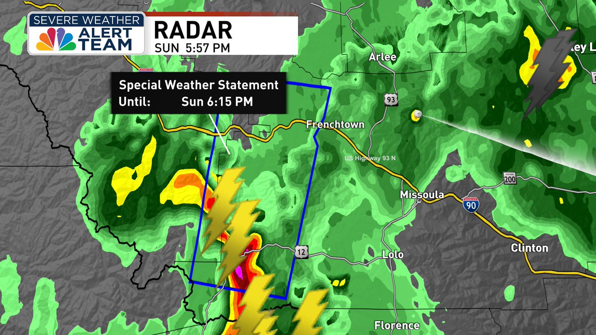
A strong thunderstorm 18 miles south of Alberton is producing nickel size hail, and will affect folks in Alberton, Frenchtown, Ninemile, Huson, Lolo Hot Springs & Stark. Minor damage to outdoor objects is possible, so monitor for updates with this storm.
https://t.co/6IwzYTMxEq
A line of strong thunderstorms will impact areas of Sanders County, including Noxon, Tuscor and Trout Creek. These storms have produced wind gusts up to 30 mph and penny size hail with brief but heavy rain. Minor damage to outdoor objects is possible.
https://t.co/6IwzYTMxEq
A strong thunderstorm is moving north near Libby at 20 mph, producing nickel size hail. Minor damage to outdoor objects is possible.
https://t.co/6IwzYTMxEq
Nickel size hail has been reported with a strong thunderstorm in Deer Lodge, Silver Bow, and Powell Counties. Folks in Anaconda, Warm Springs, Galen, Gregson Hot Springs, Opportunity, Crackerville and Racetrack should monitor for weather updates.
https://t.co/6IwzYTMxEq
A SEVERE THUNDERSTORM WARNING is now in effect until 5:30 PM for Avon, Elliston and Blossburg. Ping pong ball size hail has been reported, and people and animals outdoors will be injured. Expect damage to roofs, siding, windows, and vehicles.
https://t.co/6IwzYTMxEq