NWS Blacksburg, February 20: Snowfall accumulations: between 0.5 to 2 inches possible along/west of the Blue Ridge. Most of the snow expected Sunday/Monday. Wind gusts of 25 and 35 mph are expected with gusts of 40 to 50 mph possible along the ridgetops on Monday.
A winter storm is expected this weekend. Now is the time to prepare—secure supplies, plan for power outages, limited travel, and check on neighbors who may need assistance. Taking steps ahead of time helps keep you, your family, and first responders safe.
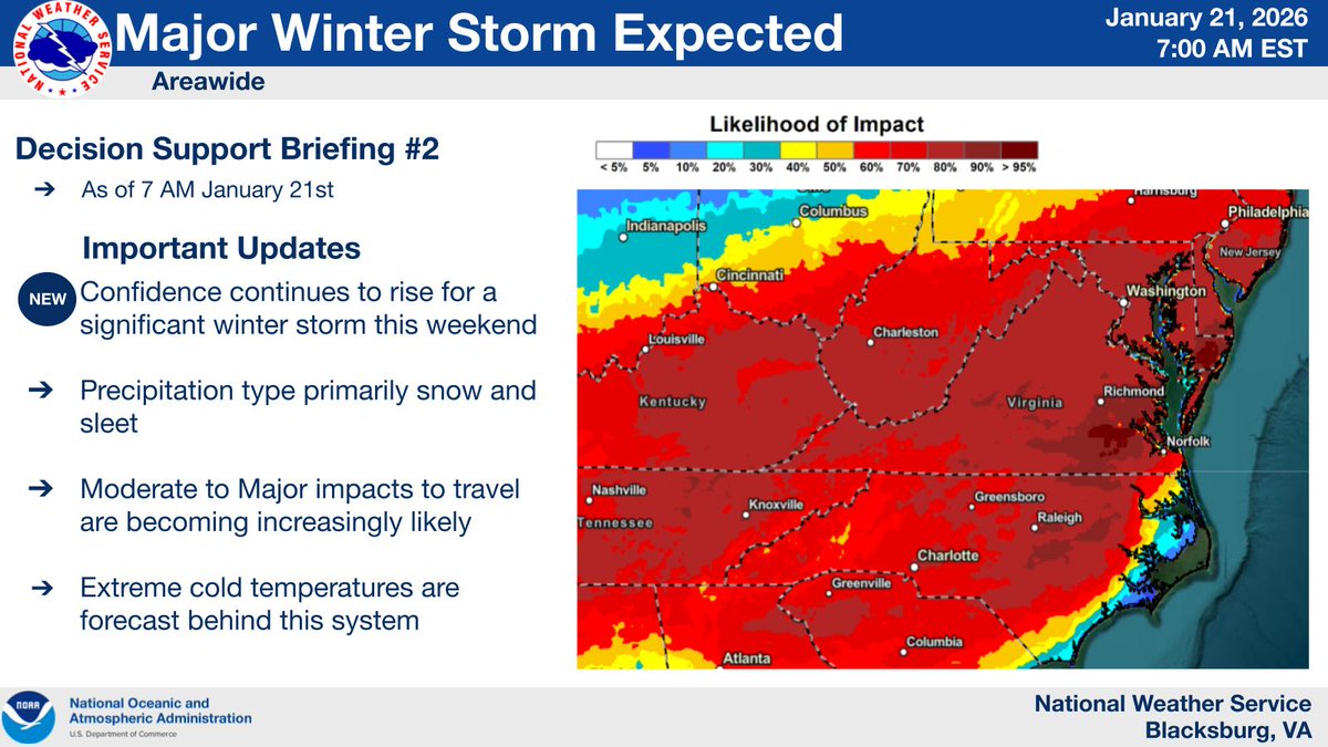
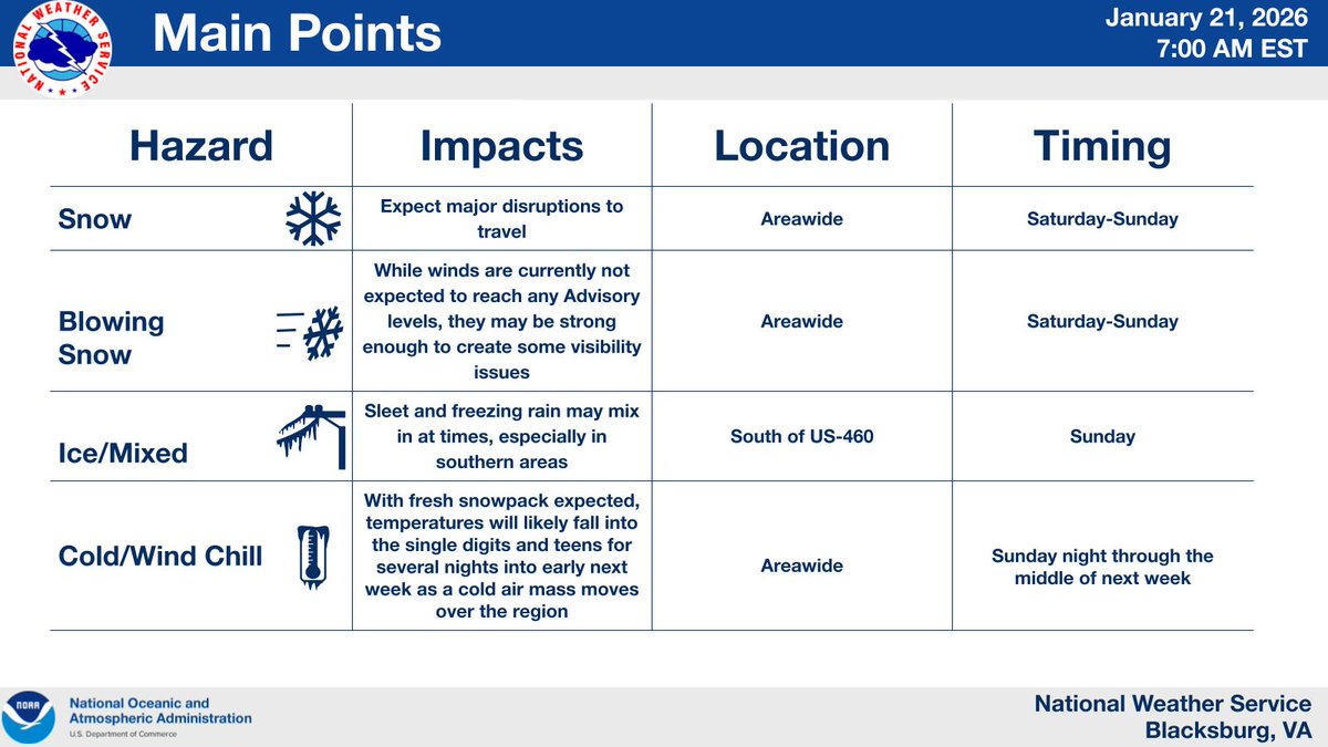
Major Winter Storm Potential Increasing Saturday through Sunday. Currently an 80-100% chance of greater than 5 inches of snowfall for the entire area leading to a high likelihood of impactful snowfall for the entire NWS Blacksburg forecast area
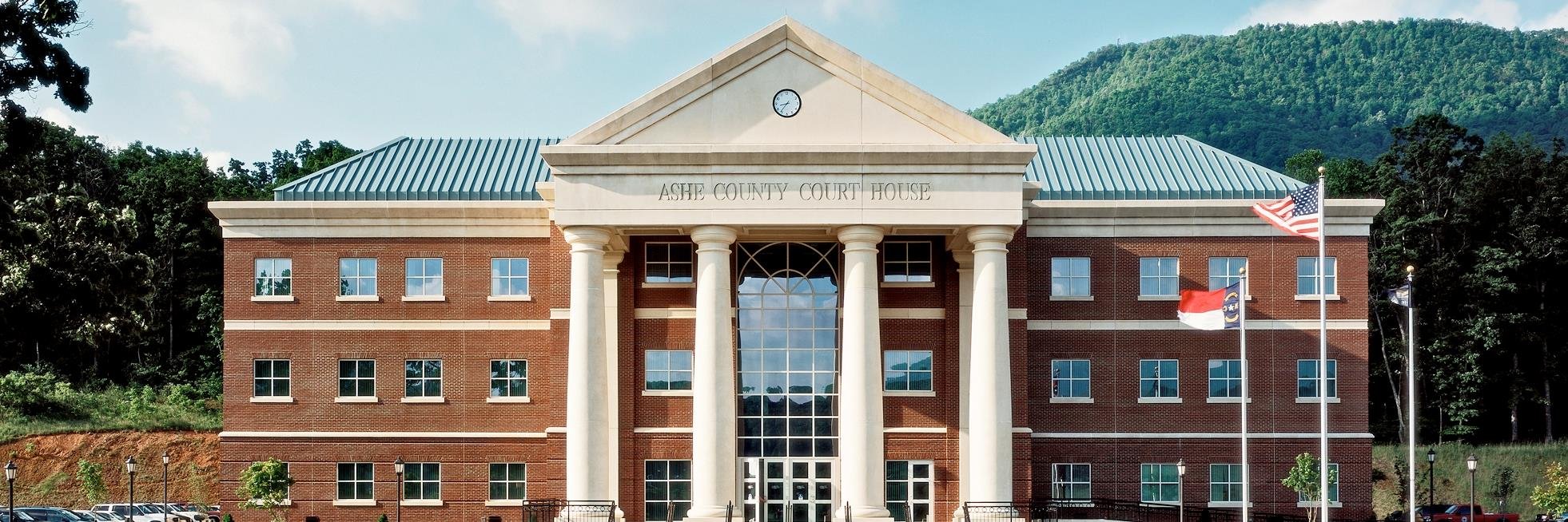
As Daylight Saving Time ends this Sunday, the Ashe County Emergency Management and Fire Marshal’s Office would like to remind everyone to change the batteries in your smoke detectors and carbon monoxide detectors.
Potential for periods of heavy rain on Wednesday10/29. Rounds of rainfall Wed./Wed. night, with some rain potentially heavy at times; Highest rainfall totals forecasted along the Blue Ridge, where locally 3+" may occur, though confidence is low as to where flooding may develop.
INCREASED FIRE DANGER TODAY FROM 11 AM UNTIL 7 PM...Outdoor burning is strongly discouraged. Dry and windy conditions with low relative humidities this afternoon across portions of NW NC combined with dry fuels (fallen leaves and dead brush), will result in increased fire threat.
Renew NC Launches Monthly Newsletter for Western NC Recovery Efforts. The newsletter drops on Oct. 15! Each edition will include links to online tools and resources.
📷 Be sure to sign up here: https://t.co/jOT79SyPO0.
📢 Stay informed, stay safe! Sign up today for Ashe County Emergency Alerts and get critical updates sent straight to your phone. Don’t wait until it’s too late—be ready before disaster strikes.
https://t.co/Fr9XUCXkRd
#BePrepared#EmergencyAlerts#CommunitySafety
We encourage everyone to download the American Red Cross Emergency App that provides National Weather Service alerts, live weather maps and more for the most up to date information during extreme weather events. Mobile Apps & Voice-Enabled Skills | Get American Red Cross Apps
NWS Blacksburg as of Tuesday, July 2, 2024: Marginal Risk for Severe Thunderstorms on Thursday in VA & WVA with damaging winds the primary threat. Heat index values 100 to 105 east of the Blue Ridge on Thursday with values potentially exceeding 105 degrees Friday.
NWS Blacksburg office as of Wed. June 5: · Showers & thunderstorms possible this afternoon. Some storms may be slow moving & may produce heavy downpours; Heavy rain may lead to localized flooding; A decrease in coverage of showers/storms late this evening.
NWS Blacksburg, June 4: · Afternoon showers & thunderstorms possible this afternoon. Storms may be slow moving & some will likely produce heavy downpours. Showers & storms should decrease this evening, but could linger into Wed. morning. More showers and storms Wed. afternoon.
NWS Blacksburg May 15, 2024: Excessive Rainfall: Along and west of the Blue Ridge & Severe Thunderstorms: Southern VA into NC this afternoon-evening.
Damaging winds, Large hail to quarter size, isolated flooding & Ponding of water on roadways, possible.
NWS Blacksburg, May 14, 2024: Excessive Rainfall today, and Severe Thunderstorms tomorrow.
Excessive Rainfall: Along and east of the Blue Ridge this afternoon and evening
Severe Thunderstorms: northwest NC, Southside VA tomorrow afternoon and evening.
NWS Blacksburg May 08, 2024: Severe Weather and Flooding over Entire Area late this evening into tonight, highest chance for impacts 6PM-10PM. Late Thursday afternoon: Damaging winds/ Isolated tornado possible west of the Blue Ridge/possible small stream flooding.
NWS Blacksburg office as of May 07, 2024: Flooding/severe weather each afternoon and evening through Thursday •Damaging winds/large hail; Scattered power outages possible; Isolated tornado possible west of Blue Ridge today and Wednesday; chance for small stream flash flooding.
From Tuesday, April 30 through Thursday, May 2, there will be intermittent traffic delays between 9 am - 2:30 pm daily at the river bridge on NC 194 North in Warrensville as the road is closed to allow crews to set bridge girders.
NWS Blacksburg office as of Thursday April 18, 2024 4:45 AM: Marginal Risk of Severe Thunderstorms in NW North Carolina Friday afternoon. The greatest hazard will be damaging wind and large hail; Possibility for thunderstorms exists primarily in the NC High Country and foothills.