Incoming!
A band of lake effect snow is building to the northwest, which will bring more heavy snow and potentially low visibility at times.
Like this morning's snow, I don't expect much accumulation on the roads--temps are too warm. #INwx#OHwx
TRACKING SUNDAY HEAVY RAIN:
Rain arrives Sunday afternoon, increasing in coverage and becoming heavy at times. Some spots could pick up as much as 3" of rain or more depending on where heavier bands set up. #INwx#OHwx
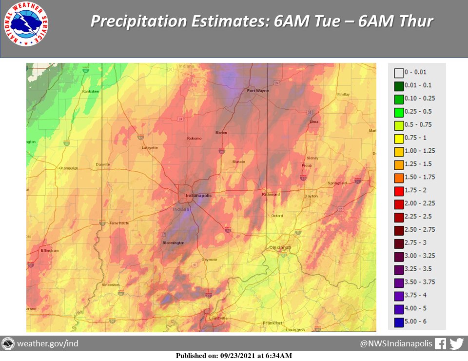
Heavy rain fell across Indiana over the last few days with amounts of over 5 inches in spots. A graphical estimate is below with exact reports in the link. Many thanks to our CoCoRaHS and COOP observers for their reports. #INwx
https://t.co/URDQgo1yex
https://t.co/Mqpmyrgqma
Whitko Families,
In order to allow Whitko staff members to remember and attend services for long-time transportation mechanic Kevin Shoemaker, Thursday September 23rd is an e-learning day for students.
@WhitkoCommunity
While Tuesday will be a dry day... storms are possible in the evening hours as they develop in Michigan and move SE.
Note the timing graphic below. Widespread severe weather doesn't look likely, but gusty winds and heavy rain are the main threats. #INwx#OHwx
@desautels_phd Great presentation and thank you so much for sharing with us today.
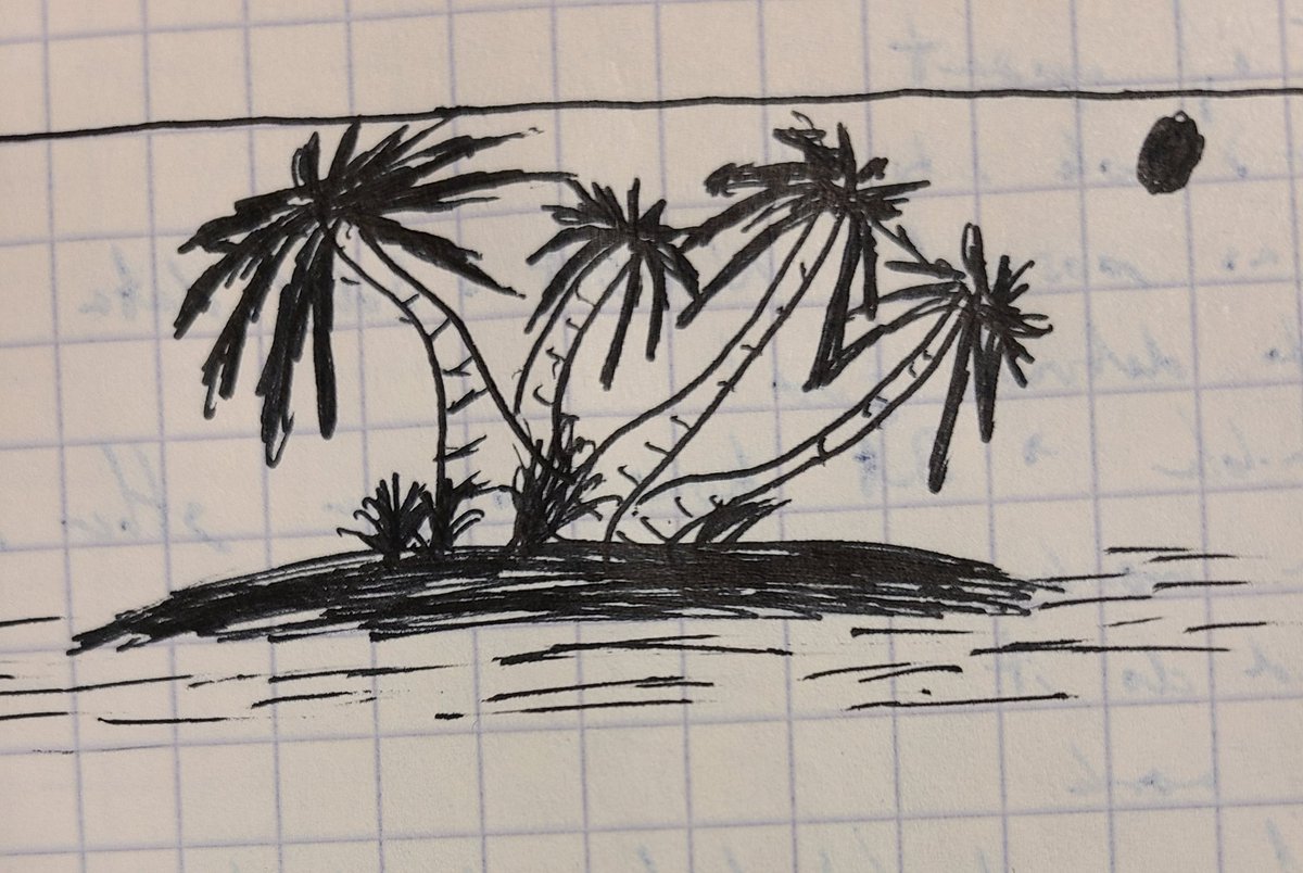
Not much of an artist, but I have been drawing palm trees in my notes since I was 18. My best imitation of Bob Ross.
@WhitkoCommunity@Whitko
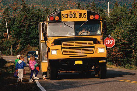
It’s Monday and another start to a week of school. Please remember to stop for the school buses and slow down in those school zones. The kiddos are depending on you!
@Cometcentral@BallState He was absolutely one of the most interesting and all around knowledgeable professors I had at Ball State while studying for my Masters. I'm sorry to see he passed away
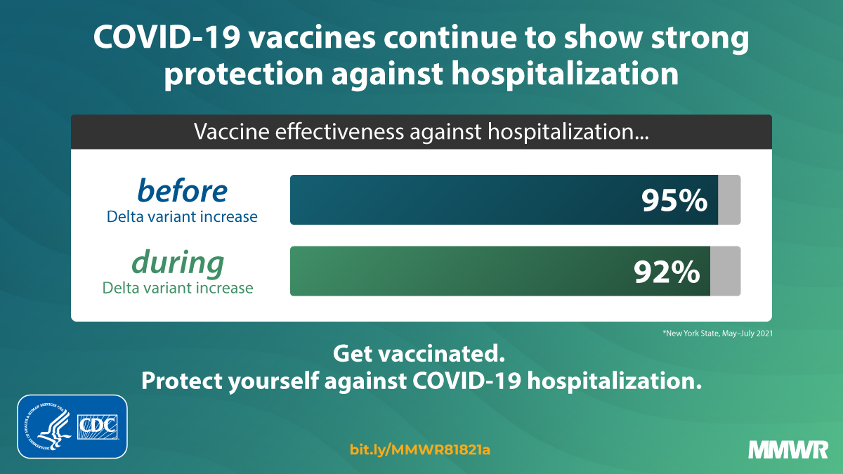
New CDC study shows that #COVID19 vaccines continue to strongly protect against hospitalization. Vaccine effectiveness against mild or moderate infections may wane over time. Get vaccinated to protect from severe disease. https://t.co/8QfEC7jl3h