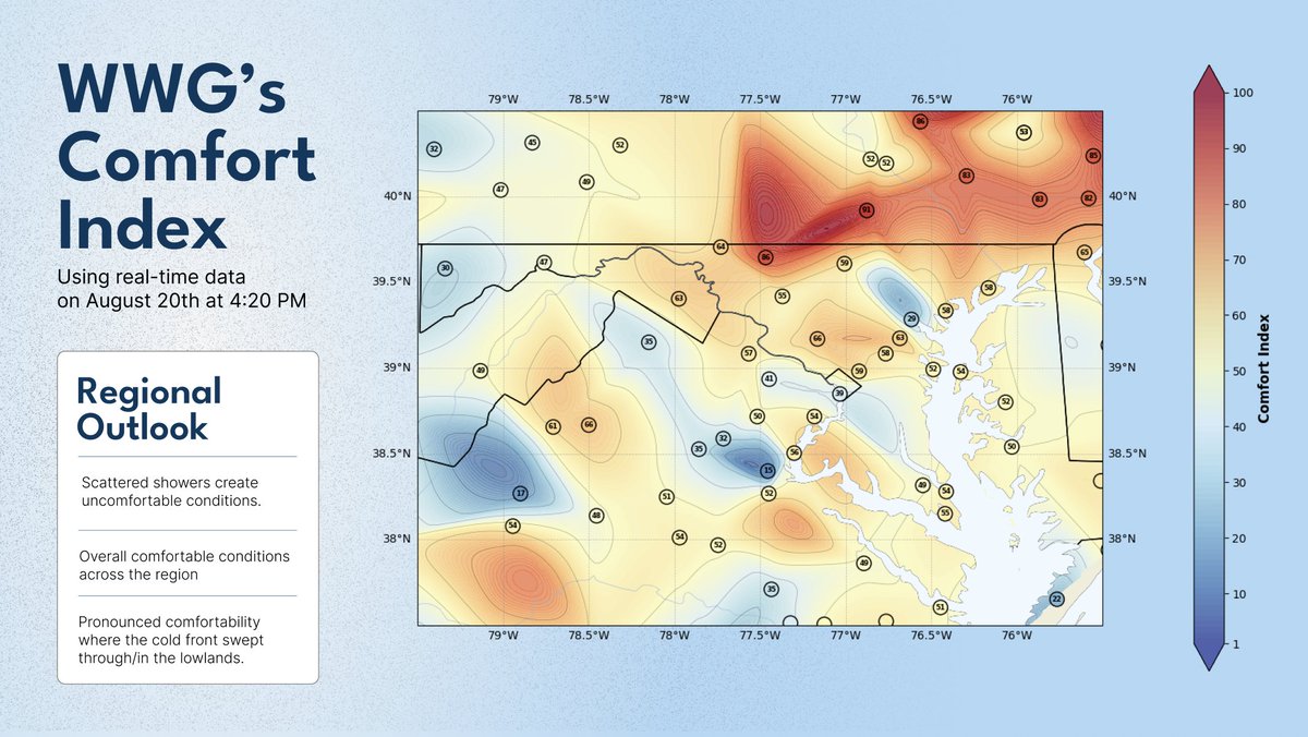
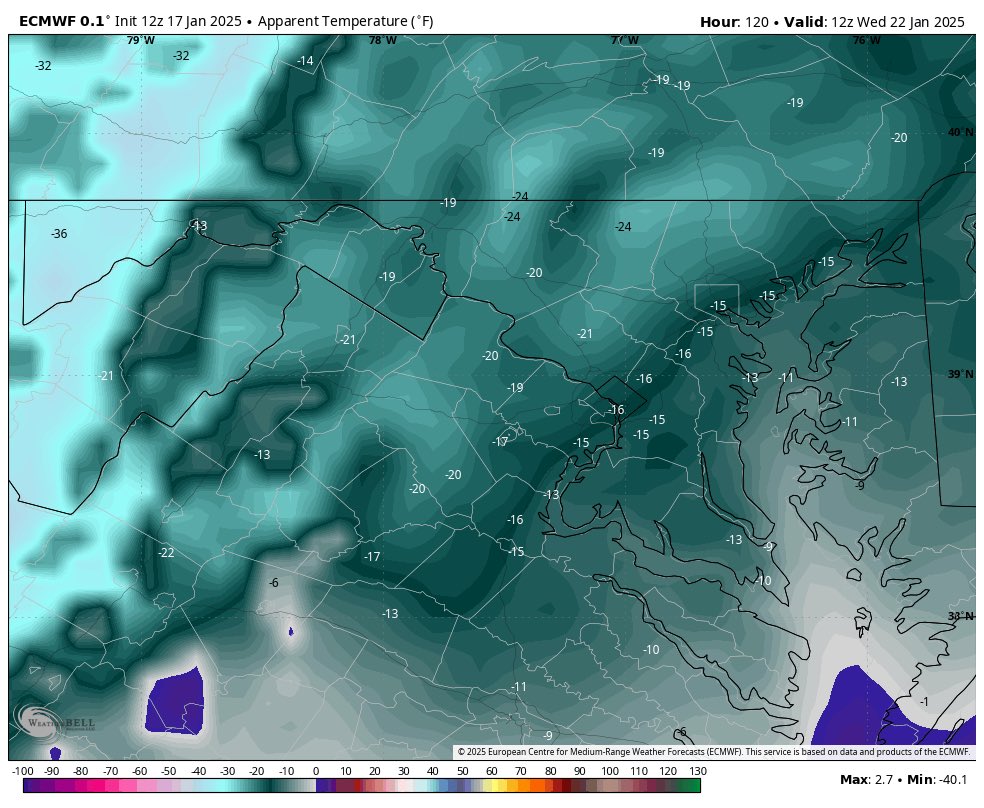
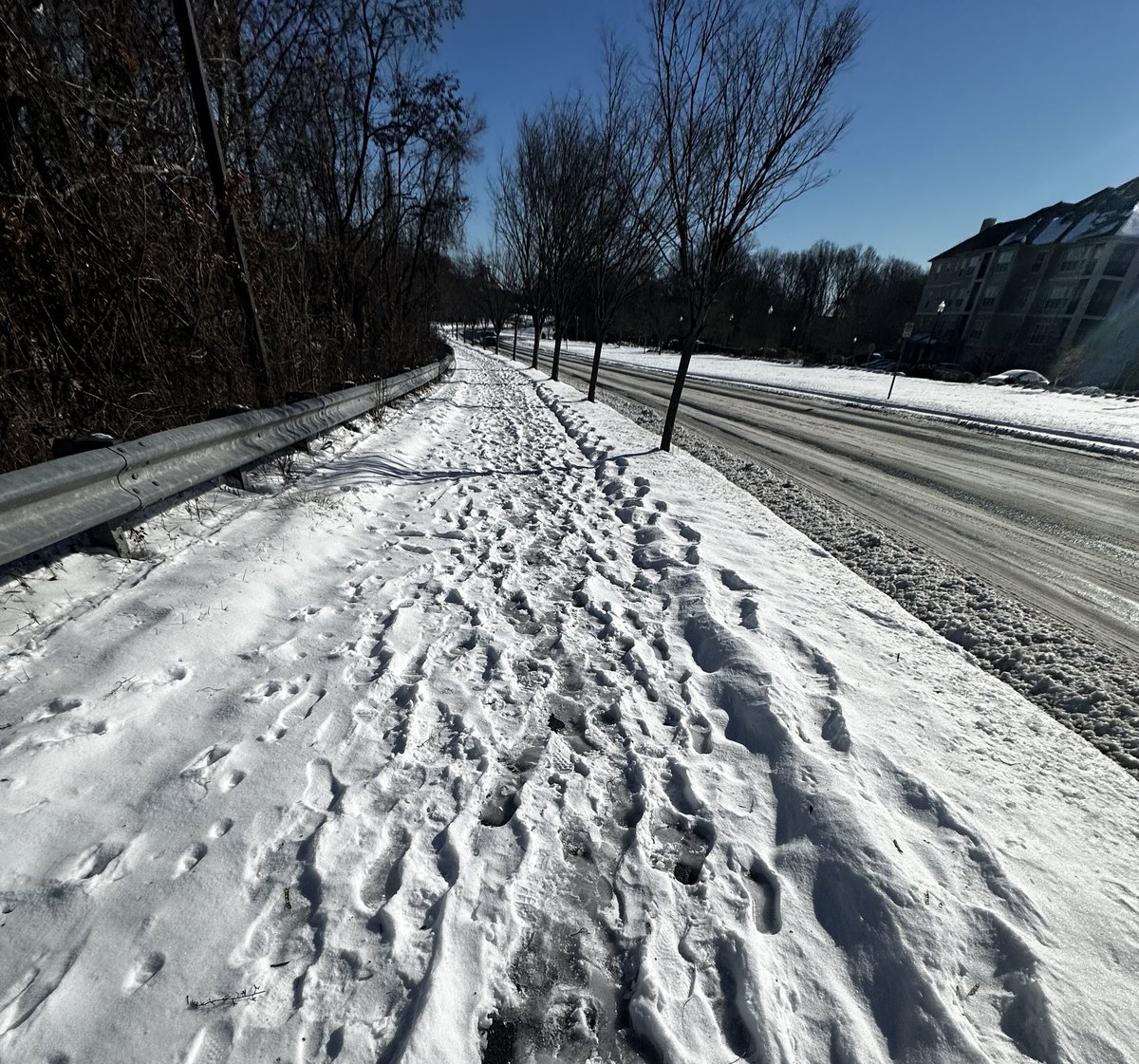
Though the weather is relatively quiet today, it's a pretty comfortable outside for most of the DMV! Though cloudy, today is a great day to go on a walk if it's not raining where you're at.
Editor's note: We're rolling out something new we made which is the plot you see below. If any of you have any questions about how it works, we'd be more than happy to explain!
Looking back at what went wrong with the storm, it seems like it was a combination of more "confluence" (a storm suppressor) pressing in more and squashing the height fields along with subtle changes both upstream & downstream causing more separation between our pieces.
Stayed up late hoping for some hope from the new 0z European…I got none. Upper low weaker. Storm allowed even farther east. Totals continue to fall…(1/2)
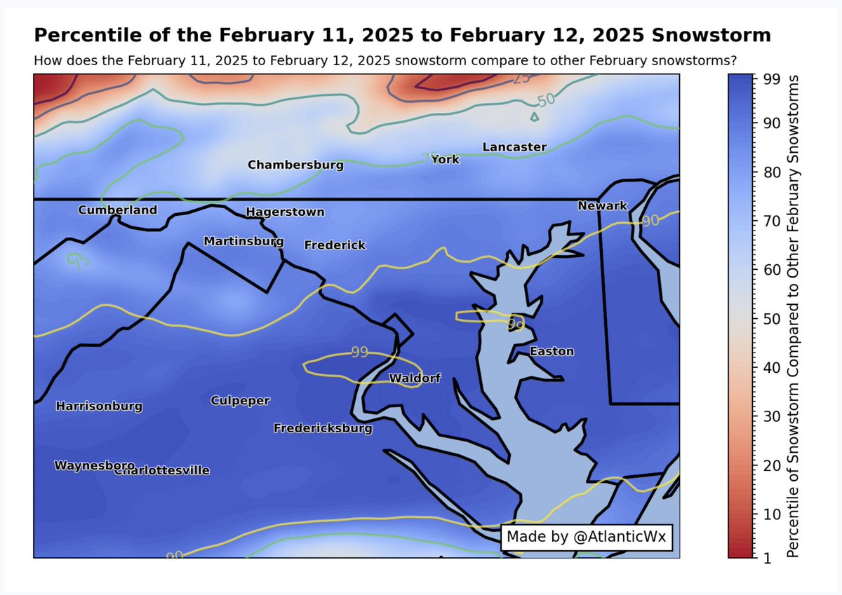
Looking back at this winter, it's nice to see that we've gotten not one but two 90th+ percentile snowstorms for the immediate DMV area—one on January 6th, and one on February 11th—a change from past winters with a possible third 90th+ percentile storm on our heels. ❄️☃️
@seckhardt@jake_wx You don't even follow me I don't know why you keep responding to my posts just to be wrong 💀 the mean is going to get skewed with higher totals and that's why it's better to just look at the median + IQR at this range to see the range of possibilities
With our upcoming threat, I would STRONGLY caution against relying on means on ensembles for the time being. Lots of potential with this one — which means big members can skew the ensembles. Ensembles will be helpful for determining the progression of the phase for now.
@MikeTFox5 Definitely one of the better setups we've had synoptically in the past few years right? I know we don't do phasing in TPV lobes well but just seeing that insane negative tilt for the phasing trough on guidance is somewhat encouraging
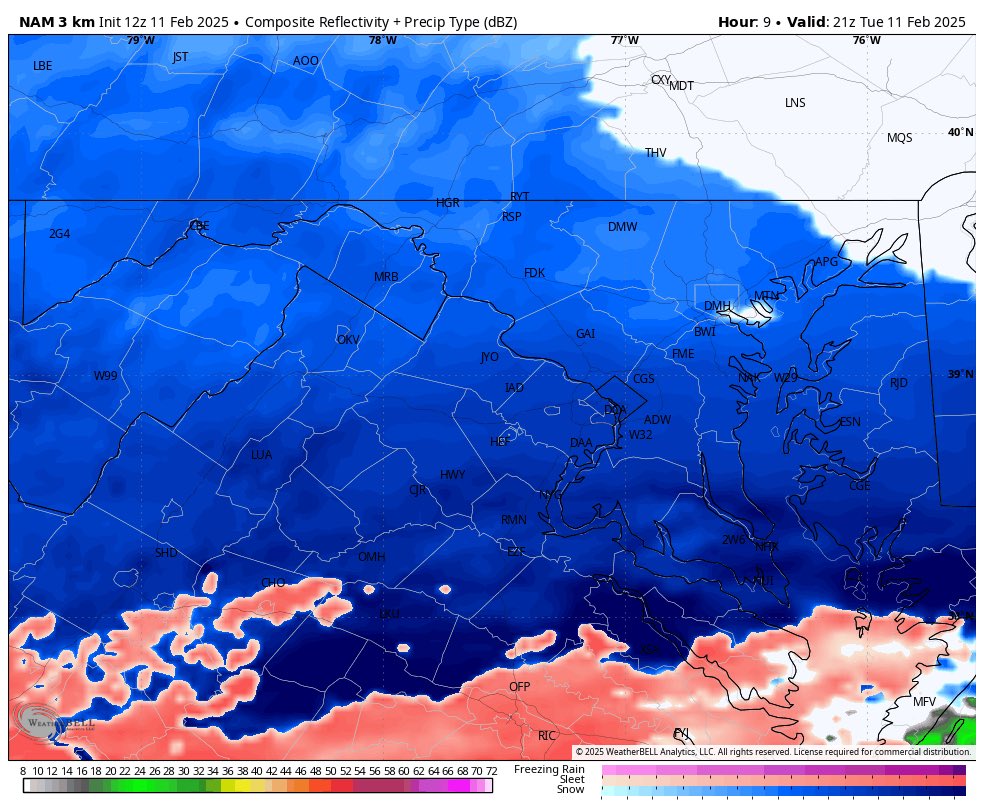
So disappointed in @MCPS's decision to presumably stay open after no announcement. As a student myself who drives home, being sent home in these conditions is unacceptable especially since there are so many students who drive back too. Temperatures are at 30° on this frame.
@seckhardt A lot of the student drivers here have little to no experience with the snow and by the time the heavy snow picks up at 4 PM, buses are actively driving home with air/ground temps <32°. You'll be fine is crazy, we're not the North 😭
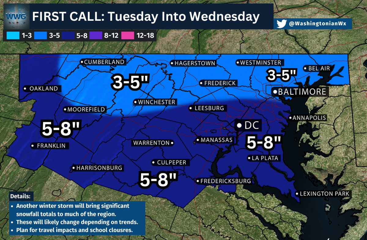
@_MikeVA@WashingtonianWx Hi, someone from WWG here — we're erring on the north compared to other meteorologists due to the setup itself. Though, I would expect 5-6", the 8" upside is for the boom potential/isolated totals the further south you go.
FIRST CALL: Here are our thoughts on the upcoming winter storm. We think the heaviest snow will fall in and around the DC Metro and to the southeast, with 3-5” expected up north.
Any preparations need to be completed today and tomorrow. This will be a long-duration snow event. School closures and significant travel impacts are likely.
This forecast is expected to change as the models continue to improve confidence in the track of this system. #vawx #mdwx #dcwx #wvwx
@TropicalSaiel Your point makes sense but DC saw sleet. While we didn't sleet for very long, NAM was the only model who was right with the warm nose since it had the sleet line climbing all the way to DC 😭
However, be prepared for this event because ground temperatures will be frigid, meaning that any snow that falls will stick immediately and wreak havoc on anyone caught offguard. Additionally, there's time left for this event to trend into a larger one, so be on the lookout!
What's next for snow? ❄️☃️
A light event will pass by our region on Saturday morning. It should be a quick hitter with the majority of the region seeing C-2" with those further north near the M/D line and south near Fredericksburg seeing 1-3". (1/x)