Midwest Storm Chaser | Based in Northwest Ohio
Severe weather forecaster, photographer, and videographer covering the Midwest and Great Lakes. Specializing in s
September 14th, 2026
⛈️ Severe Weather Possible Tuesday
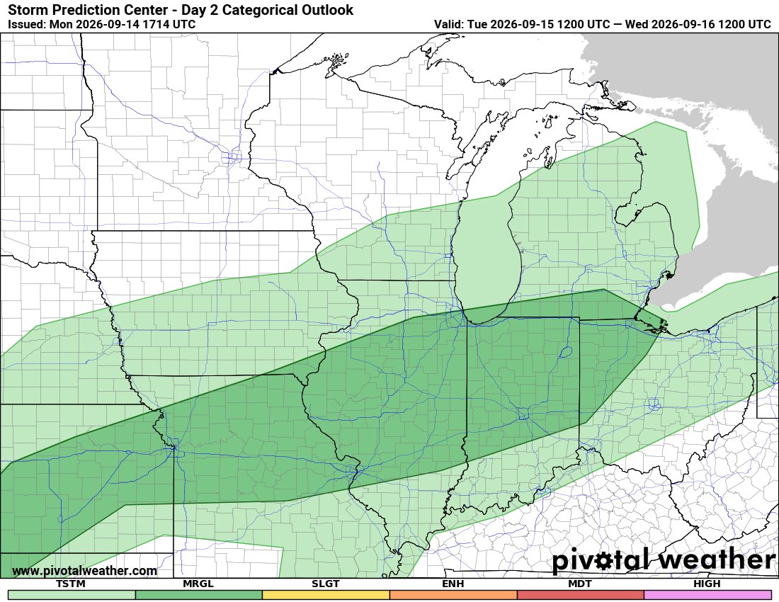
We have another chance for thunderstorms tomorrow as a cold front moves through the region.
The Storm Prediction Center has a Marginal Risk, Level 1 out of 5, stretching from Kansas into western Ohio.
We could have some storms around earlier in the day, but additional development will be possible during the afternoon and evening as things heat up ahead of the front.
💨 Isolated damaging wind gusts will be the main severe weather concern.
Right now, this doesn't look like a particularly significant severe weather setup, but it's something I'll be keeping an eye on as we get closer to tomorrow.
Northern Lights update:
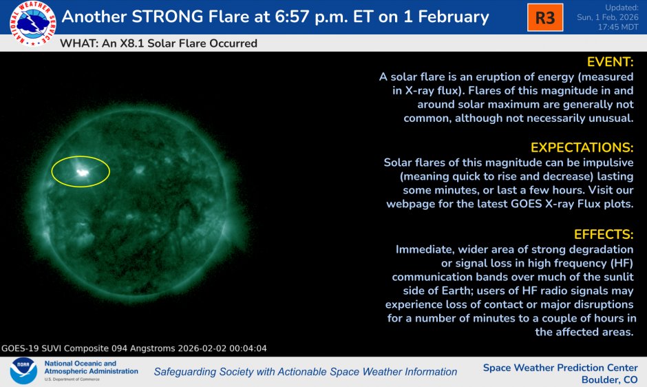
The X8.1 flare didn’t produce a full halo CME, so this won’t be a full-on hit. Looking more like a glancing blow maybe enough for a G1.
Higher latitudes could still see something, but nothing spectacular.
#NorthernLights#Aurora#SpaceWeather#Space
Heads up!
An X8.1 solar flare erupted late Sunday (Feb 1). This is a major event and could impact Earth.
Northern Lights may be visible in the next few nights possibly a strong show.
More updates soon.
#northernlights#arouraborealis#aroura#stargazing#space#spaceweather
🎃 Wishing Everyone a Very Happy Halloween! 🎃
Hope your night is filled with plenty of frights and scares — and of course, lots of candy! 🍬👻
Stay safe out there tonight and have a spooktacular evening! 🕸️🦇
#HappyHalloween#SpookySeason#TrickOrTreat#StaySafe
⚡ Game Update ⚡
The Eagles vs. Cowboys game has been suspended due to lightning! ⛈️
Right now we’re looking at about a 30–45 minute delay.
This game was just heating up hopefully we get back underway soon! 🏈🔥
#NFL#Eagles#Cowboys#NFLGameDay#LightningDelay#FootballFans
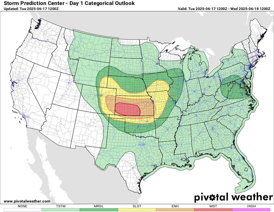
🌪️ Severe Weather – Tue, June 17
🚨 Moderate Risk: W/C KS, E CO, N OK, W MO
💨 70–100+ mph winds
💥 Large hail
🌪️ Tornadoes possible
💥 MCS likely this evening.
🔗 https://t.co/rddpgL9WcR
#SevereWeather#SPC#KSwx#OKwx#COwx#MOWx
⛈️ Severe Weather – Sat, June 14
🟡 Slight Risk: E WY, W SD/NE, NE CO
💥 2"+ hail | 💨 Strong winds | 🌪️ Few supercells
Also watching: OK, AR, VA, MD, IA, W TX, SE NM
Stay alert: https://t.co/rddpgL9WcR
#SPC#SevereWeather#HighPlains#OKwx#TXwx#VAwx#MDwx#WYWx#NEwx