We're BoulderCAST, a team of Front Range meteorologists. Providing timely, accurate weather intelligence to the local community and our clients since 2014.
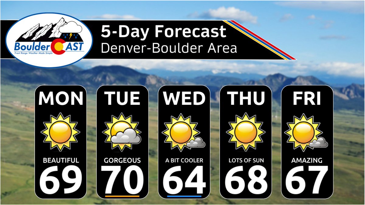
For the second time this week, Boulder Airport has hit 70° (also on Monday). Cooler temperatures due to extensive cloud cover are expected Friday, followed by even chillier autumn vibes this weekend! 📉 #COwx#Boulderwx
❄️❓ WHAT THE SNOW?
We've gotten numerous questions about a supposed "snowstorm" in the Denver area 8 days from now. Usually dont address this non-sense, but it's more than the usual...so here's a snippet from the end of our Front Range extended weather discussion this morning...be smart people!
~~~
"Looking beyond the weekend, the overall pattern remains encouraging for storm watchers. An active southern storm track is expected to persist across the Southwest through next week, with one disturbance arriving onshore Monday and another following around Wednesday. The first system currently appears likely to pass south of Colorado, bringing another round of mountain snow but little else locally. The second wave, projected to approach around November 20th, bears watching a bit more closely. Confidence is low at this range, but some guidance suggests it could finally bring a chance for lower-elevation snow along the Front Range.
We’ll emphasize the word chance for now. After this autumn’s string of southern-track near misses, we’ve learned that getting excited too early rarely pays off. Still, at least the pattern is beginning to look more interesting. Happy almost weekend! " #COWx #Colorado #denver #weather
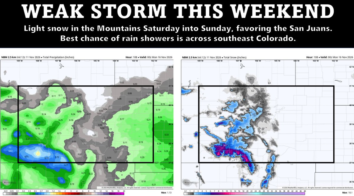
After weeks of sunshine and storms missing Colorado, the pattern is finally starting to wake up. This weekend brings cooler weather and a few shower chances, while next week could offer our first truly interesting storm track for northern Colorado. Snow hype season? Not quite... but we're watching. 👀
More in our *Premium* outlook that just went live: https://t.co/gSEUT21rbi #COwx #colorado #Denver #weather #ElNino
@PeterOhser More active here means generally cooler and minimal to no chance of 7-10 consecutive warm and dry days. It doesn't guarantee any shoveling.
Denver's stretch of beautiful November weather isn't over quite yet, but changes are brewing 🍻
In today's *Premium* forecast update, we discuss why this weekend's mountain snow is a warning flare for a much busier pattern ahead: https://t.co/q6RQWBUxqg #COwx#Denver#weather
Even after the record-breaking rainstorm last month, Boulder’s 2026 precipitation sits at just 58% of normal, more than an 8 inch deficit. And the rest of the Front Range isn’t doing much better.
More at https://t.co/Su14Tn9tPh #COWX#Denver#weather#Drought#Boulder#colorado
This Week in Colorado Weather 🌞🏖️🏜️😢
Omega Block Keeps Us High and Dry, but Change May Be Brewing Next Week
Still waiting on that first flake? You’re not alone. We’re nearly halfway through November, and Boulder hasn’t measured a single flake of snow yet. By now we’d normally have about 11 inches. This week won’t fix that: https://t.co/C35bxfleG5 #COwx #Colorado #denver #weather #elnino #Drought
Super El Niño November Update: A Historic Peak Is Coming. What Do the Latest Models Say for Colorado’s Winter?
The official BoulderCAST winter outlook brings encouraging news for some parts of the state, especially along the Front Range and eastern plains. But for skiers hoping for a blockbuster season in the nearby mountains, the outlook is more complicated and more worrying: https://t.co/xlmEPKxh3P #COwx #colorado #ElNiño #Denver #weather #COsnow
✅ Weekly outlook forecast verification for November 2-6, 2026. Forecast issued 8AM Nov 2nd. Boulder official climate site (when possible) used for verification.
🌡️ Easy peasy temperatures
☔️ Showery Monday verified
📔 Near normal temps
#COWX#Boulder#BoulderCASTVerification
A Personal Goodbye to the American NAM Model, Retired After 20 Years 🪦❄️
While technology marches forward and better models take its place, it’s impossible not to reflect on the role this one played, not just in forecasting, but in shaping the career of countless meteorologists, myself included: https://t.co/v7EhrcLT4m #weather #RIPNAM #COwx #colorado #WeatherWisdom
UPDATE: Wed November 4th 4:30PM ❄️
The petite but impressive upper low is entering western Colorado now. It will race across the southern part of the state tonight brining widespread snow to the Mountains and high valleys along and south of I-70. There is thundersnow ongoing. Dicey travel expected with up to a foot of snow falling quickly in parts of the Sawatch, Tenmile and Mosquito Ranges #COWX #colorado #Cosnow