A severe thunderstorm approaches Goodland, KS ~9:00-9:45 pm MDT on Monday June 08, 2026. View toward the west. Video ends when the hail begins. #kswx#cowx#newx
Panning up and around, trying to get a more comprehensive view of the supercell west of Goodland, KS at 4:10 pm MDT on Monday June 01, 2026. #kswx#cowx#newx
Supercell time lapse — a few miles west of Goodland, KS around 4:25-4:50 pm MDT on Monday June 01, 2026. View toward the W-WNW. Severe inflow. Awesome. #kswx#cowx#newx
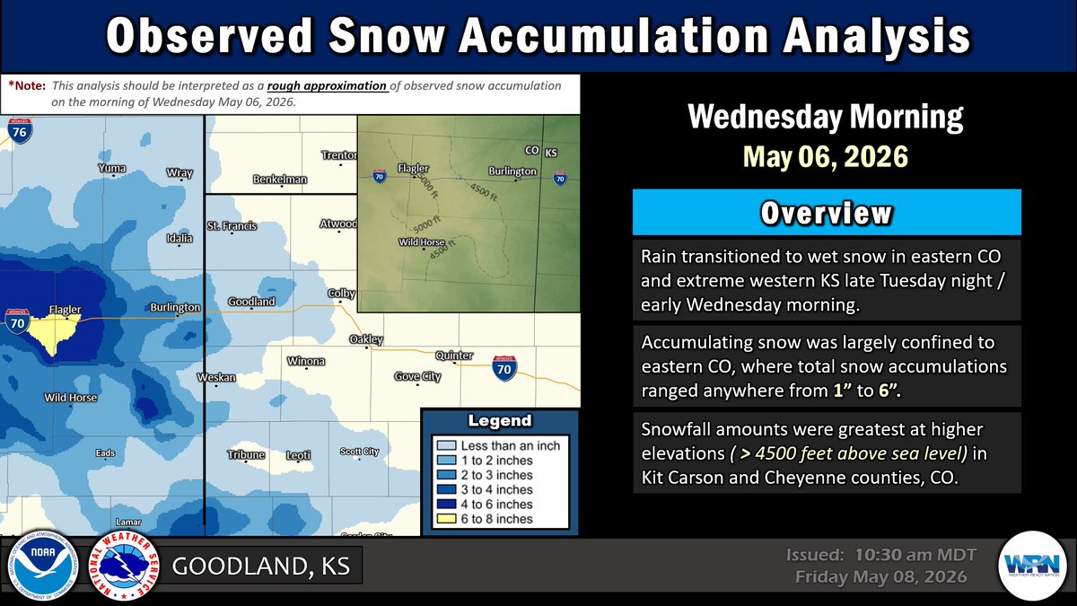
Observed Snow Accumulation on Wednesday May 06, 2026
Rain transitioned to wet snow in eastern CO and extreme western KS during the early morning on Wed May 06. Accumulating snow was largely confined to higher elevations in eastern CO. #cowx#kswx#newx
Extensive high-based showers in eastern CO (virga, not a drop of rain) produce severe outflow (60 mph winds) — kicking up plumes of dust that coalesce into a downstream dust storm — in Goodland, KS during the mid-afternoon on Thursday April 23, 2026. #kswx#cowx#newx
Do You Smell Smoke? — N to NE winds have brought smoke (emanating from wildfires in Nebraska) southward into portions of the Tri-State Area this morning (Thursday March 26, 2026). #kswx#cowx#newx
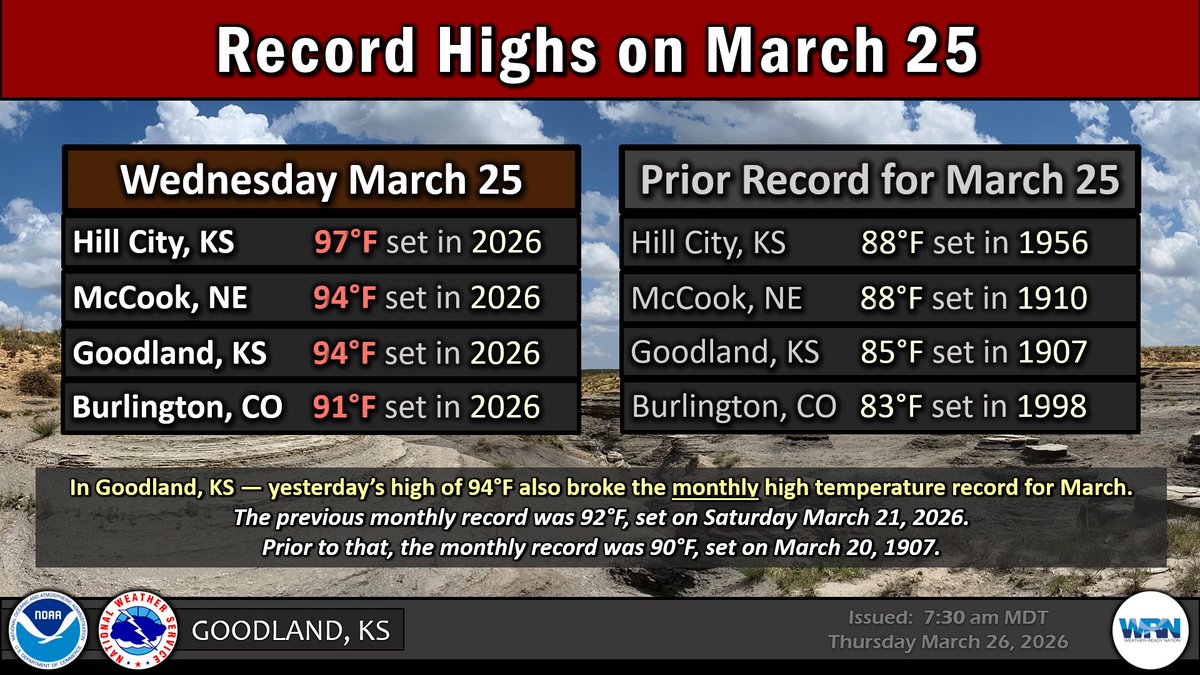
Temperatures soared into the 90's on Wednesday March 25, 2026 — smashing high temperature records (for the date) by 5-10° at Hill City, McCook, Goodland and Burlington. #kswx#cowx#newx