🌕 The #BloodMoon Total Lunar Eclipse begins at 6:04 AM. For those along the East Coast, the moon will be setting along the western horizon during totality.
Crazy scenes in South Florida the last couple days. TONS of cold-stunned iguanas immobilized after this historic cold snap. Because green iguanas invasive and harmful to the environment, groups are out humanely euthanizing them after the state relaxed rules.
📹: Isabella Martin
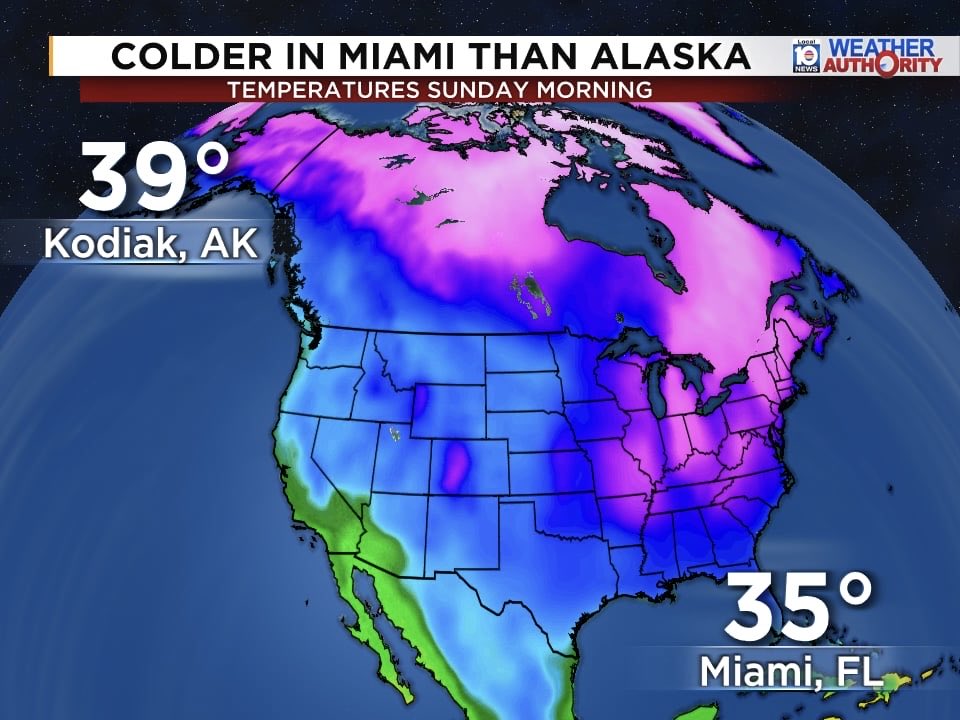
Colder in Miami than parts of Alaska! 🥶
Sunday morning temperatures dropped to 35° in Miami—colder than Kodiak, Alaska at 39°. A rare setup as Arctic air pushes deep into South Florida.
Tropical Storm #Humberto has formed, and Invest #94L is on track to become #Imelda. The European model for 2PM Sunday has 94L a little farther east compared to yesterday. We’ll have to watch the trends over the next few days before we get a better idea of what to expect.
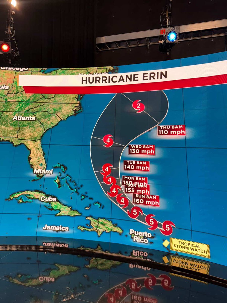
🌀 #Hurricane Erin has rapidly intensified into an extremely powerful Category 5 with 160 mph winds and 190 mph gusts. The forecast track keeps #Erin clear of land, with a northerly turn expected between the Bahamas and Bermuda early next week.
🌀BREAKING: Tropical Depression Three has formed and is forecast to to make landfall in South Carolina overnight Saturday into early Sunday. Next storm name is #Chantal. #TD3
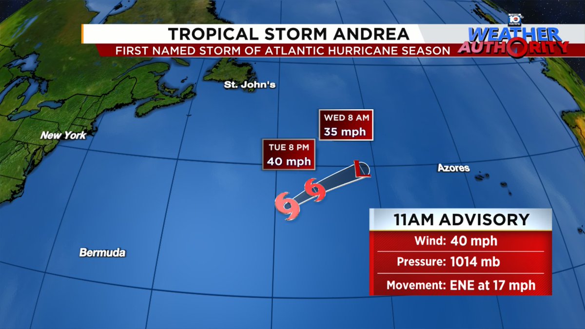
🌀Tropical Storm Andrea has formed, becoming the first named storm of the 2025 Atlantic Hurricane Season.
The storm poses no threat and will weaken as it remains over open water for the next 24 hours or so.
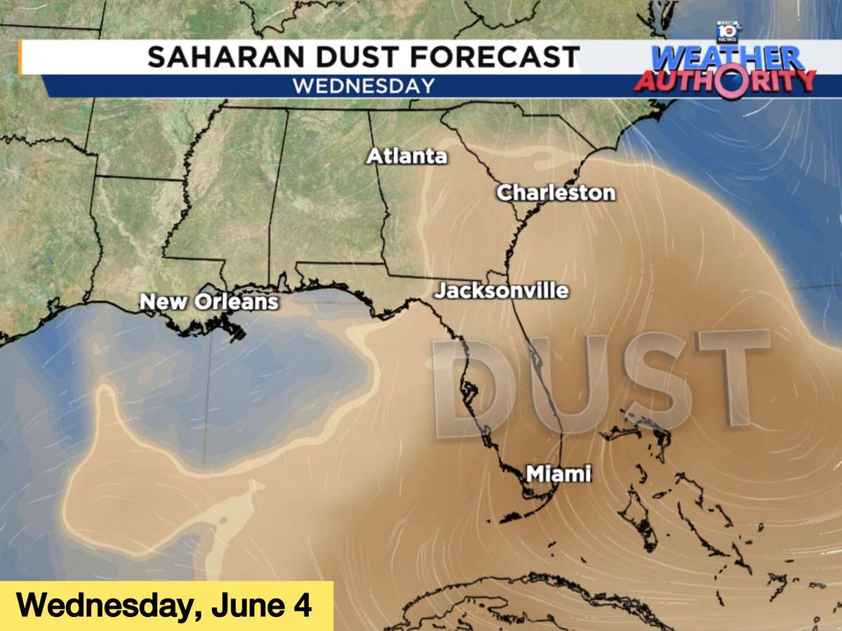
A thick plume of Saharan dust is forecast to move over Florida, Georgia, and the Carolinas on Wednesday and Thursday. Expect milky skies & vibrant red/orange sunrises and sunsets for a couple days.
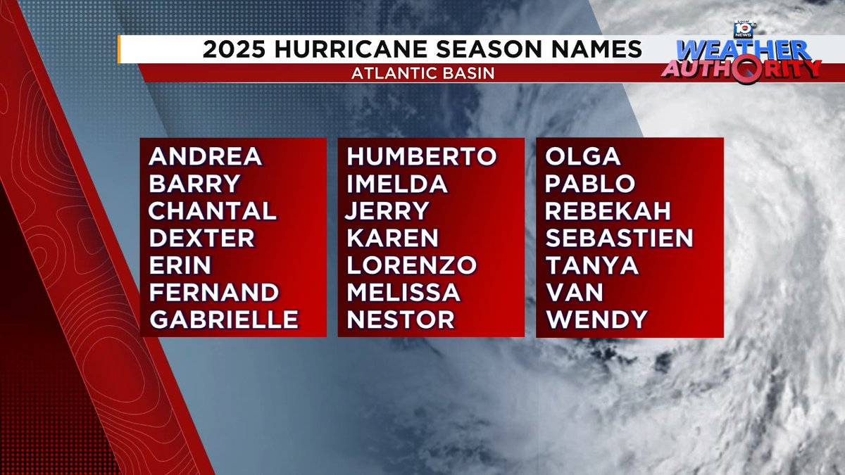
Do these hurricane names seem familiar to you? It's because we recycle the list every six years, unless a name is retired. These names were used back in 2019, with the exception of Dorian, which was retired and replaced with Dexter.
Severe Thunderstorm Watch for South Florida until 9 PM. Main threats are large hail of 1 to 2 inches in diameter and damaging wind gusts in excess of 70 mph. An isolated tornado or two cannot be ruled out.
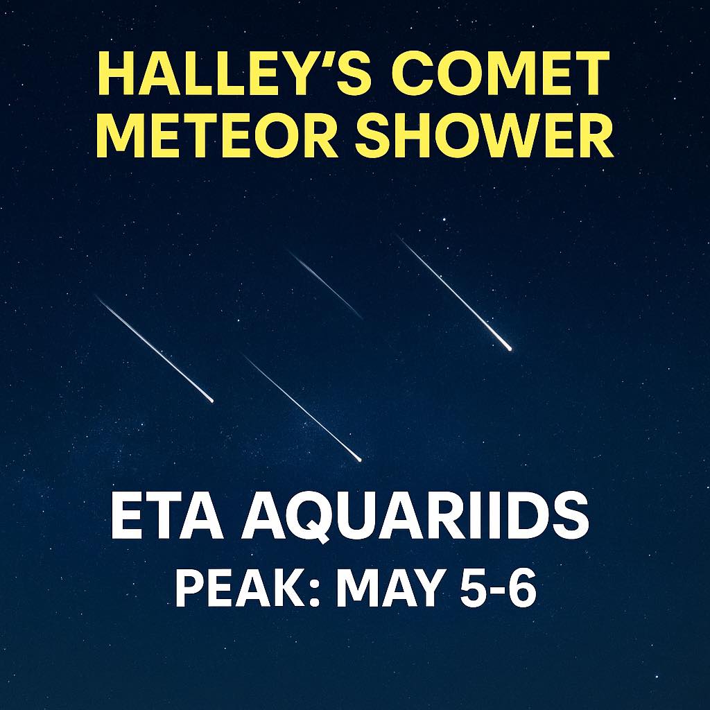
The Eta Aquariids peak May 5‑6, with dust from Halley’s Comet lighting up the sky. For best viewing, head outside after 2 a.m. and let your eyes adjust!
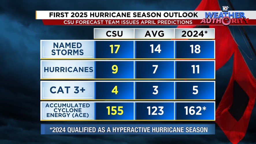
🌀 Colorado State University has released their first outlook for the 2025 Atlantic hurricane season.
➡️ CSU is calling for 17 named storms. They expect 9 of those storms to become hurricanes, of which 4 are predicted to strengthen into major hurricanes (Category 3 or higher).