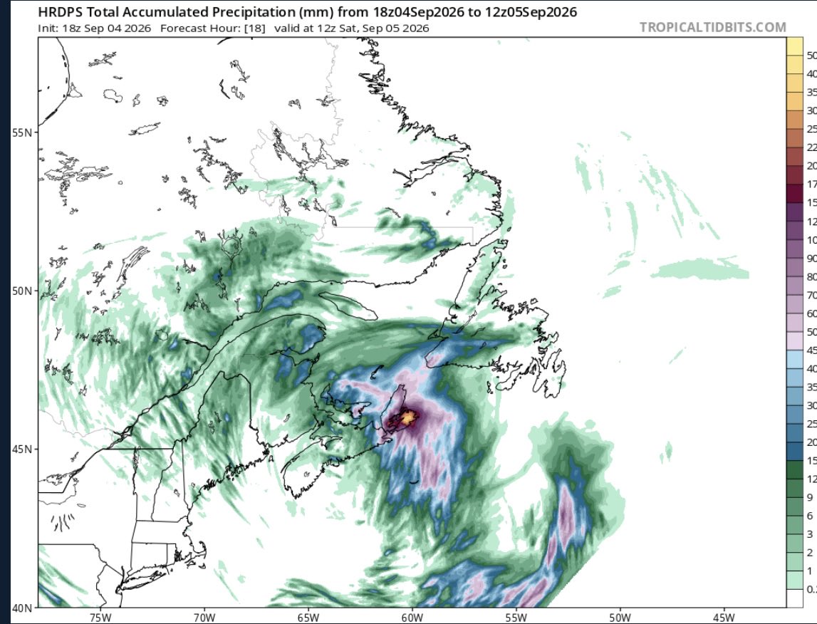
Models indicating the possibility of heavy rain tonight for some areas already dealing with flooding in Cape Breton. While they will be isolated if they do occur, puzzled as to why ECCC has no mention of it. Guess we haven’t learned from the last several weeks. #nsstorm#nswx
I take models with a grain of salt, but the possibility of these amounts locally is on the table. Keep in mind this is by tomorrow morning. Environment Canada better hope these amounts don’t verify as they have a yellow rainfall warning currently issued. #nsstorm#nswx
Several areas of Cape Breton approaching 50mm of rain in the last hour. Not a single statement or warning out for these areas. Have seen reports of roads being flooded and washouts as well. Environmental Canada refuses to acknowledge CB. #nsstorm#nswx
If June is any indication, Cape Breton is on pace for one of the worst summers. Cool almost every day with showers and wind (a few exceptions). No indication of a shift in pattern anytime soon either. Many more days around 10 C incoming. #nswx
How the #GoBolts make it to OT playing the way they do in their own zone majority of the game is crazy. They don’t want to skate until they lose possession, and then it’s a mess on what to cover.
@EddieSheerr Just curious as to what warrants a winter storm warning vs snowfall warning when the amounts/winds are similar. I feel that similar regions of Canada would follow similar criteria (I know they aren’t the same place lol), but just found it odd.
Not sure why winter storm watches only went up for a portion of the province. Models continue to highlight areas outside the watches where the heaviest snow will fall…and yes more than the 15-25cm outlined in the watch. #nswx#nsstorm
Looking like a large area could see a full turnover to rain on the next storm Monday. Highest snowfall totals likely 20-30cm. Of course much lower where the changeover occurs. #nsstorm#nswx