Higher pressure taking hold of our weather will mean hotter temperatures through the weekend(100°+)
Your 4th of July Saturday, 10% chance of a thunderstorm. We will see a high El Paso around 103°. Southeast wind 5 to 10 mph.
Track our weather: https://t.co/RPkVbF6UuT
As an area of higher pressure moves over the Southwest/Borderland, our temperatures into triple digit territory by the end of the week/for the 4th of July weekend.
Your Thursday, partly cloudy. High El Paso around 100°. SW 5 to 10+ mph
Track our weather: https://t.co/RPkVbF6UuT
As higher pressure returns this weekend. Triple digit temperatures look to return Saturday, the 4th of July.
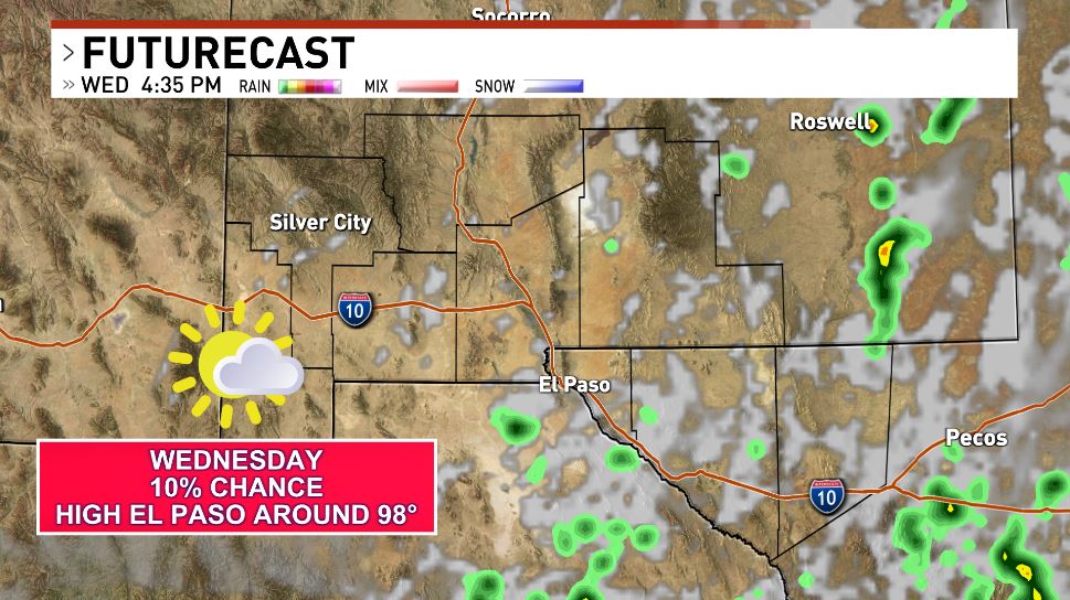
Your Wednesday will be partly cloudy. 10% chance of a storm. We will see a high El Paso around 98°. Southwest wind 5-15+ mph.
Track our weather: https://t.co/RPkVbF6UuT
As some troughiness' remains across the northern Rockies, with a resulting continued westerly flow. This will keep the best monsoon moisture to our south.
Your Tuesday, breezy. 10% storms. High El Paso around 98°. SW wind 10 to 20+ mph
Track our weather: https://t.co/RPkVbF6UuT
Dust storm advisory issued for El Paso, Dona Ana and Otero Counties. Strong winds between 25-40+ mph and lowered visibility due to a thunderstorm boundary pushing in from Mexico💨
Less than one mile of visibility.
Expires 6:45 pm.
Track our weather: https://t.co/RPkVbF6UuT
High of around 100 possible for El Paso tomorrow. We are tracking a 10% chance of showers/storms later in the day. Expect windier and gustier conditions with WSW winds of 10-20+mph 💨
Storm/shower chances higher mid next week.
Track our weather: https://t.co/RPkVbF6UuT
⚠️Weather Warn Through Friday- Heat
⚠️Heat Advisory El Paso - Through 9 PM Thursday
Your Wednesday will be partly cloudy. 10% chance of a thunderstorm. We will see a high El Paso around 107°. South wind 5 to 10 mph.
Track our weather: https://t.co/RPkVbF6UuT
⚠️Weather Warn Through Friday- Heat
⚠️Heat Advisory El Paso - Through 9 PM Wednesday
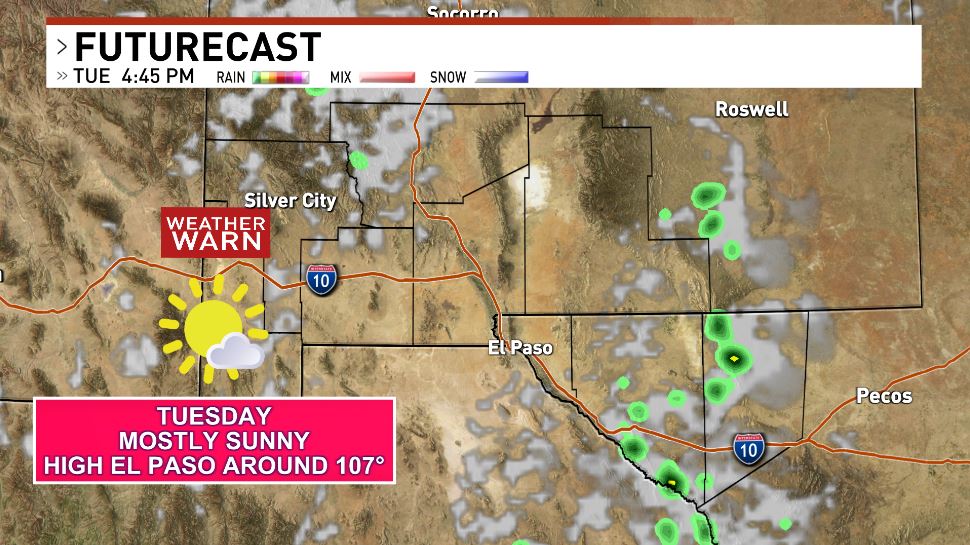
Your Tuesday will be mostly sunny. We will see a high El Paso around 107°. Southwest wind 5 to 10 mph
Track our weather: https://t.co/RPkVbF6UuT
⚠Weather Warn Monday ⚠
Tomorrow we are under a heat advisory as temperatures could be between 102° and 106°
A westerly flow continues to blow in drier conditions.
Conditions are likely to continue through most of next week.
Track our weather: https://t.co/RPkVbF6UuT
With higher pressure returning, we could see hotter temperatures returning, Sunday into next week(highs around 102° to 104°+)
Your Friday, 10% chance of a thunderstorm. We will see a high El Paso around 99°. Southwest wind 5 to 15+ mph
Track our weather: https://t.co/RPkVbF6UuT
⚠️Weather Warn Wednesday - Heat
⚠️Heat Advisory El Paso - Through 9 PM
We will see slightly better shower/storm chances Thursday.
Your Thursday, breezy to windy. We will see a high El Paso around 102°. West wind 15 to 25+ mph.
Track our weather: https://t.co/RPkVbF6UuT
⚠️Weather Warn Wednesday - Heat
⚠️Heat Advisory El Paso - Wednesday Noon Through 9 PM
Your Wednesday will be partly cloudy🌥 and breezy to windy. We will see a high El Paso around 105°. West wind 15 to 30+ mph.
Track our weather: https://t.co/RPkVbF6UuT
⚠️Weather Warn Wednesday - Heat
A westerly flow will kick some of the moisture out of the region and allow for hotter temperatures to return.
Your Tuesday will be partly cloudy🌥. We will see a high El Paso around 103°. W 5 to 10+ mph
Track our weather: https://t.co/RPkVbF6UuT
We are tracking a strong thunderstorm moving into Dona Ana and Sierra Counties.
Heavy rainfall, penny sized hail and 50+ mph gusts are pushing into the area.
Areas could be affected by 4:15 p.m.
Track our weather: https://t.co/RPkVbF6UuT
The NWS has issued a flash flood warning for central Hudspeth County into Western Texas due to incoming/ ongoing thunderstorms. Expiration: 4:45 p.m.
Some areas have already experienced 1.5" of rainfall with over 1" still expected.
Track our weather: https://t.co/RPkVbF6UuT
⚠️ Weather warning issued today, conditions likely to start 7/8 p.m. for Las Cruces, El Paso and areas east of the Rio Grande.
Storms could bring 1-2" of heavy rainfall, golf ball sized hail and 60+ mph gusts ⛈️
Stay weather aware.
Track our weather: https://t.co/RPkVbF6UuT
Weather warn issued for Sunday. Widespread showers/thunderstorms are possible. Thunderstorms could bring 1" hail and 60+ mph gusts ⛈💨
The abundance of moisture pushing into the area and daytime heating being a major factor.
Track our weather: https://t.co/RPkVbF6UuT
⚠️Weather Warn Wednesday/Thursday - Heat
⚠️Heat Advisory El Paso - Wednesday Noon Through 9 PM
Your Wednesday will be partly cloudy and hot. We will see a high El Paso around 105°. West wind 5 to 15+ mph.
Track our weather: https://t.co/RPkVbF6UuT
⚠️Weather Warn Wednesday/Thursday - Heat
Higher pressure returning to the Borderland will drive our temperatures up. This will mean highs of 104° to 106° possible Wednesday/Thursday
Your Tuesday🌥. High El Paso around 103°. S 5-10 mph
Track our weather: https://t.co/RPkVbF6UuT
Dry and hot tomorrow, when triple digits are more likely. The forecast high tomorrow is around 103° 🌡
West southwest winds of 5-10+ mph 🌥
Stay weather aware and be prepared for these hotter temperatures.
Track our weather: https://t.co/RPkVbF6UuT