A worldwide company using #data#space to help know better #Oceans and our #Planet. Pioneering on #Earth observations applications, #Argos services provider
🔎 Search and Rescue operations rely on one critical capability: Making the right decisions in the shortest possible time.
In distress situations, accurately estimating drift trajectories, defining probable search areas and coordinating rescue assets are essential to improving operational efficiency and helping save lives at sea and on land.
At CLS, we develop satellite-based Search & Rescue solutions designed to support Rescue Coordination Centers (RCCs) and authorities involved in SAR operations worldwide.
Through THEMIS SAR, operators can manage SAR missions from a single platform combining:
🛰 Drift modelling
🌊 Search area calculation
📍 Search pattern generation
🚨 Rescue asset coordination
🤝 Operational decision support
Integrated within the broader Cospas-Sarsat ecosystem, these technologies contribute to improving the planning and coordination of time-critical rescue operations in increasingly complex environments.
📅 Last week, CLS teams attended the international Cospas-Sarsat Joint Committee, held from June 2 to 5. Alongside Capgemini and Thales Alenia Space, CLS showcased the SARNEXT solution, including MEOLUT Next, MCC Next and RCC Next capabilities powered by #THEMISSAR.
During the event, our colleague Anouk Beltan represented CLS alongside Kévin Salsac from Thales Alenia Space and Nicolas Viala from Capgemini, engaging with international SAR stakeholders and discussing the future of satellite-enabled Search & Rescue operations.
🌍 The event provided a valuable opportunity to exchange with international delegations involved in distress and rescue coordination, share operational feedback and explore the next generation of satellite-enabled #SAR services.
More information about THEMIS SAR 👉 https://t.co/Ysq9ortAFf
#searchandrescue #cospassarsat #maritimesafety #airsafety
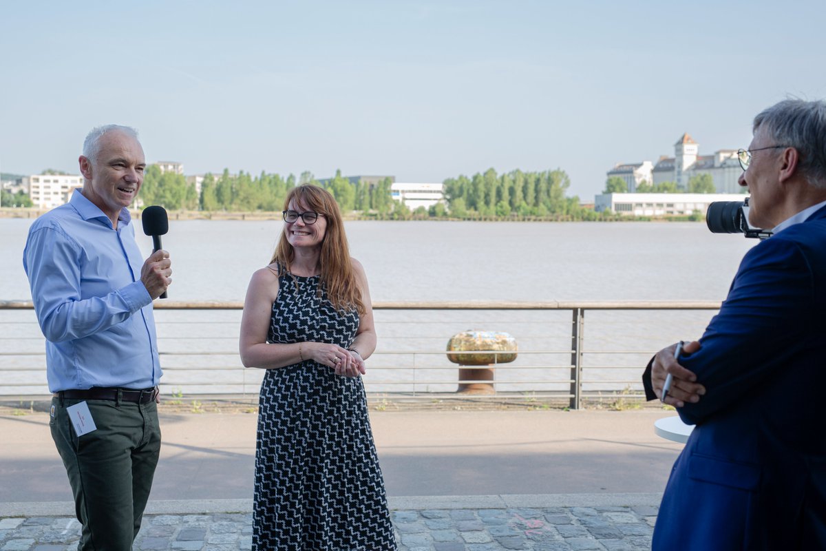
🌊🛰️ Comment transformer les données spatiales en actions concrètes pour renforcer la résilience de nos littoraux face au changement climatique ?
C'est le sujet qu'a eu le plaisir d'aborder Stephanie Limouzin, Présidente de CLS, lors du premier déjeuner-débat organisé par le French Space Club consacré aux impacts du dérèglement climatique sur les zones côtières et les écosystèmes marins. 🌍
Grâce à plus de 40 ans d'expertise en observation de la Terre, CLS développe des solutions innovantes permettant d'anticiper les risques côtiers, d'accompagner l'adaptation des territoires et de préserver les populations et la biodiversité.
Pour tout savoir sur nos solutions 👉 https://t.co/brW3ufM0wp
Merci à Ariel Fuchs, Philippe Fourrier et Giao-Minh NGUYEN Cofondateurs du French Space Club, à Catherine Chabaud, Ministre de la Mer, et à tous les parlementaires participants Claude Raynal, Daniel Salmon, Fabrice Barusseau, Denis Fégné, Robert Le Bourgeois, Anne-Cécile Violland, SOPHIE PANONACLE, Jimmy Pahun, Bertrand Bouyx ainsi qu'à Alain Blanchard, Délégué général de l'ANEL pour la richesse des échanges et les perspectives inspirantes partagées autour de l'avenir de nos océans et de nos littoraux.
#RésilienceCôtière #ObservationDeLaTerre #ChangementClimatique #Tech4Good #Space4Society #Space4Ocean
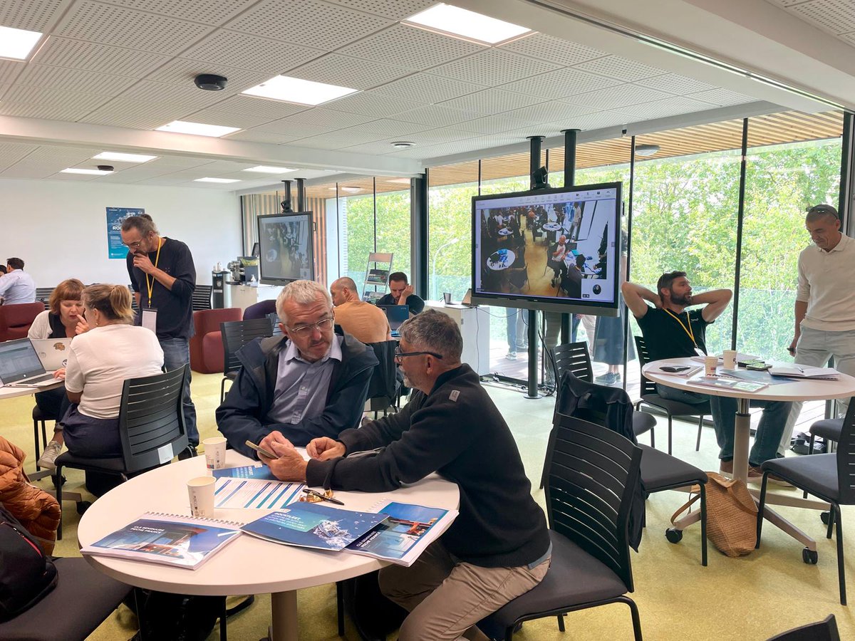
🇫🇷📍 Les 2 et 3 juin, nous avons eu le plaisir d’accueillir dans nos locaux de Toulouse le séminaire VMS France, réunissant nos équipes et partenaires français autour des enjeux de la surveillance des pêches et des solutions de suivi maritime.
Ces 2 journées ont permis d’aborder les évolutions réglementaires et opérationnelles du marché français, tout en renforçant la connaissance de nos outils, de nos configurations et de nos balises VMS, avec un focus particulier sur la solution #ROCKFLEET.
Parmi les sujets clés abordés, les évolutions de la réglementation européenne de contrôle des pêches ont occupé une place importante.
À ce titre, les navires de pêche de moins de 12 mètres devront être équipés d'un système de surveillance VMS avant le 10 janvier 2028 en France.
🎣 Cette évolution majeure constitue un enjeu important pour la filière pêche française, contribuant au renforcement du suivi et de la traçabilité des activités de pêche.
🤝 Un grand merci à l’ensemble de nos partenaires pour leur présence et leur engagement à nos côtés, ainsi qu’à Furuno pour sa participation active au sein de cet écosystème maritime en constante évolution.
Merci également à toutes les équipes mobilisées pour ces échanges riches et constructifs autour des solutions #VMS France au service des professionnels de la mer. 🛥️
Pour en savoir plus sur la réglementation en France 👉 https://t.co/8CtXgKpZE3
#Pêche
🌬️ Can seasonal forecasts and machine learning improve wind farm production forecasting for the next 6 months in the future?
👉 As power systems integrate increasing shares of renewable energy, anticipating wind power variability at seasonal timescales is becoming a critical challenge for grid operators, energy traders and asset managers.
At CLS, through our subsidiary @meteodyn, we are developing advanced forecasting approaches that combine seasonal climate predictions with machine learning to provide actionable insights on future wind energy production.
Our latest work leverages:
🔵 Seasonal forecast data from the European Centre for Medium-Range Weather Forecasts (ECMWF)
🔵 Gradient Boosting Machines (GBM) trained on historical production and meteorological data,
🔵 Quantile Regression to predict the full probability distribution of future monthly energy production rather than a single deterministic value.
📊 This probabilistic framework enables the estimation of key exceedance indicators such as P50 and P90, providing valuable information on downside production risks and helping stakeholders better anticipate periods of potential underproduction.
📈 Validated over a 9-year period (2017–2025) in a case study of a wind farm located in western France, the methodology demonstrates significant skill compared with climatological references, achieving an average 30% improvement in CRPS at a one-month lead time, while maintaining substantial forecast skill (27% improvement) even at the sixth months.
🎤 These results will be presented by Gang Huang at the @WindEuropeEvent Technology Workshop in Rotterdam, during the session:
"Skillful Seasonal Forecasting of Wind Farm Production Using Gradient Boosting Machines and Quantile Regression"
📅 Friday, 12 June 2026 | 13:30–14:30
Want to discuss how seasonal forecasting and AI can help anticipate wind power production risks months ahead?
👉 Meet our team (Edouard Leonard, Selhia Idrissi, Zixiao Jiang, Xin Xie, Gang Huang and Anthony Dijon) in Rotterdam during the WindEurope Technology Workshop.
To learn more: https://t.co/BQv3O6M7uN
#windeurope #windenergy #renewableenergy #energyforecasting
How do you keep track of #livestock when herds roam across remote territories, beyond the reach of cellular networks?
💡 For livestock managers operating in deserts, mountains, and extensive grazing systems, reliability is everything. A tracking collar must withstand harsh environmental conditions while continuing to deliver accurate positions and timely alerts.
🛰️ In our latest article, we explore what makes a robust livestock GPS collar and why battery life, rugged design, and reliable connectivity are critical for effective #herd monitoring.
We also share a real-world use case from Oman, where #CollarSAT, our dedicated livestock collar, supports camel monitoring through geofencing alerts and highway proximity notifications, with satellite locations received within just a few minutes.
Discover how CollarSAT combines GPS tracking and #satellite connectivity to help maintain visibility over herds in challenging environments.
Read the article 👉 https://t.co/FJ8TBr8cM4
#livestocktracking #herdmanagement #Argos
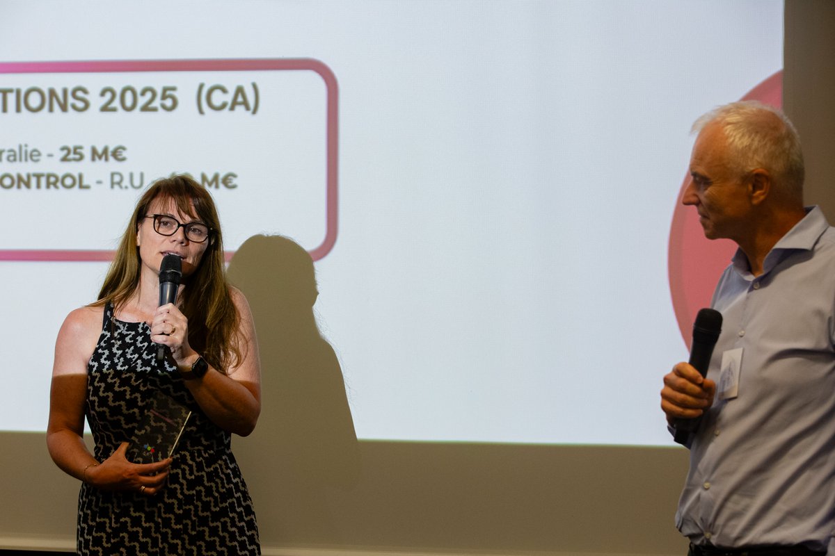
🏆 Prix International CFNEWS 2026 : une reconnaissance de notre ambition mondiale
Parce que la croissance externe est, avec l’innovation et la croissance organique, l’un des piliers du développement de CLS, nous sommes particulièrement fiers d'avoir reçu le Prix International de la Croissance Externe Sud-Ouest lors de la 4e édition des Grands Prix CFNEWS (Corporate Finance News).
Ce prix fut remis par Sylvain Guillou du @LCL à notre Présidente Stephanie Limouzin, jeudi 28 mai.
🌎 Les acquisitions stratégiques que nous avons effectuées dans notre histoire, qui sont au nombre de 19, nous permettent d’accélérer notre implantation dans des régions du monde où nos solutions satellitaires répondent à des enjeux majeurs, tout en renforçant notre proximité avec les acteurs locaux.
Elles nous permettent également d’intégrer de nouvelles expertises complémentaires et de faire grandir nos capacités d’innovation.
Les acquisitions récentes de NGIS et Ground Control illustrent pleinement cette dynamique : construire un groupe toujours plus international, agile et complémentaire, au service de la compréhension et de la protection de notre planète.
👉 Merci aux équipes, partenaires et clients qui contribuent chaque jour à cette aventure collective.
🤝 Merci aux équipes de CFNEWS pour cette reconnaissance.
#tech4good #durabilité
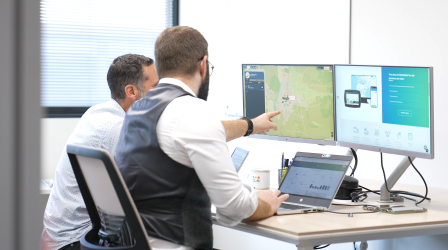
✈️ Defining efficient search areas during aeronautical SAR operations remains a complex and time-critical task, especially when only limited information is available after the loss of contact with an aircraft.
🚨 To address this operational challenge, CLS is extending the capabilities of THEMIS SAR with a new Aeronautical Search Planning module dedicated to rapid search area generation.
The workflow is based on the reconstruction of a probable flight corridor between the aircraft’s Last Known Position (LKP) and its destination airfield. Operators can define the trajectory directly on the map, after which the system automatically generates six prioritized and editable search areas along the route.
Key technical features include:
✔️ automatic generation of oriented search rectangles along the flight path
✔️ configurable high-probability corridor width up to 100NM on each side of the route
✔️ accurate local and global weather data, including winds and currents
✔️ prioritization and labeling of search areas for operational deployment
✔️ editable geometries enabling operators to refine search zones based on mission context
✔️ seamless integration into existing Search & Rescue Unit allocation workflows
The solution is specifically designed to support fast operational decision-making while maintaining flexibility for complex trajectories and evolving SAR scenarios.
🌍 Integrated within THEMIS SAR, that already embeds IAMSAR Manual guidelines for aeronautical search planning, this new functionality contributes to improving the efficiency, consistency, and responsiveness of aeronautical operations.
Interested in discovering how THEMIS SAR can support your SAR operations?
Request a personalized demo from our SAR experts 👉 https://t.co/Hx81amhvJP
#SearchAndRescue #AeronauticalSAR #MissionPlanning #EmergencyResponse #AviationSafety
Protecting biodiversity, managing natural resources sustainably, and anticipating environmental risks all start with one thing: better Earth intelligence.
Today, satellite connectivity and Earth observation data are helping transform how we:
🌍 Monitor ecosystems
🐘 Reduce human-wildlife conflict
🌱 Improve pasture and herd management
🌊 Protect coastal and marine environments
⚠️ Strengthen resilience to environmental risks
🛰️ At CLS, we combine satellite technologies, environmental intelligence, and field expertise to turn data into actionable insights for governments, NGOs, researchers, and conservation stakeholders worldwide.
As global discussions continue at the GEO-21 Symposium, collaboration between science, institutions, and technology players is more important than ever to build resilient and sustainable solutions for our planet.
Our experts Fabien Lefevre and Sebastien Delbour are attending the event this week and would be happy to connect to discuss how Earth observation and satellite-enabled services can support your environmental and climate challenges.
#EarthIntelligenceforAll #biodiversity #climate #satellitedata #geoweek @GEOSecretariat
🎣 What if we took you into the field? A closer look at our Seychelles mission.
For 5 days, CLS teams worked alongside the (SFA) to train around 30 field stakeholders (operators, coast guards, and fisheries authorities) across the Seychelles Exclusive Economic Zone (EEZ).
The main objective of this mission was to train local teams in order to strengthen their operational efficiency in monitoring fishing activities, using our CLS solutions.
Topics covered during the training:
⚓ vessel tracking through VMS modules
📊 real-time ERS data integration
🐟 hands-on use of monitoring and reporting tools (FishLog 2)
Beyond the training sessions, these 5 days were also an opportunity for field exchanges, operational testing, and a better understanding of the daily constraints faced by users, local partners, and vessel crews.
For over 12 years, THEMIS solutions have supported fisheries authorities in developing practical tools for more effective maritime surveillance and sustainable fisheries management.
🌊 In island states such as the Seychelles, maritime surveillance is essential to protect fisheries resources, efficiently monitor vast maritime areas, improve the detection of suspicious activities, and support decision-making at sea.
A big thank you to our teams, all participants, and the SFA for their warm welcome and collaboration. Explore how Themis supports fisheries authorities in the field 👉 https://t.co/uj97XQXydt
#SustainableFisheries #FisheriesMonitoring
🚚In humanitarian operations, every unnecessary kilometer, fuel loss, or vehicle breakdown directly affects operational performance. That is why optimizing fleet management is not simply about reducing costs, but about maximizing mission efficiency in the field.
In the Democratic Republic of Congo, where humanitarian organizations must notably cope with the recent resurgence of Ebola, the ability to effectively coordinate teams and ensure operational continuity is essential.
As an example, we supported our client in analyzing the first 12 months of operations of a 70-vehicle fleet, with tangible results:
🛡️ 10% reduction in insurance costs thanks to safer driving behavior
⬇️ 8% reduction in maintenance and tire costs driven by a proactive maintenance strategy
🚚 5% reduction in fleet size with no impact on operational capacity si
⛽12% reduction in fuel consumption through real-time monitoring and fuel control
These results demonstrate how HUMANAV helps organizations optimize fleet operations, control costs, enhance safety, and improve coordination between field teams and headquarters through real-time visibility and more reliable decision-maki
Smarter fleet management means more efficient missions and greater impact where it matters most. Discover how HUMANAV can optimize your operations 👉https://t.co/IDF3nUqiOe
#FleetManagement #Humanitarian
❄️ Defence, sovereignty and resilience: polar regions are becoming major strategic areas.
As Arctic maritime routes progressively open and geopolitical tensions intensify, the need for maritime surveillance and situational awareness in these extreme environments is accelerating.
How can we monitor such vast, remote and hard-to-access areas?
Which technologies can today track sea ice, icebergs, vessels and sensitive maritime activities in polar regions?
And how can we guarantee the sovereignty and resilience of space capabilities in an increasingly complex geopolitical landscape?
Satellite technologies play a key role in addressing these challenges: radar imagery, AIS and satellite data fusion, ice drift modelling, vessel behaviour analysis, AI-powered maritime intelligence…
Polar-orbit satellite constellations also provide revisit capabilities particularly well suited to high-latitude monitoring.
Yet several challenges remain central:
➡️ improving the responsiveness of satellite tasking and image acquisition,
➡️ strengthening the resilience of space infrastructures,
➡️ ensuring sovereign access to strategic data,
➡️ and maintaining reliable, near real-time maritime awareness.
This week, Vincent Kerbaol, Director of CLS Brest and expert in satellite-based maritime surveillance, took part in a roundtable discussion during the forum Brest sur le Pont, dedicated to Defence and Space challenges in polar regions.
He shared CLS expertise on:
🧊 sea ice and iceberg monitoring,
🚢 navigation safety in polar waters,
📡 maritime intelligence and vessel behaviour analysis,
🌍 as well as sovereignty and resilience challenges related to space capabilities.
Discover more about CLS Maritime Intelligence solutions: https://t.co/gmTK0e5cgU
#defence #arctic #antarctica #maritimesecurity
🌱 Farming is changing fast and space technology is becoming a real ally in the field.
🚜 At CLS, we help turn #satellite data into practical tools support farmers, cooperatives, seed producers, land managers, and agricultural stakeholders in their everyday decisions.
From monitoring crops and pasture conditions to improving #irrigation and understanding climate impacts, our solutions are designed to make agriculture more efficient, resilient, and sustainable.
Here’s how we support smarter farming:
🌾 Crop and field mapping
💧 Irrigation and soil moisture monitoring
🌦️ Weather and agrometeorological insights
📈 Yield estimation and vegetation monitoring
🐄 Pasture and herd monitoring
🛰️ Satellite connectivity for remote farming areas
By combining Earth observation, field data, and satellite connectivity, we help bring useful insights directly to the people who need them, even in areas with limited network coverage.
📍 Want to learn more?
Meet our experts Steven ROSA , Karim MEHAH and Nathalie RYCKEBUSCH at the 6th Intelligent Farming Summit organized by @Luxatia_intl in Berlin to talk more about the future of smart agriculture.
#smartagriculture #agtech #IntelligentFarming2026
🌬️ LiDAR Data CFD Correction: improving wind measurement reliability in complex terrain
LiDAR technologies are now widely used for wind measurement campaigns. However, in complex terrain environments (hills, valleys, forested areas), airflow becomes non-uniform and can introduce significant bias into wind measurements.
At CLS, through , we provide a LiDAR Data CFD Correction service based on high-resolution CFD simulations to correct terrain-induced distortions and improve wind data accuracy.
The service enables:
✔️ sector-by-sector and height-by-height correction of LiDAR measurements
✔️ improved correlation with meteorological mast data
✔️ increased reliability for AEP calculations and bankability studies
📊 This scientific approach has been validated on multiple complex terrain sites with significant results:
• mean bias reduction up to 7%, resulting in an error of about 1-2%
• average performance error improvement up to -0.06% ± 2% and for some sectors, wind speed measurement errors below 1% in 50% of cases CFD-based LiDAR flow curvature correction in complex terrain; Meteodyn, CGN New Energy Holdings Co.,Ltd, Nanjing Movelaser Co., Ltd, 2022).
🌍 As wind projects move toward increasingly complex and high-yield sites, reducing uncertainty in wind resource assessment becomes critical. Even small deviations in wind speed measurements can significantly impact annual energy production estimates, project financing and investment decisions.
By combining LiDAR measurements with CFD-based flow modeling, developers and consultants can achieve a more robust understanding of site-specific wind behavior and reduce uncertainty throughout the project lifecycle.
⚙️ Compatible with major LiDAR technologies including ZX Lidars, WindCube® and Vaisala, this solution helps secure wind resource assessment in the most challenging environments.
To learn more: https://t.co/nUkP51spDC
#windenergy #cfd #lidar #windresourceassessment #renewableenergy #windmeasurement
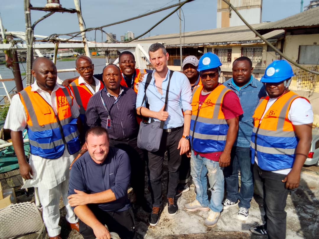
🌊 Nouveau déploiement de NEMO et TRITON en cours au Cameroun
👉 Les équipes CLS ont récemment réalisé l’installation de plusieurs balises #VMS à Douala afin de renforcer les capacités de suivi et de surveillance des activités en mer.
🛰️ Dans le contexte camerounais, où les zones côtières et maritimes disposent parfois d’une couverture réseau limitée, l’utilisation d’équipements de surveillance satellitaire est essentielle pour assurer la continuité du suivi des navires en mer.
🔧 Sur le terrain, une installation réussie repose sur quelques étapes clés :
1. La configuration et activation des balises
2. Les tests de connectivité mobile et satellite
3. La validation des transmissions de données en temps réel
4. L’accompagnement des équipes locales pour une prise en main opérationnelle
🎣 L’objectif commun est de fournir aux autorités des services et technologies contribuant à une gestion durable des pêches, à la sécurité en mer des pêcheurs et à la lutte contre la #pêche illégale.
🤝 Merci à notre partenaire local ETS BETHANIES pour ce déploiement réussi, ainsi qu’à nos équipes CLS. Merci également à la Brigade de Contrôle et de Surveillance des Activités de Pêche (BCSAP) et au Ministère de l’Élevage, des Pêches et des Industries Animales (MINEPIA) pour leur confiance.
Pour en savoir plus sur ce déploiement 👉https://t.co/eFtDtFEE9B
#PêcheDurable #Connectivité
🌬️ How much do you trust your Turbulence Intensity measurements?
Turbulence Intensity (TI) directly impacts turbine design, performance, fatigue loads and overall asset service life.
But offshore, measuring TI is far from straightforward.
Floating LiDAR systems do not measure wind at a single point, they sample the motion of a parcel of air, while the platform itself is moving.
The result: Quality of TI estimates can be significantly degraded.
And today, there is no universally accepted standard to correct this.
At CLS Group, we developed a correction methodology specifically tailored to our DeepCLidar buoy:
✔ Perform a transformation of measurement records into earth (fixed) coordinates
✔ Removal of motion-induced artifacts, including buoy eccentricity effects
✔ Methodology independent of sampling frequency and pattern
✔ Consistent TI correction across varying measurement conditions
📊 Result: up to 10% RMSE reduction in the critical 9–16 m/s wind speed range.
Not just better measurements, more reliable solutions across the entire project lifecycle.
📩 Want to improve your TI measurements? Let’s talk.
#offshorewind #windenergy #lidar #turbulence
🌍 Across Europe, water is changing.
🌊 From rising sea levels to river flooding and shrinking water resources, climate change is already reshaping our environment and impacting communities, ecosystems, and infrastructure.
💡 The European State of the Climate 2025 report, produced by the #Copernicus Climate Change Service (#C3S), @ECMWF and the @WMO brings together key scientific observations to better understand these changes and support climate adaptation.
🛰️ CLS is proud to contribute to this collaborative effort through satellite-based water monitoring expertise. Using satellite altimetry, we help monitor water levels in lakes and rivers worldwide, while supporting the observation of sea level rise and flood dynamics from space.
Turning satellite data into actionable climate information is essential to help scientists, decision-makers, and communities anticipate and adapt to a changing climate.
🎥 Discover how satellite observations help us better understand Europe’s changing water systems in our latest video.
#ESOTC2025 #climatedata
🌍 #MeetTheTeam at CLS Indonesia
Our teams are driven by passionate people combining technology, innovation and international perspectives to build impactful solutions. Today, we are proud to spotlight Meru Radite Harjono, R&D Manager at CLS Indonesia.
🛰️ With a background in Physics from Institut Teknologi Bandung (ITB), Meru has dedicated more than 20 years to developing cutting-edge maritime and satellite-based solutions.
🚢 From Vessel Tracking Systems to Fuel & RPM Monitoring Systems powered by satellite technologies, his work contributes to improving maritime safety, operational efficiency and sustainable ocean management across the region.
💡Throughout his career, Meru has led and contributed to major projects for international clients and institutions, always with the same passion for innovation and teamwork.
🎥 @wttj recently chose to interview Meru to highlight his unique bicultural journey between France and Indonesia, with technology at the heart of his professional path.
Discover his inspiring story and what it means to work at CLS in an international and fast-evolving environment. 👇
🚀 Looking for a meaningful career with real impact?
Interested in new technologies, space, maritime challenges and international projects?
🌊 Our Careers page is regularly updated with many opportunities worldwide. Join us and help shape the future with data and innovation.
#tech4good #innovation #maritimetech #içiçarecrute #joboftheweek
🌍 El Niño is back. What does it mean for fisheries?
🔍 According to the @WMO, there is around a 40% chance that an event will develop between May and July, while @NOAAClimate estimates up to a 90% probability by September. After the 2024 episode, this is a signal worth watching closely.
El Niño is driven by a weakening of the trade winds, reducing upwelling off South America, warming eastern Pacific waters, and disrupting marine ecosystems.
🎣For fisheries, the impacts are already well known:
- Productivity becomes more variable especially in the eastern Pacific, Peru, Ecuador and Chile making resources less predictable.
- Food webs shift, and species respond.
- Tuna, in particular, move as ocean conditions and prey availability change.
At CLS, we support this transition with ecosystem-based models like SEAPODYM, helping anticipate changes in habitats and better understand stock movements.
Learn more about El Niño impacts on fisheries and how CLS helps anticipate change 👉 https://t.co/mrnVWwy7lI
#OceanScience #Fisheries #SEAPODYM
80% of participants experienced GNSS disruption in the past 12 months
Not a future risk. A current operational reality.
Thanks to everyone who joined our webinar, strong engagement and a clear takeaway:
GNSS can no longer be relied on alone in high-risk regions.
When positioning fails:
📍Crews lose situational awareness
📍Vessels appear in the wrong waters
📍Decisions are made on false data
This is not a positioning issue.
This is a control issue.
🛰️That’s exactly why we developed RockFLEET Assured:
✔ Trusted positioning, even when GNSS is compromised
✔ Real-time detection of jamming & spoofing
✔ Continuous operational visibility
Because when your GPS lies… you still need the truth.
Want to see it in action? 👉 Reach out to our CLS team and Fehmi Sanaa, Sales Representative at CLS, for a demo.
#GNSS #jamming #spoofing #maritimesecurity #fleetmanagement #PNT
🗺️ In the field, managing a humanitarian fleet is not just about tracking vehicles. It’s about understanding the environment they operate in.
🏫💧With HUMANAV, new map layers enrich operations with key data: schools, water points, critical infrastructure…
Why does it matter?
- Prioritizing sensitive or strategic areas
- Protecting people: drivers and passengers
- Better mission planning by integrating real field conditions
- Adding context to decisions, not just data
🚚 Because in humanitarian operations, every point on the map can represent a need or an emergency. Having the right information, in the right place, means acting faster and more effectively.
💻 Humanav is a global web and mobile platform connecting every level of organizations, from your headquarters to the field, designed for humanitarian operations worldwide.
Contact our team to learn more about HUMANAV and its new map layer features 👉 https://t.co/TyFyMlrSs9