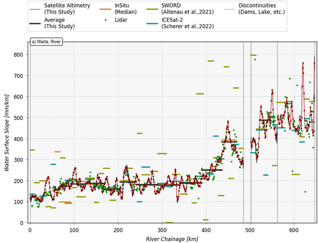
High-res #WaterSurfaceSlope derived from Satellite #Altimetry for rivers in Poland shows an average RMSE of 27 mm/km (11 mm/km in lowlands) compared to slopes from gauge data. The method can be applied worldwide and benefit flow velocity & discharge: WRR, https://t.co/smwVEzcYRP
A milestone is reached! For meanwhile 10,000 targets worldwide our DAHITI Database for Hydrological Time Series of Inland Waters provides free hydrological information like water level, surface area & volume change from satellite data. Explore it at https://t.co/SirbRVBRYD
#Lakes
River slopes observed by #ICESat2: New algorithm enables the use of lidar data for continuous monitoring of water surface slopes (WSS) on reach-scale. WSS is essential for estimating flow velocity & discharge, and relevant as an altimetry range correction: https://t.co/gunSZOGG1T