Advisory level gusts are being reported today across the area along with isolated tree and power issues. Our meteorologist Chris Roscia helped set up the DOT station that clocked a 49 mph gust.
Very cold tonight and VERY COLD tomorrow night. Lows tonight below could reach the single digits across much of CT per the latest HRRR. Let’s see how these verify in the morning. Subtract another 5 degrees for tomorrow night. 🥶
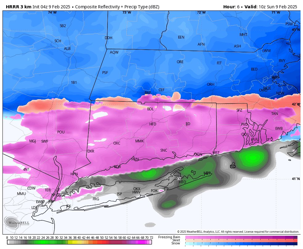
Forecast worked out well today! Watch for slick spots this evening as wet areas may freeze up. Snow showers are possible late tonight and around dawn, especially in Western areas. ❄️
A WINTER WEATHER ADVISORY is in effect for most of interior CT and adjacent NY state tomrrow. Up to an inch of snow is possible in the highest elevations, but the main concern is a few hundreds of an inch of ice accretion. This can make untreated surface extremely slippery.
Some signal for a storm next weekend as cold air interacts with a southern branch storm system. Definitely something to watch. 18Z GFS below as a depiction of what could happen IF things come together well.
Another multi-acre brush fire today in Litchfield County. Extreme fire danger will continue Sunday! Conditions are just so dry. Credit East Litchfield Volunteer Fire Dept.
The SPC had highlighted the next few days for elevated risk of fire spread. Interested to see if we expand to a Level 2 (critical) on Saturday when winds are highest. Worth watching!
Incredible plume of smoke on satellite from a wildfire in NW NJ today. It travels hundreds of miles to the SE out over the ocean. With no clouds around today, I could actually see this from Western CT on the SW horizon.