The #CowCanyonFire started in Selah, WA and affects community members in both Yakima County and Kittitas County. Here is an update including recent LEVEL 3 - LEAVE NOW and LEVEL 2 - BE READY evacuations:
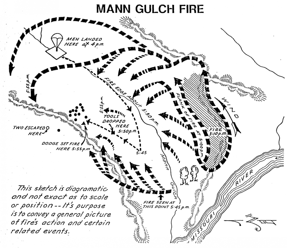
On #ThisDayInHistory, 15 Missoula Smokejumpers and one Meriwether Fire Guard were burned over on the Mann Gulch fire in 1949. Only five would survive the blow-up. Two would die from their burns the next day.
#6MFS#NeverForgotten
https://t.co/qb0BbF307C
#VantageHighwayFire PM Update for 8/4: Vantage Highway is OPEN.
Productive shift today building & securing control lines and working with the weather. Thank you to fire crews!
@KCSheriffOffice @SE_WA_IMT
Tonight, an infrared flight will give us a more accurate estimate of actual acres burned. In the meantime, crews are still on the ground constructing and securing containment lines.
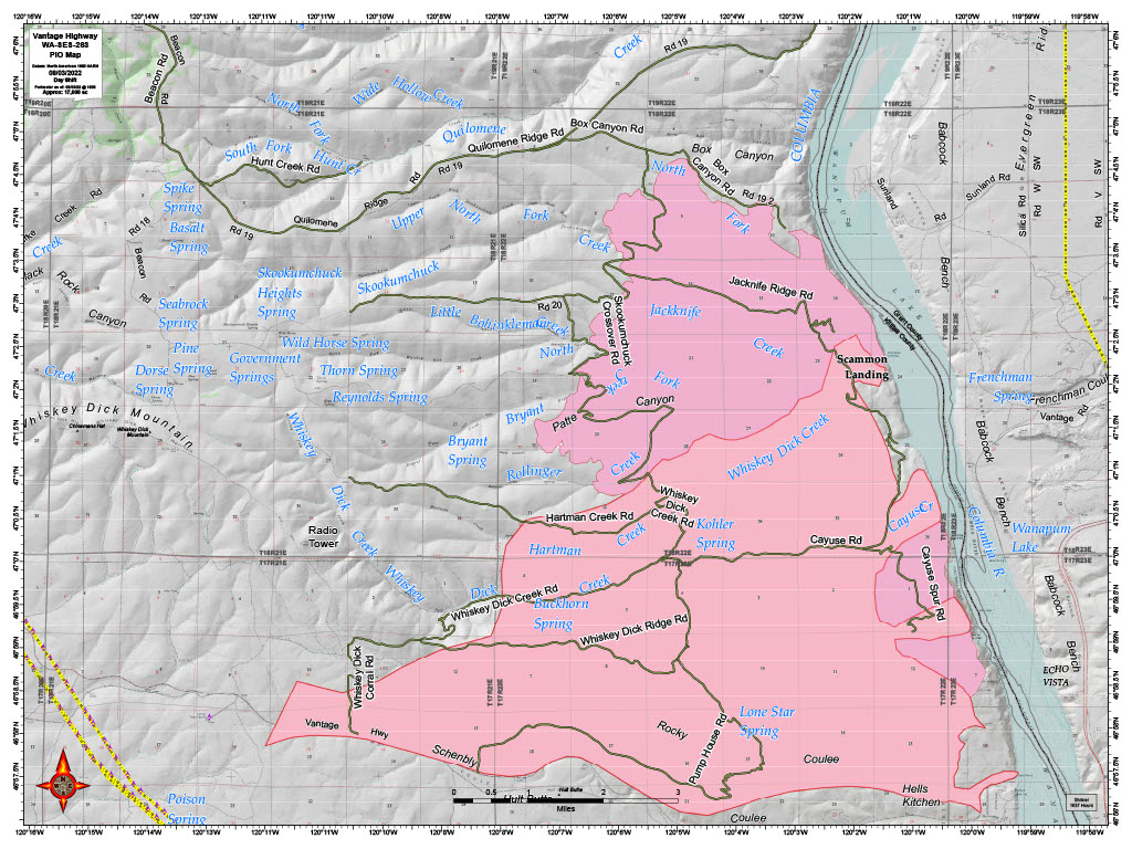
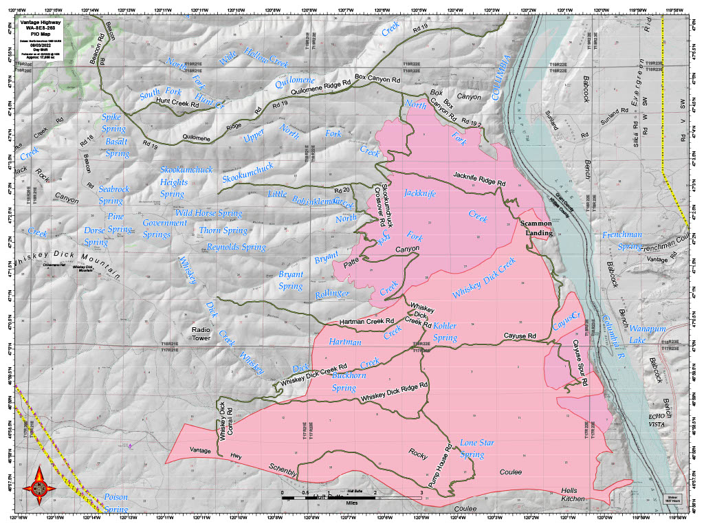
#VantageHighwayFire Containment: 25%. Today, an observational flight of fire perimeter provided more accurate map of external borders of the fire. Total area within this perimeter is 26,500 acres, but the burn is interrupted by sizeable pockets of unburned fuel (not yet depicted)
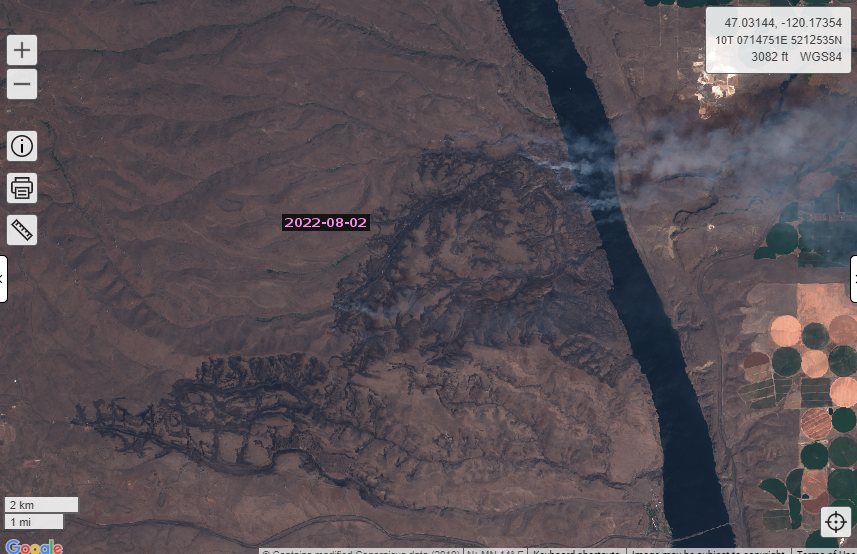
Seeing smoke? If you are in west central Grant County, you may be experiencing smoky conditions from the #VantageHighwayFire. Fire burned down into the Columbia River gorge on the Kittitas Co side. Winds are carrying smoke across the river & up into Grant County @GrantCoSheriff
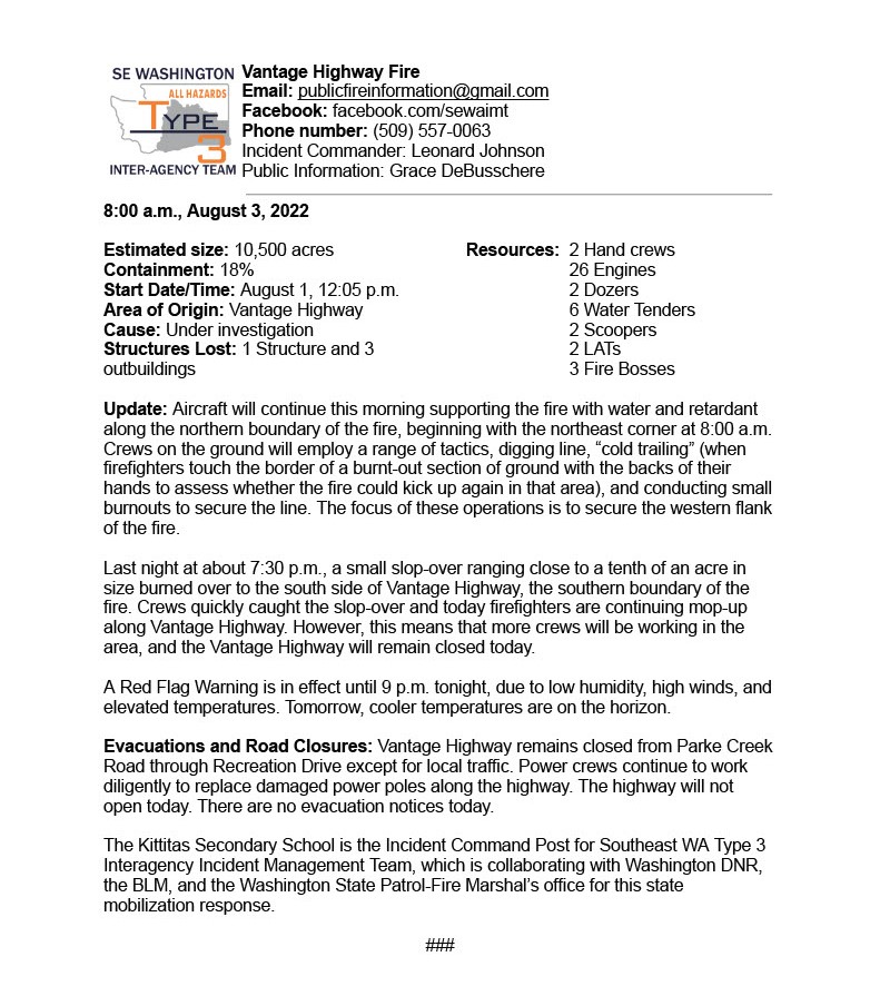
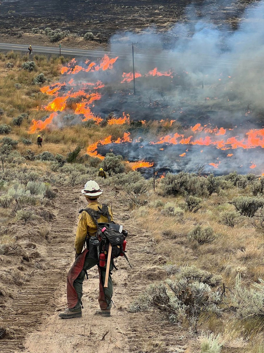
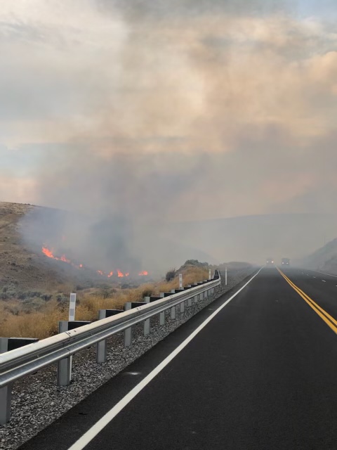
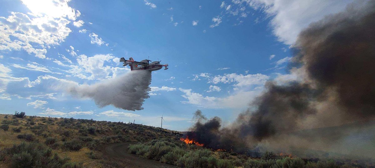
#VantageHighwayFire Update: At 8 AM retardant & water drops will begin on the NE corner of the fire and continue west. Crews on ground are cold trailing, burning, and digging line to secure NW flank. Vantage Hwy still closed due to small slopover last PM. S flank mopup continues.
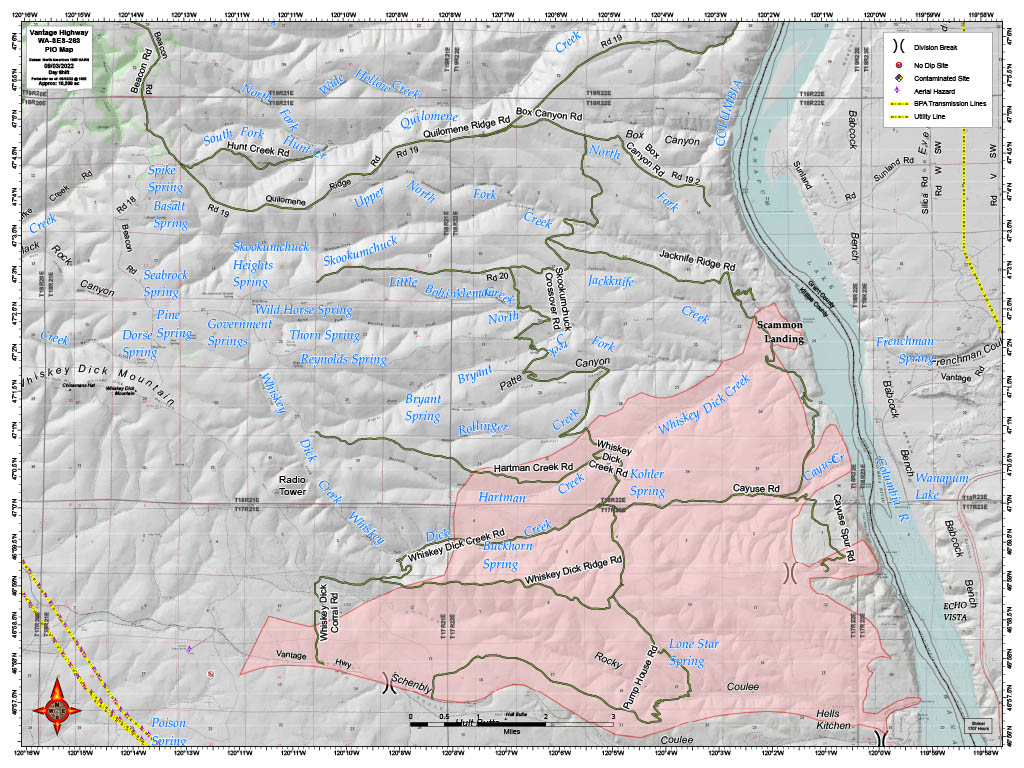
#VantageHighwayFire PM Update for 8/2. 10,500 est acreage and 18% contained. One cabin and 3 outbuildings lost. Evacuation notices lifted, Vantage power back on, Vantage Highway still closed. Night shift resources will be patrolling the southern line near Vantage and the highway
#VantageHighwayFire Update: According to the Kittitas County Sheriff's Office, the Level 2 Evacuations in Vantage have been lifted and there are now NO evacuation notices in place for the fire. @KCSheriffOffice
We are still experiencing "Red Flag Warning" weather. As the head of the fire continues to push north, aerial resources are hitting those northernmost drainages with water drops and retardant. Hand crews are being sent into the drainages to attack the fire's spread on the ground.
#VANTAGEHIGHWAYFIRE Update: Acreage is estimated at 10,500 acres. While the fire perimeter on this map appears to depict a solid, continuous burn, that is not the case; the fire area is actually dispersed with large swathes of green, unburned fuels.
#VANTAGEHIGHWAYFIRE Update: Fire is estimated at 8000 acres, but a more accurate estimate will be available after aerial recon flight happening shortly. The fire is pushing north towards the Whiskey Dick Creek Drainage. Evacuations for Vantage are still at a Level 2 - BE PREPARED
A Red Flag Warning is in effect until 9 p.m. Fire activity is expected to pick up midday with the higher temps and winds. You may see a column form in the afternoon as the fire reaches unburned pockets of fuel. Aerial resources are working throughout the day. Do not fly drones!
#VANTAGEHIGHWAYFIRE Update: fire remained active until 2:30 a.m. last night, when cooler temps and higher humidity levels assisted firefighters working on the line overnight. This a.m., an aerial flight of the fire’s perimeter will provide a better acreage estimate.