Info about the Golden State’s earthquakes, geology, & minerals from scientists at the California Geological Survey (CGS), a division of @CalConservation
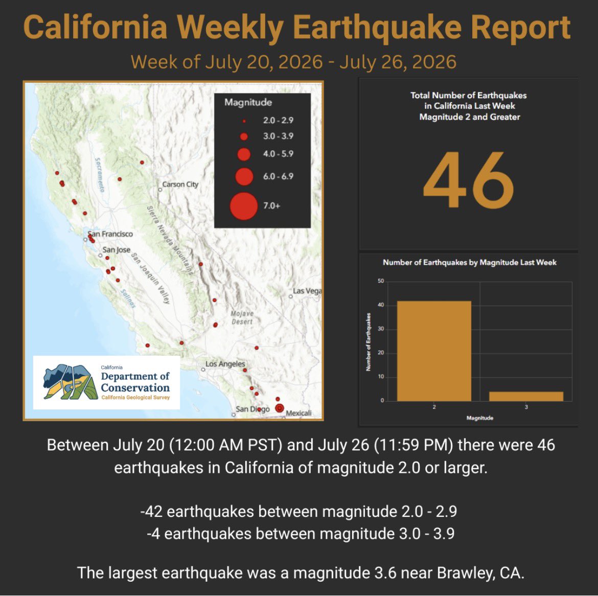
Between July 20 (12:00 AM PST) and July 26 (11:59 PM) there were 46 earthquakes in California of magnitude 2.0 or larger.
🔸42 earthquakes between magnitude 2.0 - 2.9
🔸4 earthquakes between magnitude 3.0 - 3.9
The largest earthquake was a magnitude 3.6 near Brawley, CA.
We are hiring!
The Geologic Mapping and Paleontology Program at UGS is looking for a full-time, permanent Preparator – Field Paleontologist to help document, preserve, and promote Utah’s vast paleontological resources.
Learn more and apply by 8/6/2026: https://t.co/vEaG3OyGi5
Between July 13 (12:00 AM PST) and July 19 (11:59 PM) there were 54 earthquakes in California of magnitude (M) 2.0 or larger.
🔸51 quakes between M2.0 - 2.9
🔸2 quakes between M3.0 - 3.9
🔸1 quakes between M4.0 - 4.9
The largest earthquake was a M4.3 N of Johannesburg, CA.
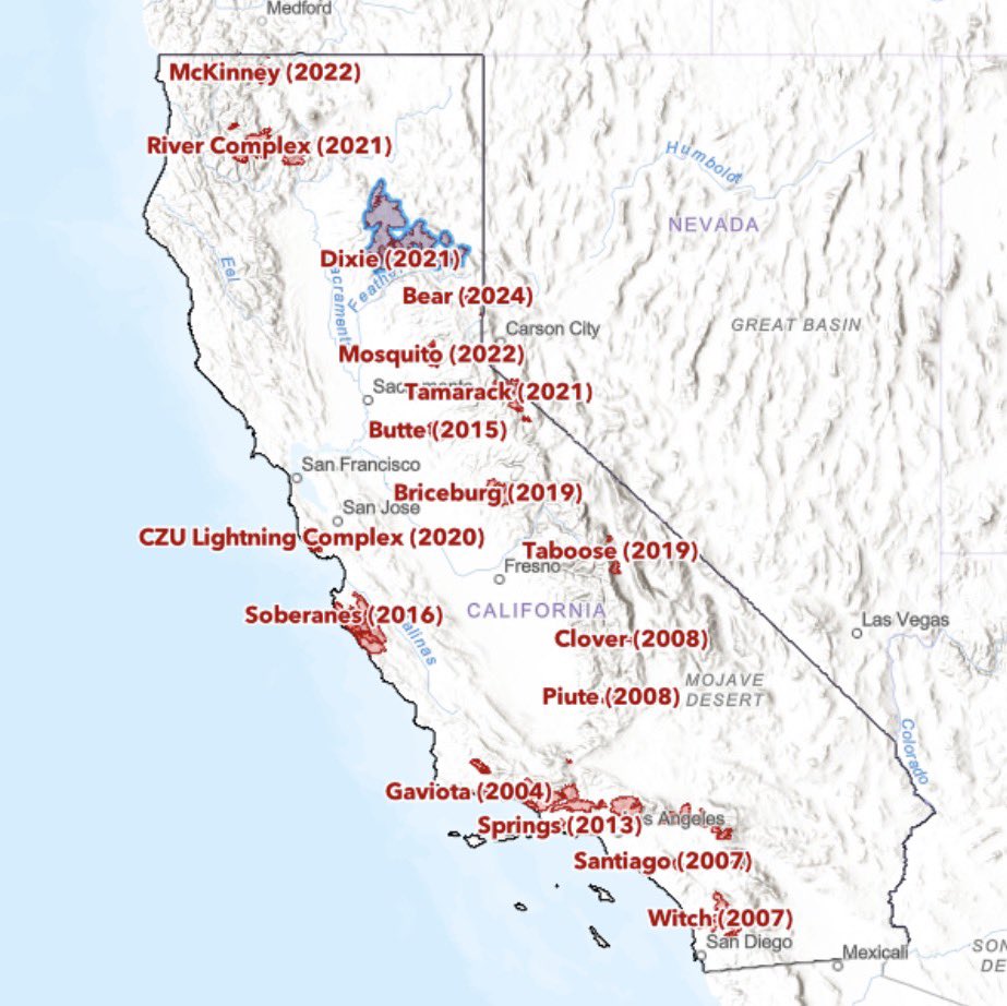
Explore our Postfire Debris Flow database, an interactive map of debris flow events since 2000, built on data from government agencies, media, scientific literature, and the public. https://t.co/I00j9KEvU4
NEW MAP! The brand-new California Geological Survey (CGS) Postfire Debris Flow Potential Map depicts the combined annual probability of wildfire and subsequent debris flow that is triggered by rainfall. https://t.co/bqEBp0btGC
To help communities prepare for postfire hazards, the CGS developed a statewide prefire model to provide info on potential postfire debris-flow hazards across California. The map products from this effort can be used to better inform potential mitigation strategies prior to fire.
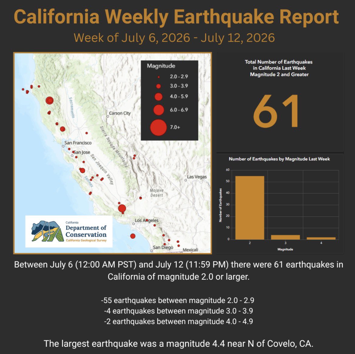
Between July 6 (12:00 AM PST) and July 12 (11:59 PM) there were 61 earthquakes in California of magnitude (M) 2.0 or larger.
🔸55 quakes between M2.0 - 2.9
🔸4 quakes between M3.0 - 3.9
🔸2 quakes between M4.0 - 4.9
The largest earthquake was a magnitude 4.4 N of Covelo, CA.
Explore the fascinating history of California captured in the Sierra Nevada Earth Science Atlas!
A high-resolution PDF of the map is available here https://t.co/yRn6CbXFyd
Between June 29 (12:00 AM PST) and July 5 (11:59 PM) there were 45 earthquakes in California of magnitude 2.0 or larger.
🔸41 earthquakes between magnitude 2.0 - 2.9
🔸4 earthquakes between magnitude 3.0 - 3.9
The largest earthquake was a magnitude 3.9 near Alder Springs, CA.
A magnitude 5.6 earthquake occurred 11 km N of Redwood Valley, CA at 8:10 am. This earthquake produced strong to very strong shaking near the epicenter and light shaking that was felt across Northern California.
CGS is monitoring the situation.
https://t.co/Vy1JsaRxqI