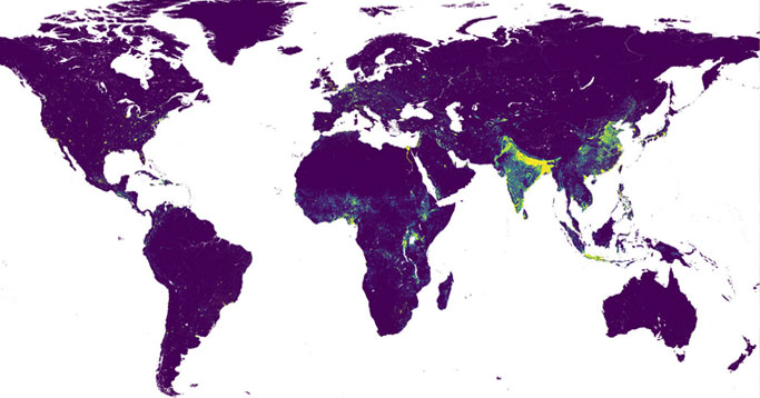
🚨 New preprint led by Dorothea Woods describing 🌍 global gridded multi-temporal datasets to support human population distribution #modelling
🔗 https://t.co/AIAlBUNCol
💻 Data: https://t.co/iHT6WwGxbU
🧮 Code: https://t.co/Hb4EhMi7lr
Congratulations @WorldPopProject on 10 years of groundbreaking research mapping the world’s population! 🎉
Here’s to many more years of making a difference! 🌍 #WorldPop10
In our second session we’re reflecting on leveraging geospatial data for global development. Our director Professor @AndyTatem has been reflecting on “A Decade of Demographic Mapping at WorldPop”, with an overview of some of our key work from the last 10 years. 🎉
#WorldPop10
On #InternationalWomensDay, we are celebrating the recent work of staff and students in WorldPop:
@CarlaPi83 is leading work with @CIFFchild on mapping health and development indicators:
https://t.co/dhOrZ5LhFN
Read about previous work in India here:
https://t.co/rlhl6EOitN
🚨 We're hiring 🚨
Join us as a Research Fellow in Spatiotemporal Statistical Modelling & Analysis @unisouthampton Working on a variety of exciting projects: https://t.co/zOlQ7fTMCP
https://t.co/9oDkQgbjWr
Our latest work is now out! @WorldPopProject
Geographical distribution of fertility rates in 70 low-income, lower-middle-income, and upper-middle-income countries, 2010–16: a subnational analysis of cross-sectional surveys - ScienceDirect https://t.co/65Xn7X9CZV
Interested in spatial demographics and got some good statistical/geospatial/coding skills? We're looking for a new research fellow: https://t.co/GWQqMMAYvM
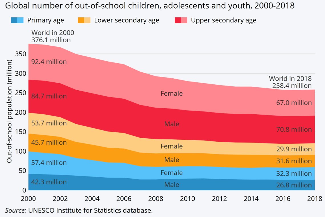
Don’t forget about those who were not in school before the pandemic - read our new blog here on the value of geographic data for tackling low school attendance rates: https://t.co/bnU8BfNnOl