OPW water-level data and rainfall estimates from weather radar show a very sudden spike in river levels at Bantry Library following heavy rainfall overnight, with the peak coinciding almost exactly with high tide.
We need to know whether Ireland’s flood forecasting system identified a risk of flooding in Bantry ahead of this event.
Battleground of air-masses this coming week with cold air into Eastern Europe but milder air in Atlantic. We will see some cooler air over Ireland Wednesday and Thursday.
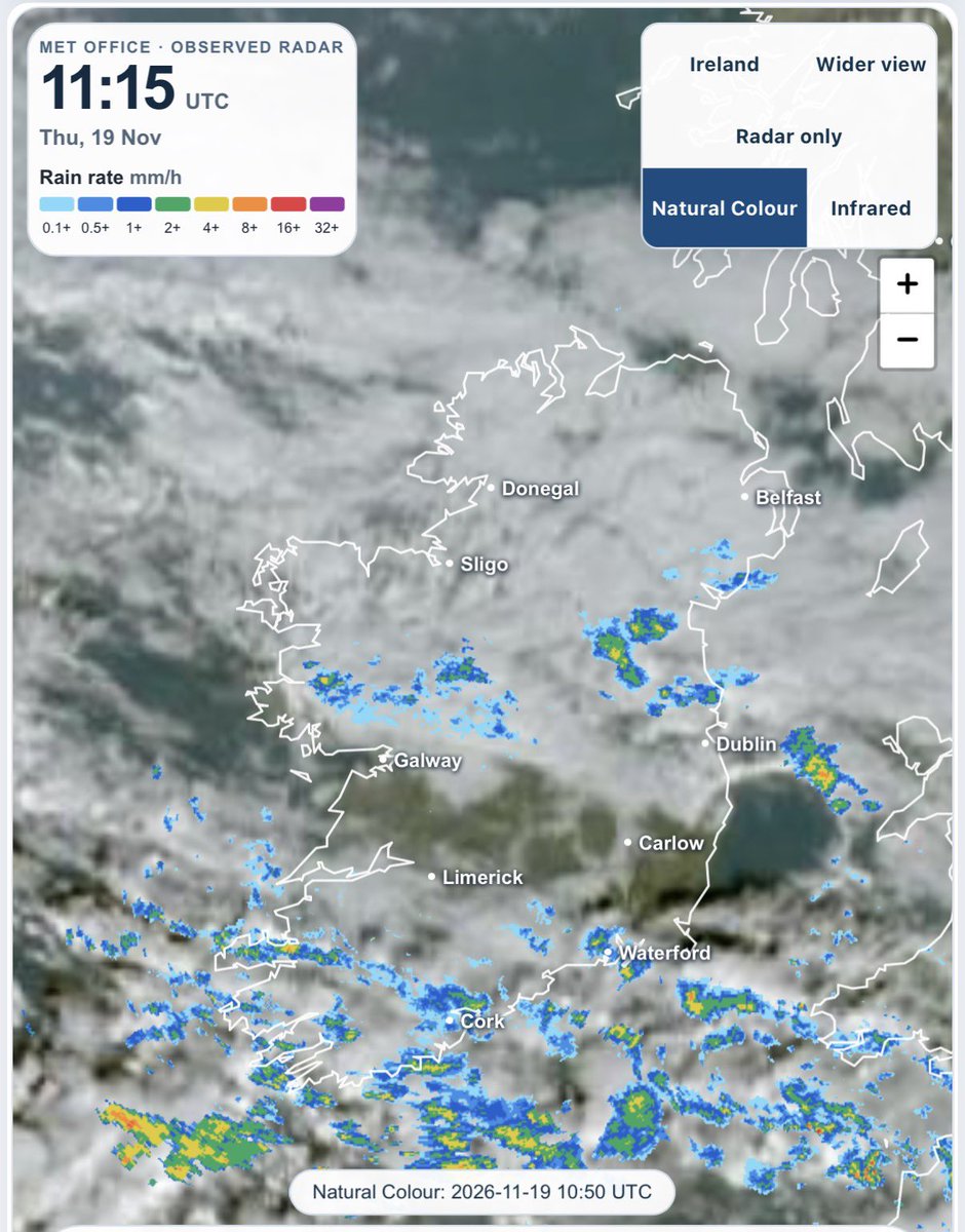
A breezy morning and heavy in some areas with more rain to come today and possibly over 30mm more for Waterford. Up to 28mm has fallen in the last 24 hours in parts of Cork with reports of flooding in Bantry.
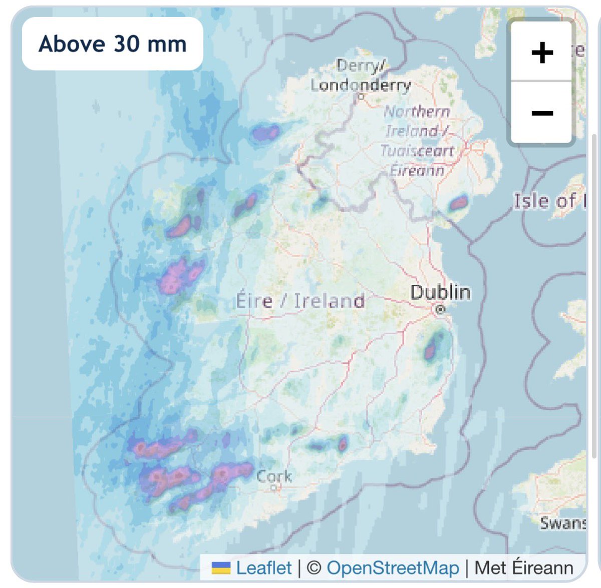
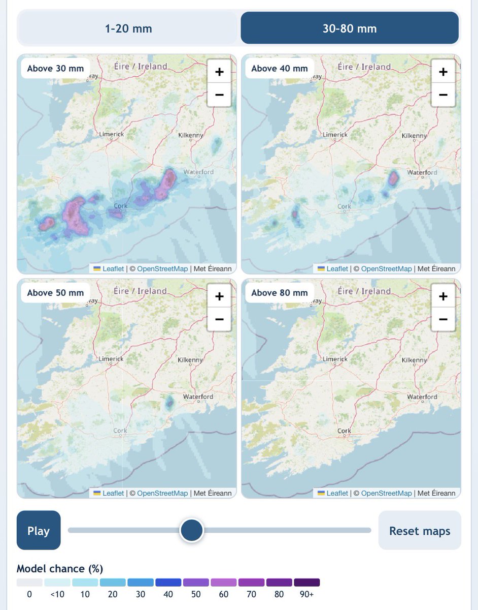
Rain has arrived in the Southwest now and will continue to slowly move in through tonight, a wet Sunday morning and afternoon in Southern half of country. Weather models vary on the rainfall totals but over 40mm is possible in parts of South. Those in areas prone to flooding in the South, should be alert.
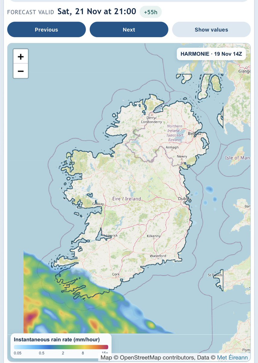
Latest high resolution charts show the heavy rain still pushing into the Southwest tonight but amounts over the next 36 hours are a little lower than models had shown yesterday. Still over 30mm possible in parts of South.
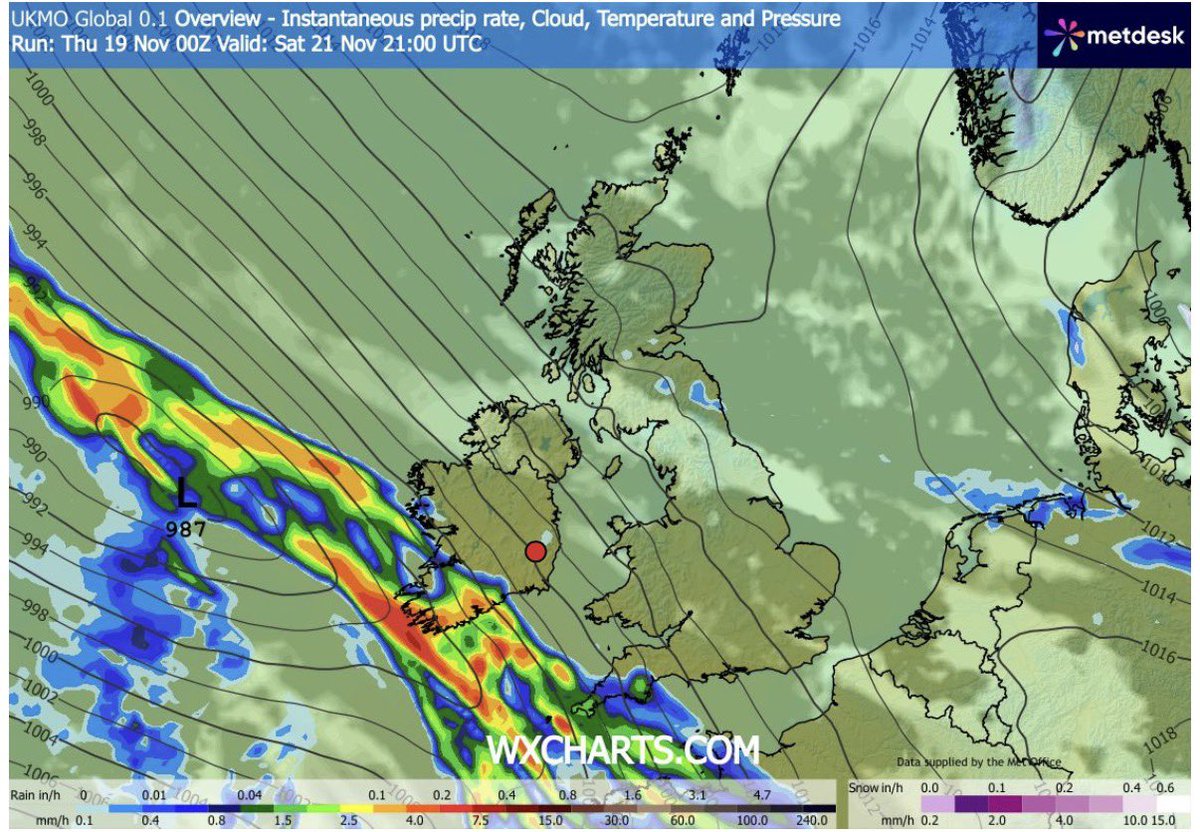
Friday evening update with a cool night and some fog, heavy rain pushing into the South Saturday evening and some high totals there over the next 48 hours. Some strong gusts into the South coast early Sunday too.
Some yellow weather warnings issued for Southern areas for Saturday into Sunday with heavy rain and risk of local flooding. The details are a little uncertain and vary across the models but areas prone to flooding be alert.
Heavy rain pushing into Southwest Saturday evening but how far North it makes it on Sunday is uncertain. Over 20mm is possible in parts of South as ensemble charts from 3 different models show. These are custom charts I’ve created on https://t.co/ZPRrHRcUAm
A chilly night ahead with Northern areas down to 0c before good sunny spells Friday. Rain will push up Saturday but likely to be 8-9pm before it reaches the Southwest on the latest high resolution charts.
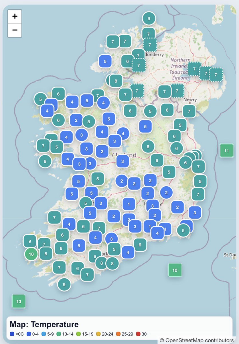
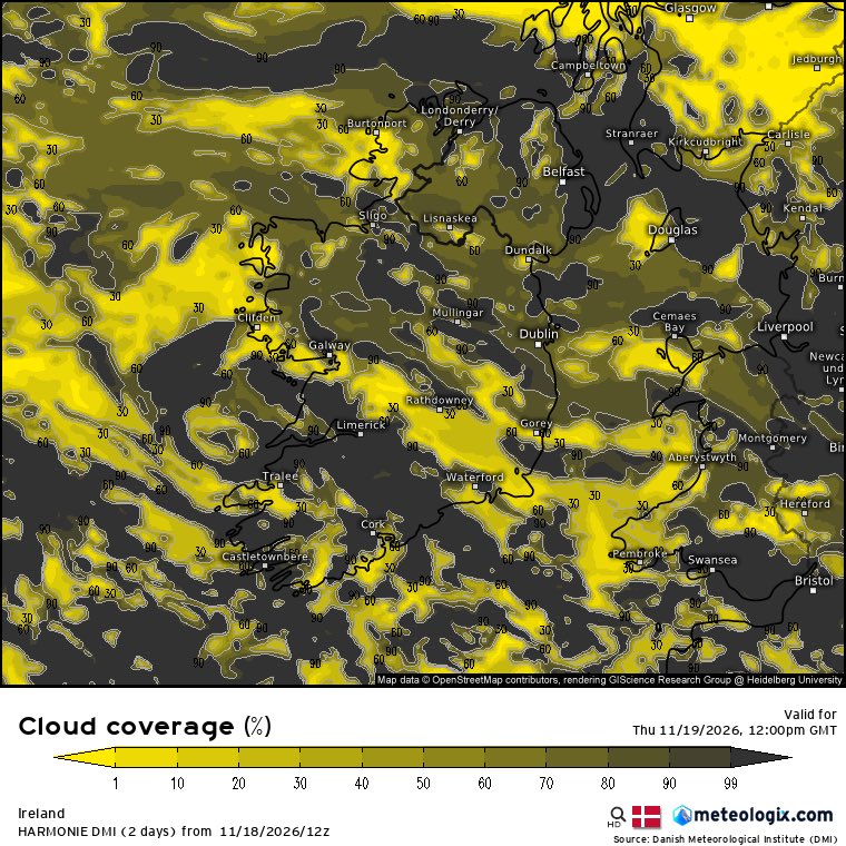
Cooler morning for many with temperatures ranging from 0c to 10c and most of the showers in the Southwest. A few sunny spells today with showers mainly in Southwest. Good sunny spells Friday and rain should hold off on Saturday until evening time when it will push into Southwest.
Main risk of rain Saturday is later in eveing in Southwest and then moving up the country but as charts from 4 different models here, lot of uncertainty yet