Jasper, TN native. MCHS 2020. Vol State 2025. Soon-to-be Mississippi State meteorology student. Forecaster for the Tri-State Area Weather (TN/AL/GA) group.
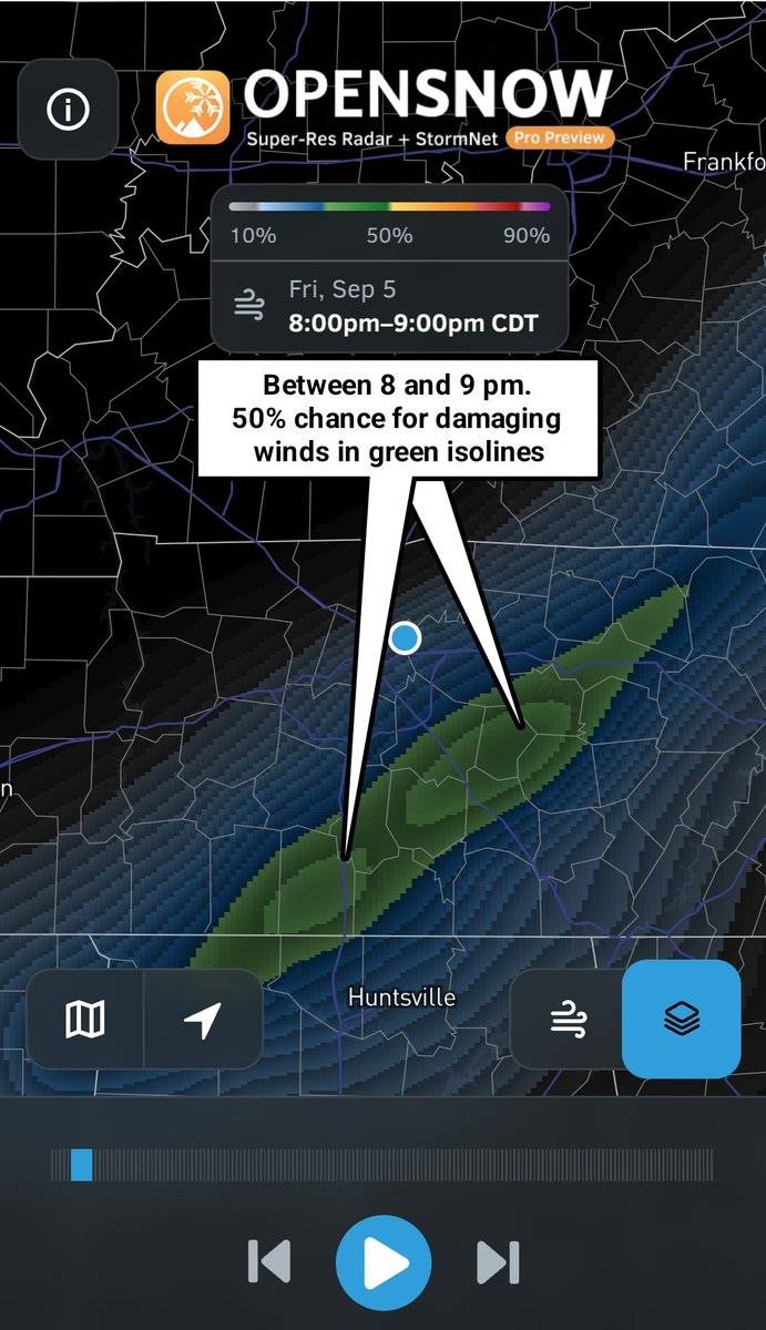
Latest Stormnet-AI continues the trend of wide swath of damaging winds with embedded spin ups. This looks to be more of a QLCS type event for Middle Tennessee and southern Kentucky. Wind damage could be widespread. My Tempest has start time for the stronger storms in Nashville around 9 pm with storms overnight by 1 or 2 am followed shortly by FROPA.
#MRX issues Record Event Report (RER) at Nov 11, 3:44 AM EST ...RECORD DAILY LOW MAXIMUM TEMPERATURE TIED AT LOVELL FIELD AIRPORT... https://t.co/GCQwg4T1lJ
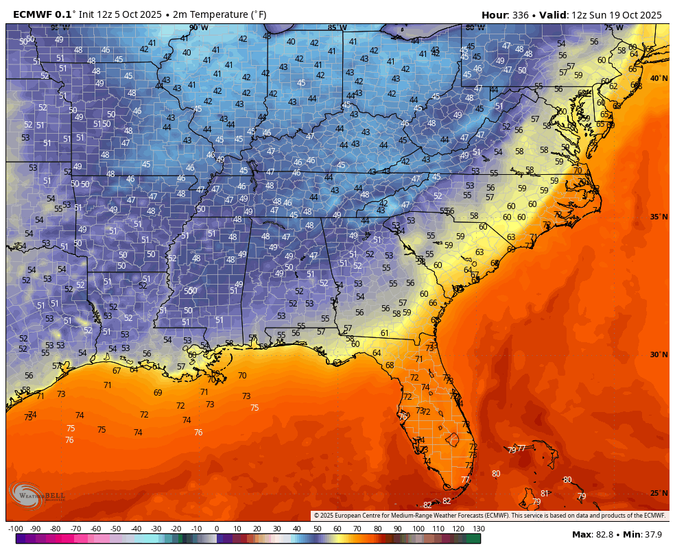
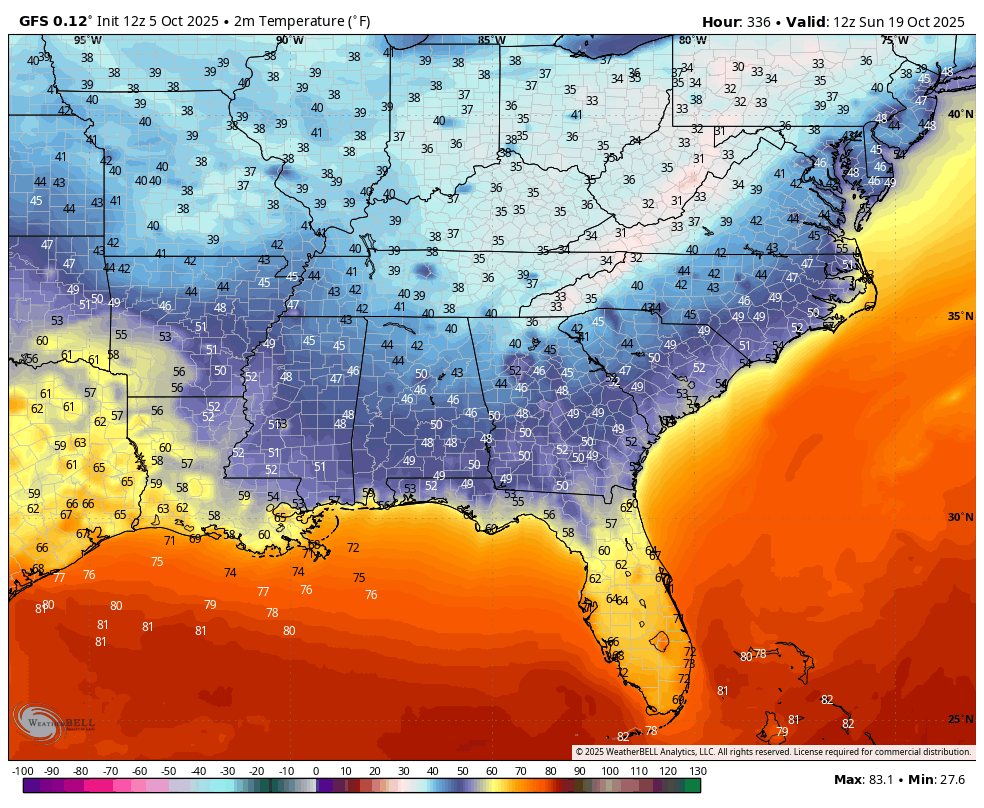
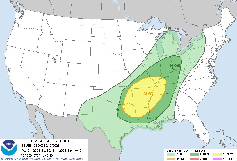
Going to have to say I am surprised to see this good of agreement on a mid-late October cold snap that is some 2 weeks out in time. Let's see if the trend holds true... #tnwx#gawx#alwx
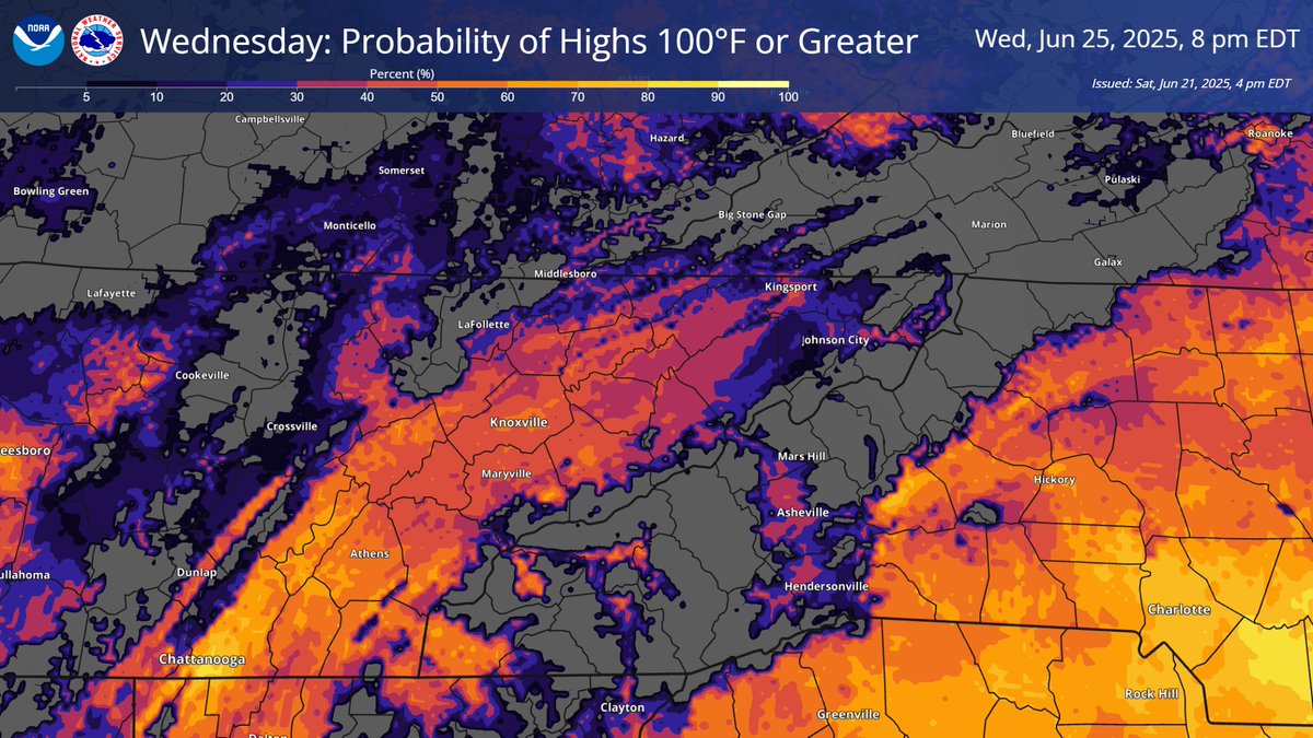
Temperatures will continue to increase into early next week with Wednesday possibly being the hottest day of this heat wave. For much of the Valley, there is generally a 40% to 70% chance of actual temperatures reaching 100°F with heat index values approaching 105°F for some.
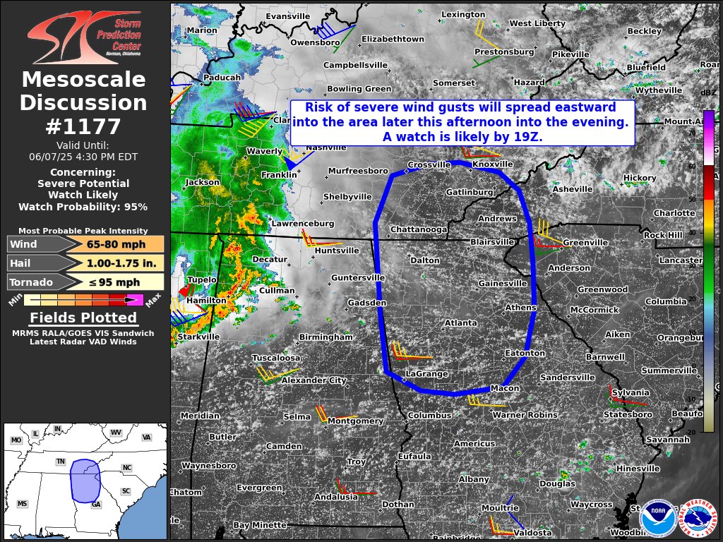
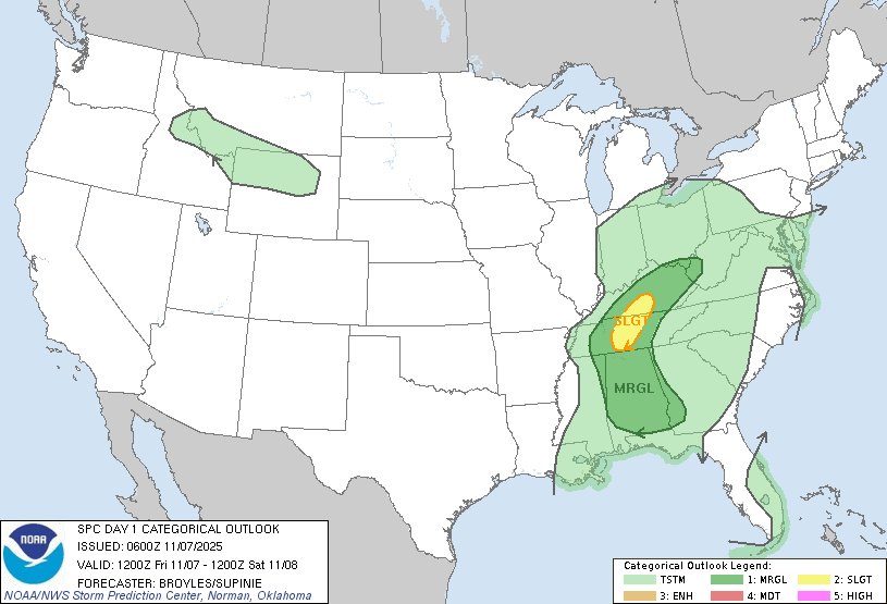
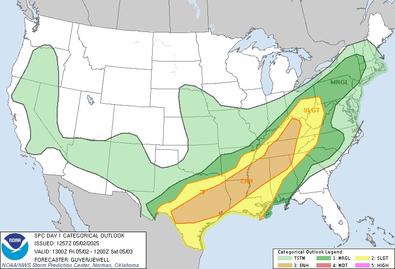
12:56am CDT #SPC Day1 Outlook Slight Risk: across parts the southern Appalachians, Tennessee Valley, Southeast and Rio Grande Valley https://t.co/TgJgC6cj9Y